A strong weather system took an anomalous path for April 27 and brought a combination of widespread precipitation and cold air. This allowed for rain to change over to snow across northern Illinois and northern Indiana. Precipitation type at times varied, wobbling between snow and rain (even ice pellets in some places). Snow at times was heavy, sharply reducing visibility causing patches of hazardous travel, and by late afternoon into evening causing accumulation on some roadways. With temperatures around freezing, slickness developed on some roads as well. |
|
Fast Facts
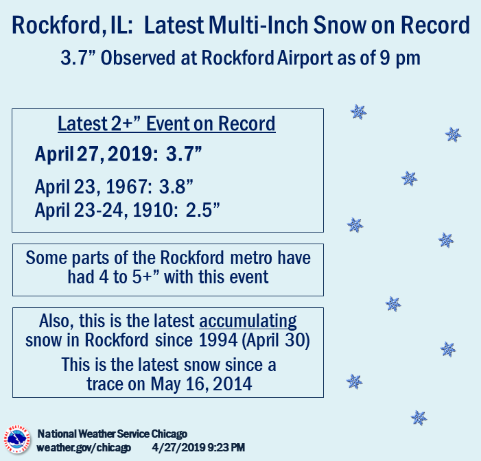
For more snow climatology for our area, see our local snow climatology page.
Snow/Ice Totals
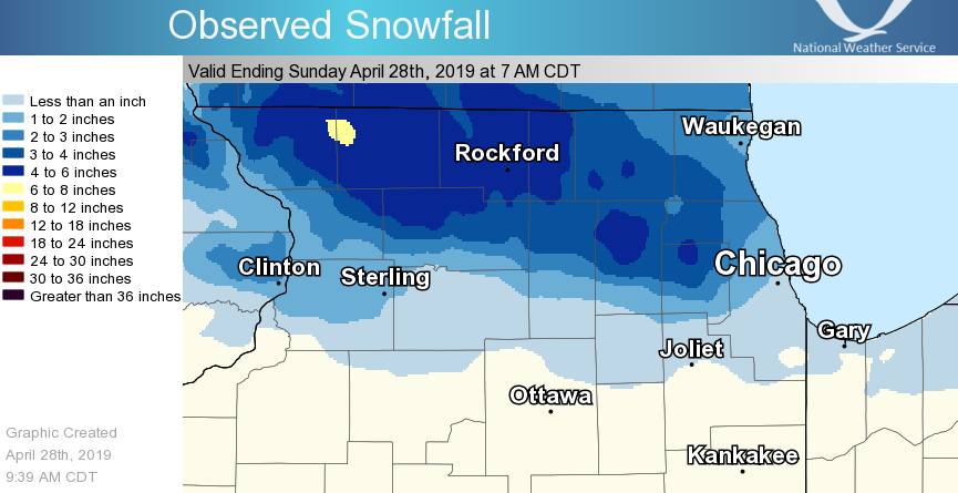 |
| Map of 24 hour snowfalls |
Public Information Statement
National Weather Service Chicago IL
0948 AM CDT Sun Apr 28 2019

...Morning Snowfall Roundup...

   The following are snow amounts for the previous 24 hours
   as measured in the morning by NWS Cooperative Observers
   and CoCoRaHS observers.
   Observations are usually taken at 7 AM.

   24-hour Snowfall Amounts for Sunday(04/28/19)...


Northern Illinois                              Snow
  Location (County):                           fall(inches)

  St. Charles 6NW (Kane)........................6.0
  Roscoe 2ESE (Winnebago).......................5.1
  Roscoe 2se (Winnebago)........................5.1
  Wheaton 2NNE (Du Page)........................5.0
  St. Charles (Kane)............................5.0
  Hoffman Estates 2SE (Cook)....................4.9
  Gilberts (Kane)...............................4.9
  Elgin 2W (Kane)...............................4.5
  Lake Zurich (Lake)............................4.5
  Elk Grove Village 2WSW (Cook).................4.3
  Genoa (De Kalb)...............................4.1
  Capron (Boone)................................4.0
  Schaumburg 2E (Cook)..........................4.0
  Roselle 1ESE (Du Page)........................4.0
  Algonquin 1N (McHenry)........................4.0
  Mundelein (Lake)..............................4.0
  Hebron (McHenry)..............................3.8
  Bull Valley 2WNW (McHenry)....................3.7
  Rockford (Winnebago)..........................3.7
  Rockford 1NW (Winnebago)......................3.5
  Woodstock (McHenry)...........................3.5
  Mundelein 2WNW (Lake).........................3.2
  Woodstock 4SW (McHenry).......................3.2
  Elk Grove Village 1ESE (Cook).................3.1
  Elburn (Kane).................................3.0
  Palatine 1E (Cook)............................3.0
  Elburn (Kane).................................3.0
  De Kalb 1SW (De Kalb).........................2.8
  Glen Ellyn 2SSE (Du Page).....................2.8
  Highwood 1S (Lake)............................2.8
  De Kalb (De Kalb).............................2.7
  Fox Lake 2SE (Lake)...........................2.7
  Elgin (Kane)..................................2.6
  Park Ridge (Cook).............................2.6
  Botanic Gardens (Cook)........................2.5
  Elmhurst (Du Page)............................2.5
  Gurnee 2W (Lake)..............................2.5
  Ohare Airport (Cook)..........................2.5
  Oak Park 1NNE (Cook)..........................2.0
  La Grange Park 1SSW (Cook)....................2.0
  Midway Coop (Cook)............................1.7
  Batavia (Kane)................................1.6
  Cortland (De Kalb)............................1.6
  Oak Park 2S (Cook)............................1.5
  Naperville 1NW (Du Page)......................1.5
  North Aurora 2NE (Kane).......................1.5
  Westmont (Du Page)............................1.5
  Batavia 1WNW (Kane)...........................1.3
  Harwood Heights (Cook)........................1.1
  Aurora (Kane).................................1.0
  Oak Lawn (Cook)...............................1.0
  Countryside 1ENE (Cook).......................1.0
  Dixon 3NNW (Lee)..............................1.0
  Plainfield (Will).............................0.9
  Lincolnwood 2E (Cook).........................0.8
  Aurora 4SE (Du Page)..........................0.8
  Chicago Ridge (Cook)..........................0.7
  Burr Ridge 2SW (Du Page)......................0.5
  Plainfield 5SW (Kendall)......................0.5
  Worth (Cook)..................................0.4
  Romeoville (Will).............................0.4
  Barrington (Lake).............................0.3
  Paw Paw (Lee).................................0.3
  Waukegan 2N (Lake)............................0.2
  Plainfield 2SSE (Will)........................0.2
  Joliet 2n (Will)..............................0.2
  Earlville 3S (La Salle).......................0.1
  New Lenox 3E (Will)...........................0.1
  Coal City 4NNW (Grundy).....................TRACE
  Chicago 6ESE (Cook).........................TRACE
  Park Forest 1SW (Cook)......................TRACE
  Carbon Hill 3.1N (Grundy)...................TRACE
  Watseka 6.9WNW (Iroquois)...................TRACE
  Crete 3E (Will).............................TRACE
  Mokena 1W (Will)............................TRACE
  Peotone (Will)..............................TRACE
  New Lenox 2SE (Will)........................TRACE
  Lansing (Cook)..............................TRACE
  Manhattan (Will)............................TRACE
  Peotone (Will)..............................TRACE

Northwest Indiana                              Snow
  Location (County):                           fall(inches)

  Gary 5ENE (Lake)..............................0.5
  Valparaiso 4SW (Porter).......................0.5
  Crown Point 2WSW (Lake).....................TRACE
  Valparaiso 6SSW (Porter)....................TRACE
  Hebron 4NE (Porter).........................TRACE
  Valparaiso 6WSW (Porter)....................TRACE
  Valparaiso 1NNW (Porter)....................TRACE

$$
Storm Reports
PRELIMINARY LOCAL STORM REPORT...SUMMARY
NATIONAL WEATHER SERVICE CHICAGO IL
612 PM CDT SUN APR 28 2019

..TIME...   ...EVENT...      ...CITY LOCATION...     ...LAT.LON...
..DATE...   ....MAG....      ..COUNTY LOCATION..ST.. ...SOURCE....
            ..REMARKS..

0800 AM     SNOW             PALATINE                42.11N 88.04W
04/28/2019  M4.8 INCH        COOK               IL   PUBLIC


0800 AM     SNOW             NORTH BARRINGTON        42.21N 88.13W
04/28/2019  M3.7 INCH        LAKE               IL   PUBLIC


0717 AM     SNOW             1 N BYRON               42.15N 89.25W
04/28/2019  M4.3 INCH        OGLE               IL   PUBLIC


0657 AM     SNOW             2 S MOUNT PROSPECT      42.04N 87.93W
04/28/2019  M3.0 INCH        COOK               IL   PUBLIC


0100 AM     SNOW             3 SW MIDWAY AIRPORT     41.74N 87.78W
04/28/2019  M1.7 INCH        COOK               IL   CO-OP OBSERVER

            STORM TOTAL SNOWFALL. 1.09 OF LIQUID FOR THE
            EVENT.

0100 AM     SNOW             OHARE AIRPORT           41.98N 87.90W
04/28/2019  M2.5 INCH        COOK               IL   OFFICIAL NWS OBS

            STORM TOTAL SNOWFALL.

0100 AM     SNOW             NWS CHICAGO-ROMEOVILLE  41.60N 88.08W
04/28/2019  M0.4 INCH        WILL               IL   OFFICIAL NWS OBS

            STORM TOTAL SNOWFALL.

0100 AM     SNOW             ROCKFORD AIRPORT        42.20N 89.10W
04/28/2019  M3.7 INCH        WINNEBAGO          IL   OFFICIAL NWS OBS

            STORM TOTAL SNOWFALL.

1030 PM     SNOW             1 SSW MEDINAH           41.96N 88.06W
04/27/2019  M5.1 INCH        DUPAGE             IL   COCORAHS

            STORM TOTAL SNOWFALL.

1016 PM     SNOW             CRYSTAL LAKE            42.24N 88.32W
04/27/2019  M2.8 INCH        MCHENRY            IL   CO-OP OBSERVER


0951 PM     SNOW             3 N CAMPTON HILLS       41.98N 88.38W
04/27/2019  M5.8 INCH        KANE               IL   PUBLIC


0950 PM     SNOW             6 NW ST. CHARLES        41.98N 88.40W
04/27/2019  M5.8 INCH        KANE               IL   COCORAHS


0940 PM     SNOW             BELVIDERE               42.26N 88.84W
04/27/2019  M5.5 INCH        BOONE              IL   BROADCAST MEDIA


0930 PM     SNOW             LIBERTYVILLE            42.28N 87.95W
04/27/2019  M3.1 INCH        LAKE               IL   EMERGENCY MNGR


0930 PM     SNOW             NORTHBROOK              42.13N 87.83W
04/27/2019  M3.9 INCH        COOK               IL   EMERGENCY MNGR


0930 PM     SNOW             ROUND LAKE              42.35N 88.09W
04/27/2019  M3.3 INCH        LAKE               IL   PUBLIC


0913 PM     SNOW             PINGREE GROVE           42.07N 88.41W
04/27/2019  M4.3 INCH        KANE               IL   TRAINED SPOTTER


0910 PM     SNOW             HUNTLEY                 42.17N 88.43W
04/27/2019  M4.9 INCH        MCHENRY            IL   PUBLIC


0900 PM     SNOW             ROCKFORD AIRPORT        42.20N 89.10W
04/27/2019  M3.7 INCH        WINNEBAGO          IL   OFFICIAL NWS OBS

            CORRECTS PREVIOUS SNOW REPORT FROM ROCKFORD
            AIRPORT.

0900 PM     SNOW             1 WNW CHERRY VALLEY     42.25N 88.98W
04/27/2019  M4.3 INCH        WINNEBAGO          IL   PUBLIC


0900 PM     SNOW             WOODSTOCK               42.31N 88.45W
04/27/2019  M3.5 INCH        MCHENRY            IL   CO-OP OBSERVER


0846 PM     SNOW             HIGHWOOD                42.20N 87.81W
04/27/2019  M2.8 INCH        LAKE               IL   PUBLIC


0840 PM     SNOW             ARLINGTON HEIGHTS       42.08N 87.98W
04/27/2019  M3.5 INCH        COOK               IL   PUBLIC


0821 PM     SNOW             MACHESNEY PARK          42.35N 89.04W
04/27/2019  M4.0 INCH        WINNEBAGO          IL   PUBLIC


0800 PM     SNOW             3 WNW BULL VALLEY       42.33N 88.40W
04/27/2019  M3.6 INCH        MCHENRY            IL   TRAINED SPOTTER


0800 PM     SNOW             1 NW PROSPECT HEIGHTS   42.11N 87.93W
04/27/2019  E1.8 INCH        COOK               IL   PUBLIC


0800 PM     SNOW             DES PLAINES             42.04N 87.89W
04/27/2019  M2.0 INCH        COOK               IL   PUBLIC
Meteorology
 |
|
|||
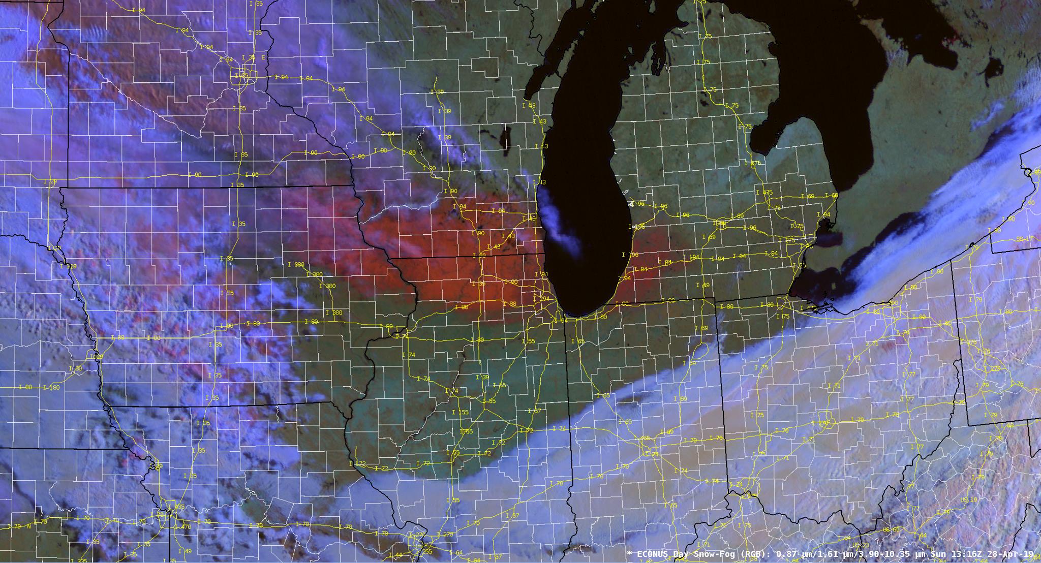
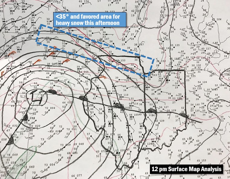
| April 27, 12 pm Hand Analyzed Surface Map. With the area north of the warm front, a stiff easterly wind in the atmospheric low-levels along with widespread precipitation prevented temperatures from warming despite the late April sun angle. The low pressure was strong, a reflection of deep atmospheric lift, and it was quick moving to the east, preventing the warm front from reaching northern Illinois. | April 28, Morning Satellite RGB Composite Image. With the sun making a return the day after the snow, GOES-16 satellite depicted the snowfall across the area. The snow shows up as a reddish-orange hue in this composite image.​ Clodus are in blueish-lavender. |
Photos & Service
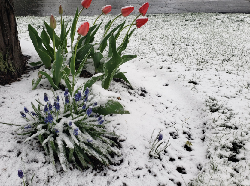
Photos
 |
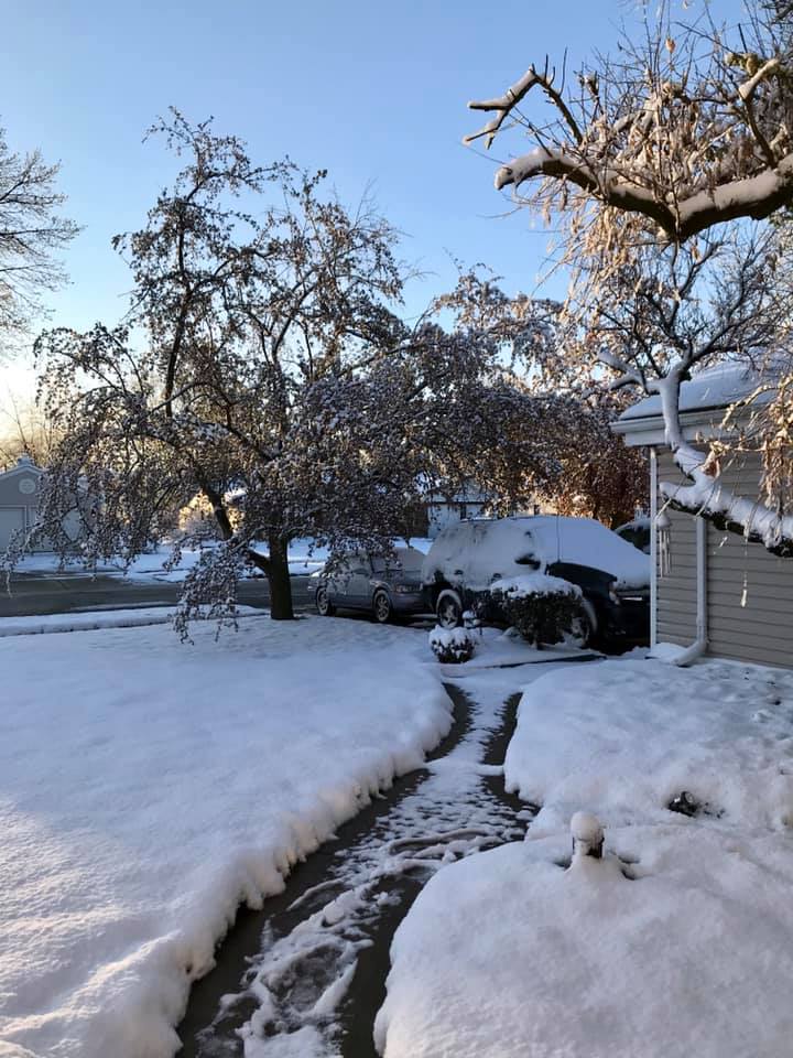 |
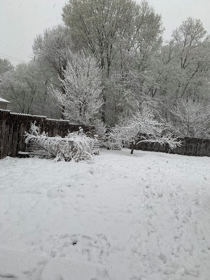
| Machesney Park, IL courtesy of Kasandra Ann | Schaumburg, IL courtesy of Susan Chervinko |
 |
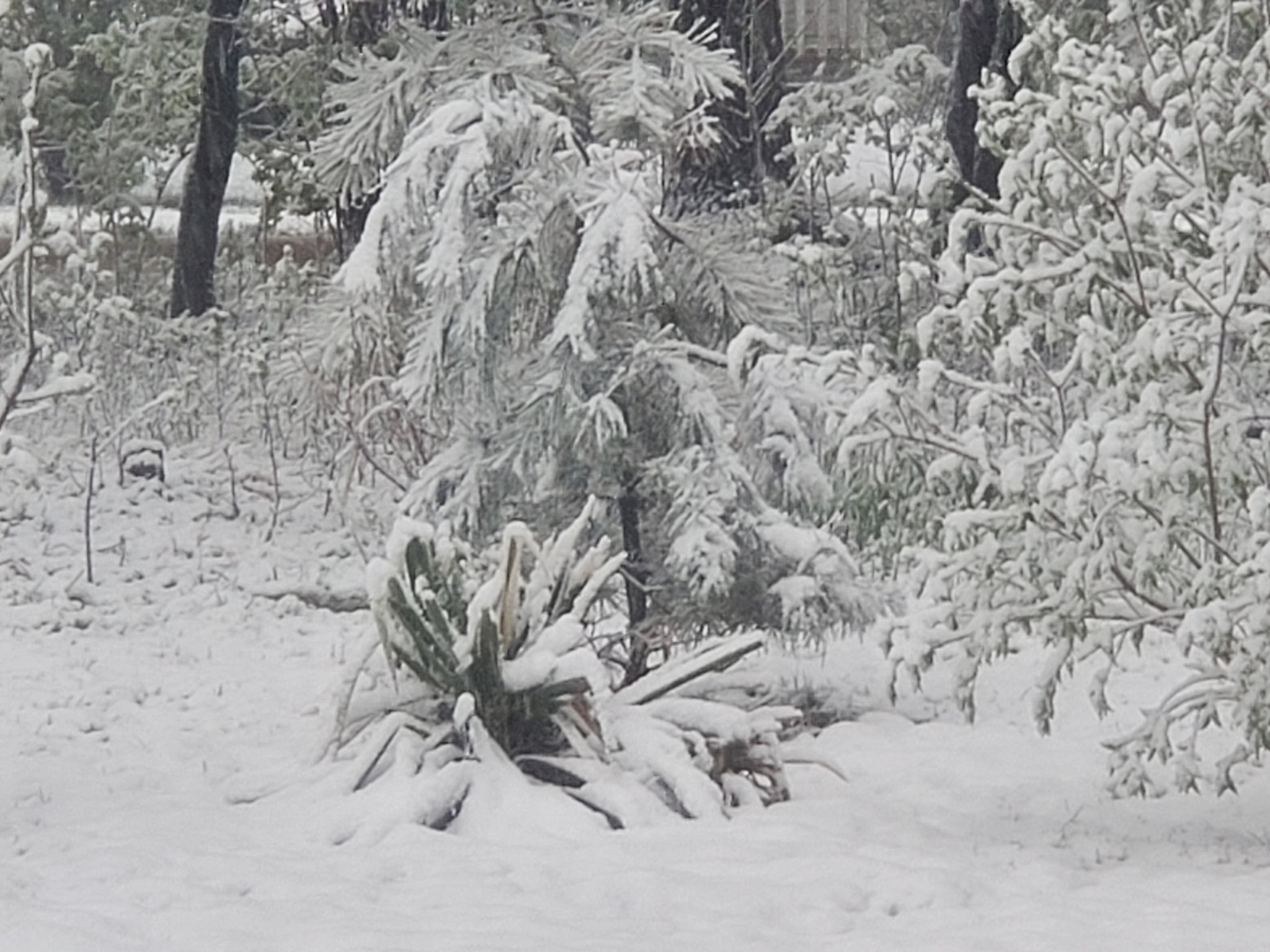 |
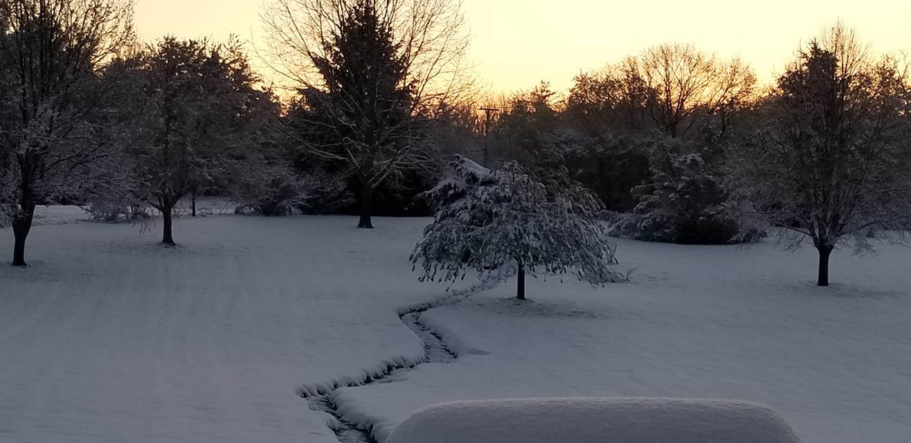
| East Rockford, courtesy of Jennifer Sanchez | Algonquin, IL courtesy of Marguerite Van Ness |
Service
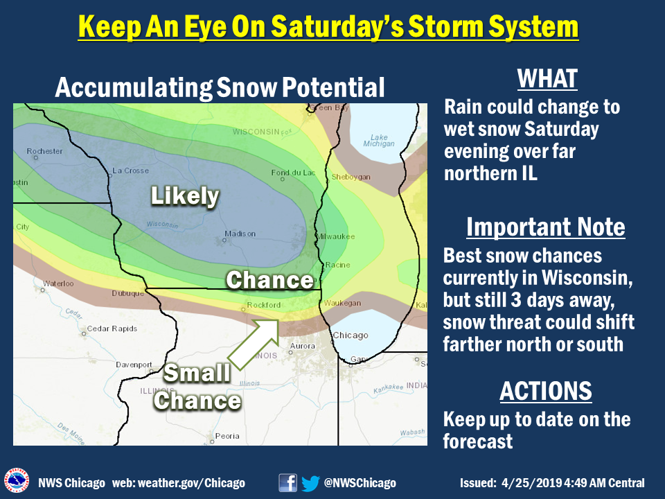 |
 |
 |
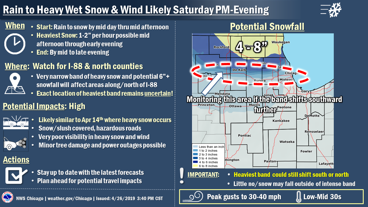
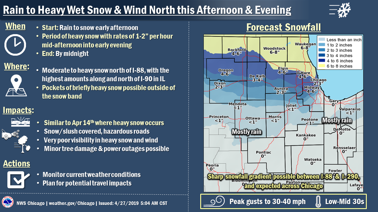
| April 25 Morning Weather Story | April 25 Afternoon Weather Story | April 26 Morning Weather Story |
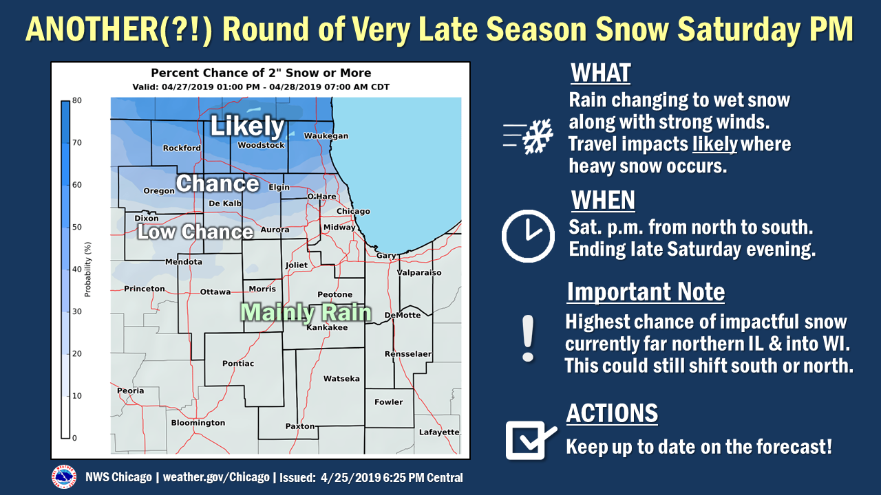
 |
 |
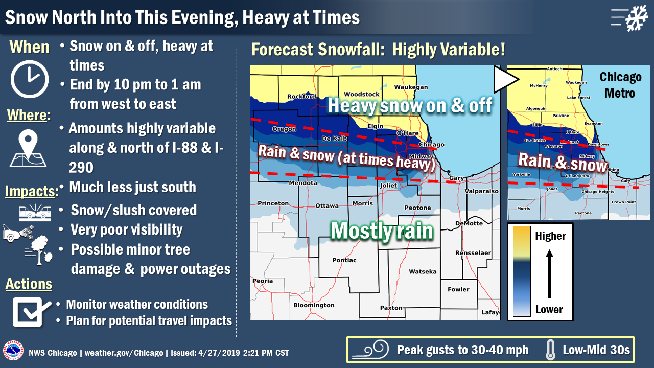 |
| April 26 Afternoon Weather Story | April 26 Morning Weather Story | April 26 Midday Weather Story |
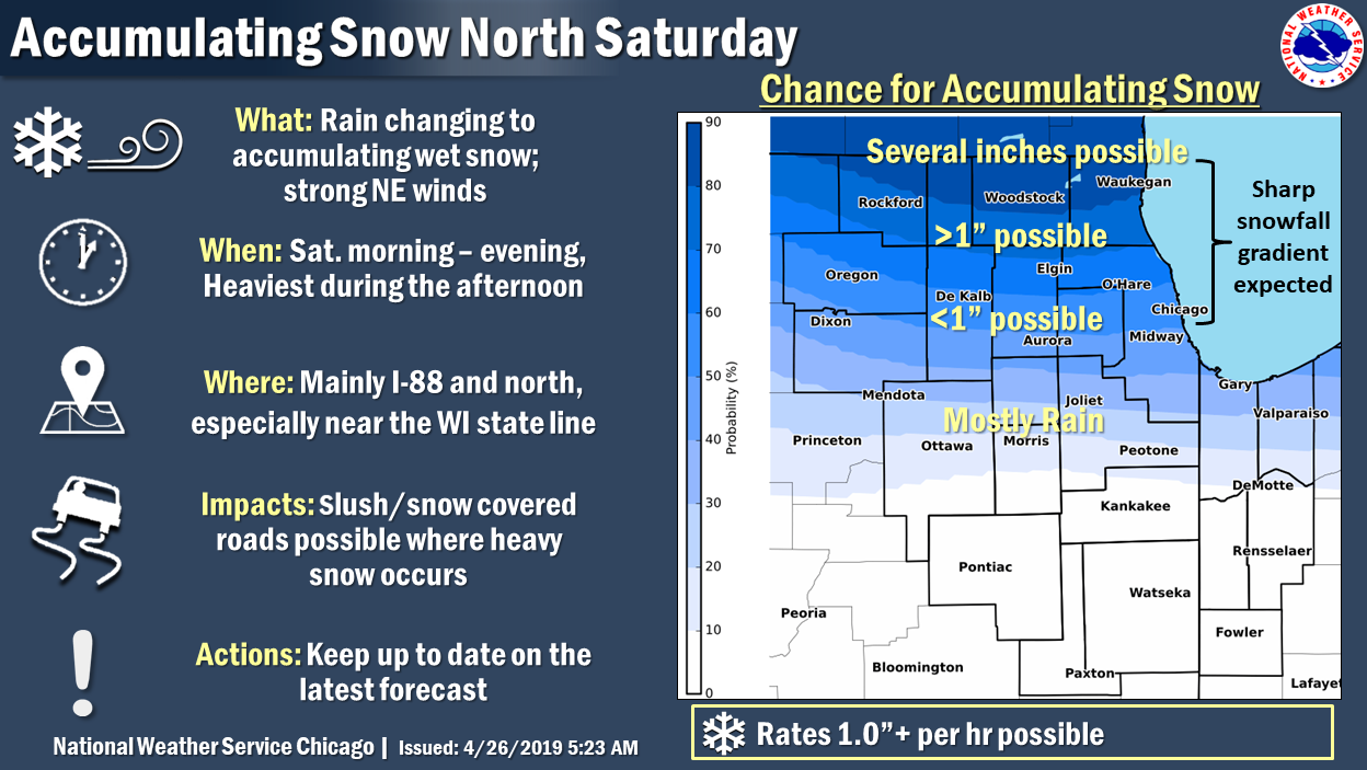
|
| Observed Snowfall |
Links
 |
Media use of NWS Web News Stories is encouraged! Additional recaps can be found on the NWS Chicago Science & Past Events Page. |
|