Heat expands across the Desert Southwest, Plains, Mississippi Valley and Midwest into Monday. Fire weather concerns continue for portions of the Intermountain West. Active monsoonal moisture fuels thunderstorms over the Southwest with possible flash flooding. Tropical cyclone Fausto in the Pacific, should weaken as it approaches Hawaii; Dangerous surf, swells and rip currents are expected. Read More >
Major River Basins
|
||||||
|
More Information
|
||||||
|
|
||||||
Terrain
|
||||||
|
|
||||||
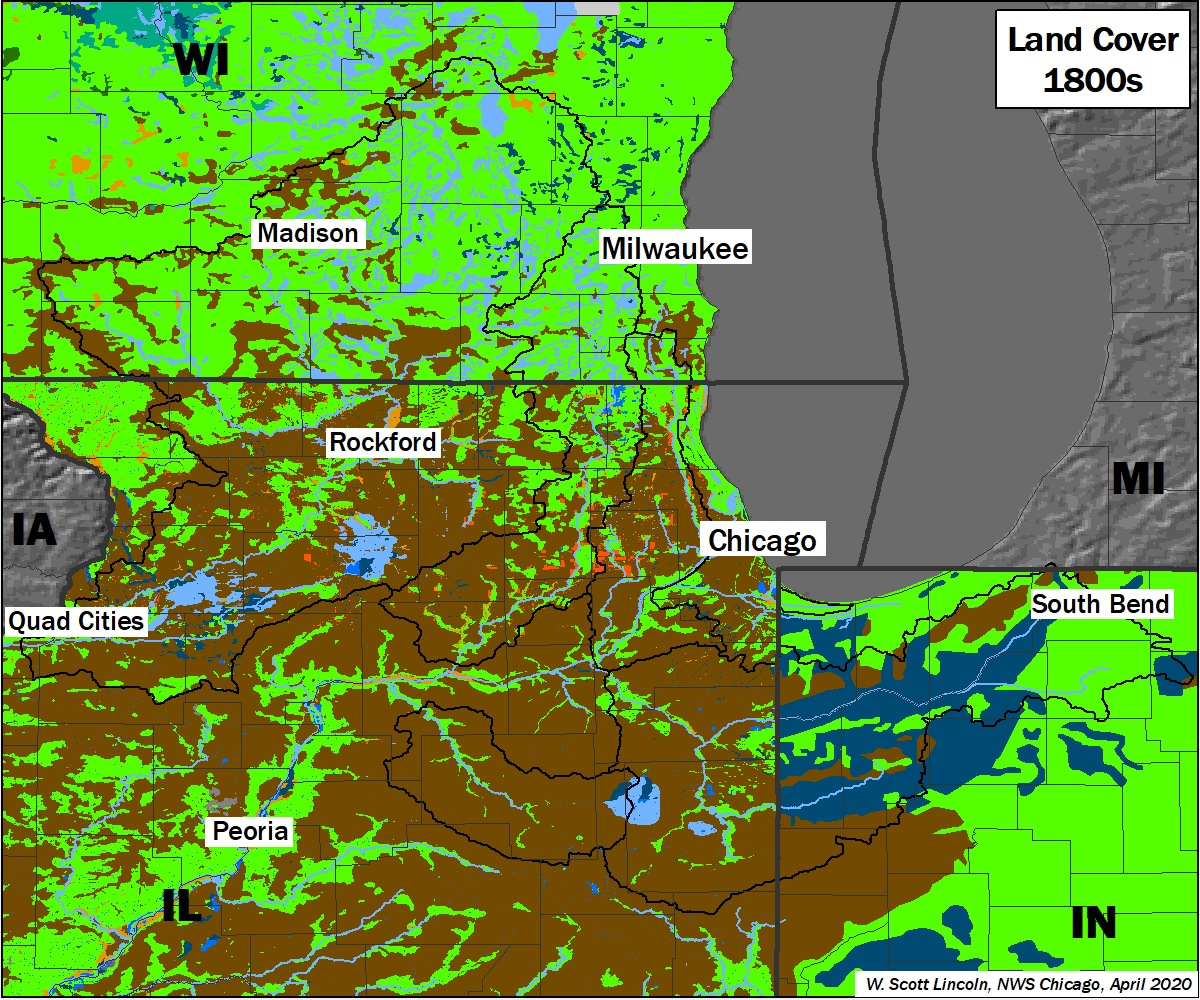
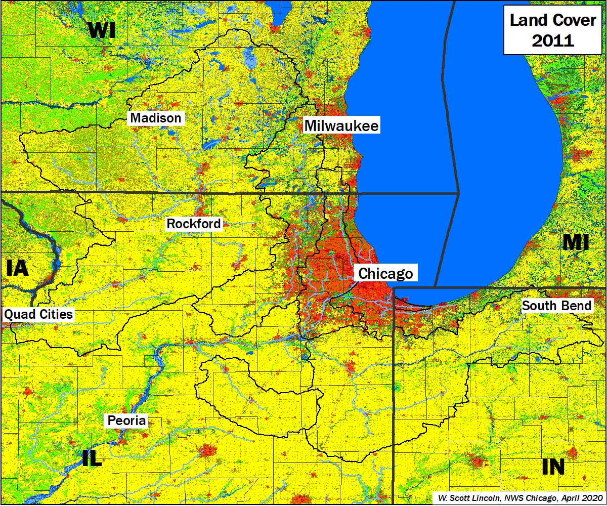
Land Cover
The land cover of the area has changed dramatically since before the widespread settlement of the area in the 1800s. The area was once mostly covered with prairie, forest, and wetlands (below, left). Numerous large wetlands were present, including the Grand Kankakee Marsh in northwest Indiana, the Inlet Swamp in Lee & Ogle Counties at the headwaters of the Green River, the Winnebago Swamp along the Green River in Lee and Bureau Counties, and the Vermillion Swamp covering portions of Livingston, Ford, and Iroquois Counties at the headwaters of the Vermilion River. Today, much of the land has been altered by humans to support agricultural and large urbanized areas (below, right). Small areas of forest and wetland remain, mostly near rivers and streams. The significant changes to area land cover including the removal of large marshes impacted the hydrology of area rivers in ways that are still noticed today.
|
||||||
|
|
||||||
Population
NOTE: Population data is "ambient population" - the average location of persons throughout the 24-hr day. Data was last updated in 2010. |
||||||