Widespread life-threatening flash and urban flooding continues in south-central Texas, with considerable flooding impacts possible across central Texas. Wildfire smoke is impacting air quality across much of the Great Lakes region into southern New England and the Mid-Atlantic. Monsoonal thunderstorms may produce isolated to scattered flash flooding across the Southwest into the Great Basin. Read More >
Tropical cyclones are organized weather systems with a closed circulation that develop over the tropics. They organize and strengthen in conditions of warm ocean waters and little wind shear. In the North Atlantic Basin, tropical cyclones are most favored during summer and autumn. These systems in their beginning stages are known as tropical depressions. If they continue to intensify with deepening pressure and strengthening winds, they are then named tropical storms. Further intensification with sustained winds reaching 74 mph or stronger would mean classification as hurricanes. The scale for hurricane intensity based on wind speed is known as the Saffir-Simpson scale. Tropical cyclones in the North Atlantic Basin are tracked and forecasted by the National Hurricane Center.
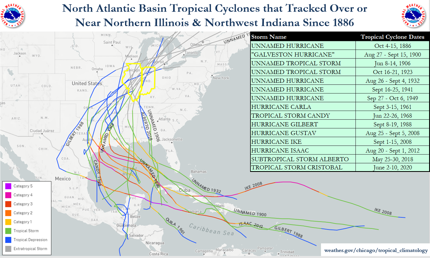
While often known for their damaging winds and battering waves along the shore, tropical cyclones can have impacts well after landfall, namely heavy rainfall. The system remnants gradually lose a portion or much of their "tropical" characteristics as they track inland, and are eventually referred to as extratropical. Remnants of tropical systems have tracked near and even over northern Illinois and northwest Indiana. They have brought rain, sometimes heavy with flooding impacts. Tropical cyclone remnants that affect the local area tend to be curving to the northeast or east, because as they move north after landfall, they become more steered by the mid-latitude westerly winds. In fact, northern Illinois and northwest Indiana are about as far northwest as Atlantic Basin tropical remnants can track, as seen on this tropical cyclone history map from the National Hurricane Center.
Below are wide scale and zoomed-in track maps, followed by a fact list for tropical system remnants that have moved over the NWS Chicago County Warning Area (CWA) since 1886.
|
|
|
||
| Figure 1: Tropical cyclone remnant tracks that have impacted the NWS Chicago CWA. | Figure 2: Same as Figure 1, but zoomed in with each storm track labeled. |
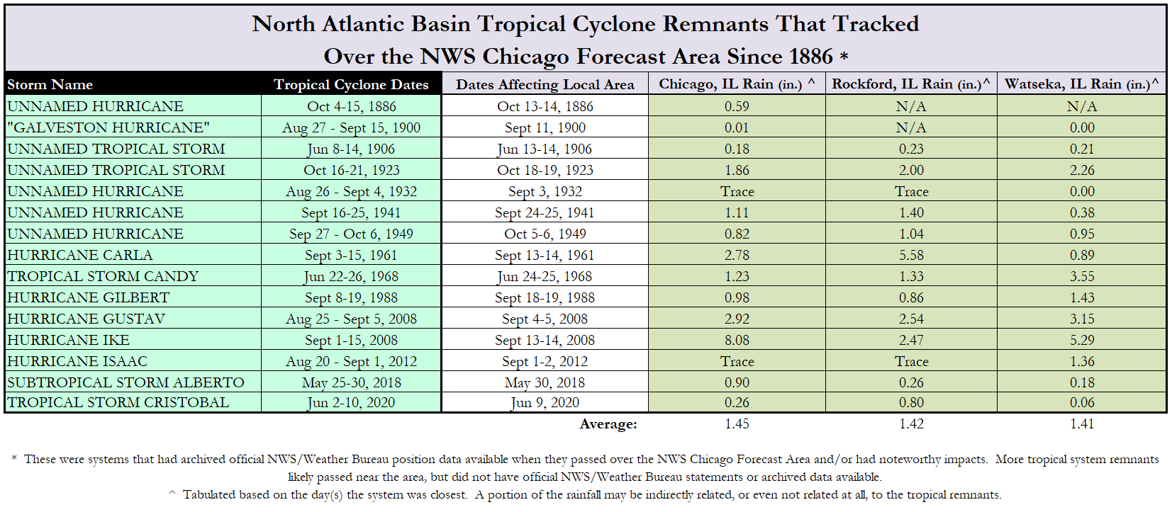 |
| Table 1: Listing of tropical systems that have impacted the NWS Chicago CWA and associated rainfall. |
|
Related Links:
Compiled by Matt Friedlein, Lead Forecaster - 2012 (updated 2021)