
Scattered thunderstorms with severe gusts, hail and a tornado risk are possible near a cold front from the Ohio Valley to the Mid-Atlantic tonight. Tropical Storm Bertha is expected to bring tropical storm conditions to portions of the Gulf Coast from the panhandle of Florida into Louisiana through Wednesday. Read More >
March Continues to Roar for West Texas
28 March 2007
Severe Thunderstorms and Tornadoes
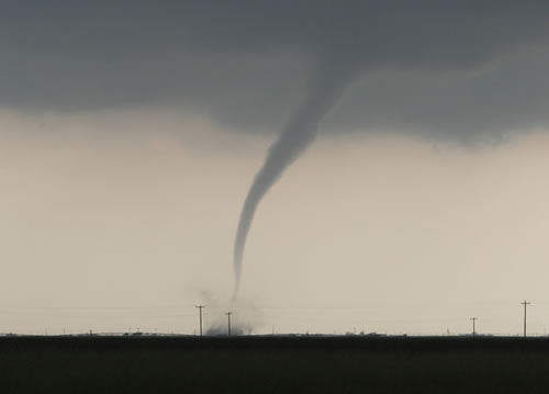
A picture of tornado that touched down southwest of Silverton between 5:30 and 6:00 pm on 28 March 2007. The picture is courtesy of KCBD Channel 11 News viewer Connie Barnett.
Another round of strong to severe thunderstorms occurred across the South Plains and Texas Panhandle Wednesday, 28 March 2007. The storms occurred in response to a approaching powerful upper-level system in combination with sufficient wind shear and plenty of moisture and instability.
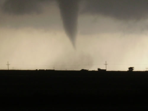
A picture of a tornado taken near Silverton. The picture is courtesy of KCBD Channel 11 News viewer Marcos Patino.
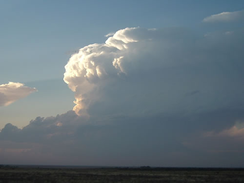
The first storms of the day fired over the central South Plains during the mid-afternoon. These storms quickly intensified and became severe, producing large hail. After a short time, a storm moving into Briscoe County became even better organized and began producing tornadoes. The first tornado touchdown of the day was reported at 520 pm, approximately 10 miles southwest of Silverton. This storm continued to produce tornadoes as it moved northeast toward Silverton. Thankfully, though, the worst part of the storm narrowly missed Silverton before proceeding off to the northeast into Palo Duro Canyon, still occasionally producing tornadoes.
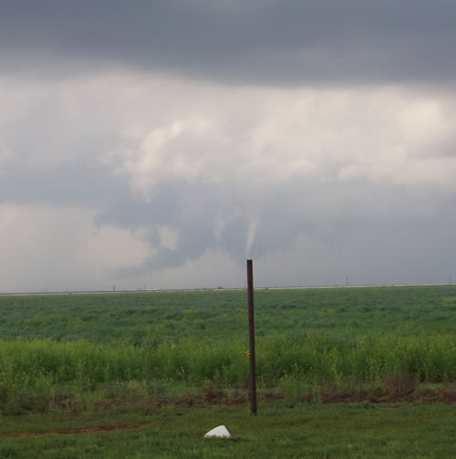
A picture of a developing tornado taken near South Plains. The picture is courtesy of KCBD Channel 11 News viewer Cathy Webster.
As the first tornadic storm moved off into the canyon, another supercell thunderstorm intensified, following a track just to the southeast of the previous storm. This strongly rotating storm then produced its first observed tornado just to the southeast of the community South Plains in northern Floyd County at 606 pm. Like the earlier storm, this cyclic tornadic supercell continued to produce occasional tornadoes as it tracked off to the northeast into southeast Briscoe County, near Caprock Canyon State Park, and eventually into northwest Hall County.
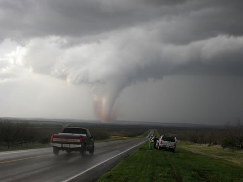
A picture tornado approximately 2 miles west of highway 256/70 intersection north of Turkey. The picture was taken by NWS employee Bruce Haynie.
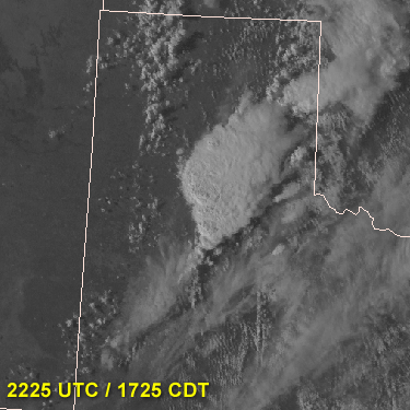
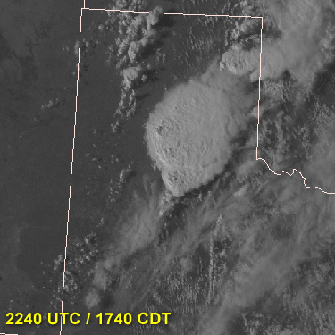
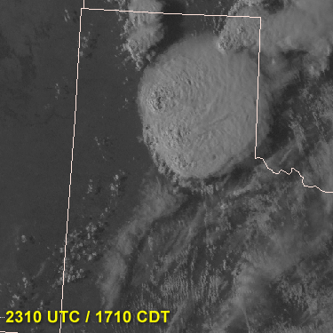
Below are a series of satellite images that show the two supercells that developed and spawned the tornadoes:
 |
 |
|
| Both storms are quickly strengthening along a convergence line | Right around the time of the tornado near Silverton (1st storm) | |
 |
 |
|
| Northern storm has split - producing three cells in the cluster | Near the time of the tornado near South Plains (2nd storm) | |
| Click on the images for larger versions. These images were obtained from the West Texas Mesonet (www.mesonet.ttu.edu) | ||
Then, after a short reprieve, a line of storm developed near the state line and preceded to advance eastward, passing across much of the South Plains and southern Texas Panhandle during the late evening, and then across the southeast Texas Panhandle and Rolling Plains during the early morning hours of the 29th. This line of storms produced considerable amounts of severe hail (generally between 0.75 and 1.50 in diameter) and sporadic severe wind gusts, primarily on the Caprock.
A picture of developing thunderstorms looking west from west of Brownfield Wednesday evening. The picture is courtesy of KCBD Channel 11 News viewers Jamie and Tina Pewitt.
To view a preliminary local storm report that includes details on reports of tornadoes, severe hail and severe wind gusts received by WFO Lubbock CLICK HERE. Keep in mind that these reports are preliminary and are subject to change.

