
Numerous severe thunderstorms are expected across a broad region from the Ohio Valley to the Mid-Atlantic and Northeast States today into tonight. Swaths of damaging wind gusts are expected and some tornadoes are possible. Bertha is expected to bring tropical storm conditions to portions of the Gulf Coast from the Florida Panhandle westward to southeastern Louisiana later today and Wednesday. Read More >
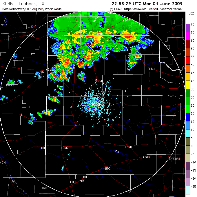
An area of showers and thunderstorms developed across the northwest South Plains and southwest Texas Panhandle during the afternoon of Monday, 1 June 2009. This activity congealed into a small complex the moved east and then more southeast across Rolling Plains during the evening hours. Instability and wind shear was rather limited during the afternoon hours, so widespread severe weather was not observed, but a few storms occasionally became strong to briefly severe, especially into the evening and overnight hours when moisture increased slightly as a southerly low level jet developed. The intensifying low level jet along with an approaching upper level storm system also supported the redevelopment of a couple of strong thunderstorms that tracked from the northeast South Plains into the northern Rolling Plains during the early morning hours Tuesday (2 June).
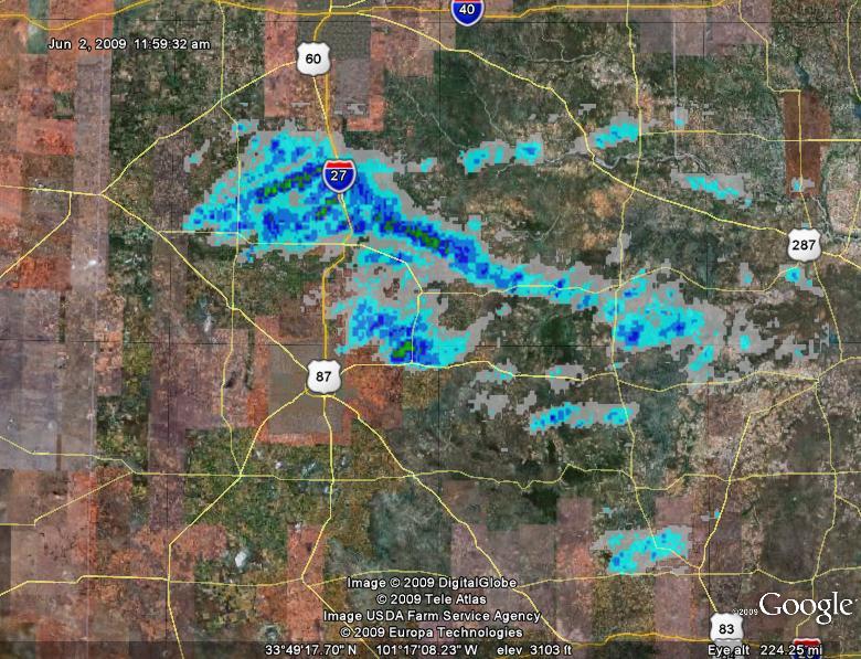
The stronger thunderstorms produced localized heavy rain along with areas of hail and gusty winds, including some storms which briefly eclipsed severe thresholds. A wind gust to 62 mph was measured near Turkey by the West Texas Mesonet just after 8 pm, with a report of 1 inch diameter hail in Ralls shortly after 10 pm. The above image displays hail swaths, as estimated by the Lubbock radar during this thunderstorm event. One notable swath, from just north of Plainview east-southeast into the Rolling Plains, occurred during the overnight hours with the two isolated storms that formed around midnight. For a more complete list of the preliminary storm reports for this event CLICK HERE.
|
|||||||
|
|

