|
More Heavy Rain and Snow |
 |
|
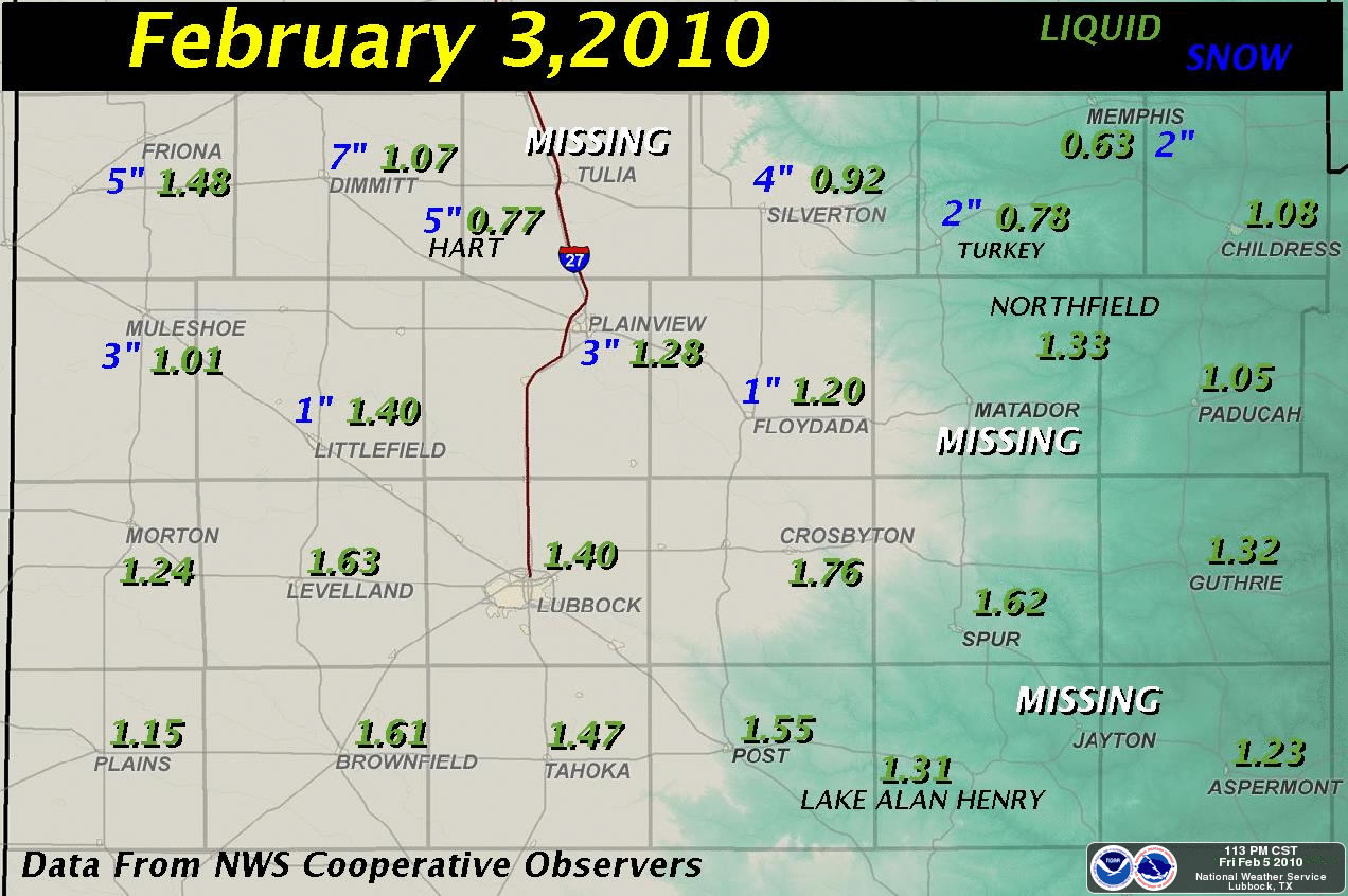
Graphic displaying the amount of rain (green) and snow (blue) observed from the February 3rd storm. Amounts are in inches. Click on the image for a larger view. |
|
Before the winter storm was all said and done, it provided the region with another round of beneficial precipitation. The above graphic shows that most locations recorded anywhere from an inch to an inch and a half of liquid, with even a few slightly higher amounts over the central and southern South Plains. Additionally, the southern Panhandle into the northern South Plains saw widespread 2 to 5 inch snows, with locally heavier amounts. Dimmitt was the snowfall winner, reporting 7 inches. To view the public information statement issued regarding this event CLICK HERE. To read the local storm report referencing the snow CLICK HERE. |
 |
|
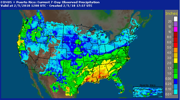
Imaging depicting the 7-day observed precipitation across the United States ending at 6 am CST on February 5, 2010. Click on the image for a larger view. |
|
|
 |
|
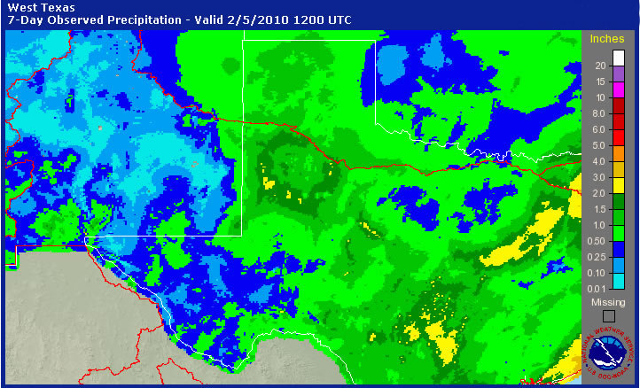
Graphic showing the 7-day observed precipitation across western Texas, western Oklahoma and eastern New Mexico ending at 6 am CST on February 5, 2010. Click on the image for a larger view. |
|
|



 Follow us on X
 Follow us on Facebook
 Follow us on YouTube
 LUB RSS Feed


