
Scattered thunderstorms with severe gusts, hail and a tornado risk are possible near a cold front from the Ohio Valley to the Mid-Atlantic tonight. Tropical Storm Bertha is expected to bring tropical storm conditions to portions of the Gulf Coast from the panhandle of Florida into Louisiana through Wednesday. Read More >
Severe Thunderstorms Bring Hail and Flooding Rains
|
|||||||
 |
|||||||
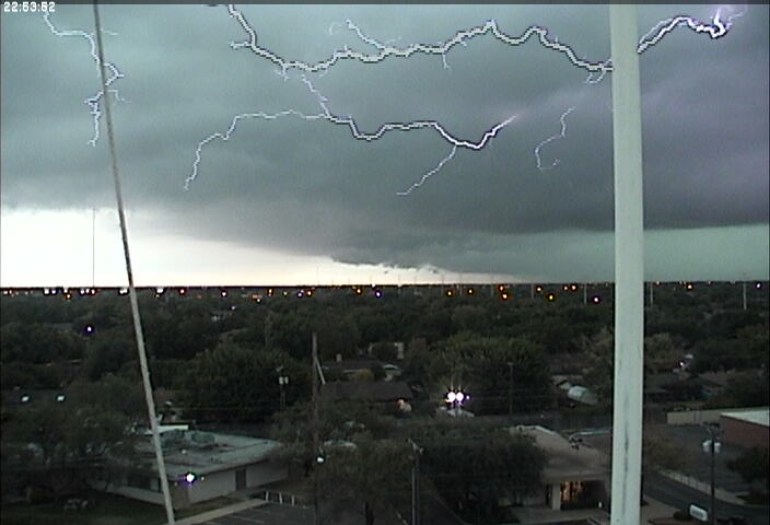
| Picture taken from south Lubbock as a storm approached around 6 pm on 21 October 2010. | |||||||
| A powerful late October storm system brought rounds of heavy rain and severe weather to the South Plains region from Thursday (21 Oct) to Friday afternoon (22 Oct). Initially, strong lift from the approaching system generated a large complex of thunderstorms that tracked across the northern South Plains into the Texas Panhandle, bringing widespread rainfall across that area. | |||||||
|
|
|||||||
| Picture taken near University and 89th Street in Lubbock on the evening of 21 October 2010. The Picture is courtesy of KCBD and Robin Simpson. | |||||||
| Then, as things heated up just enough, a new round of thunderstorms erupted from the southern into the central South Plains. The strongest of these storms were prolific hail producers, with quarter to golf ball sized hail reported anywhere from just east of Plains to near Brownfield, Meadow and into parts of Lubbock. | |||||||
|
|
|||||||
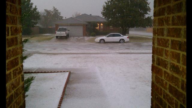
| Picture taken in Meadow, TX, on the evening of 21 October 2010. The Picture is courtesy of KCBD and Shaena F. | |||||||
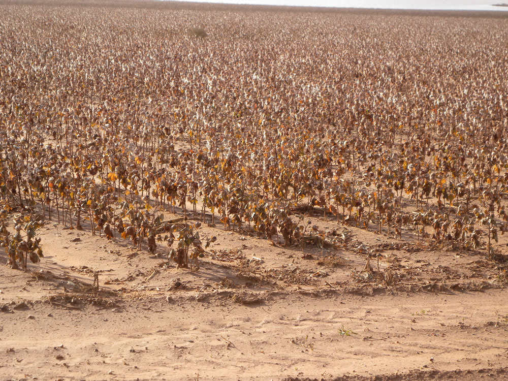
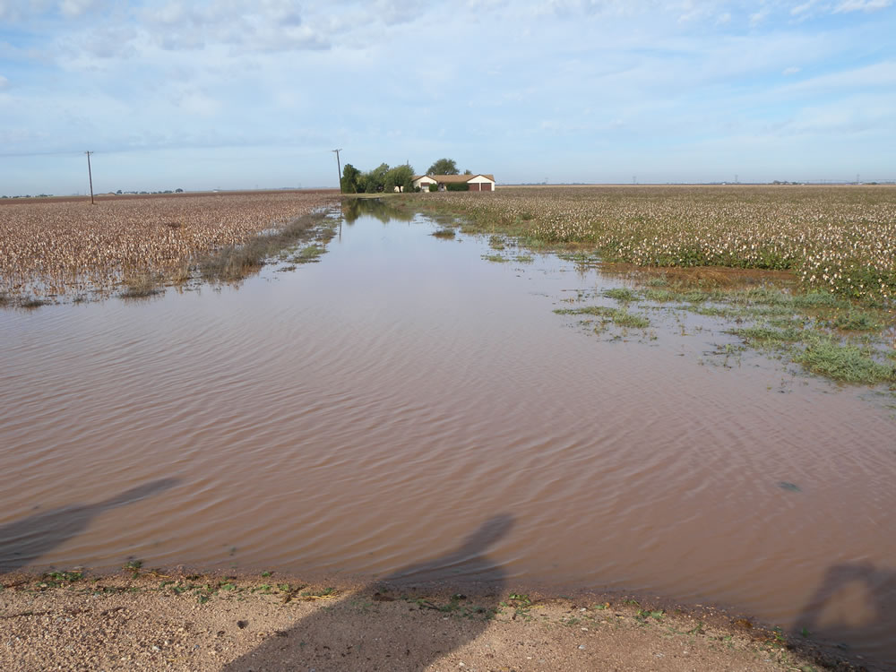
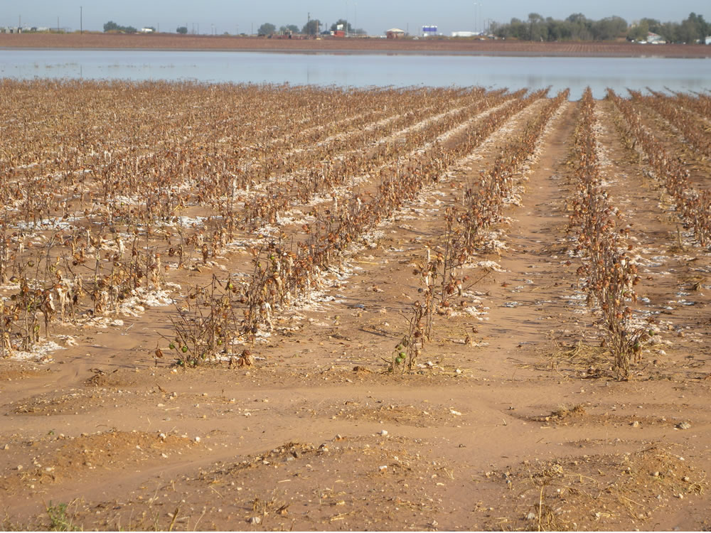
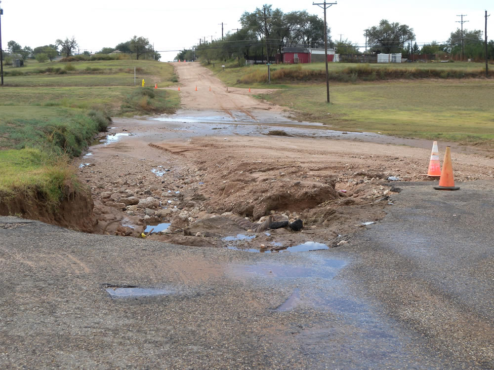
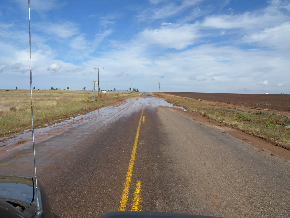
| In addition to the hail, the storms continued to redevelop and train over the same areas, bringing very heavy rain anywhere from Brownfield through Meadow, Lubbock, Slaton and Ralls. The heavy rain flooded many streets and low lying areas including swelling playa lakes, while the combination of heavy rain and hail damaged or destroyed a lot of cotton sitting in the fields. Eventually the storms shifted eastward and slowly weakened as they moved into the Rolling Plains during the evening hours. | |||||||
|
|
|||||||
| Map created from measured rainfall totals from Thursday (21 October) through the afternoon of Friday (22 October 2010). Click on the map for a larger view. Rainfall data is courtesy of the Texas Tech West Texas Mesonet and the National Weather Service. | |||||||
| Then, as a strong upper level jet spread over from the west, another batch of thunderstorms developed across the South Plains and then blossomed over parts of the Rolling Plains and southeast Texas Panhandle during the early morning Friday. This round of activity produced more moderate to heavy rain, with many locations picking up another third of an inch to an inch and a half, with a few sites receiving 1.5-2.5 inches. | |||||||
|
|||||||
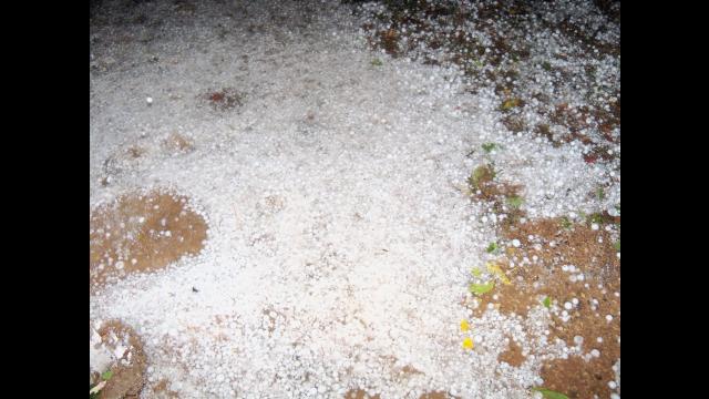
| Pictures of rain and hail impacts around Terry county. Images were taken on Friday, 22 October 2010. Click on the images for a larger view. | |||||||
|
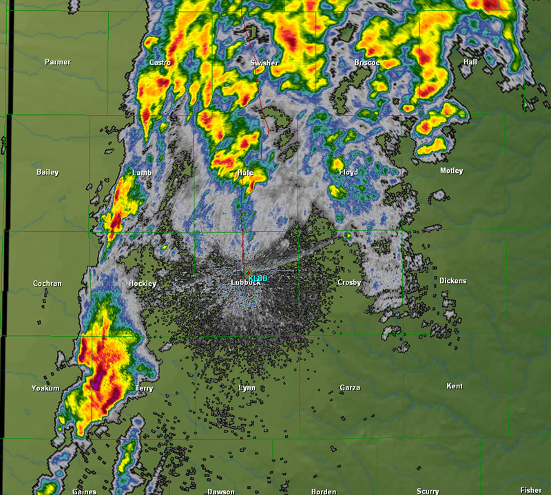
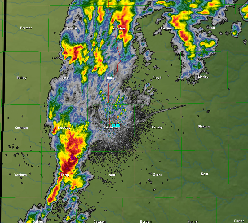
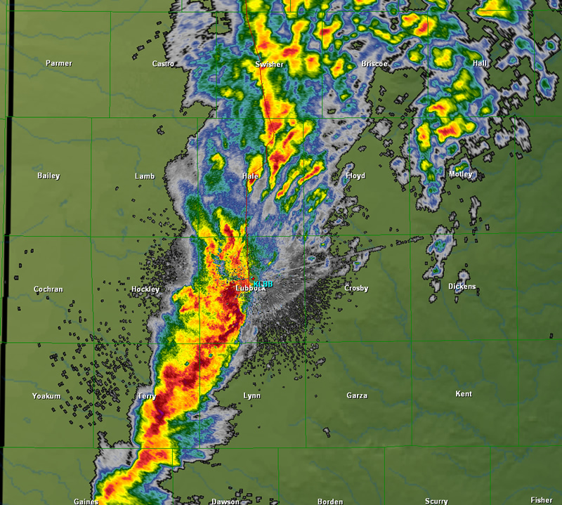
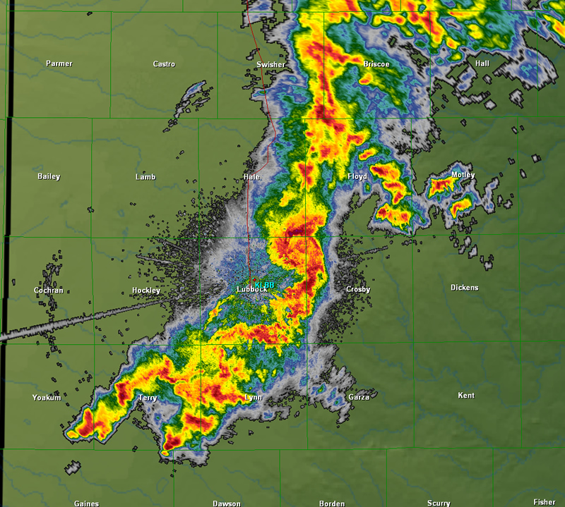
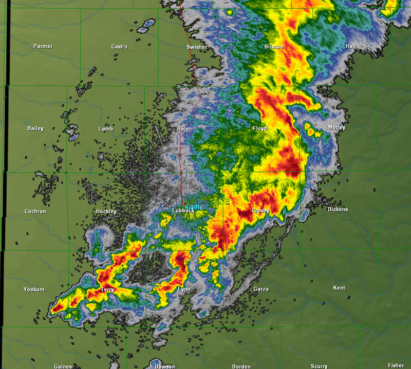
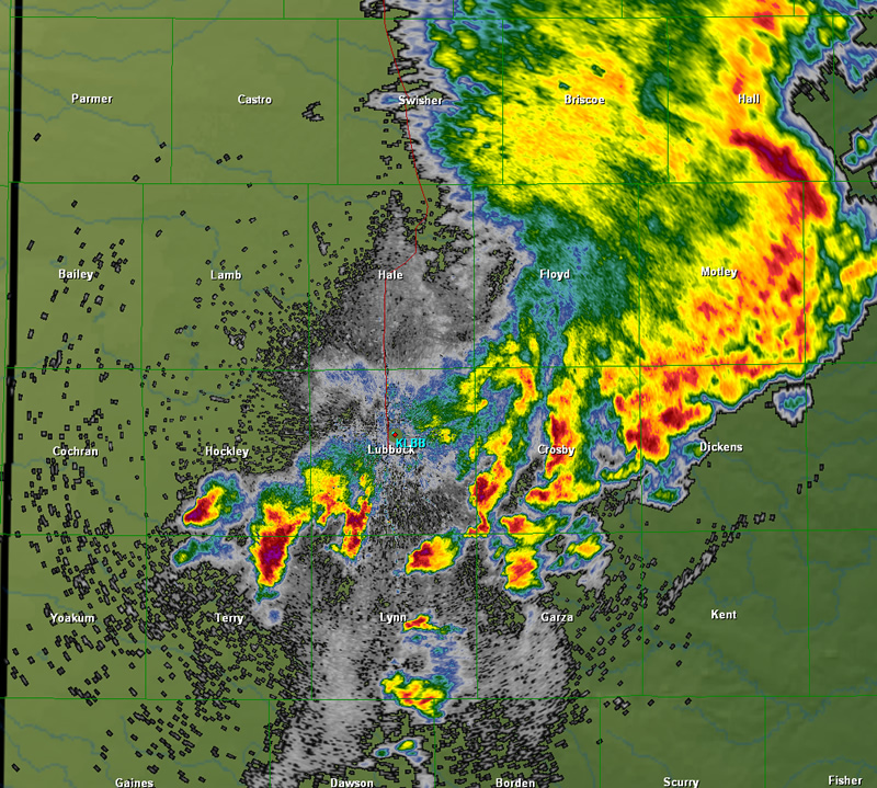
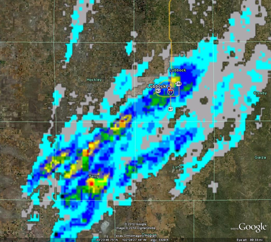
All of the precipitation finally shifted east of the Rolling Plains by mid-morning Friday. However, one last storm did develop across the southern Rolling Plains and briefly became severe as it moved across Stonewall County during the mid-afternoon. Below is a sequence of radar images from the National Weather Service radar at Lubbock during the height of the severe thunderstorm activity late Thursday afternoon into Thursday night. |
|||||||
 |
 |
||||||
 |
 |
||||||
 |
 |
||||||
| Images from the Lubbock WSR-88D base reflectivity display. The image times (image sequence is across, then down) are approximately 4 pm, 5 pm, 6 pm, 7 pm, 8 pm, and 9 pm. Click on the images for a larger view. | |||||||
| The structure of the storms, as observed by radar, can also be used to calculate the maximum expected hail size produced by the storm. The below image depicts the maximum estimated hail size the fell over the South Plains during the afternoon and evening of the 21st. The image shows that much of Terry County saw significant hail, with a hail swath through southeast Hockley into central Lubbock Counties. Another hail swath can be seen through central and northern Lynn County. | |||||||
|
|
|||||||
| The above image displays the radar estimated maximum hail size that fell over the southern and central South Plains during the afternoon and evening of the 21st. The light blue colors correspond to small hail, with yellows and reds indicating hail possibly as large as 1.75" to over 2" in diameter. Click on the image for a larger view. | |||||||
|
To view the preliminary Local Storm Reports (LSR) for this event CLICK HERE. To view a story on this event composed by the Texas Tech West Texas Mesonet CLICK HERE. |
|||||||


