
Dangerous heat will expand from the Gulf Coast into the Southern Plains and Desert Southwest through week's end. Additional extreme heat impacting the Pacific Northwest will shift to the northern Plains by the weekend. Tropical Storm Bertha is expected to continue to impact portions of the northern Gulf Coast from the western Florida Panhandle to southeastern Louisiana through tonight. Read More >
|
Widespread rain and thunderstorms |
|
 |
|
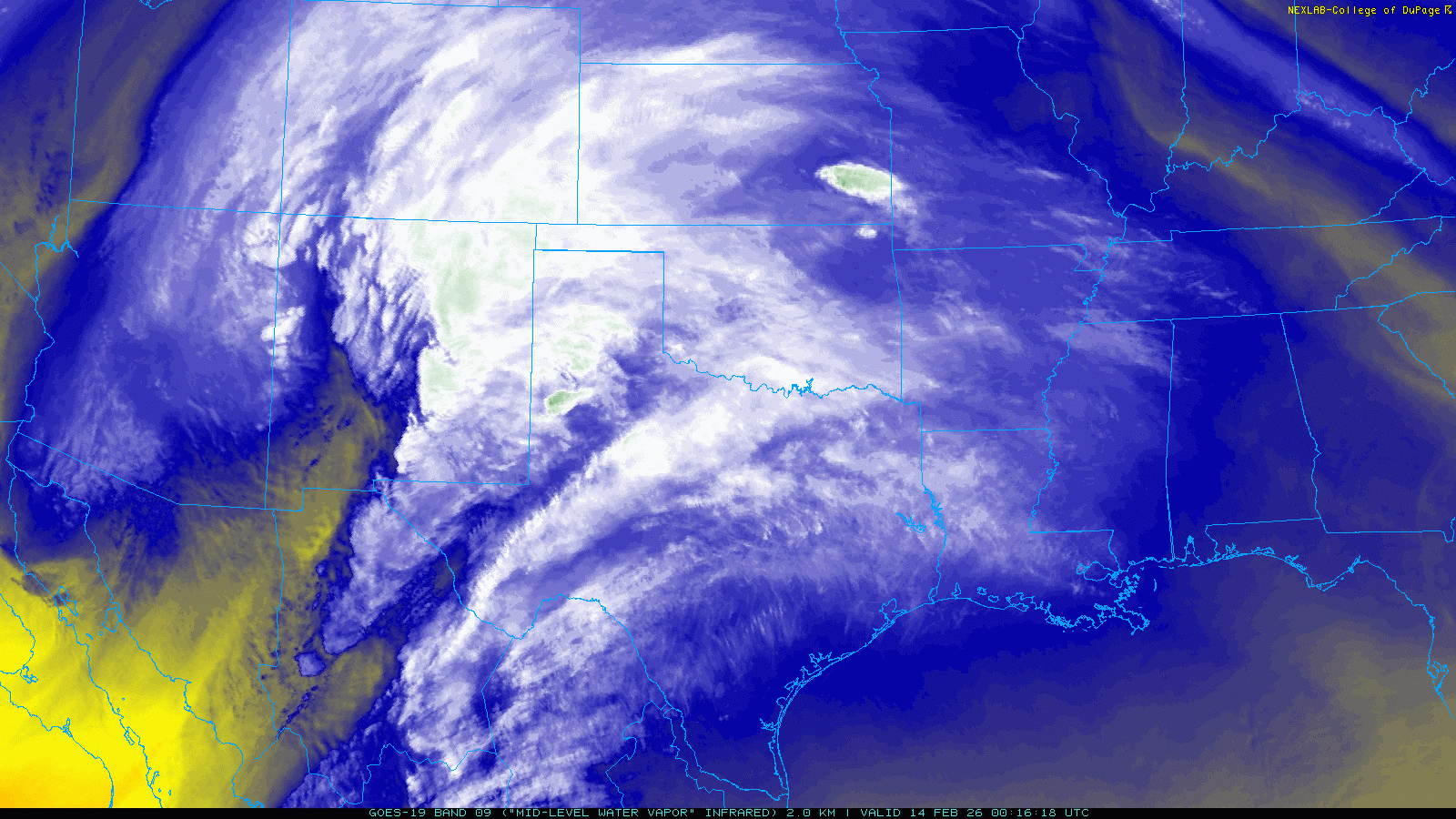
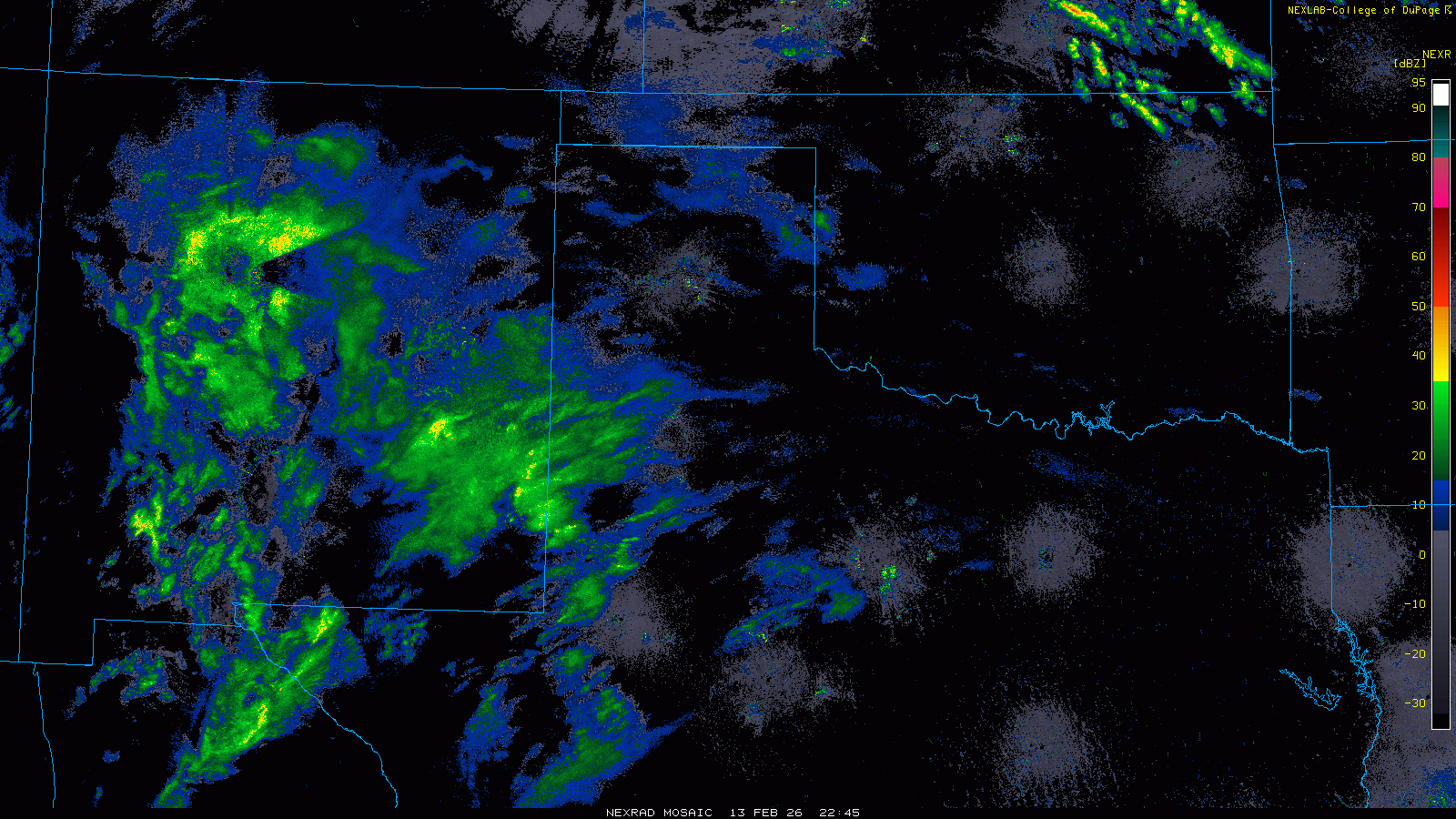
| Water vapor satellite animation valid from 6:16 pm to 7:21 pm on Friday (13 February 2026). | |
|
An early Valentine's Day gift, in the form of widespread rain, fell on the South Plains region Friday evening/night (13 February). The rain, and embedded thunderstorms, was triggered by a potent storm system as it emerged from the Desert Southwest. Lift and moisture accompanying the system initially caused a broad area of showers to form over eastern New Mexico and the western South Plains late Friday afternoon into the early evening hours. |
|
 |
|
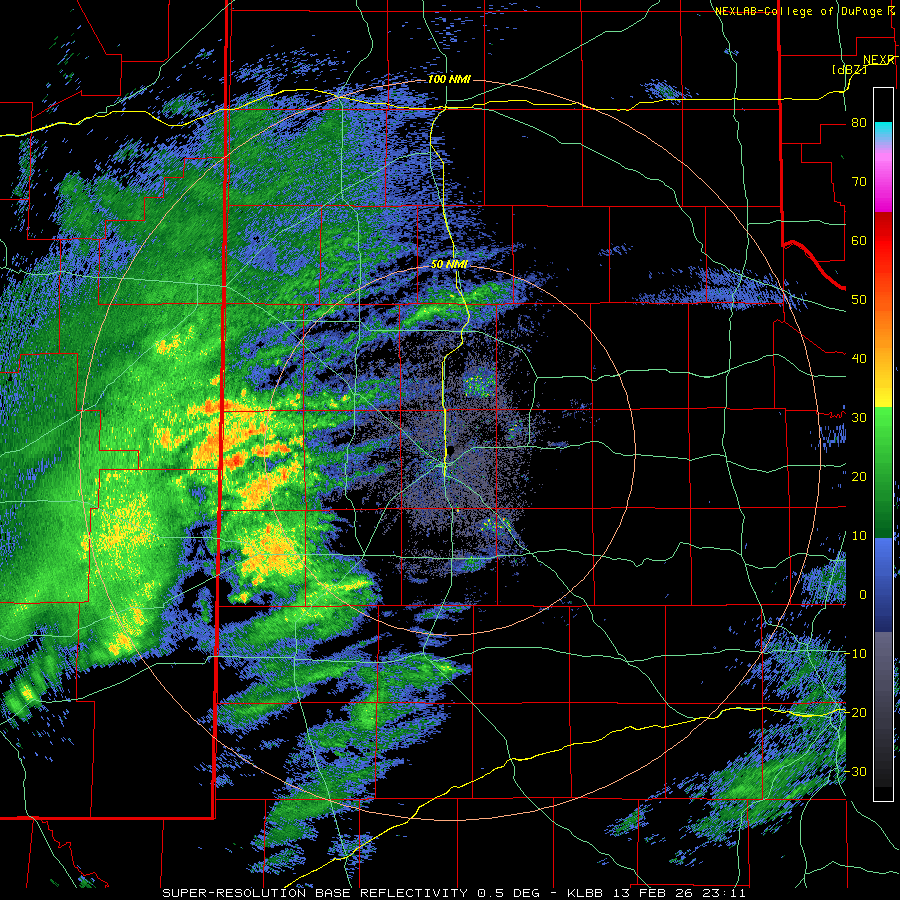
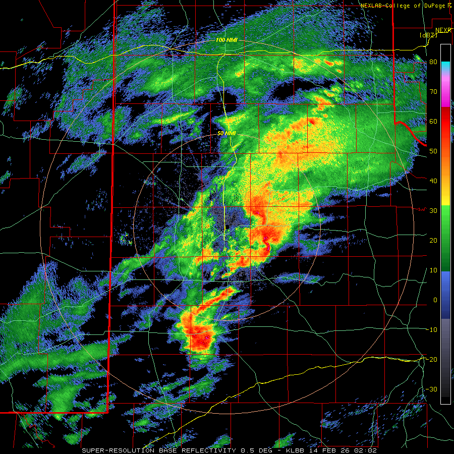
| Lubbock WSR-88D radar animation valid from 5:11 pm to 9:54 pm on Friday (13 February 2026). An additional radar animation, valid from 8:02 pm on Friday to 10:18 am on Saturday (13-14 February), can be FOUND HERE. A regional radar animation, valid from 4:05 pm on Friday to 10:05 am on Saturday, can be VIEWED HERE. | |
| Embedded thunderstorms rapidly formed Friday evening as the storm system tapped Gulf moisture and improved instability over the South Plains. One intense thunderstorm developed over the western South Plains and tracked eastward, impacting locations in and near Lubbock, Slaton, Crosbyton and Dickens, before weakening as it spread farther into the Rolling Plains. The most intense thunderstorm activity produced brief heavy rain and even pockets of small hail, despite relatively limited instability. | |
 |
|
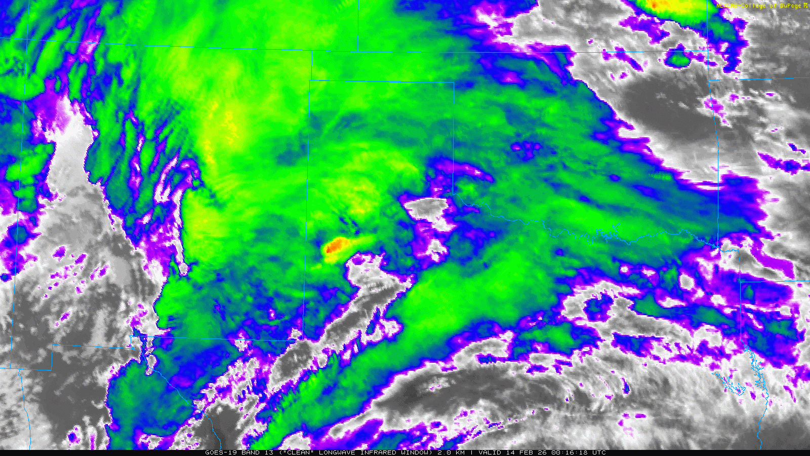
| Infrared satellite animation valid from 6:16 pm to 7:21 pm on Friday (13 February 2026). | |
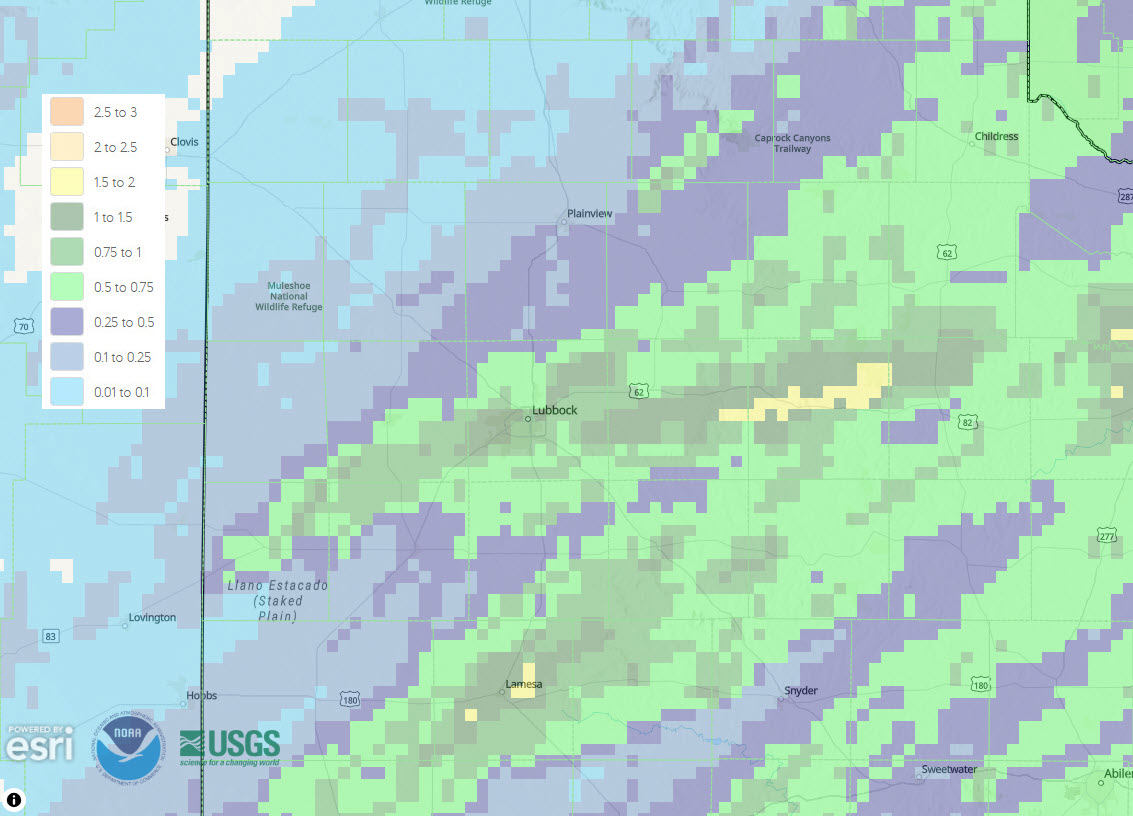
| Additional rounds of showers and thunderstorms continued Friday night and into early Saturday morning, focused primarily over the Rolling Plains and southeastern South Plains. The activity gradually shifted east of the region after daybreak on Valentine's Day, but not before bringing rain to the entire region. Unfortunately, the precipitation was on the light side, under a tenth of an inch, across the southwest Texas Panhandle and northwestern South Plains, as well as the southwest South Plains. Elsewhere, rain totals of a third of an inch to over a half inch was common. | |
 |
|
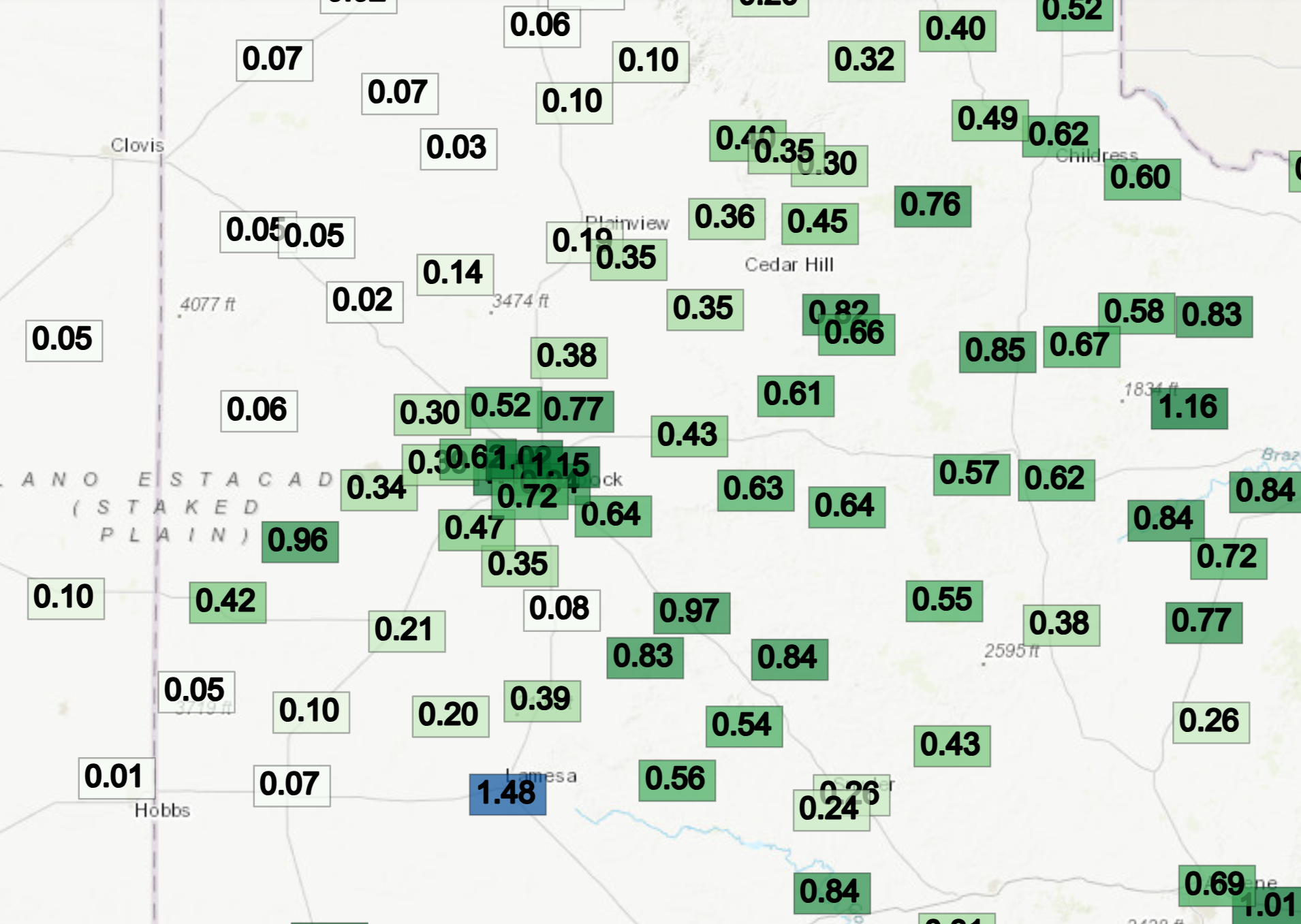
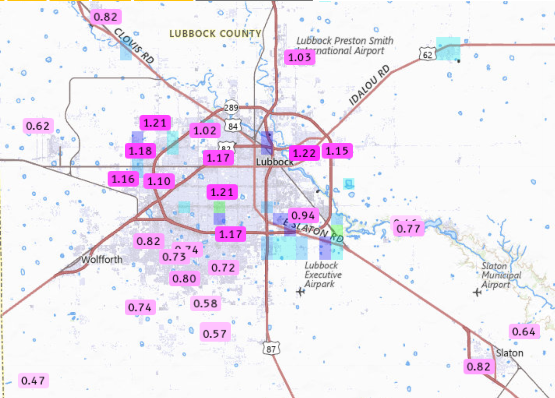
| 24-hour rain totals measured through 10 am on Saturday (14 February 2026). The data are courtesy of the West Texas Mesonet. Additional rain totals from around Lubbock can be found HERE and HERE. | |
|
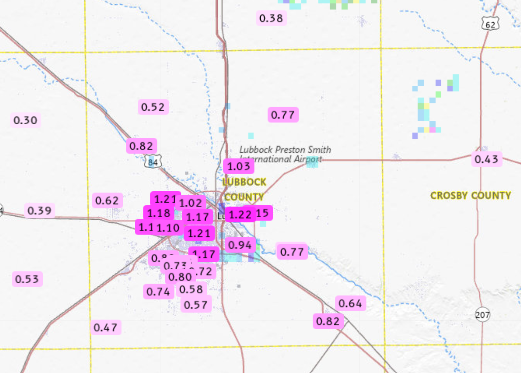
Some of the heaviest rain targeted Lubbock, with many sites around town measuring between 0.70 and 1.25 inches of rain, much of which fell in about a half hour. The torrential rain caused widespread street flooding as runoff quickly filled the roadways. Officially, the Lubbock Airport measured 0.93 inches Friday evening into early Saturday, more than doubling the year-to-date rain total to 1.59 inches. |
|
 |
|
| Flooded intersection at 98th Street and Indiana Avenue in Lubbock at 7:38 pm Friday evening (13 February). The image is courtesy of the City of Lubbock. | |
| In addition to producing heavy rain, the intense thunderstorm generated a peak wind gust of 65 mph at the West Texas Mesonet site on the northeast side of Slaton. | |
 |
|
| Radar-estimated and bias-corrected 24-hour rainfall ending at 6 am on Saturday (14 February 2026). | |
| The preliminary storm report collected by WFO Lubbock for this event can be found below. | |
Preliminary Local Storm Report
National Weather Service Lubbock TX
801 PM CST Fri Feb 13 2026

..TIME...   ...EVENT...      ...CITY LOCATION...     ...LAT.LON...
..DATE...   ....MAG....      ..COUNTY LOCATION..ST.. ...SOURCE....
            ..REMARKS..

0747 PM     Tstm Wnd Gst     2 NE Slaton             33.46N 101.62W
02/13/2026  M65 MPH          Lubbock            TX   Mesonet

