
Scattered thunderstorms with severe gusts, hail and a tornado risk are possible near a cold front from the Ohio Valley to the Mid-Atlantic tonight. Tropical Storm Bertha is expected to bring tropical storm conditions to portions of the Gulf Coast from the panhandle of Florida into Louisiana through Wednesday. Read More >
|
Widespread Rain for West Texas
13 October 2013 |
 |
| Heavy rains resulted in flooding in and around Turkey, Texas, Sunday afternoon and evening (October 13, 2013). This picture was taken on the south side of Turkey and is courtesy of Travis Kimbell. Click on the image for a larger view. |
| A return of deep moisture coupled with a passing upper level storm system was enough to support a large area of rain with embedded thunderstorms on Sunday (13 October 2013). The complex of precipitation tracked slowly eastward across much of the South Plains and into the Rolling Plains and southeastern Texas Panhandle, bringing welcome widespread rain to the region. |
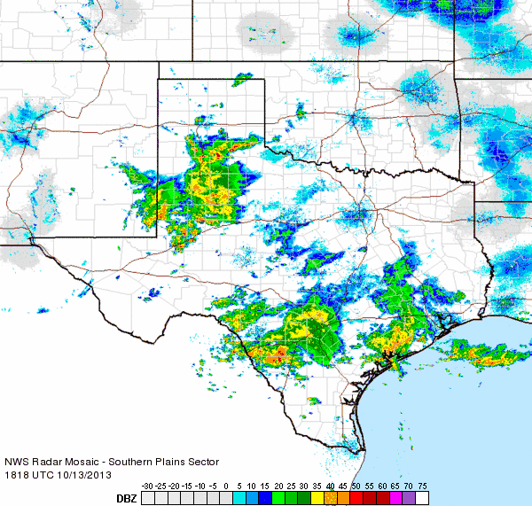 |
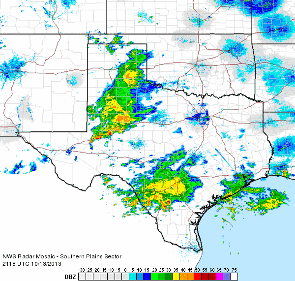
| Regional radar animation from 1:18 to 2:28 pm on Sunday, 13 October 2013. An additional radar animation valid from 4:18 to 5:28 pm can be FOUND HERE. |
| Many locations received between 0.5 and 1.5 inches of welcome rainfall. The rain was maximized across the southern South Plains where 1.5 to over 2 inches fell. In addition, a swath of heavy rain developed from east of Plainview through Turkey, where 2+ inches fell, with localized amounts in excess of 6 inches. The heaviest rain fell near Turkey where the COOP observer measured 7.15 inches. The heaviest rain did result in areas of flooding, particularly in and around Turkey. On the other extreme, the southwest Texas Panhandle, far northwest South Plains and much of Cottle County largely missed out on the rain. |
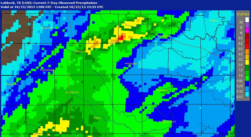 |
| 7-day total radar estimated and bias-corrected rainfall for the South Plains region, ending at 7 am on Wednesday (15 October 2013). Click on the image for a bigger view. |
|
The rain gradually tapered off and shifted east Sunday night. However, another shield of rain did develop late Monday night and lingered through much of the day on Tuesday. This area of rain was directly largely to the south of the area, from the Permian Basin into Central and North Texas, though the southern Rolling Plains received a glancing blow, with spots around Jayton and Aspermont picking up several tenths of an inch. The below map shows the rainfall totals, as recorded by the West Texas Mesonet, over several different time spans through this wet mid-October stretch. |
|
|
||
|
Toggle 48 hr rain total (inches) ending on October 14, 2013 at 9 pm
|
Toggle 72 hr rain total (inches) ending on October 14, 2013 at 9 pm
|
Toggle 96 hr rain total (inches) ending on October 15, 2013 at 7 pm
|

