| Early September Storms 6-7 September 2016 |
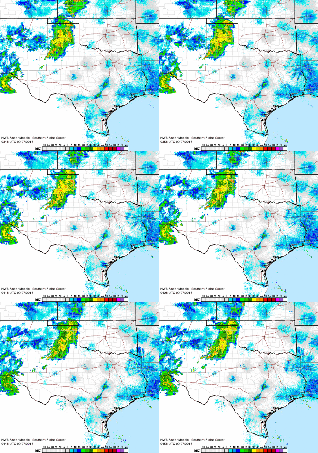 |
| Regional radar animation valid from 10:48 pm to 11:58 pm on Tuesday, 6 September 2016. |
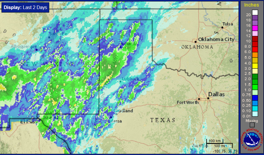
| Early September brought another bout of moderate to heavy rain to the region. This time the heaviest rain was focused across southwest Texas Panhandle into the northwestern South Plains as a slug of moisture associated with eastern Pacific Hurricane Newton spread across West Texas. The efficient rain-producing showers and thunderstorms overspread the western South Plains during Tuesday evening and overnight (6 September). |
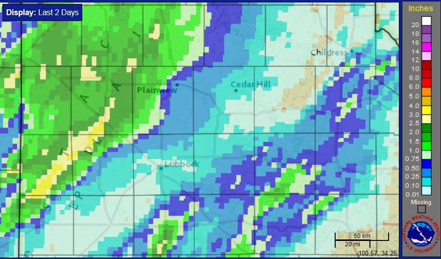 |
| Two-day radar-estimated and bias-correct rainfall totals ending at 5 am on Thursday, 8 September 2016. A regional view of the same image can be FOUND HERE. |
| The heavier rain diminished early Wednesday, but another batch of showers and thunderstorms redeveloped further east dropping pockets of moderate to heavy rain from the southeast South Plains into the Rolling Plains. This activity wasn't as concentrated as the night before, but a few spots still recorded intense rain rates. One particularly intense storm developed around midnight and tracked across O'Donnell and Tahoka where it dumped 1-2+ inches in less than an hour before weakening. |
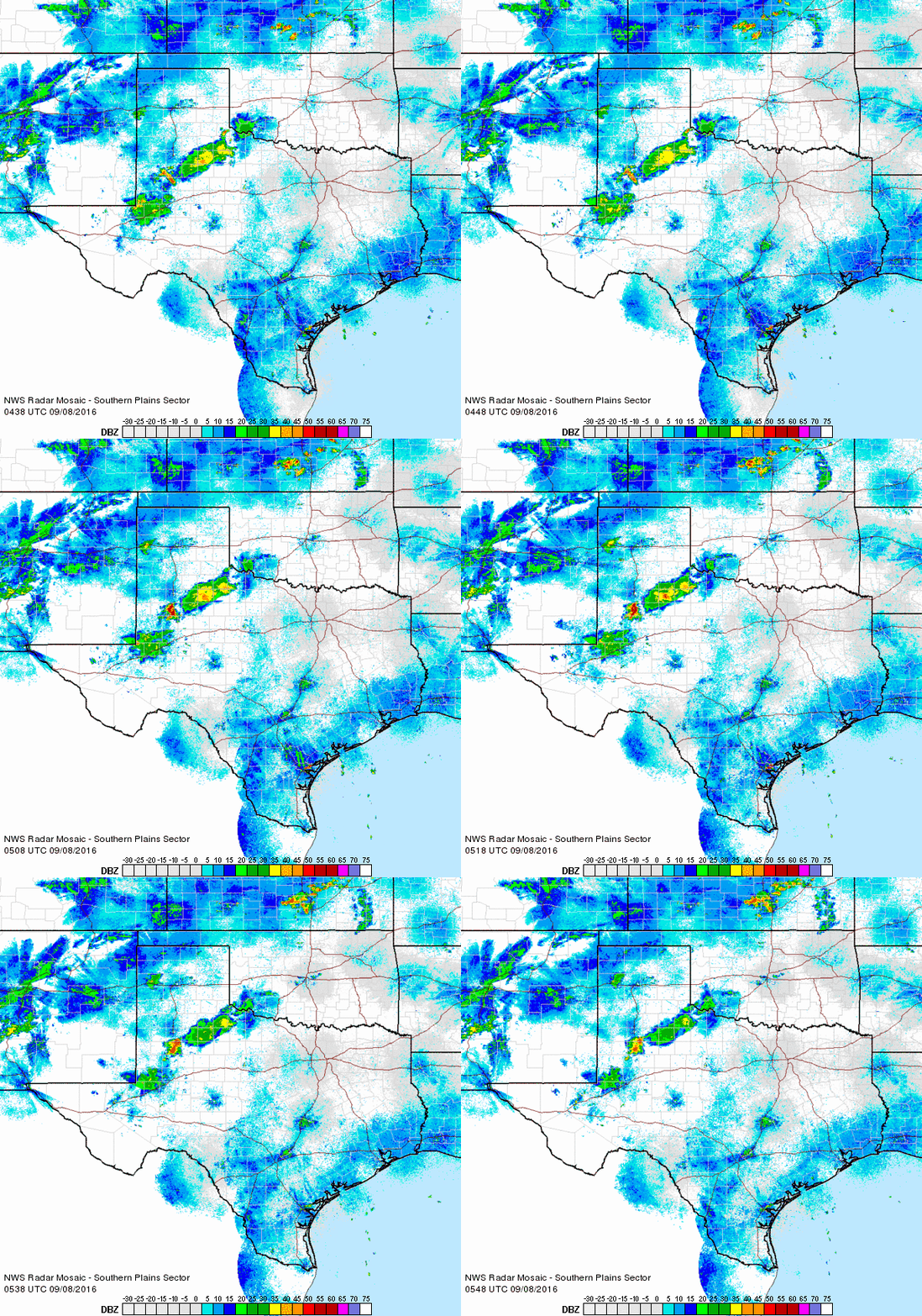 |
| Regional radar animation valid from 11:38 pm on the 7th to 12:48 am on Thursday, 8 September 2016. |
| After the two rounds of rain, many locations in the South Plains region recorded anywhere between 1 and 3 inches, with localized even higher amounts. However, a swath of land from the southwest and central South Plains into the southeast Texas Panhandle, including Lubbock and Childress, largely missed out, with tallies of a trace to a couple tenths of an inch common. |
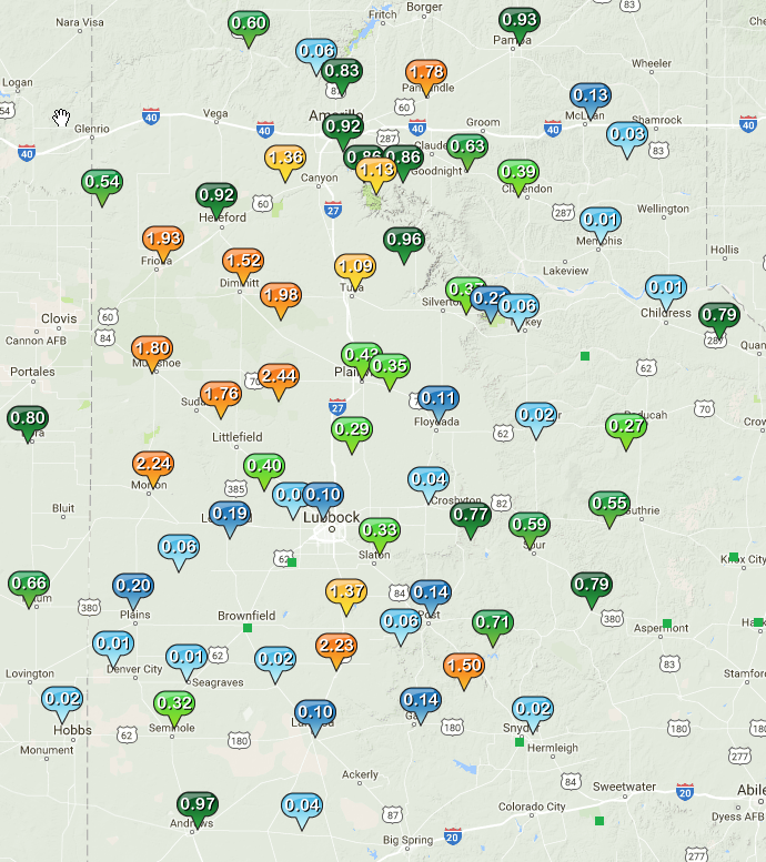 |
| 48 hour rainfall totals, as measured by the Texas Tech West Texas Mesonet, ending at 7 am on Thursday, 8 September 2016. |



 Follow us on X
 Follow us on Facebook
 Follow us on YouTube
 LUB RSS Feed