| Hurricane Sergio's remnants bring West Texas rain 12-13 October 2018 |
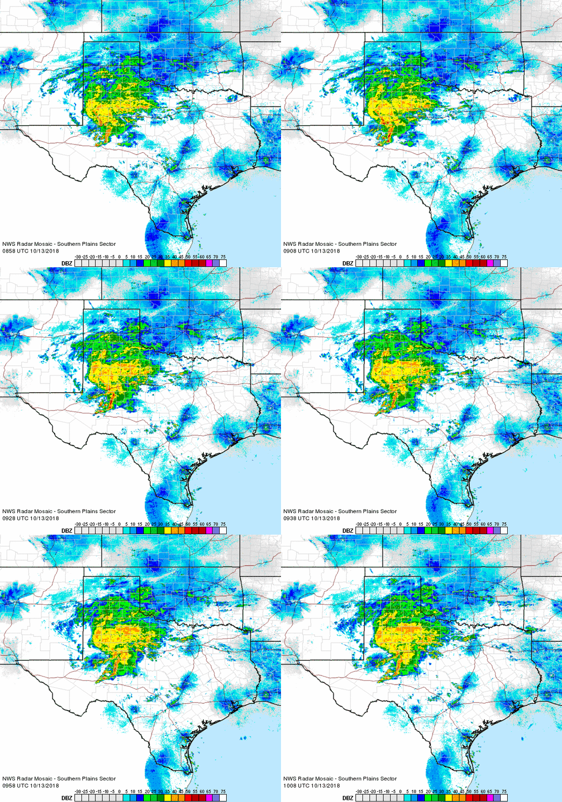 |
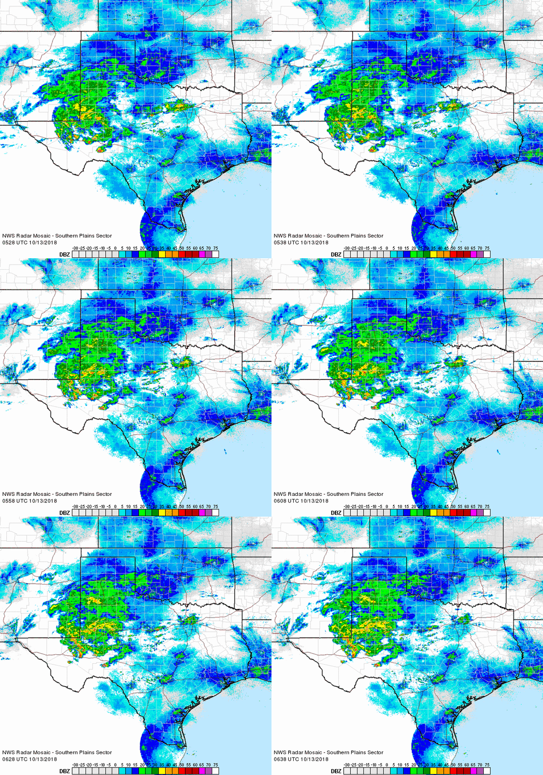
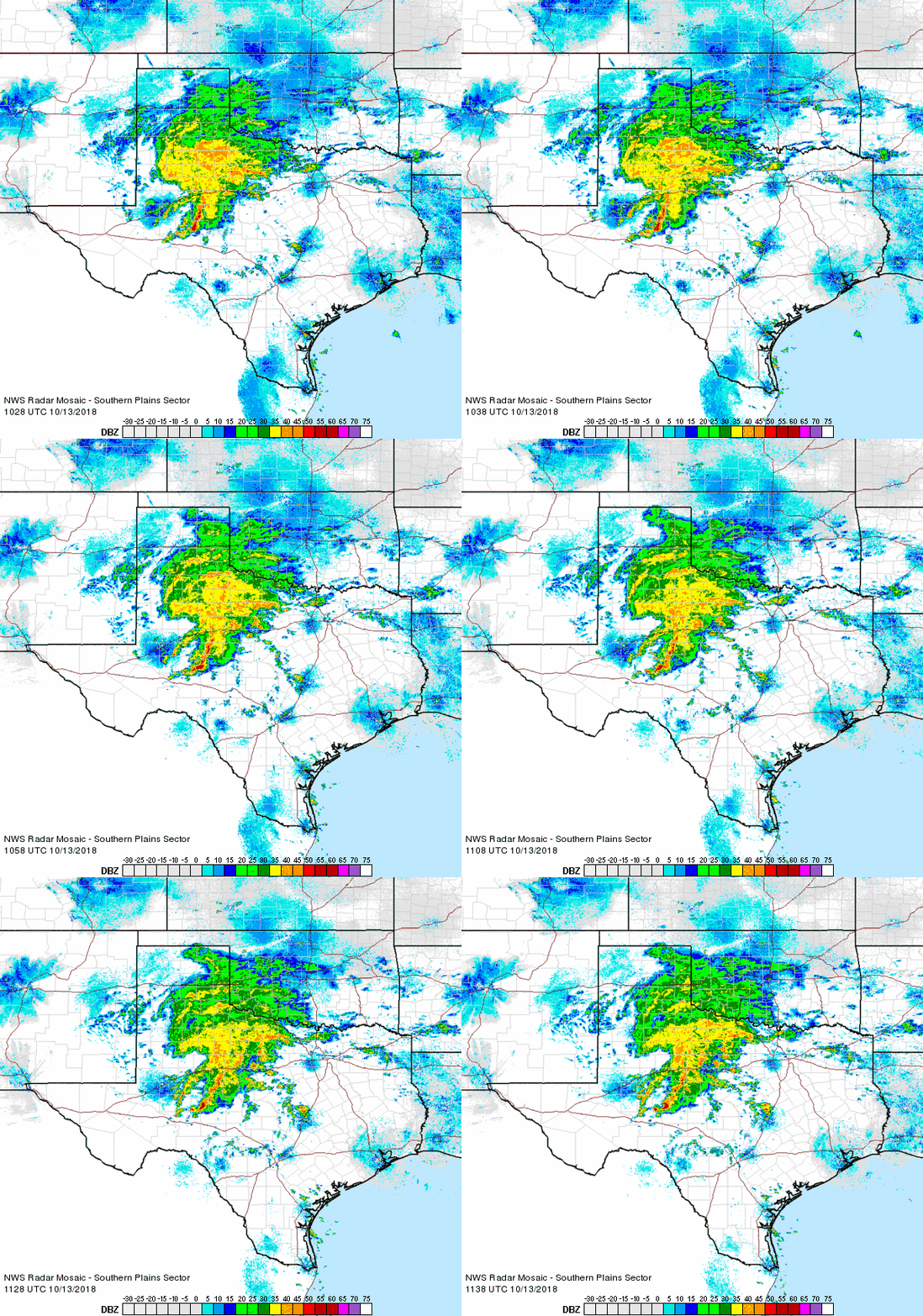
| Regional radar animation valid from 3:58 am to 5:08 am on Saturday, 13 October 2018. Additional radar animation are available at: 12:28 am to 1:38 am on Saturday; and 5:28 am to 6:38 am on Saturday. |
| The remnants of Hurricane Sergio, originating in the eastern Pacific Ocean, accelerated eastward up and over Texas late Friday into Saturday (12-13 October). The slug of tropical moisture brought widespread rain to the South Plains region during the early morning hours of Saturday, the 13th. |
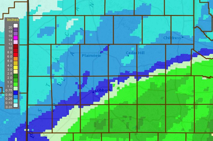 |
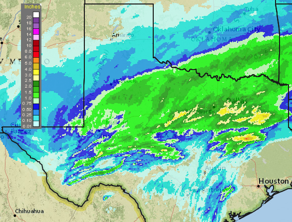
| 24-hour radar-estimated and bias-corrected rainfall ending at 7 pm on 13 October 2018. A regional view of the same information can be VIEWED HERE. |
| Moderate to heavy rain developed and raced east-northeastward during the overnight hours. The heaviest rain fell in a swath from the southeast South Plains and eastern Permian Basin into North Texas and southern Oklahoma. Rain totals of 1 to 2 inches were common, with locally higher amounts. North of the heaviest rainfall, the remainder of the South Plains into the southern Texas Panhandle generally recorded a couple tenths to a half inch of rain. |
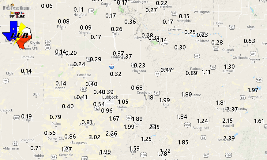 |
| West Texas Mesonet 24-hour rain totals ending at 8 pm on 13 October 2018. |
| Officially the Lubbock Airport recorded 0.37 inches from this event, while Childress tallied 0.28 inches. Both of the airports were located just north of the heaviest rain. |



 Follow us on X
 Follow us on Facebook
 Follow us on YouTube
 LUB RSS Feed