On Sunday afternoon, May 5th, 2019, scattered thunderstorm cells developed across the western South Plains along a dryline. This activity quickly became strong to severe as it tracked eastward through the late afternoon and evening hours. Initially, the strongest storms produced large hail, as big as golf balls near Wolfforth.
Tornadoes in Lynn County, Texas |
||||||||||||||||||||||||
|
|
||||||||||||||||||||||||
|
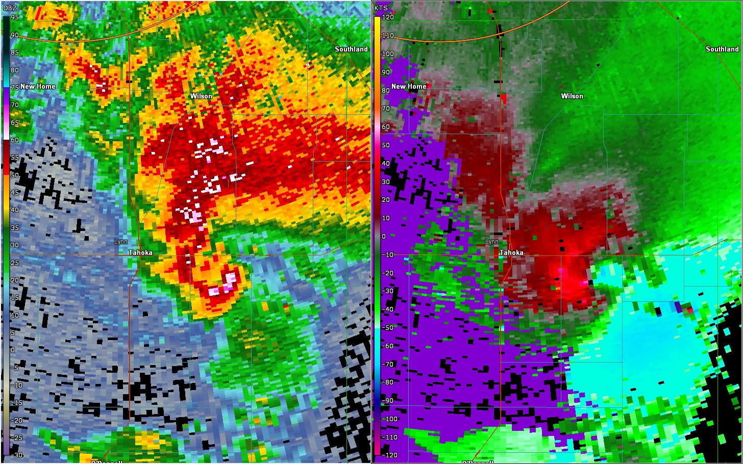
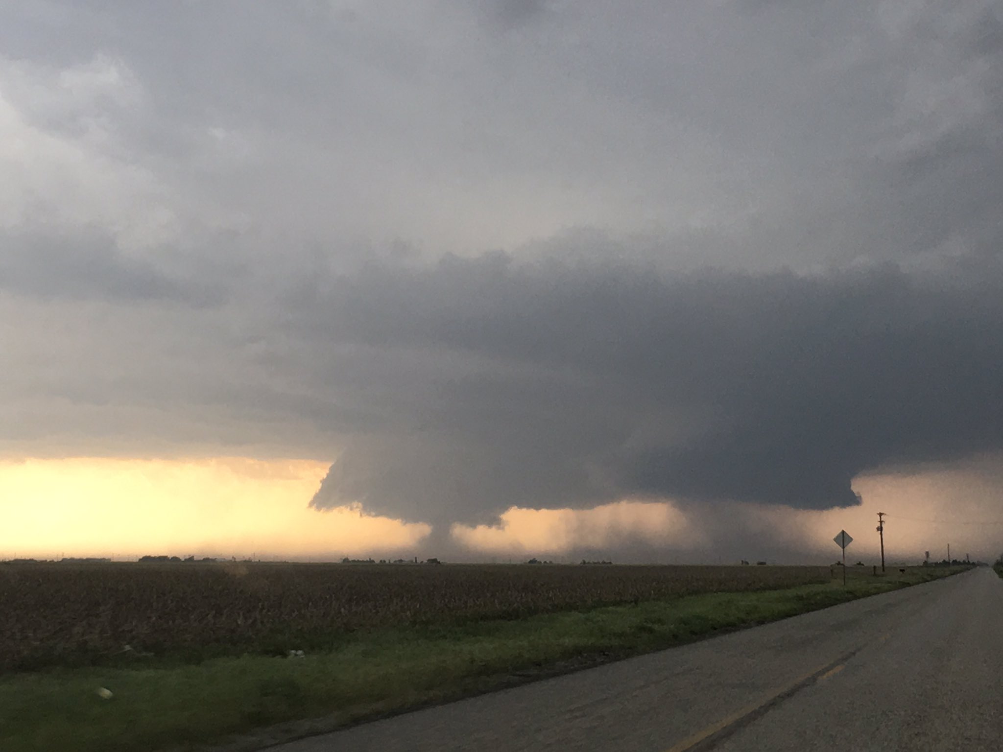
By 5 pm, the southern cell that produced the large hail just south of Lubbock organized into a supercell thunderstorm over southern Lubbock and northern Lynn Counties. Rotation with this storm quickly increased and it began to produce a tornado in Lynn County, north of Tahoka. The storm and the tornado tracked slowly southeastward passing off to the east of Tahoka, before lifting southeast of town.
 |
 |
|
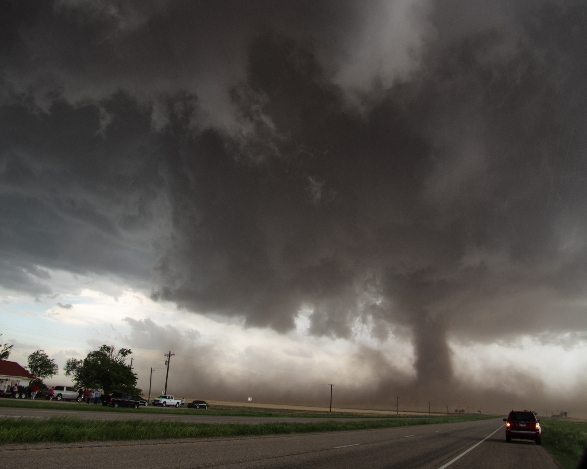
Evolution of the first tornado as it developed north of Tahoka on 5 May 2019. The left picture was taken at 5:45 pm and the second was taken at 5:49 pm.
|
|
The tornadic storm slowed to a crawl as it moved through central and southern Lynn County. The storm did drop hail as large as tennis balls southeast of Tahoka, where it shattered the back windshield of a storm chaser. In addition, the storm generated another shorter duration tornado over far southeast Lynn County.
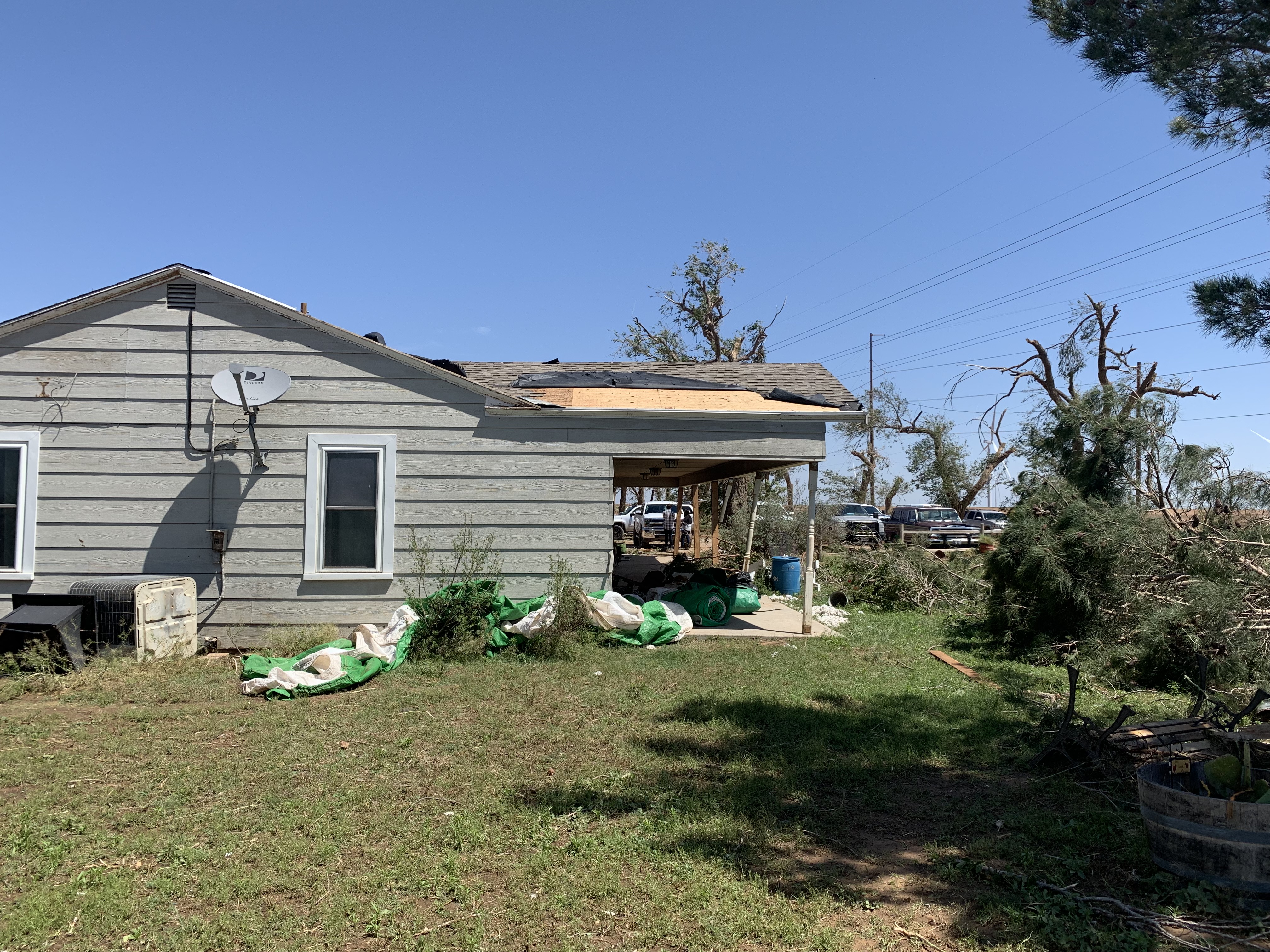
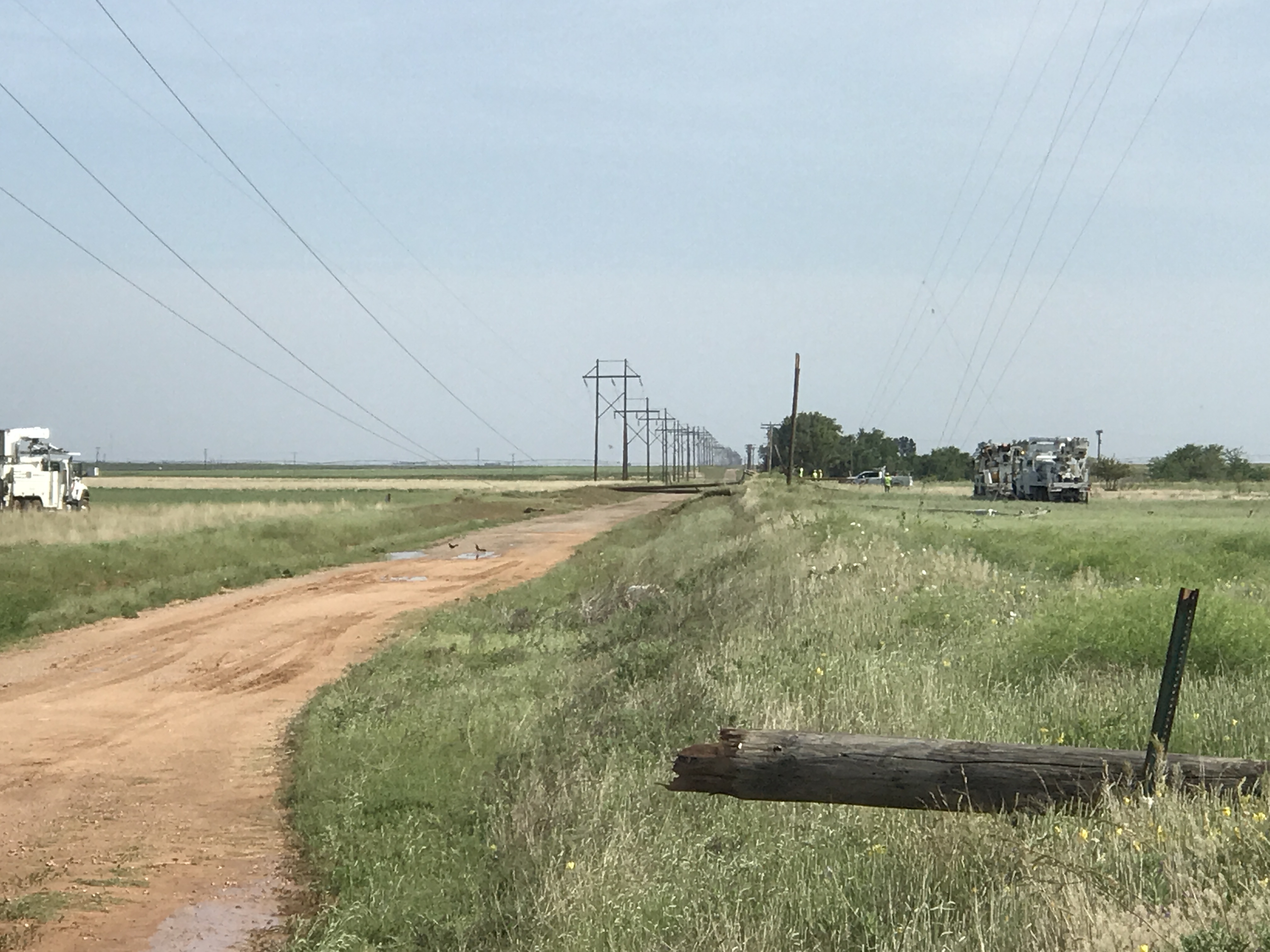
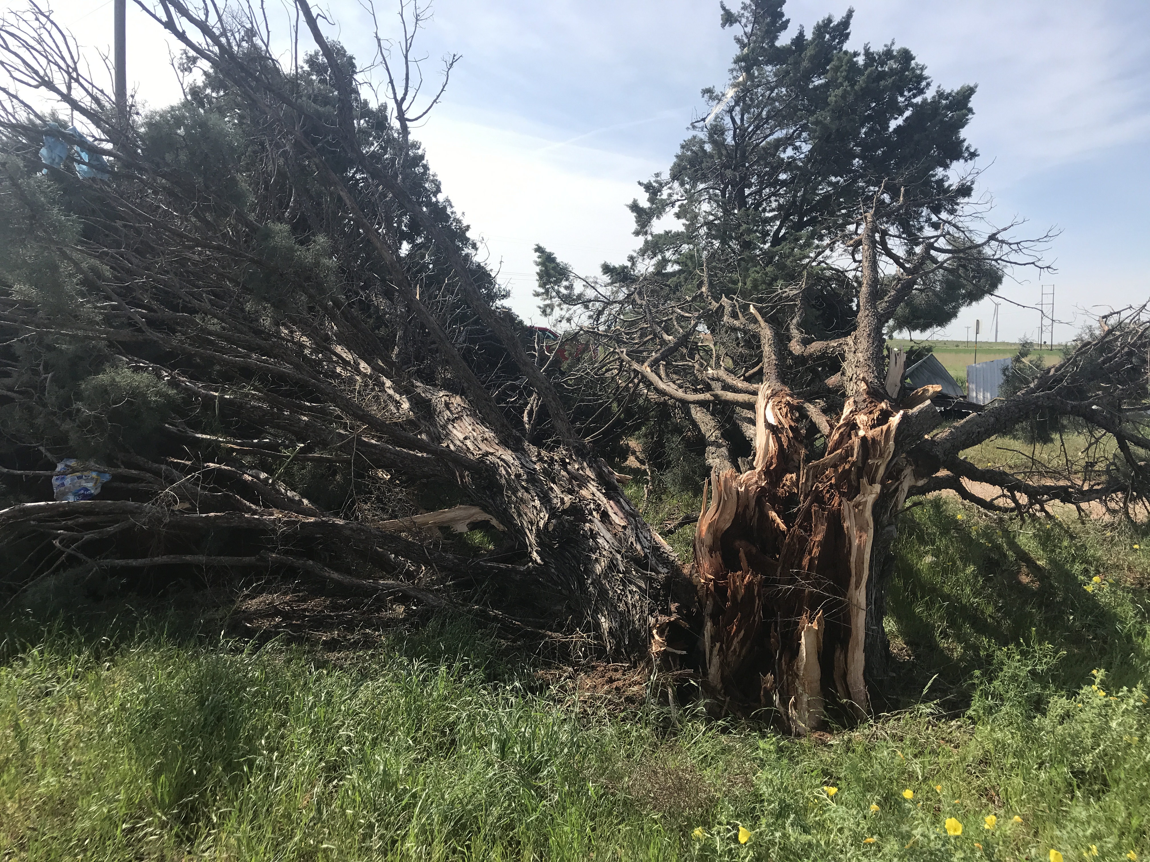
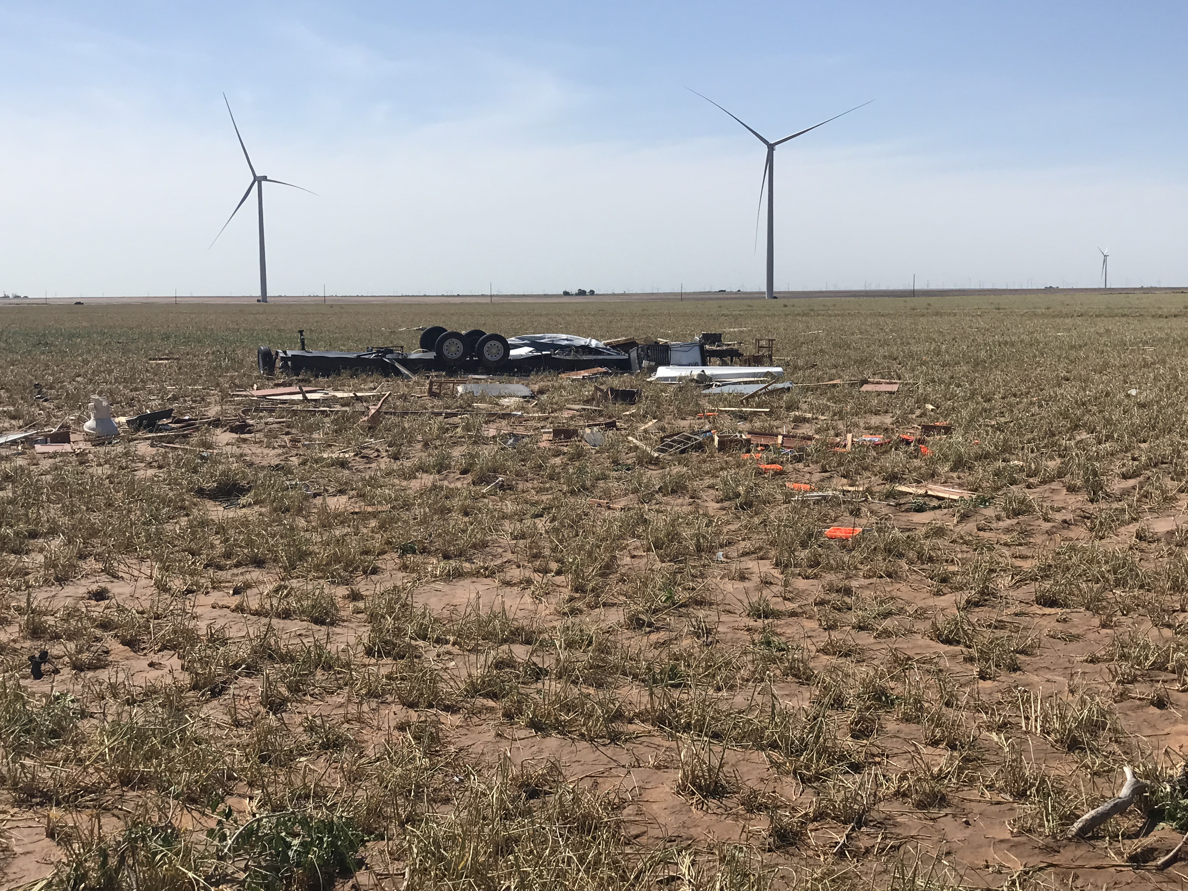
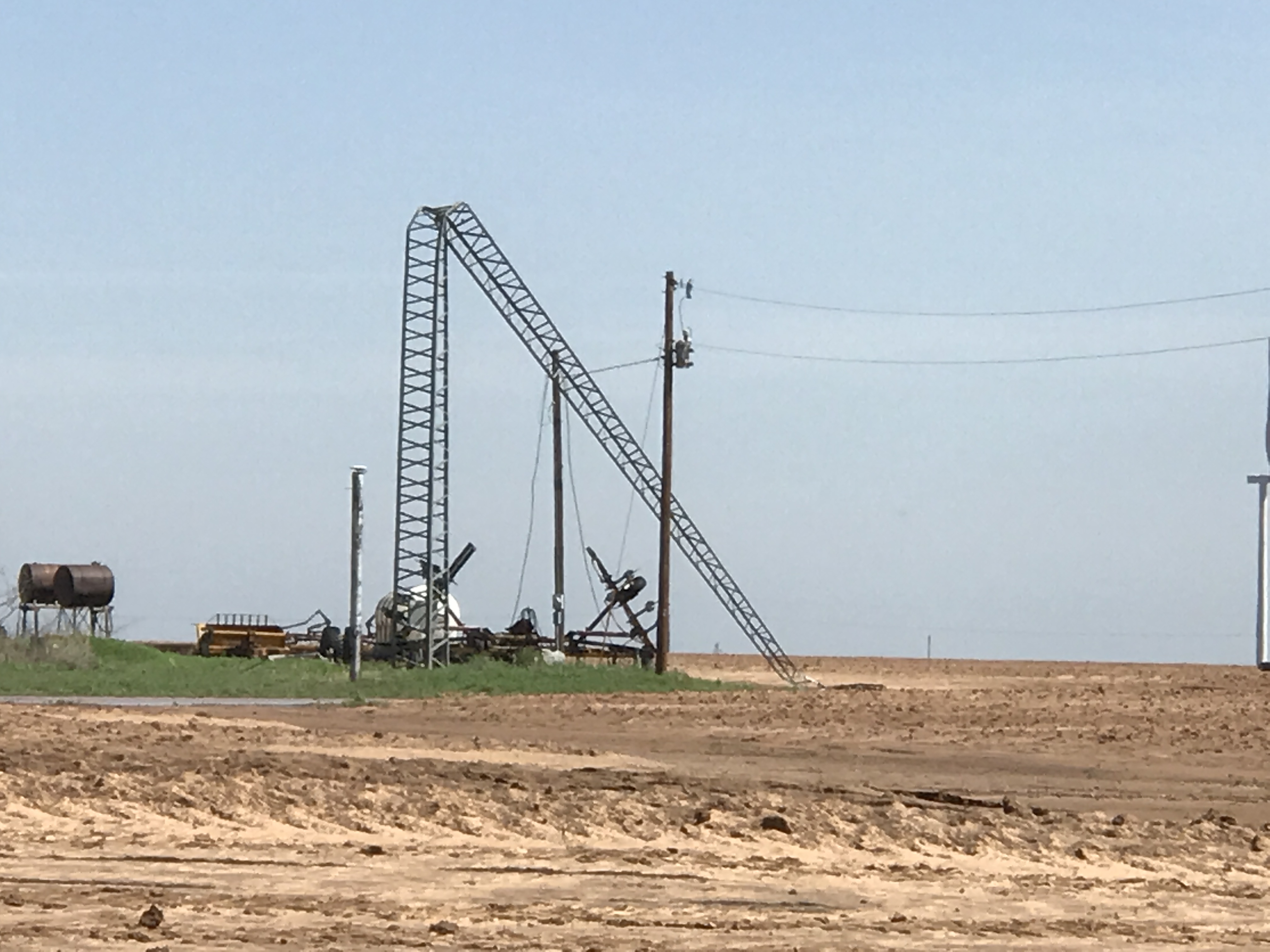
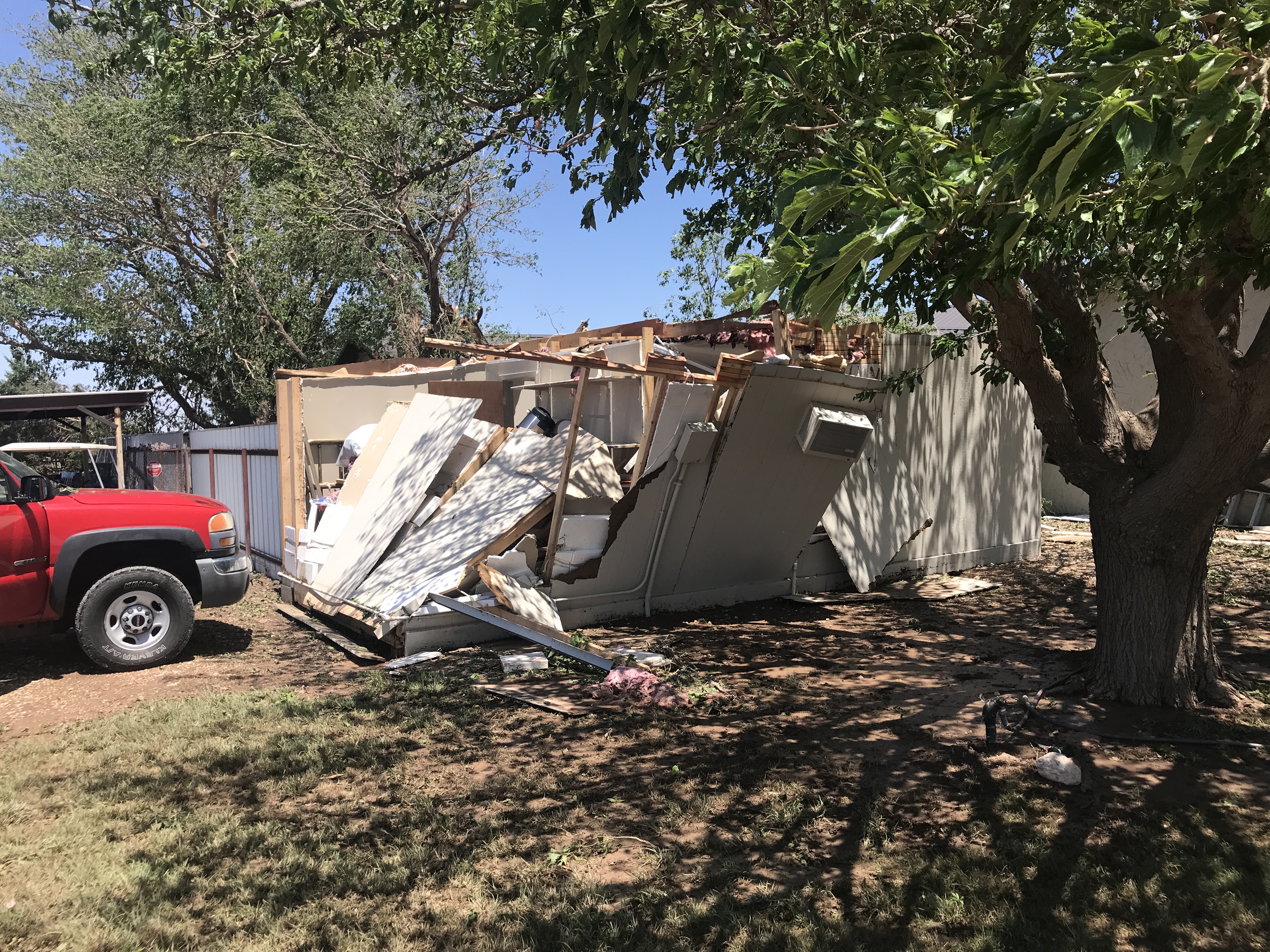
Thankfully, the tornadoes remained in rural parts of the county, but unfortunately they did still impact several structures, including homes, out buildings, trees and power poles. The damage incurred an EF-2 for the first tornado and EF-1 for the second tornado. The EF-2 rating was based on damage to power poles approximately 2.7 miles north-northeast of Tahoka.

Below are six examples of the damage recorded by the NWS Lubbock damage survey to the north, east and southeast of Tahoka. To view the complete damage survey results go to this NWS Damage Assessment Viewer (DAT). Once on the DAT page select "Lubbock" for your Office ID. Then select a begin date of 05/04/2019 and an end date to 05/08/2019 toward the top right of the page and click "Filter". At this point the relevant damage survey points near Tahoka should be visible. You can then zoom in and select the points to view more details and images.
 |
 |
|
Photos of damage sustained from a tornado that tracked north and east of Tahoka on 5 May 2019.
|
|
 |
 |
|
Photos of damage sustained from a tornado that tracked north and east of Tahoka on 5 May 2019.
|
|
 |
 |
|
Photos of damage sustained from a tornado that tracked north and east of Tahoka on 5 May 2019.
|
|
Below is another view of the first tornado north of Tahoka Sunday evening. A large wall cloud is apparent in addition to the tornado in progress.
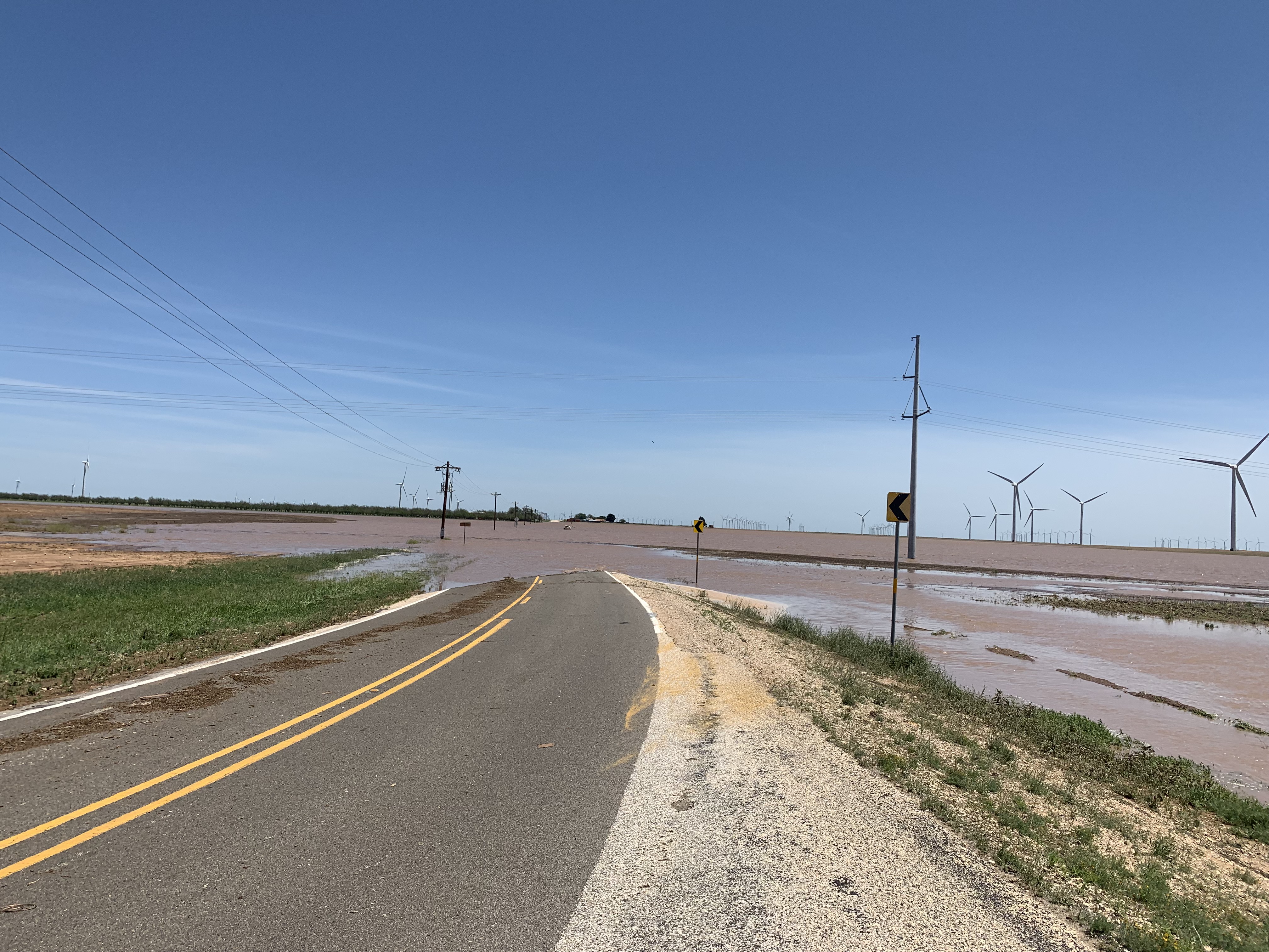
In addition to producing tornadoes and giant hail, the slow-moving thunderstorm dropped torrential rain over central and southeastern Lynn County. Runoff from the intense rain inundated roadways, as the below picture shows. Unfortunately, the deep water wasn't forgiving for those that tried to traverse the roads. If you look closely at the picture below you can see a stalled out vehicle in the middle of the "lake."
A Public Information Statement (PNS) summarizing the findings of Lubbock's Damage Survey Team can be read below. Additionally, the preliminary storm reports from May 5th can be found below.
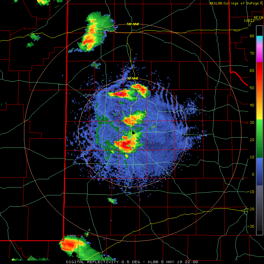
...NWS Damage Survey for the May 5, 2019 Lynn County Tornadoes...

Tornado #1:
Rating: EF-2
Estimated Peak Wind: 120 MPH

Path length: 17.2 Miles
Path width: 1.2 Miles
Fatalities: 0
Injuries: 0

Start date: 05-05-2019
Start time: 545PM CDT (Approx)
Start location: Tahoka, TX 8 NNW
Start Lat/Lon: 33.267 -101.853

End date: 05-05-2019
End time: 650PM CDT (Approx)
End location: Tahoka, TX 6 SE
End_lat/lon: 33.107 -101.727

Tornado #2:
Rating: EF-1
Estimated Peak Wind: 90 MPH

Path length: 5.0 Miles
Path width: 0.5 Miles
Fatalities: 0
Injuries: 0

Start date: 05-05-2019
Start time: 712PM CDT (Approx)
Start location: O'Donnell, TX 11 ENE
Start Lat/Lon: 33.020 -101.658

End date: 05-05-2019
End time: 725PM CDT (Approx)
End location: O'Donnell, TX  11 E
End_lat/lon: 32.967 -101.649

Meteorologists with the National Weather Service in Lubbock
conducted a storm damage survey in Lynn County on Monday, May 6th.
This team surveyed damage across central and eastern portions of
the county guided by radar data, local law enforcement, and
available video from the event.

The tornadoes were associated with a supercell thunderstorm which
developed over southwest Hockley and southern Lubbock Counties.
Initially the storm moved eastward, but around 530 pm CDT the storm
began rapid development southward into northern Lynn County.

Storm spotters and chasers observed the rapid development of a
tornado between New Home and Tahoka, a couple miles west of U.S.
Highway 87, at approximately 545 pm CDT, which was roughly coincident
with the development of a couplet in velocity from the Lubbock WSR-88D.
The tornado crossed Highway 87 north of Tahoka at approximately 555 pm
CDT, accompanied by very large hail, but minimal wind damage was
observed along the highway. The tornado increased in strength quickly
as it moved south-southeast east of Highway 87, causing EF-2 damage to
power poles approximately 2.7 miles N-NE of Tahoka.

The tornado crossed U.S. Highway 380 about 3 miles east of Tahoka around
605 pm CDT. The tornado caused EF-1 damage to a residence along U.S. 380.
About a half mile south of the highway the tornado caused EF-1 to EF-2
damage to a manufactured home and farm equipment. The KLBB WSR-88D
indicated about 40 to 55 kts low-level rotational velocity during this
period.

By 630 pm CDT, the tornado and parent mesocyclone halted their S-SE motion
and wobbled back to the west as indicated by the radar data and storm
spotter/chaser video. The strength of the velocity couplet gradually
decreased and by about 650 pm CDT no further reports of the tornado were
received. The end time and location of the tornado is estimated by the
radar data.

Shortly after 700 pm CDT, the radar-observed mesocyclone began to strengthen
again in southeast Lynn County to the E-NE of O'Donnell. EF-1 Tree damage
was observed at a residence along FM 1054 south of the small community of
Draw, TX, roughly coincident with peak low-level rotational velocities of
about 50 kts from the KLBB WSR-88D. Lacking other damage indicators, the
start and end times/locations of the second tornado were estimated by radar.

Additional small tornadoes may have occurred with this supercell across
southern and eastern portions of Lynn County but no other reports of damage
have been received.
--

EF Scale:  The Enhanced Fujita Scale Classifies Tornadoes into
the following categories.

EF0...Weak......65 to 85 MPH
EF1...Weak......86 to 110 MPH
EF2...Strong....111 to 135 MPH
EF3...Strong....136 to 165 MPH
EF4...Violent...166 To 200 MPH
EF5...Violent...>200 MPH

Note:
The information in this statement is preliminary and subject to
change pending final review of the event and publication in NWS
Storm Data.

