
Dangerous heat will expand from the Gulf Coast into the Southern Plains and Desert Southwest through week's end. Additional extreme heat impacting the Pacific Northwest will shift to the northern Plains by the weekend. Tropical Storm Bertha is expected to continue to impact portions of the northern Gulf Coast from the western Florida Panhandle to southeastern Louisiana through tonight. Read More >
|
Intense heat fuels isolated severe storms |
|||||||||||||||
 |
|||||||||||||||
| Thunderstorm actively dropping a load of rain and hail Thursday evening (9 July), resulting in a downburst on the west side of Lubbock. The image is courtesy of Thomas Paholski. | |||||||||||||||
|
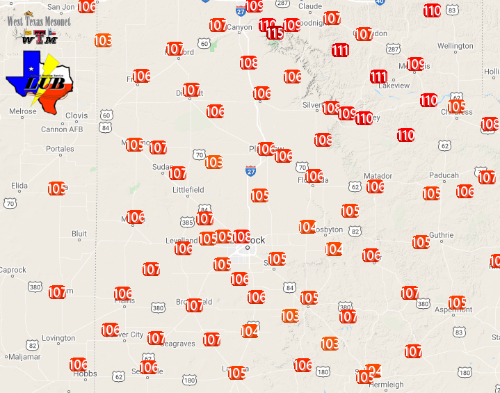
Extreme heat baked West Texas on Thursday, July 9th. Afternoon temperatures peaked at 105 to 110+ degrees. The hottest temperature recorded, 115ËšF, occurred in Palo Duro Canyon, while temperatures near 110ËšF affected Caprock Canyons State Park. Unfortunately, the intense heat did lead to one visitor being air lifted from Caprock Canyons Thursday afternoon. |
|||||||||||||||
 |
|||||||||||||||
| High temperatures observed on Thursday, 9 July 2020. The data are courtesy of the West Texas Mesonet. | |||||||||||||||
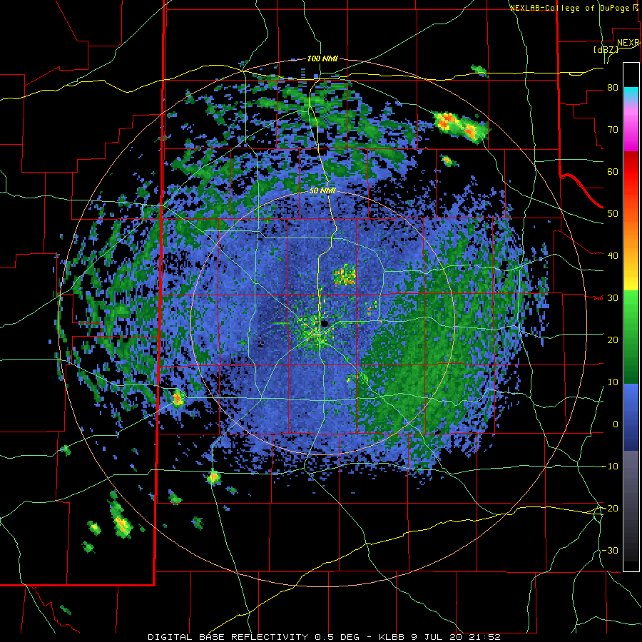
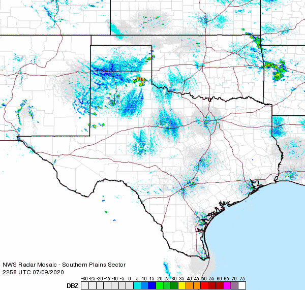
| The extreme heat, combined with just enough moisture and converging winds, caused isolated thunderstorms to develop late Thursday afternoon. A couple of these storms became severe as they tracked southward through the evening hours. The most intense storm of the evening formed across the southeast Texas Panhandle and tracked southward into the northern Rolling Plains, producing damaging wind gusts and small hail. | |||||||||||||||
 |
|||||||||||||||
| Lubbock WSR-88D radar base reflectivity animation valid from 4:52 pm to 7:48 pm on 9 July 2020. Regional radar animations valid the evening of 9 July can be found at: 5:58 pm to 7:08 pm; and from 8:18 pm to 9:28 pm. | |||||||||||||||
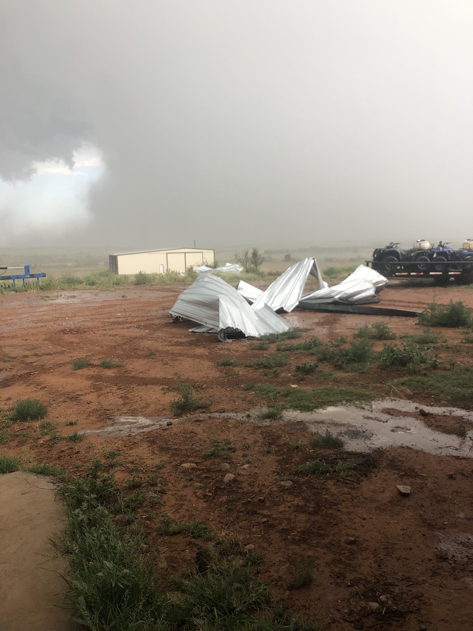
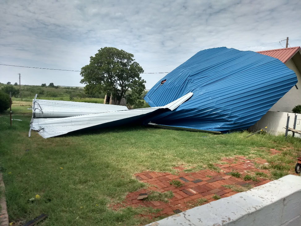
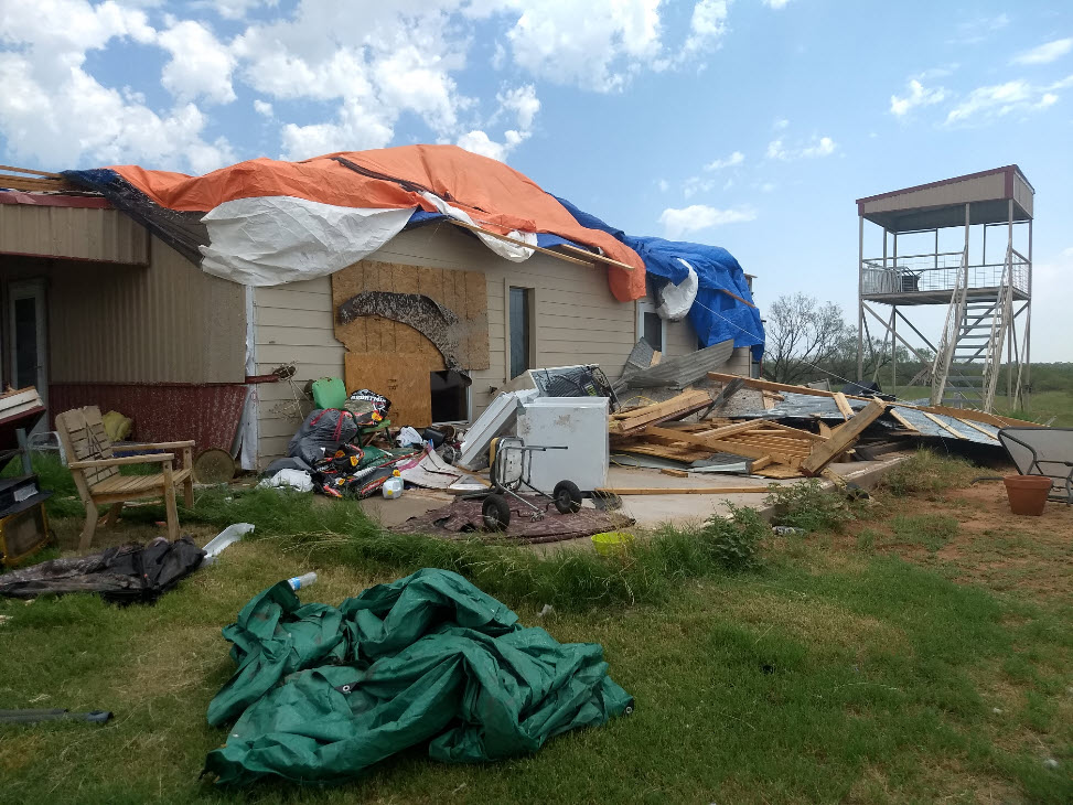
| The West Texas Mesonet site near Memphis recorded a peak wind gust of 63 mph. This storm went on to drop quarter size hail in Estelline and walnut sized hail in Northfield. In addition, downburst winds damaged several homes and sheds and downed power poles west of Estelline. The only positive was that a few spots received welcome rainfall and cooler temperatures. | |||||||||||||||
 |
 |
||||||||||||||
|
|||||||||||||||
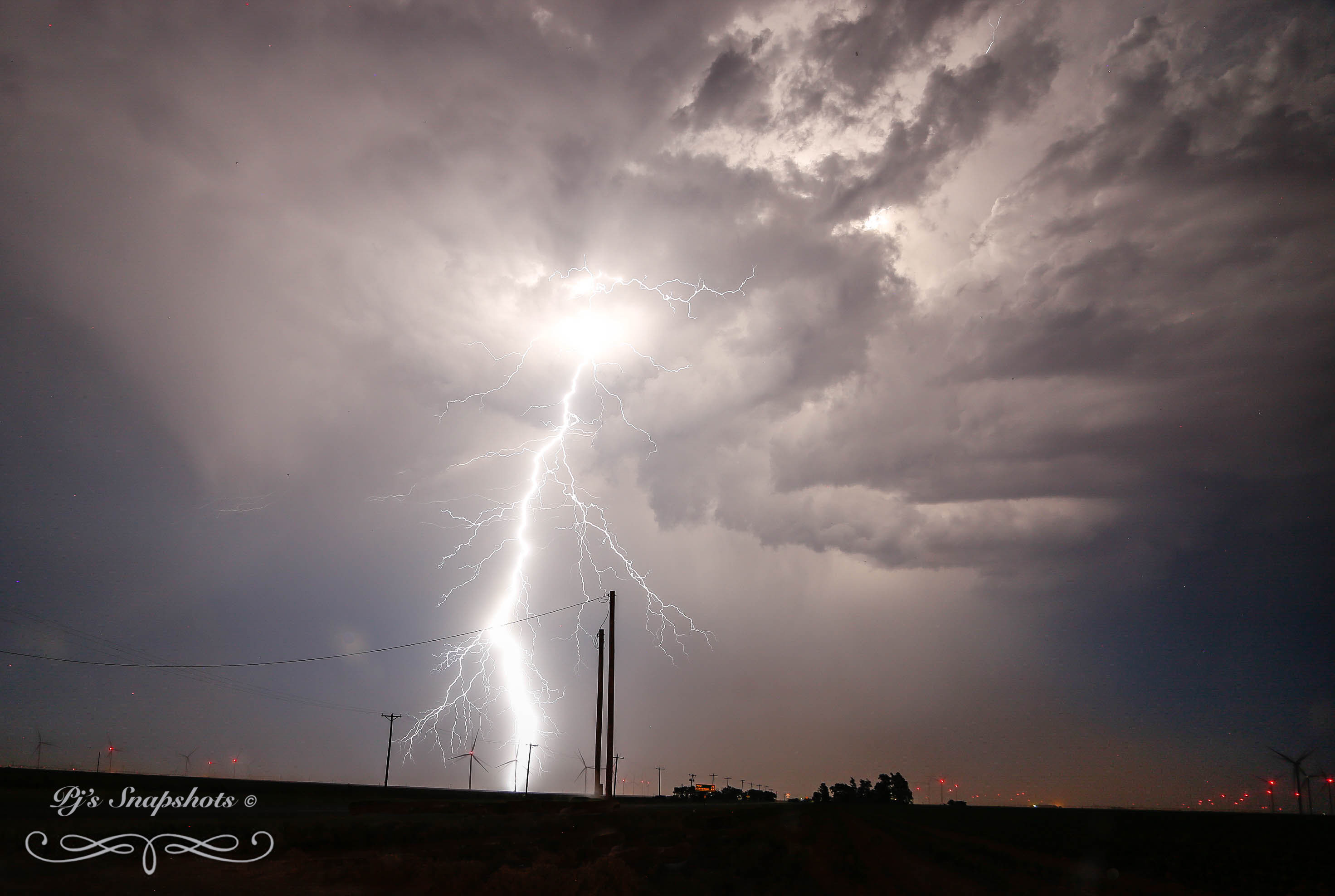
| The thunderstorms did produce an impressive lightning show too, as captured by Pam Elrod east of Tahoka. The storms eventually weakened late Thursday evening. | |||||||||||||||
 |
|||||||||||||||
| Storm east of Tahoka Thursday night (9 July 2020). The image is courtesy of Pam Elrod. | |||||||||||||||
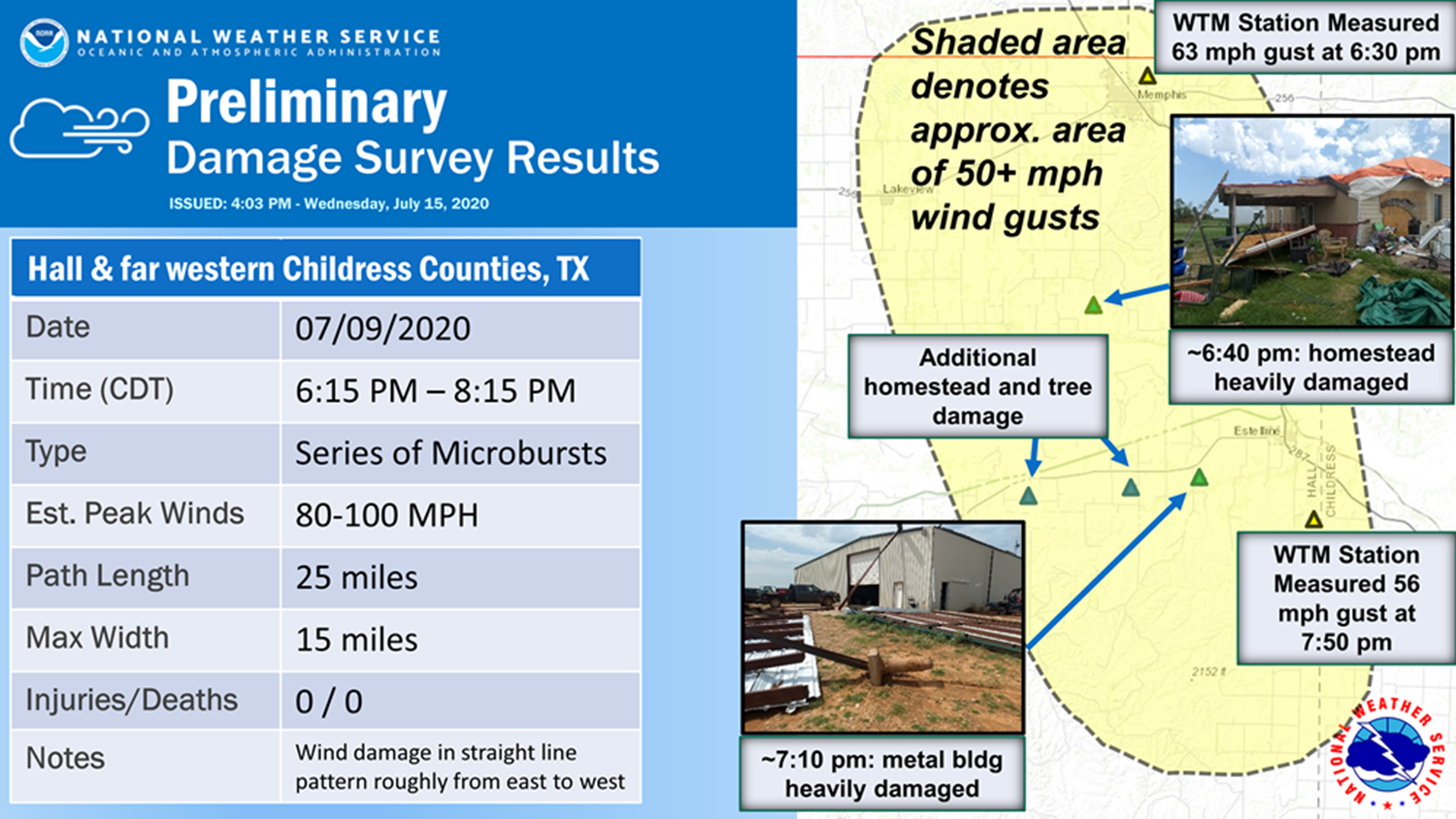
| The National Weather Service in Lubbock deployed a damage survey team to the southeast Texas Panhandle the next day, July 10th, The survey confirmed that a series of microbursts affected the region, with localized wind gusts as strong as 80 to 100 mph. See the below image for a summary of the findings. | |||||||||||||||
 |
|||||||||||||||
| Summary of Damage Survey conducted by the National Weather Service in Hall and Childress Counties. | |||||||||||||||
|
The preliminary storm reports and NWS Damage Survey results for this active July evening can be viewed below. |
|||||||||||||||
PRELIMINARY LOCAL STORM REPORT
NATIONAL WEATHER SERVICE LUBBOCK TX
903 PM CDT THU JUL 09 2020
..TIME... ...EVENT... ...CITY LOCATION... ...LAT.LON...
..DATE... ....MAG.... ..COUNTY LOCATION..ST.. ...SOURCE....
..REMARKS..
0630 PM TSTM WND GST 1 NE MEMPHIS 34.73N 100.53W
07/09/2020 M63 MPH HALL TX MESONET
0634 PM HAIL ESTELLINE 34.55N 100.44W
07/09/2020 M1.00 INCH HALL TX TRAINED SPOTTER
0645 PM TSTM WND DMG 4 W ESTELLINE 34.55N 100.51W
07/09/2020 HALL TX TRAINED SPOTTER
ROOF BLOWN OFF HOME AND POWER POLES DOWN
0801 PM HAIL NORTHFIELD 34.29N 100.60W
07/09/2020 E1.25 INCH MOTLEY TX CO-OP OBSERVER
WALNUT SIZE HAIL
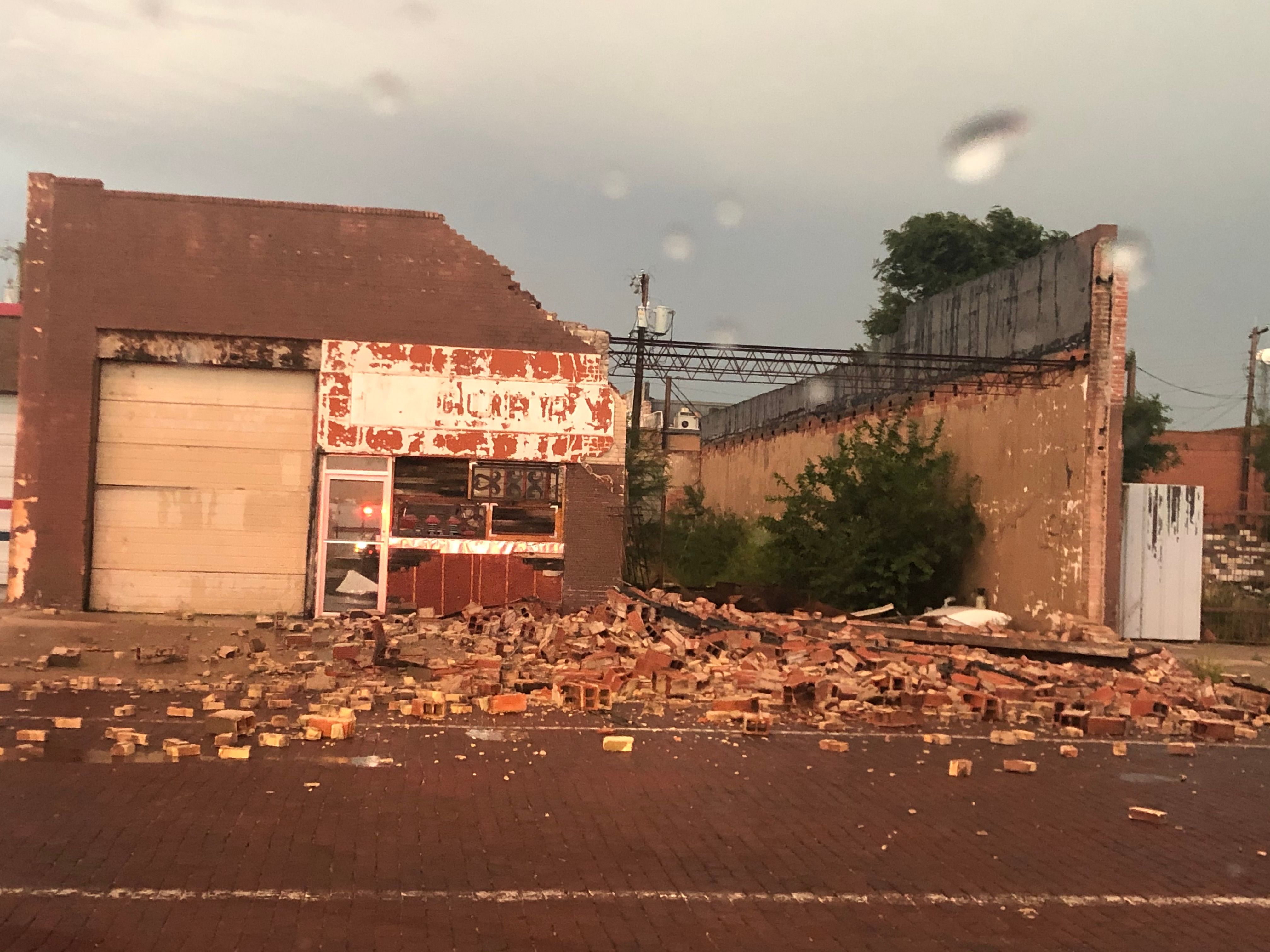
0842 PM TSTM WND DMG DOWNTOWN LUBBOCK 33.59N 101.84W
07/09/2020 LUBBOCK TX EMERGENCY MNGR
BRICK WALL KNOCKED OVER FROM THUNDERSTORM WINDS. TIME
ESTIMATED FROM RADAR.
0846 PM TSTM WND DMG 2 E DOWNTOWN LUBBOCK 33.59N 101.81W
07/09/2020 LUBBOCK TX EMERGENCY MNGR
DOWNED UTILITY POLE AND METAL SHEET ROOF BLOWN OFF
STRUCTURE. TIME ESTIMATED FROM RADAR.

