
Dangerous heat will expand from the Gulf Coast into the Southern Plains and Desert Southwest through week's end. Additional extreme heat impacting the Pacific Northwest will shift to the northern Plains by the weekend. Tropical Storm Bertha is expected to continue to impact portions of the northern Gulf Coast from the western Florida Panhandle to southeastern Louisiana through tonight. Read More >
|
Scattered severe storms return to West Texas |
|
 |
|
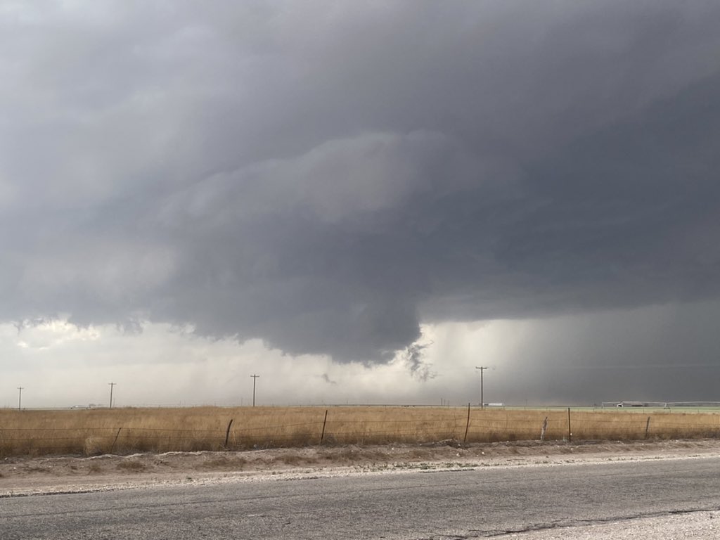
| Rotating wall cloud west of Denver City Sunday afternoon (1 May 2022). The picture is courtesy of Jack Maney. | |
|
May started off with a bang, bringing the first bout of scattered severe thunderstorms to the South Plains region. Sunday, May 1st, started off dry and pleasant. However, as the winds switched around to southeast and increased, they carried rich moisture sitting downstate back into West Texas. |
|
 |
|
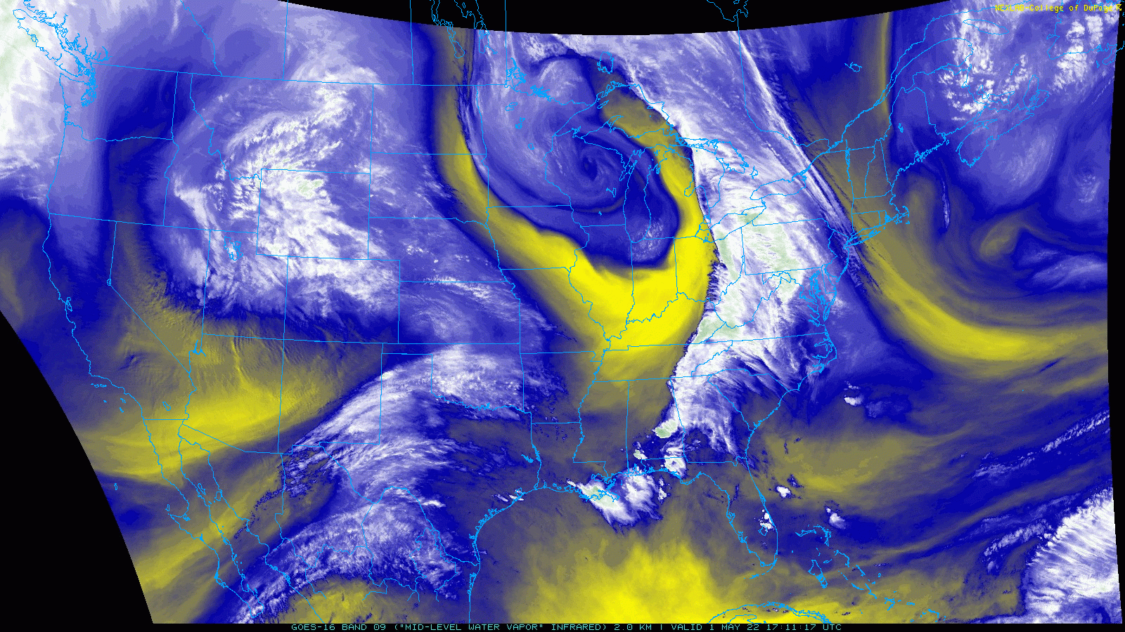
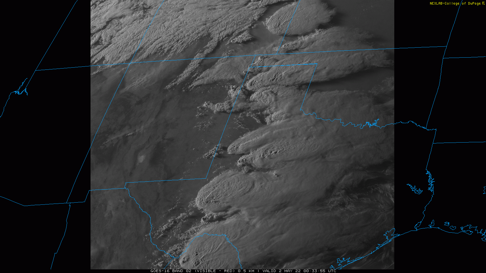
| Water vapor satellite loop valid from 12:11 pm to 12:36 pm on Sunday (1 May 2022). | |
|
The moisture returned just in time to coincide with peak heating and the approach of an upper level disturbance through the Intermountain West. |
|
 |
|
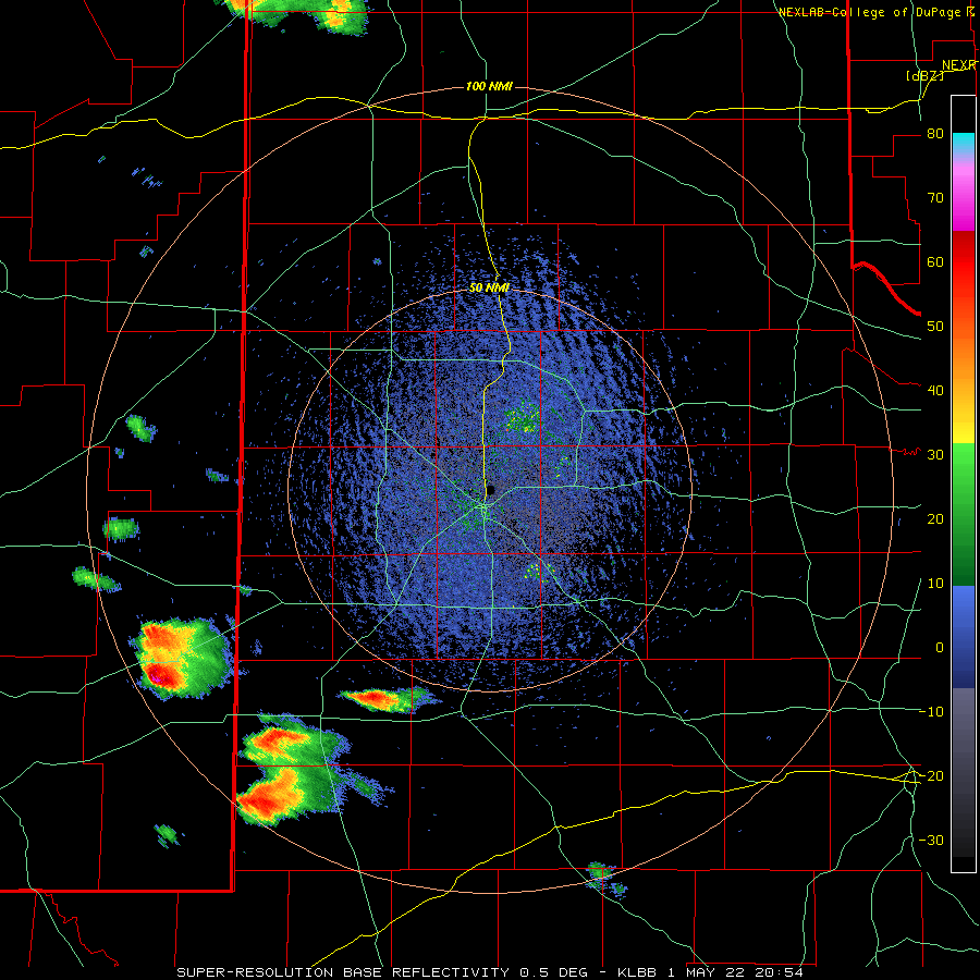
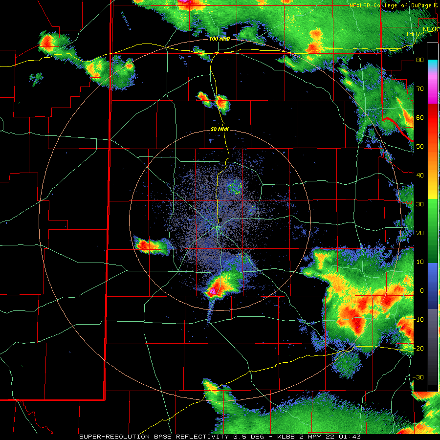
| Lubbock WSR-88D radar animation valid from 3:54 pm to 6:19 pm on 1 May 2022. | |
|
In response, scattered thunderstorms rapidly developed late Sunday afternoon. Relatively strong wind shear and moderate instability spurred several of the storms to rotate and produce very large hail. The configuration of the increasing and turning winds with height were right to favor splitting supercell (rotating) storms. |
|
 |
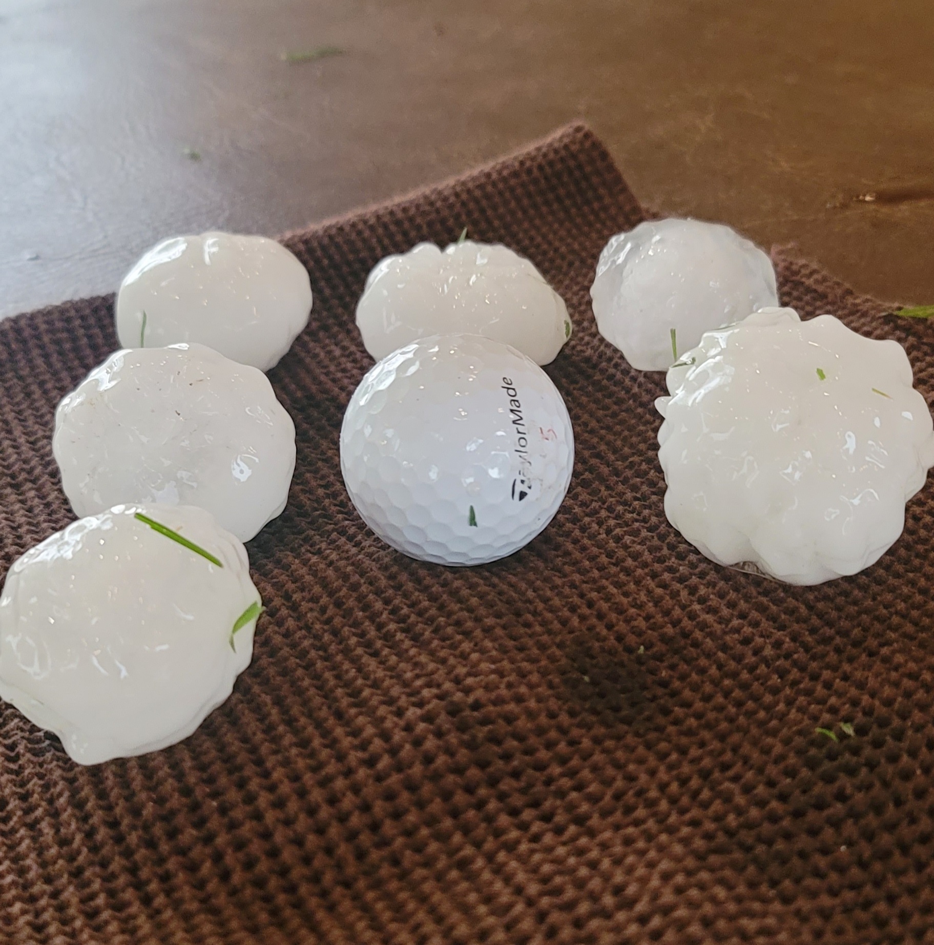 |
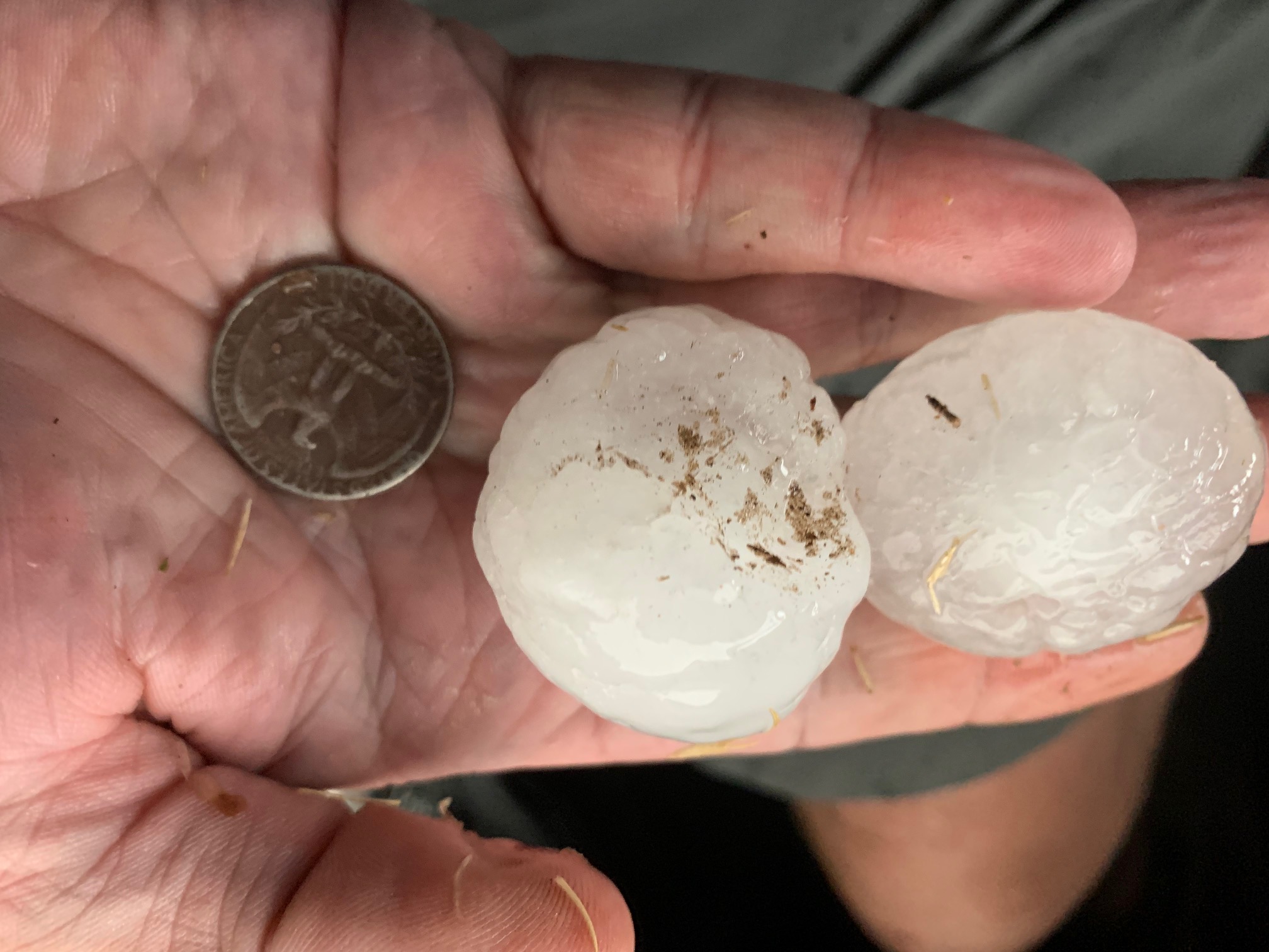
| Large hail that fell in Muleshoe (left) and Denver City (right) Sunday evening (1 May 2022). The left image is courtesy of Gil Rennels and the right one is courtesy of Charlie Espinoza and KAMC. | |
|
The "left" splits raced north-northeastward bringing brief heavy rain, large hail and sporadic wind gusts. Golf ball to baseball size hail fell from the strongest of these northward-racing storms, which affected parts of Muleshoe and Levelland. Where the largest hail fell, western portions of Levelland experienced extensive damage, primarily from shattered glass. |
|
 |
|
| Late evening visible satellite loop valid from 7:33 pm to 7:41 pm on Sunday (1 May 2022). Note the shadows associated with the overshooting tops of the most intense thunderstorms. | |
|
As opposed to the "left" splits, the "right" splits moved slowly to the east, producing locally heavy/flooding rains. These storms also dropped huge hail, near and greater than baseball size. |
|
 |
|
| Lubbock WSR-88D radar animation valid from 8:43 pm to 9:09 pm on 1 May 2022. A longer radar animation, from 1:37 pm to 9:11 pm can be VIEWED HERE. | |
| One of these storms developed in southeast New Mexico during the afternoon, then tracked steadily across the southern South Plains, from near Denver City to O'Donnell through the evening hours before finally diminishing as it approached the edge of the Caprock late in the evening. In addition to hurling damaging hail, a rotating wall cloud was occasionally observed with this storm. | |
 |
|
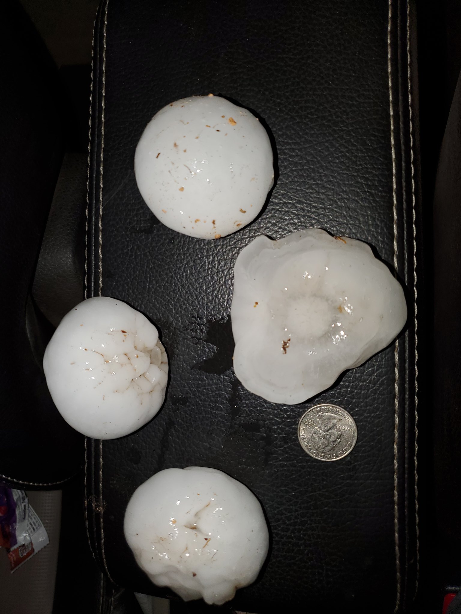
| Large hail that fell just north of O'Donnell Sunday evening (1 May 2022). The picture is courtesy Timothy Siliwinski. | |
| The severe weather was primarily confined to spots on the Caprock for the Texas Panhandle and South Plains, but ventured further east across the Permian Basin into the Big Country. The most intense cluster of storms produced a damaging tornado in Hermleigh and flooding rains (3-4+ inches) in Snyder. | |
 |
|
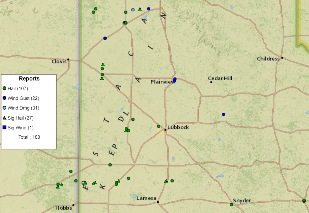
| Storm reports collected by the National Weather Service and displayed by the Storm Prediction Center for 1 May 2022. | |
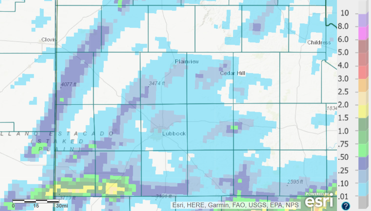
| On the positive side, the thunderstorm activity did bring welcome moisture to a few locations, though meaningful rainfall was limited in coverage. Many locations across the South Plains and southern Rolling Plains saw a trace to couple tenths of an inch of rain, with heavier totals confined to southern parts of Yoakum and Terry Counties. Officially, the Lubbock Airport recorded 0.20 inches or rain, though most of the city of Lubbock saw less rain, with a few pockets of small hail too. | |
 |
|
| 24-hour radar-estimated and bias-correct rainfall ending at 7 am on 2 May 2022. | |
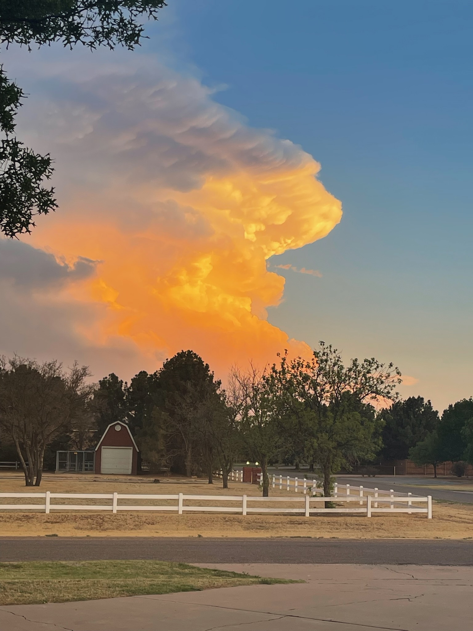
| Several locations were treated to a picturesque end of the day as the setting sun illuminated the storms. | |
 |
|
| Beautiful evening sunset, as viewed from south of Lubbock, on 1 May 2022. The picture is courtesy of John Lipe. | |
| The preliminary storm reports collected on this active late afternoon and evening can be found below. | |
PRELIMINARY LOCAL STORM REPORT...SUMMARY
NATIONAL WEATHER SERVICE LUBBOCK TX
433 AM CDT MON MAY 02 2022

..TIME...   ...EVENT...      ...CITY LOCATION...     ...LAT.LON...
..DATE...   ....MAG....      ..COUNTY LOCATION..ST.. ...SOURCE....
            ..REMARKS..

0445 PM     HAIL             20 W BROWNFIELD         33.18N 102.62W
05/01/2022  E1.75 INCH       YOAKUM             TX   PUBLIC

0530 PM     HAIL             LEVELLAND               33.58N 102.36W
05/01/2022  E1.50 INCH       HOCKLEY            TX   SOCIAL MEDIA

            PICTURE OF HAIL ON TWITTER. TIME ESTIMATED FROM RADAR.

0530 PM     HAIL             2 W LEVELLAND           33.58N 102.40W
05/01/2022  E2.75 INCH       HOCKLEY            TX   EMERGENCY MNGR

            TIME AND LOCATION ESTIMATED FROM RADAR. REPORT RELAYED
            FROM EM.

0535 PM     HAIL             2 NW LEVELLAND          33.60N 102.39W
05/01/2022  E1.75 INCH       HOCKLEY            TX   EMERGENCY MNGR

            TIME ESTIMATED FROM RADAR

0540 PM     HAIL             8 W DENVER CITY         32.97N 102.97W
05/01/2022  E2.75 INCH       YOAKUM             TX   TRAINED SPOTTER

            BASEBALL SIZE HAIL ON THE GROUND. PING PONG BALL SIZE
            HAIL FALLING AT 5:45 PM. TIME OF BASEBALL SIZE HAIL
            ESTIMATED.

0545 PM     HAIL             5 NW LUBBOCK            33.63N 101.94W
05/01/2022  E1.00 INCH       LUBBOCK            TX   PUBLIC

            PICTURE OF QUARTER SIZE HAIL AT ERSKINE AND DOVER IN NW
            LUBBOCK.

0545 PM     HAIL             10 NNE LEVELLAND        33.71N 102.30W
05/01/2022  E1.50 INCH       HOCKLEY            TX   SOCIAL MEDIA

            PICTURE OF 1-1.5 INCH DIAMETER HAIL IN WITHARRAL,
            TEXAS. HAIL FELL BETWEEN 4:45 AND 4:50 PM.

0548 PM     HAIL             DENVER CITY             32.97N 102.83W
05/01/2022  E2.00 INCH       YOAKUM             TX   SOCIAL MEDIA

            PICTURES ON TWITTER OF HAIL SLIGHTLY LARGER THAN GOLF
            BALL SIZE.

0550 PM     HAIL             3 S MULESHOE            34.19N 102.73W
05/01/2022  E2.50 INCH       BAILEY             TX   STORM CHASER

            CONTINUOUS GOLF BALL SIZED HAIL WITH SEVERAL AS LARGE
            AS TENNIS BALLS.

0555 PM     HAIL             MULESHOE                34.23N 102.73W
05/01/2022  E1.75 INCH       BAILEY             TX   CO-OP OBSERVER

            PICTURE OF GOLF BALL SIZE HAIL.

0557 PM     HAIL             5 N MULESHOE            34.30N 102.73W
05/01/2022  E1.75 INCH       BAILEY             TX   STORM CHASER

0603 PM     HAIL             1 WSW DENVER CITY       32.96N 102.85W
05/01/2022  E2.00 INCH       YOAKUM             TX   STORM CHASER

0605 PM     HAIL             7 WSW LAZBUDDIE         34.35N 102.72W
05/01/2022  E2.00 INCH       PARMER             TX   STORM CHASER

            2 TO 2.25 INCH DIAMETER HAIL SITTING ON THE SIDE OF THE
            ROAD. TIME IS ESTIMATED FROM RADAR.

0626 PM     TSTM WND GST     2 NE FRIONA             34.65N 102.69W
05/01/2022  M62 MPH          PARMER             TX   MESONET

            WEST TEXAS MESONET REPORT. WIND GUST OCCURRED WELL
            NORTHWEST OF THE PRIMARY THUNDERSTORM CELL. A GUST TO 60
            MPH WAS MEASURED AT 6:25 PM.

0647 PM     TSTM WND GST     1 S PLAINVIEW           34.18N 101.71W
05/01/2022  M71 MPH          HALE               TX   MESONET

            WEST TEXAS MESONET

0650 PM     TSTM WND GST     1 S PLAINVIEW           34.16N 101.72W
05/01/2022  M61 MPH          HALE               TX   AWOS

0658 PM     HAIL             8 SW WELLMAN            32.97N 102.53W
05/01/2022  E1.75 INCH       TERRY              TX   TRAINED SPOTTER

            PING PONG TO GOLF BALL SIZE HAIL FALLING 2 MILES NORTH
            OF SEAGRAVES.

0702 PM     TSTM WND GST     3 NNW MCADOO            33.77N 101.03W
05/01/2022  M68 MPH          DICKENS            TX   MESONET

            MEASURED BY THE WEST TEXAS MESONET. OCCURRED ON THE
            BACK EDGE OF WEAK SHOWERS AND THUNDERSTORMS.

0715 PM     HAIL             6 SW WELLMAN            32.99N 102.50W
05/01/2022  E2.50 INCH       TERRY              TX   TRAINED SPOTTER

            GOLF BALL TO TENNIS BALL SIZE HAIL ON THE GROUND. TIME
            OF HAIL FALL ESTIMATED FROM RADAR.

0726 PM     HAIL             4 ESE WELLMAN           33.02N 102.36W
05/01/2022  E1.75 INCH       TERRY              TX   STORM CHASER

            HAIL FROM NICKEL TO GOLF BALL SIZE. TIME ESTIMATED FROM
            RADAR.

0745 PM     FUNNEL CLOUD     12 SSE BROWNFIELD       33.02N 102.19W
05/01/2022                   TERRY              TX   STORM CHASER

            WALL CLOUD AND POSSIBLE FUNNEL CLOUD. OBSERVER WAS
            LOCATED 1 MILE WEST OF WELCH LOOKING NORTHWESTWARD.
            LOCATION IS ESTIMATED.

0855 PM     HAIL             2 N O`DONNELL           32.99N 101.83W
05/01/2022  E3.00 INCH       LYNN               TX   TRAINED SPOTTER

            SEVERAL PHOTOS OF HAIL AROUND 3 INCH IN DIAMETER. TIME
            WAS ESTIMATED FROM RADAR.

0858 PM     HAIL             1 NNW O`DONNELL         32.98N 101.84W
05/01/2022  E2.00 INCH       LYNN               TX   STORM CHASER

0901 PM     HAIL             5 ENE O`DONNELL         32.99N 101.75W
05/01/2022  E1.75 INCH       LYNN               TX   STORM CHASER

            MOSTLY 1 TO 1.25 INCH DIAMETER HAIL, WITH LARGEST GOLF
            BALL SIZE

0902 PM     HAIL             1 NNW O`DONNELL         32.98N 101.84W
05/01/2022  E2.50 INCH       LYNN               TX   STORM CHASER

