
Dangerous and extreme heat will remain across portions of the Central U.S. this week, persisting across the Mid to Lower Mississippi Valleys, Gulf Coast, Southern Plains and portions of Texas. A heat wave over the Southwest will intensify late this week. Severe thunderstorms and flash flooding will spread from the Great Lakes/Ohio Valley to the Mid-Atlantic and Northeast the next few days. Read More >
|
Rounds of thunderstorms bring widespread rain & spotty severe weather |
|
 |
|
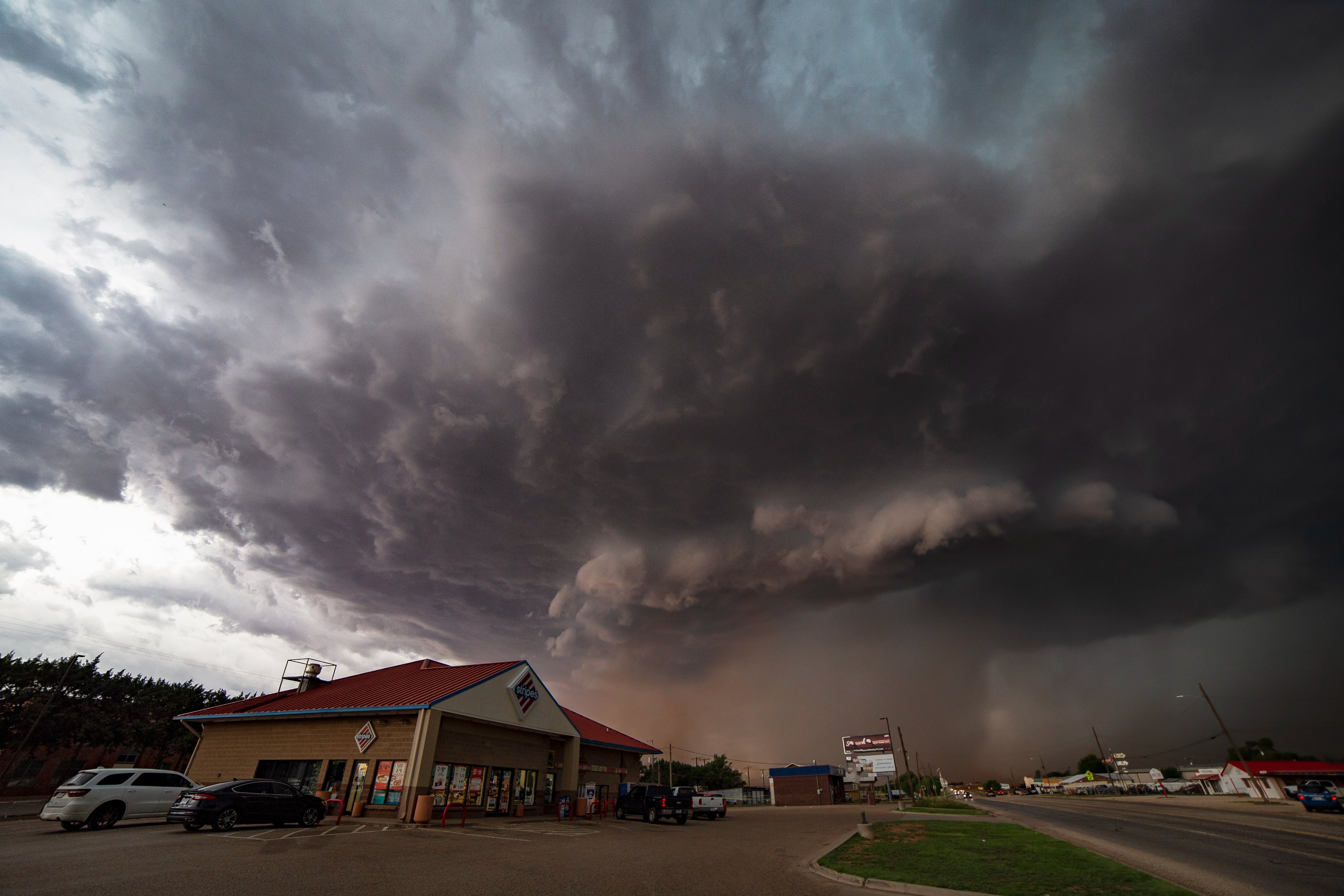
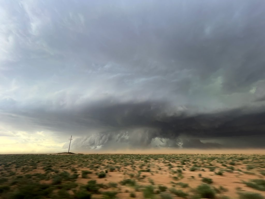
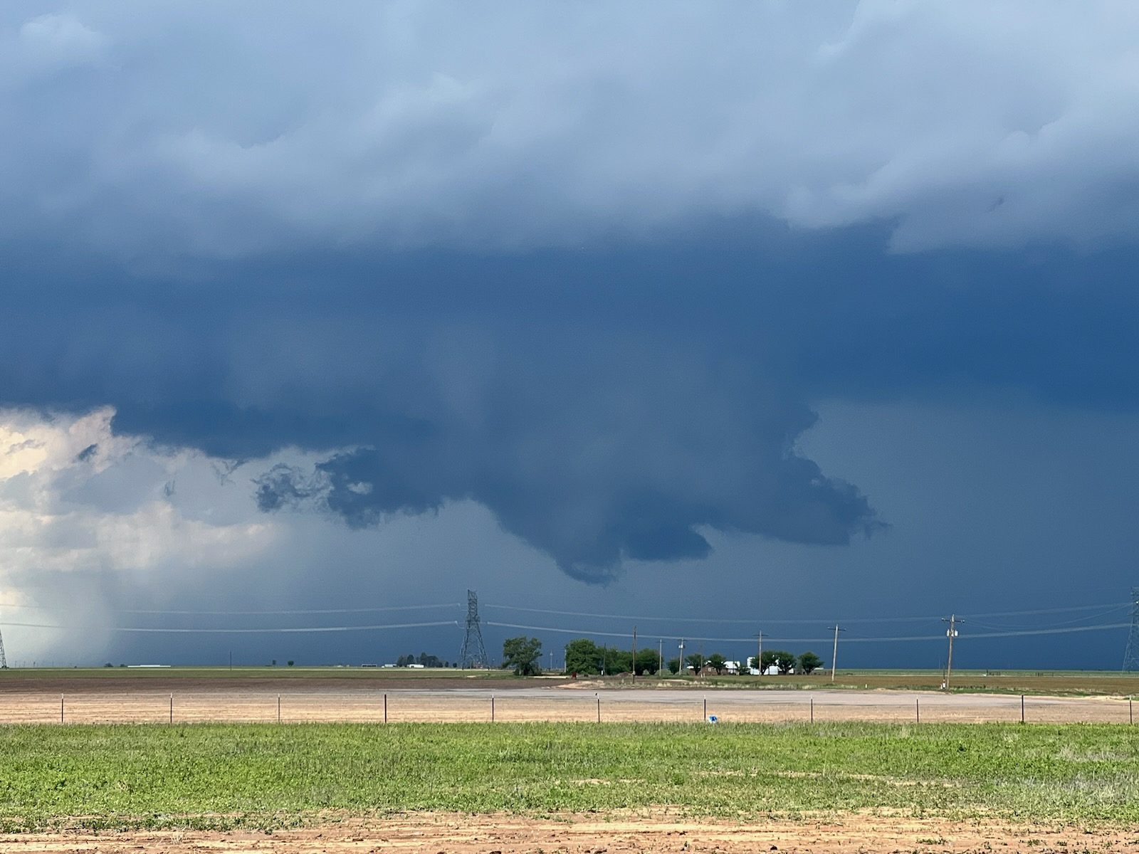
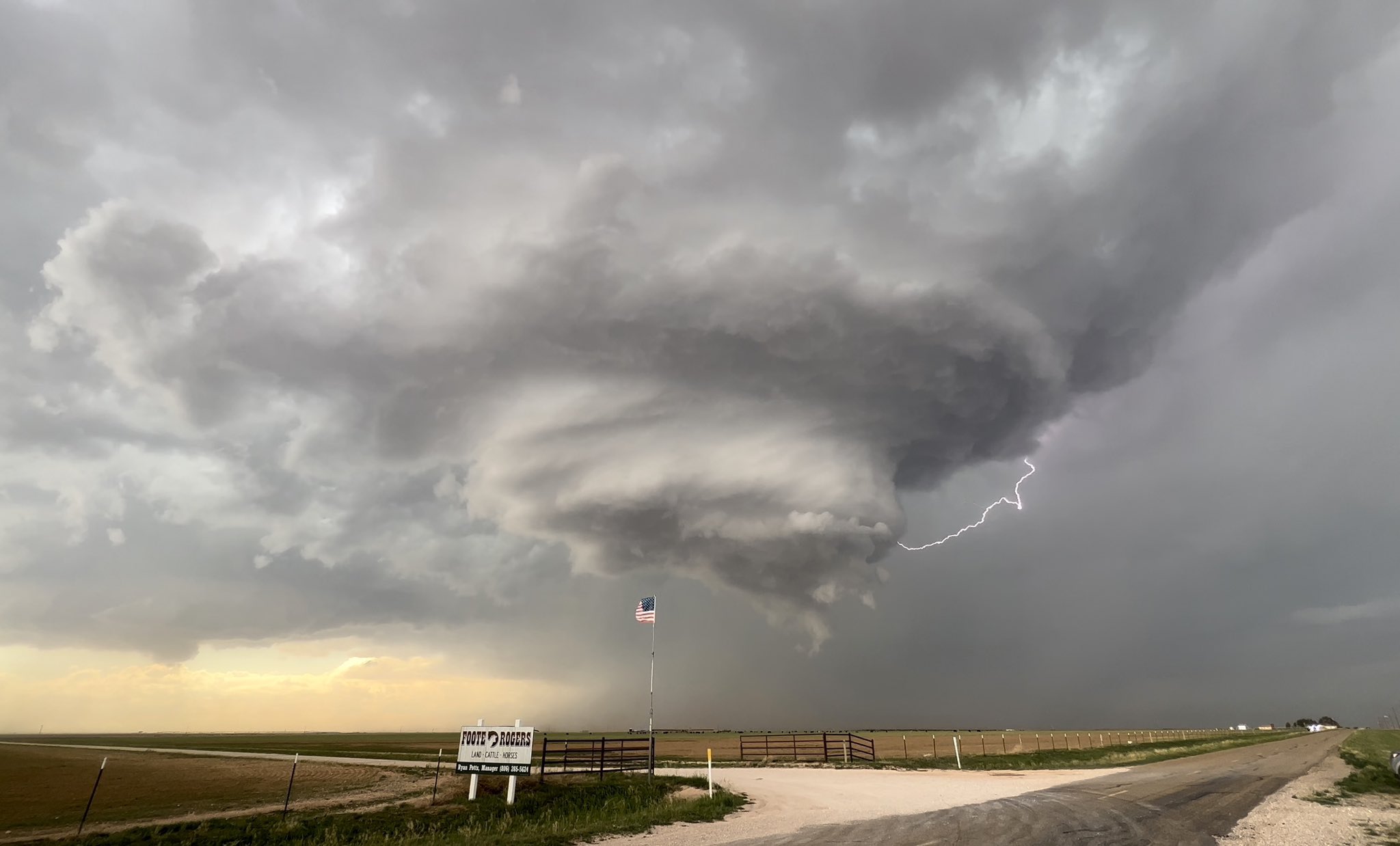
| Supercell thunderstorm near Crosbyton, TX, Monday evening (22 May 2023). The picture is courtesy of Aaron Rigsby. | |
|
After a relatively slow start to the month, and the year, the weather turned notably more active for West Texas in the middle of May. The ramp up in activity didn't follow the "usual" pattern often experienced on the South Plains in the heart of our severe weather season. Instead, initially only limited severe weather was observed with the increase in shower and thunderstorm activity that started on May 16th. |
|
 |
|
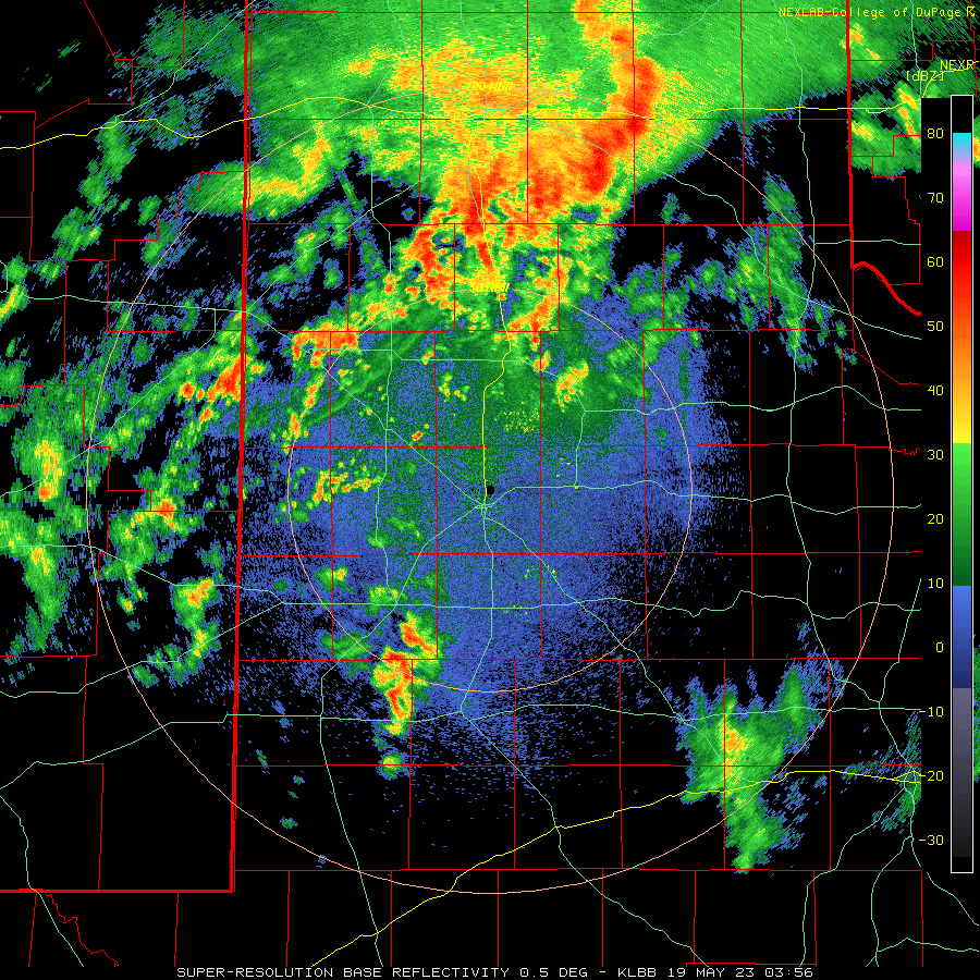
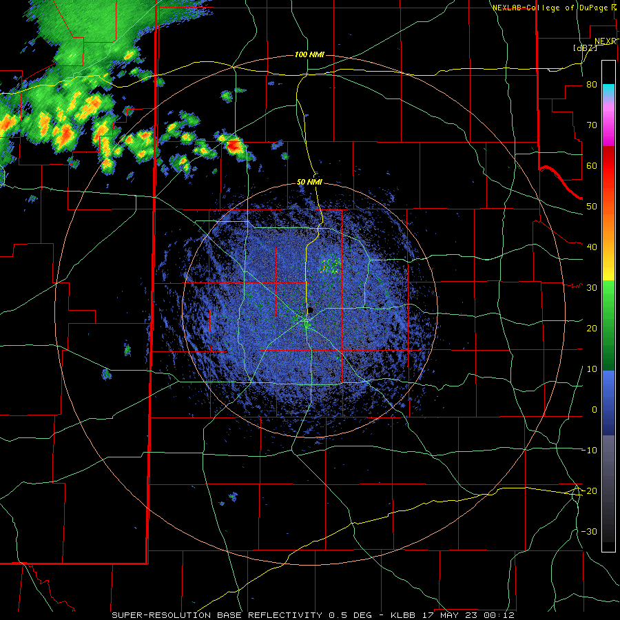
| Lubbock WSR-88D radar animation valid from 10:56 pm on Thursday (18 May) to 6:27 am on Friday (19 May). Additional Lubbock radar animations in mid-May 2023 can be found at: 7:12 pm on Wednesday (17 May) to 6:19 am on Thursday (18 May); 11:05 am to 8:26 pm on Wednesday (17 May); and 2:13 pm to 9:44 pm on Thursday (18 May). | |
| The first round of thunderstorms to affect the region over this prolonged unsettled period occurred Tuesday evening/night (16 May), as a small cluster of thunderstorms of thunderstorms built out of northeast New Mexico and into the southwest Texas Panhandle and northwest South Plains before diminishing late. This activity brought localized heavy rainfall and gusty winds, but no severe weather. | |
 |
|
| Storm near Wellman, TX, Friday evening (19 May 2023). The image is courtesy of Blake Bednarz. A Lubbock radar animation valid from 6:17 pm on Friday (19 May) to 8:53 am on Saturday (20 May) can be VIEWED HERE. | |
| The following afternoon and evening (Wednesday, 17 May) brought another round of isolated to scattered thunderstorms, this time affecting a good chunk of the South Plains region. While the activity across the central and southern South Plains faded Wednesday night, more widespread rain and thunderstorms developed and track across the southern Texas Panhandle and northern South and Rolling Plains early Thursday morning. Impressively, none of these mid-May thunderstorms generated any known severe weather either, primarily thanks to limited instability and a dearth of vertical wind shear. | |
 |
|
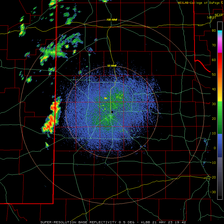
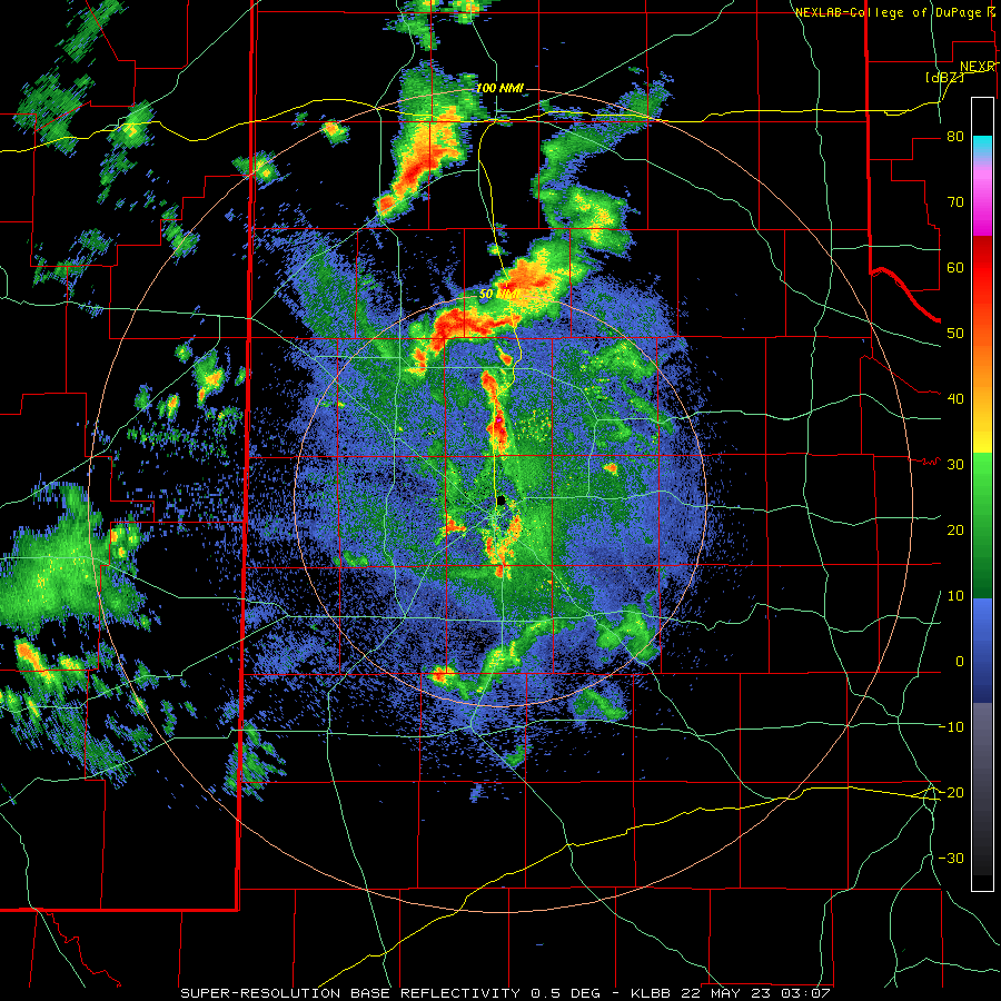
| Lubbock WSR-88D radar animation valid from 2:42 pm to 6:47 pm on Sunday (21 May). Additional radar animation can be found at: 2:42 pm to 10:07 pm on the 21st; and 10:01 pm on the 21st to 6:27 am on the 22nd. | |
| After a brief lull, isolated to scattered thunderstorms that developed across southeast New Mexico, tracked southeastward over portions of the western and southwestern South Plains Friday evening (19 May). Although more limited in coverage than previous days, a modest increase in instability and wind shear promoted better storm organization, including rotating storms. The most intense storm of the evening produced an estimated wind gust of 60 mph as it was tracking through southwest Cochran County, south of Bledsoe. This storm also likely generated some hail, though no reports were received. | |
 |
|
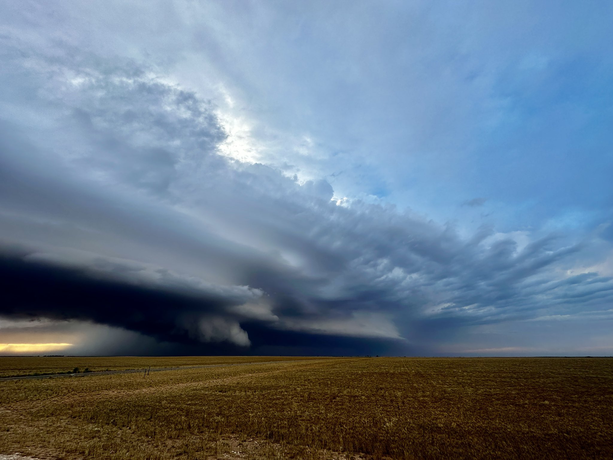
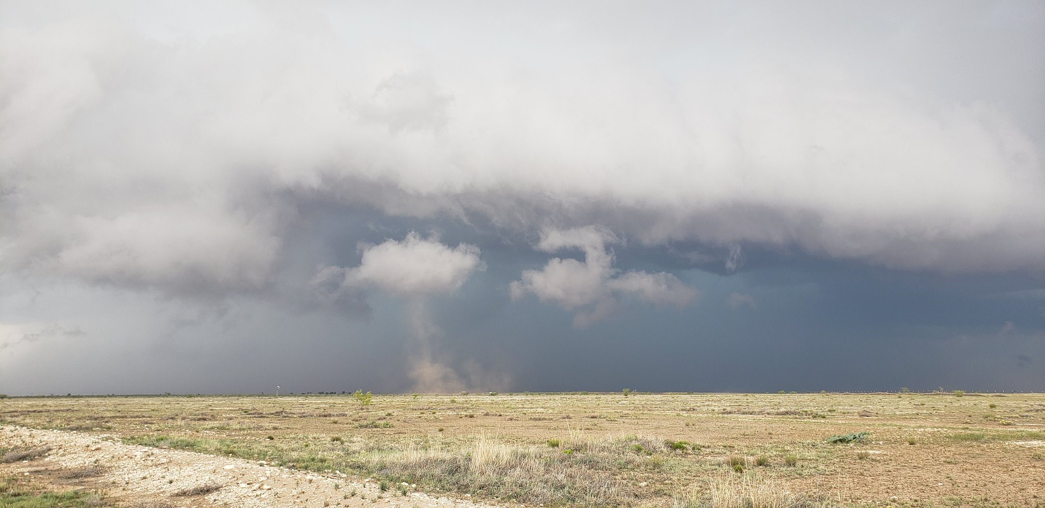
| Dusty supercell south of Morton on Sunday evening (21 May 2023). The picture is courtesy of James T. (Twitter handle: @JTMediaOH). | |
|
Saturday, May 20th, provided a rare quiet weather day behind a weak cold front. High temperatures only reached the 70s, making for a beautiful day to kick off the weekend. The pleasant break didn't last long as returning low level moisture helped fuel scattered thunderstorm Sunday afternoon and evening (21 May). This activity was a bit stronger than previous days thanks to a slight uptick in wind fields aloft, with the more intense storms generating gusty winds, small hail and very heavy rain. One storm did produce a 59 mph wind gust near Aiken, while another generated several gustnadoes (see below) near Plains. A few storms even lingered into early Monday morning, dropping localized heavy rain, including across much of Lubbock. |
|
 |
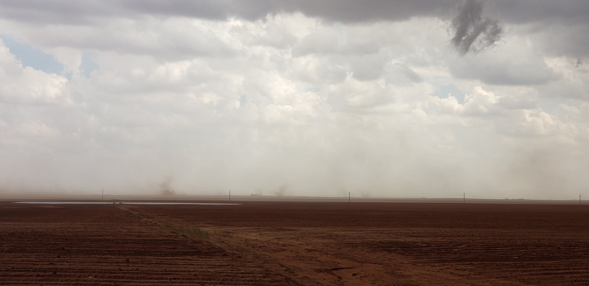 |
| Pictures of gustnadoes associated with a thunderstorm near Plains, TX, Sunday afternoon (21 May 2023). The images are courtesy of Jeff Frame (Twitter handle: @VORTEXJeff). | |
| The next afternoon and evening, Monday, May 22nd, brought another round of scattered thunderstorms. Both instability and wind shear increased from Sunday, which in turn resulted in better storm updraft organization which allowed several to breach severe thresholds. | |
 |
|
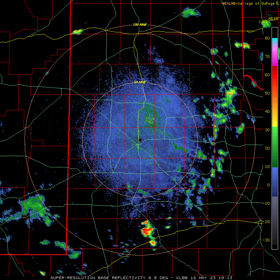
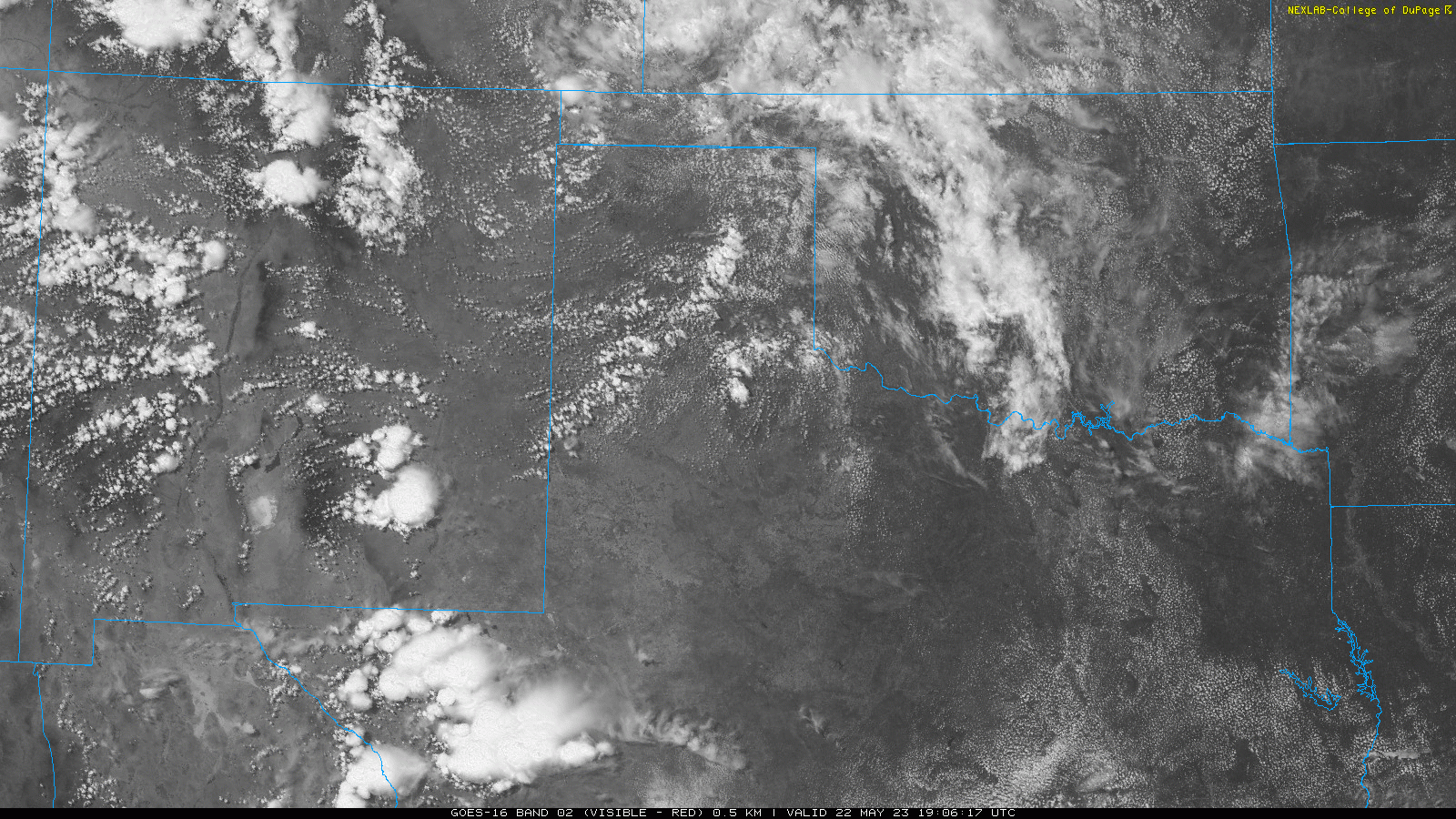
| Lubbock WSR-88D radar animation valid from 11:34 am to 5:42 pm on Monday (22 May). A visible satellite loop showing the initial thunderstorm development Monday afternoon can be VIEWED HERE. | |
| One of the initial storms that developed near Kress produced a good looking wall cloud (shown below), while another core developing quickly on the southwest flank of that storm dropped hail as large as golf balls just northeast of Kress (also shown below). | |
 |
 |
| (left) Looking northward at a wall cloud from near Kress, TX, Monday afternoon (22 May). (right) Hail falling near Kress Monday afternoon. Both pictures are courtesy of Darin Martin. | |
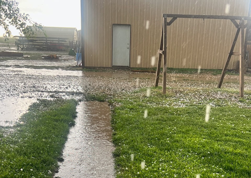
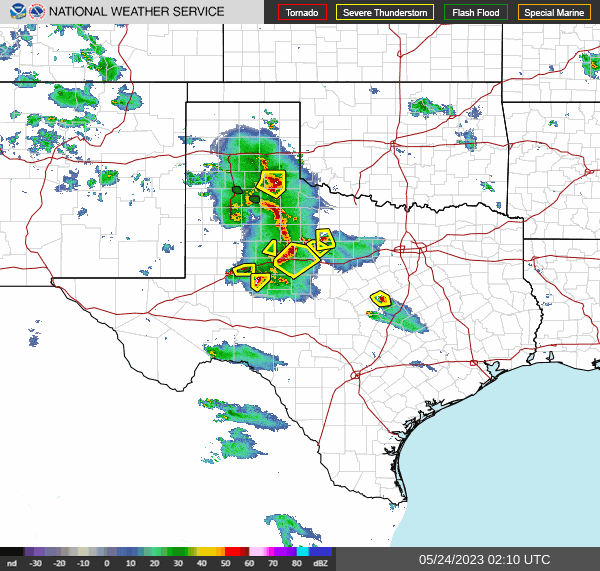
| Additional severe thunderstorms dropped hail as large as 2 inches in diameter west of Tell and northeast of Childress late Monday afternoon. Gradually, the activity organized into a larger complex of thunderstorms that produced heavy rain and severe wind gusts as it accelerated southeastward through the Rolling Plains Monday evening. The bowing line of t-storms generated a peak wind gust of 80 mph as it moved across the West Texas Mesonet (WTM) site 3 miles northeast of Aspermont. | |
 |
|
| Lubbock WSR-88D radar animation valid from 6:40 pm to 9:34 pm on Monday (22 May). | |
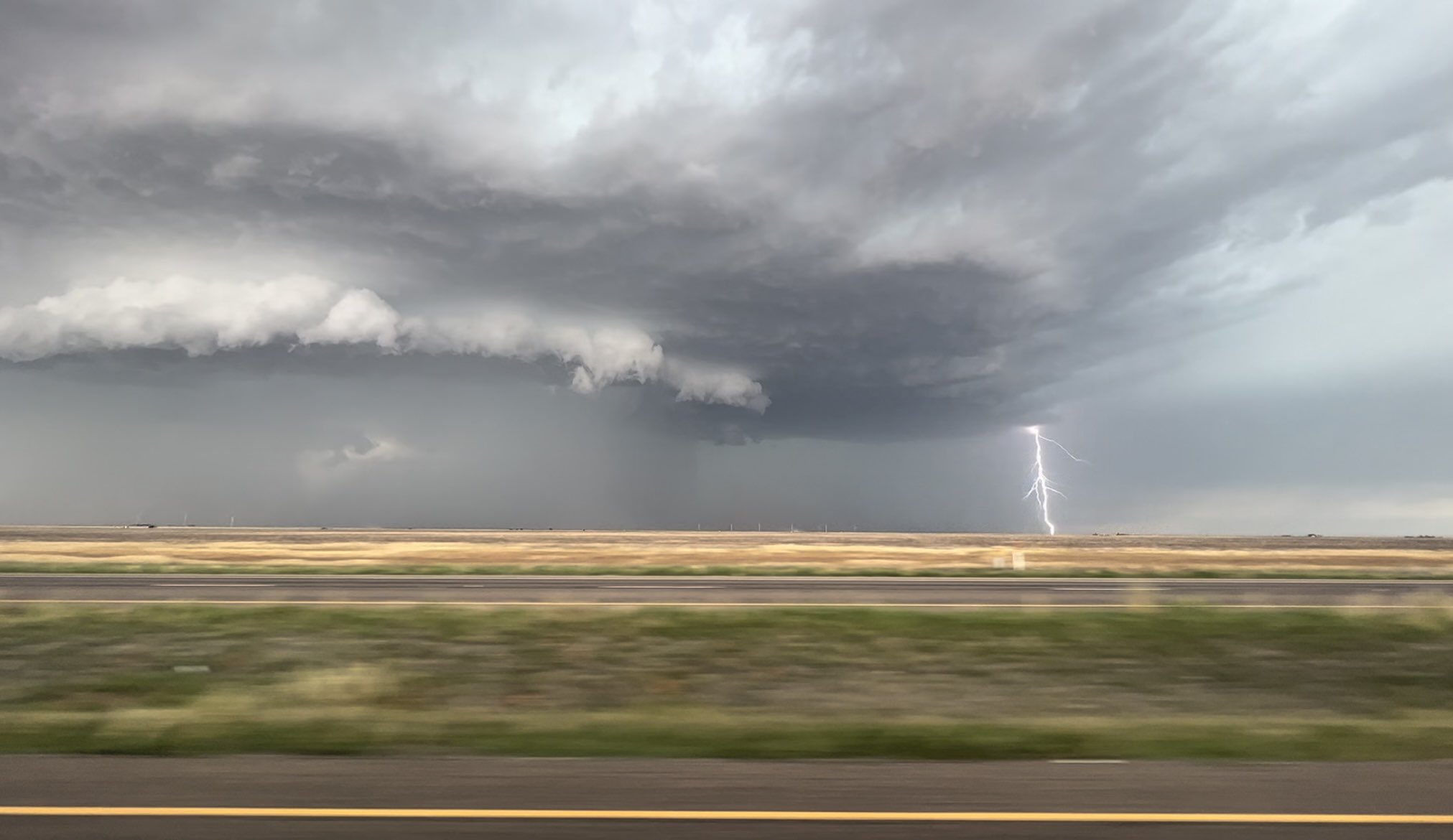
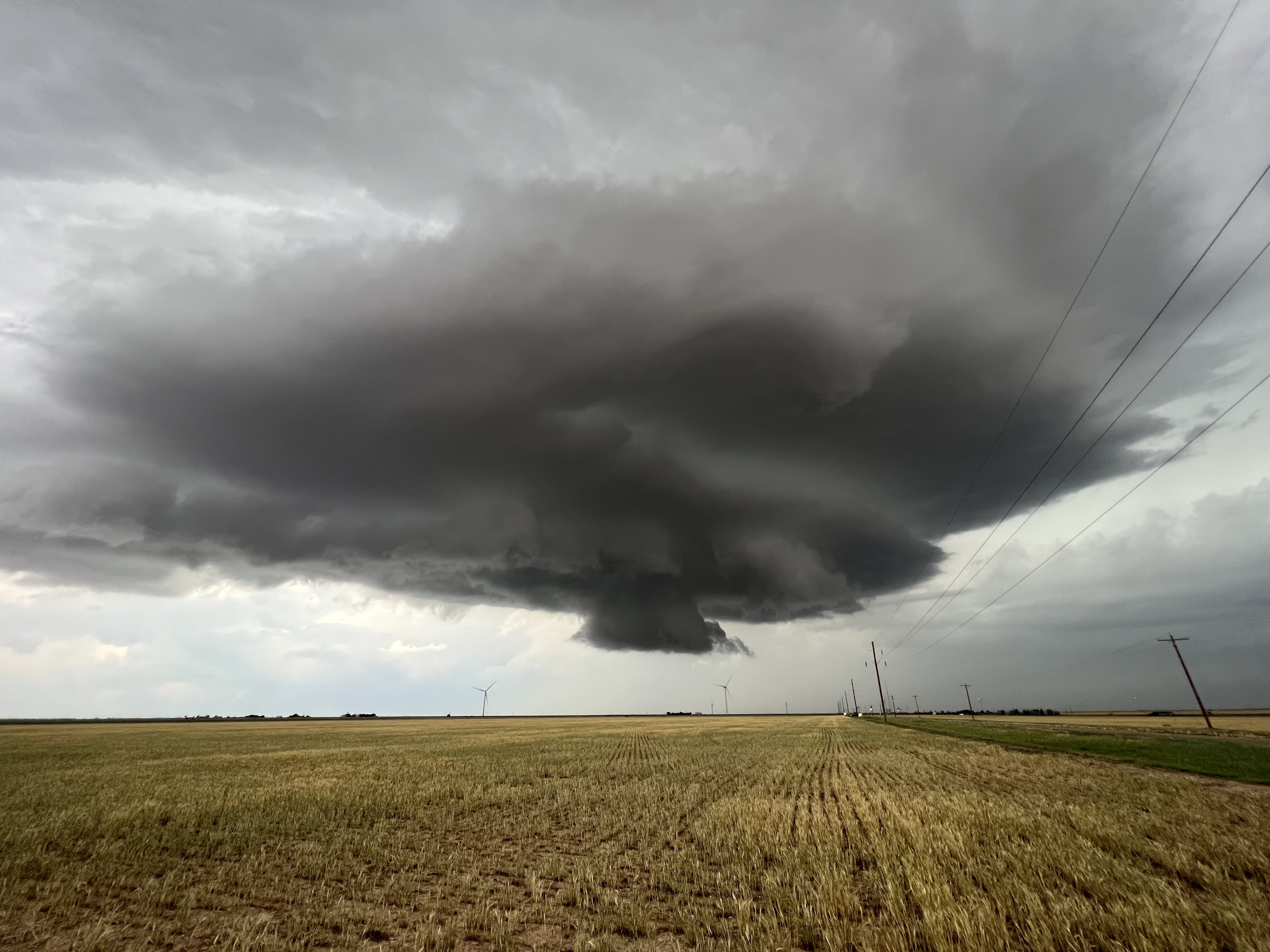
| The organized thunderstorms made for an ominous sky, like seen below with a supercell approaching Ralls Monday evening. | |
 |
|
| Supercell thunderstorm northwest of Ralls, TX, Monday evening (22 May). The picture is courtesy of Brianna Salazar. | |
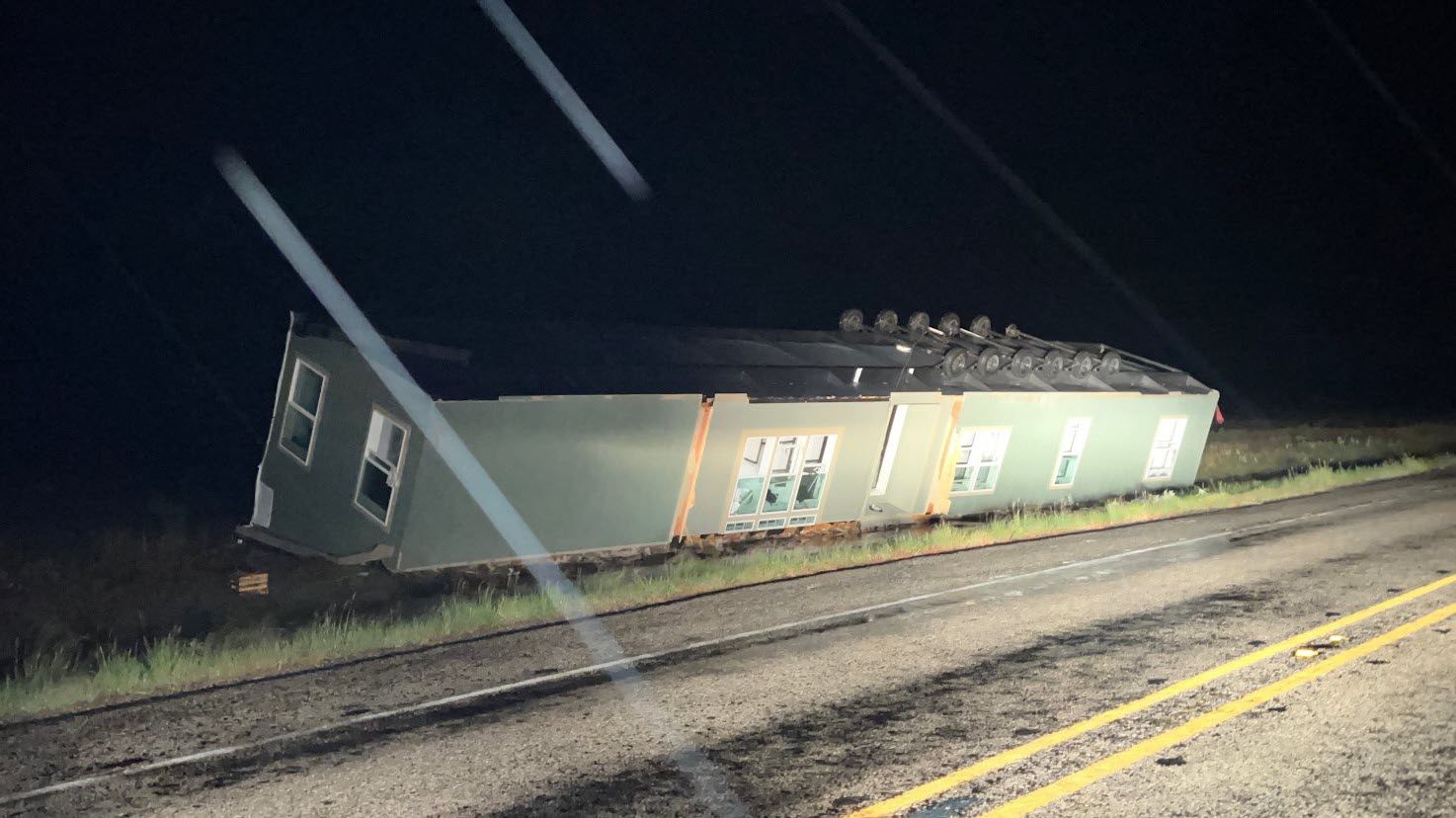
| Unfortunately, the 60-80 mph wind gusts did cause damage in spots, including toppling a manufactured home west of Aspermont (shown below). On the positive side, the widespread activity dropped 1/2" to 1"+ across a good portion of the central and eastern Rolling Plains Monday evening, with comparable spotty totals found to the west up on the Caprock. | |
 |
|
| A toppled manufactured home west of Aspermont Monday evening (22 May). The image is courtesy of Chadwick Stelzl. | |
| Like a broken record, Tuesday afternoon and evening provided more severe thunderstorms for the South Plains region. This bulk of this activity was focus on the Caprock through the daytime hours, before shifting into the Rolling Plains late. | |
 |
|
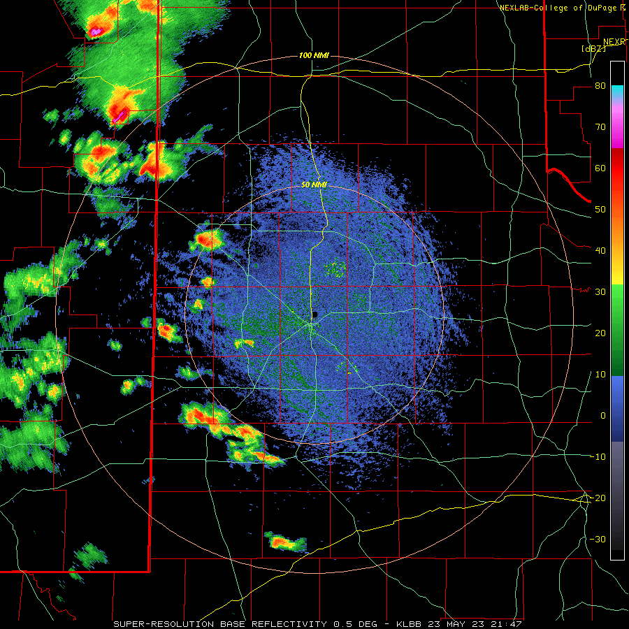
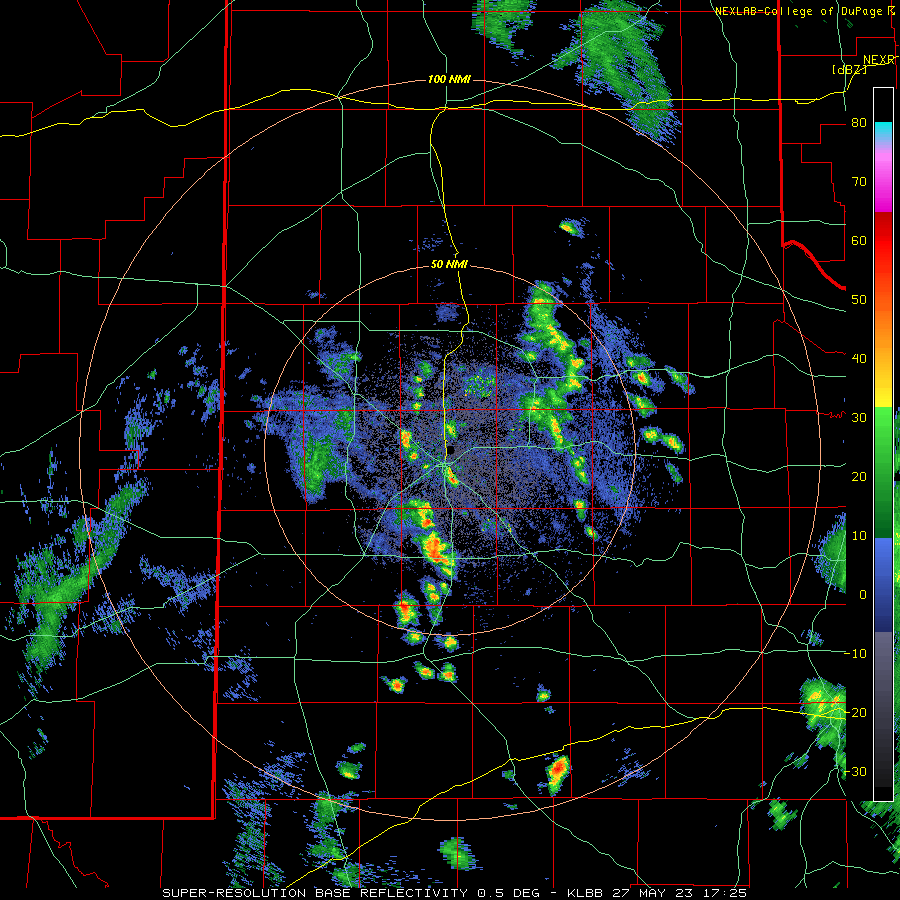
| Lubbock WSR-88D radar animation valid from 5:54 pm to 7:41 pm on Tuesday (23 May). An additional radar animation, valid from 4:47 pm to 6:02 pm on the 23rd, can be VIEWED HERE. | |
| Several of the thunderstorms on Tuesday gain significant mid-level rotation which allowed them to generate very large hail. Hailstones as large as baseballs damaged multiple vehicles southeast of Anton, while many other spots incurred impacts from golf ball sized hail. | |
 |
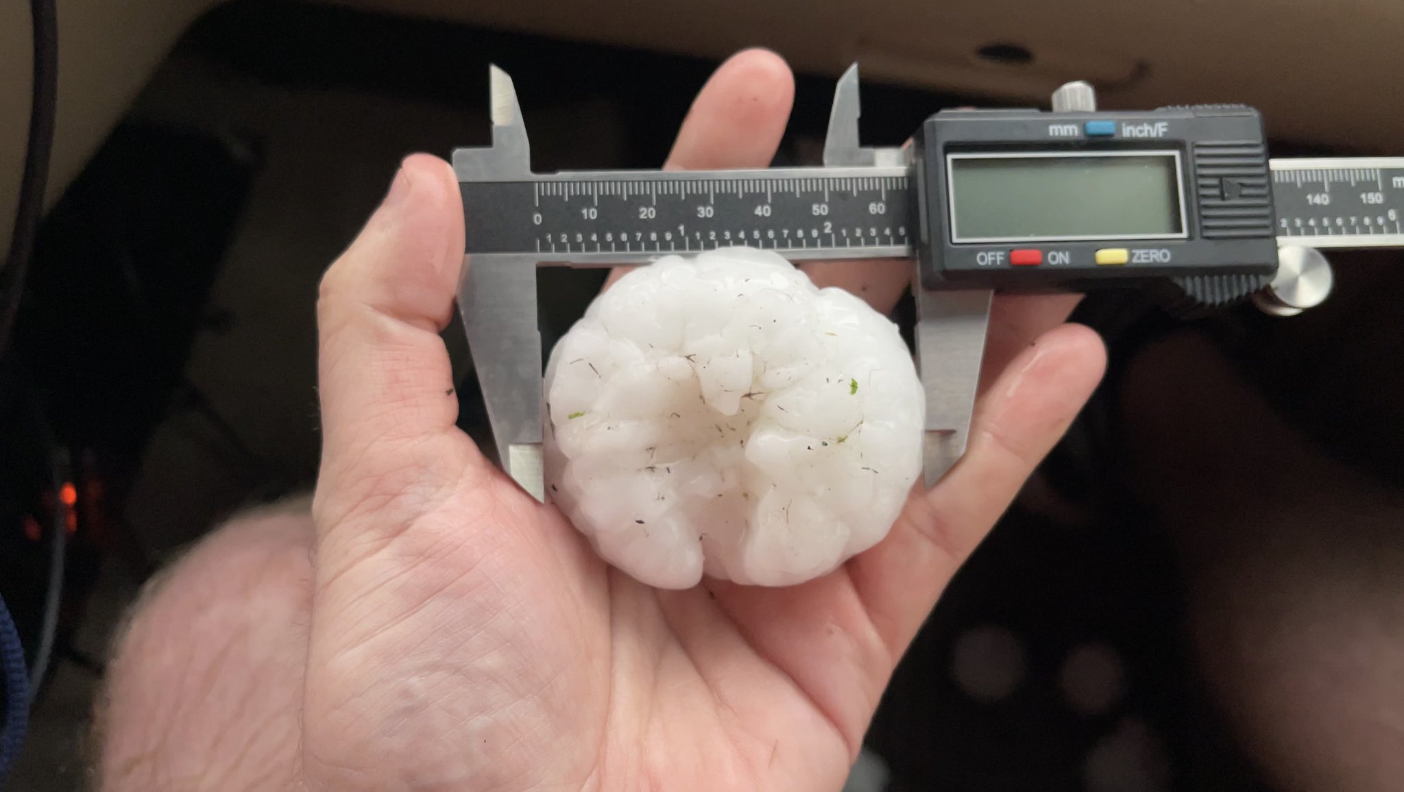 |
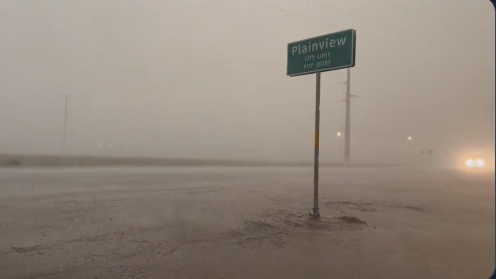
| (left) Flooded roadway immediately north of Plainview, TX, on Tuesday evening (23 May). The image is courtesy of Chad Casey. (right) Large hail measured near Anton Tuesday evening, courtesy of Live Storms Media on Twitter | |
| In addition to producing large hail, the slow-moving storms also dumped torrential rainfall. Where the thunderstorms lingered the longest, a quick 2 to 4+ inches fell, which resulted in pockets of flooding. One such pocket of torrential rain targets points just to the north of Plainview, where several roads were underwater. | |
 |
|
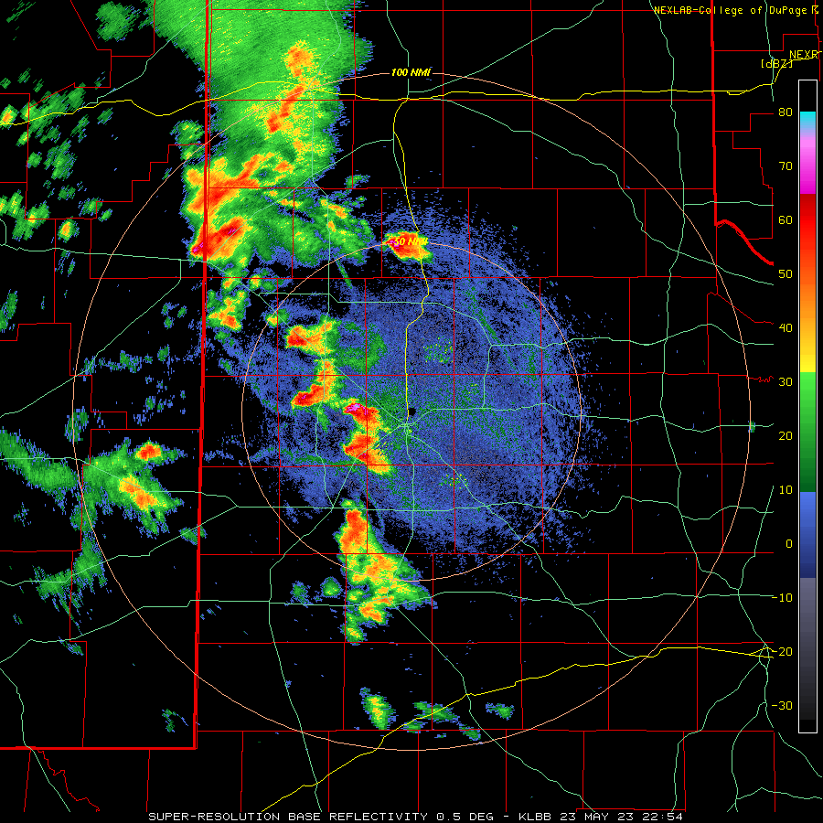
| Regional radar animation valid from 9:10 pm to 9:28 pm on Tuesday (23 May). | |
| Tuesday's supercells generated numerous wall clouds (see below), but thankfully no know tornadoes. | |
 |
 |
| (left) Supercell thunderstorm near Farwell, TX, on Tuesday evening (23 May). The image is courtesy of Sam Dienst. (right) Another supercell thunderstorm with a pronounced wall cloud Tuesday evening, located northeast of Floydada. The picture near Floydada is courtesy of WxIntercepts on Twitter. | |
| The weather finally quieted down for much of the day on Wednesday (24 May), but that didn't last. In fact, very intense thunderstorms that developed in northeast New Mexico during Wednesday afternoon built southeastward through the evening and overnight hours. The most intense storm of the evening produced a few tornadoes in eastern New Mexico, north of Clovis, before moving across the state line with torrential rain, large hail and damaging winds over portions of Parmer County. | |
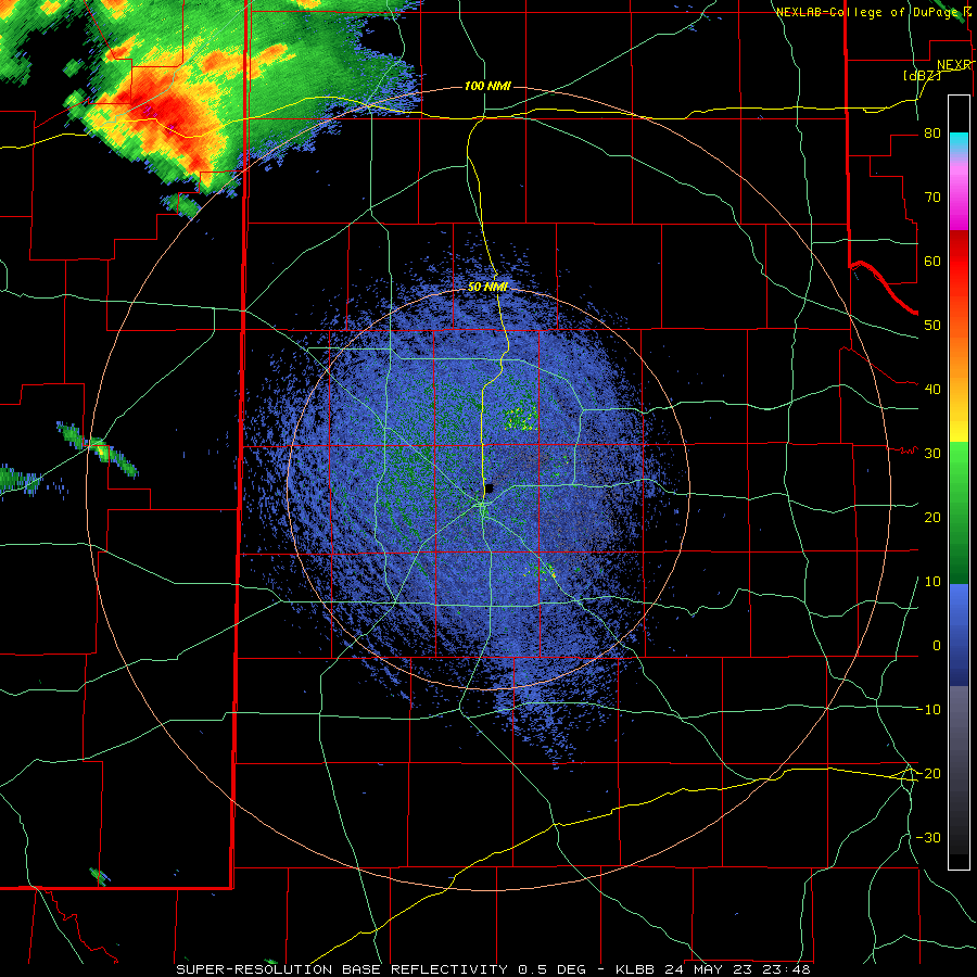 |
|
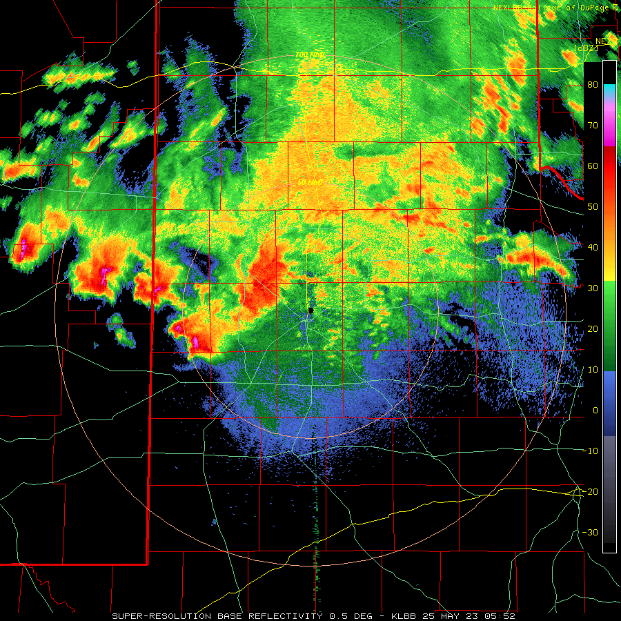
| Lubbock WSR-88D radar animation valid from 6:48 pm to 11:27 pm on Wednesday (24 May). An additional radar animation, valid from 12:52 am to 6:11 am early Thursday morning (25 May), can be VIEWED HERE. | |
| The thunderstorm continued all night, not exiting the Rolling Plains until after dawn Thursday morning. A couple of the storms continued to toss hail and generate damaging wind through about 3 am, while the heavy rain and areas of flooding persisted much of the night. A peak wind gust of 67 mph was measured by the WTM immediately northeast of Friona late Wednesday evening, while hail as large as golf balls was reported as late as 2:16 am Thursday southwest of Brownfield. | |
 |
|
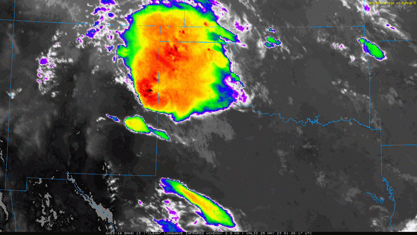
| Infrared satellite animation valid from 8:26 pm Wednesday evening to 6:06 am Thursday (24-25 May). | |
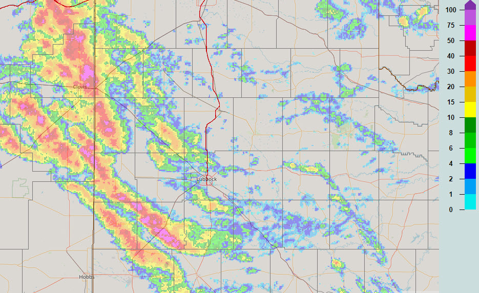
| The above satellite loop shows the cold cloud top (reds and oranges) associated with the tops of tall, intense thunderstorms Wednesday evening into Thursday morning. These tall storms generated several swaths of large hail, as estimated by the Multi-Radar Multi-Sensor (MRMS) system below. | |
 |
|
| 24-hour Multi-Radar Multi-Sensor (MRMS) hail swath plot ending at 7 am on 25 May 2023. | |
| The early-day activity helped cool and stabilize the atmosphere over the South Plains region for the remainder of Thursday. However, another round of thunderstorms did fire across the higher terrain of northeast New Mexico. This activity was a bit delayed from the previous day, but followed a similar evolution and track, eventually propagating into the southwest Texas Panhandle and northwest South Plains in the early morning hours of Friday (26 May). | |
 |
|
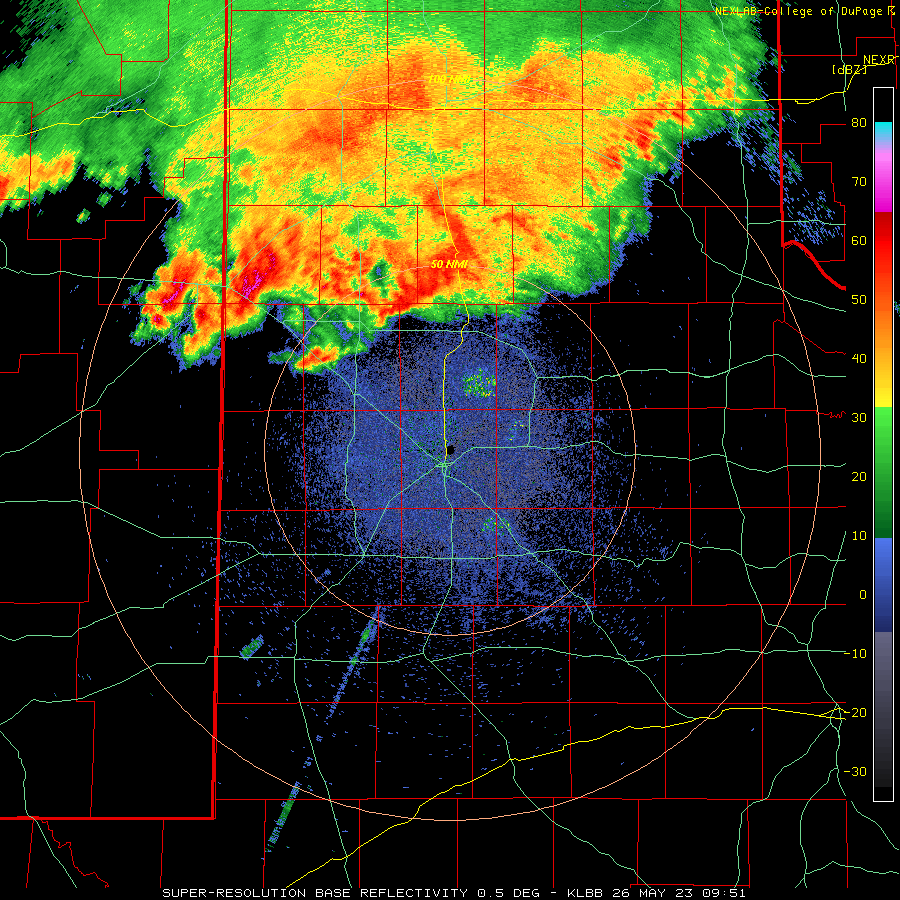
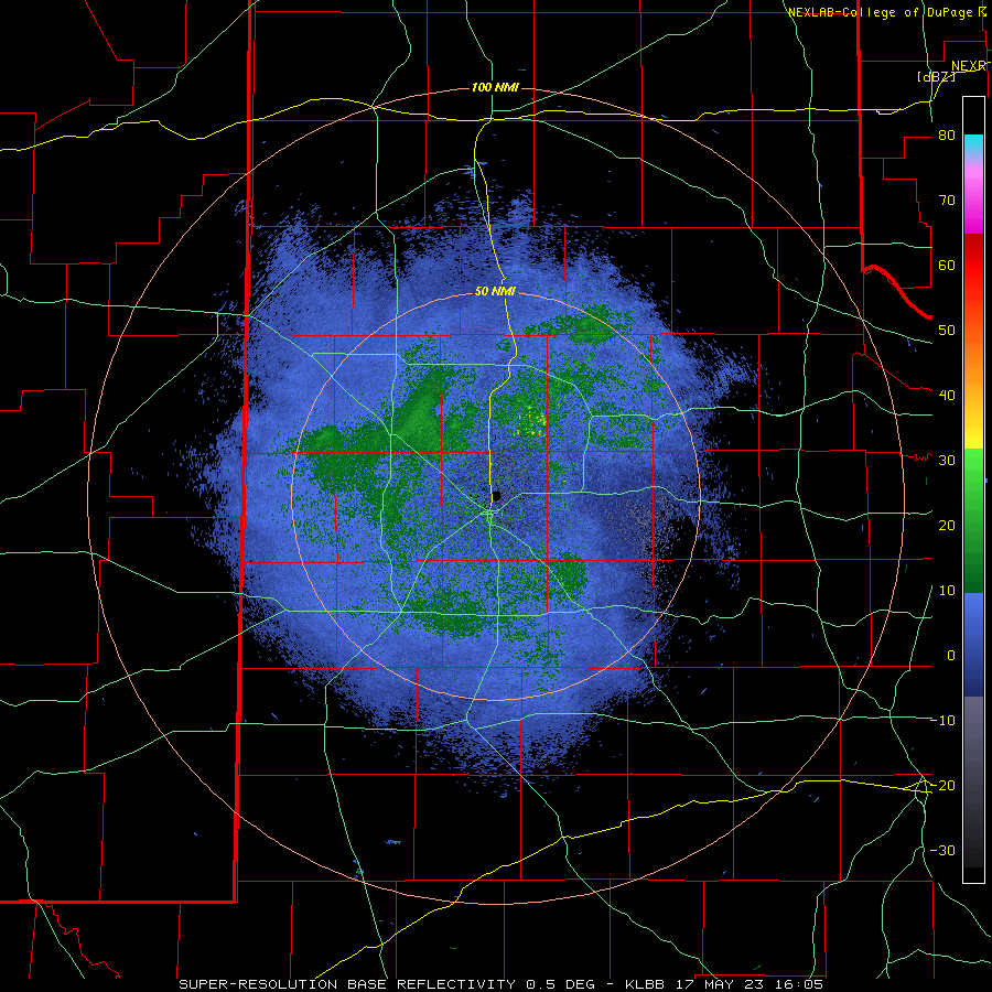
| Lubbock WSR-88D radar animation valid from 4:51 am to 10:26 am on Friday (26 May 2023). | |
| The activity eventually accelerated southeastward, sweeping across much of the central and southern South Plains and Rolling Plains through Friday morning. A couple of severe wind gusts were recorded with the most intense activity near Shallowater and the Lubbock Airport shortly after 7 am, but the most widespread impact was brief torrential rainfall that caused lots of street flooding, both in Lubbock and around the area. | |
 |
|
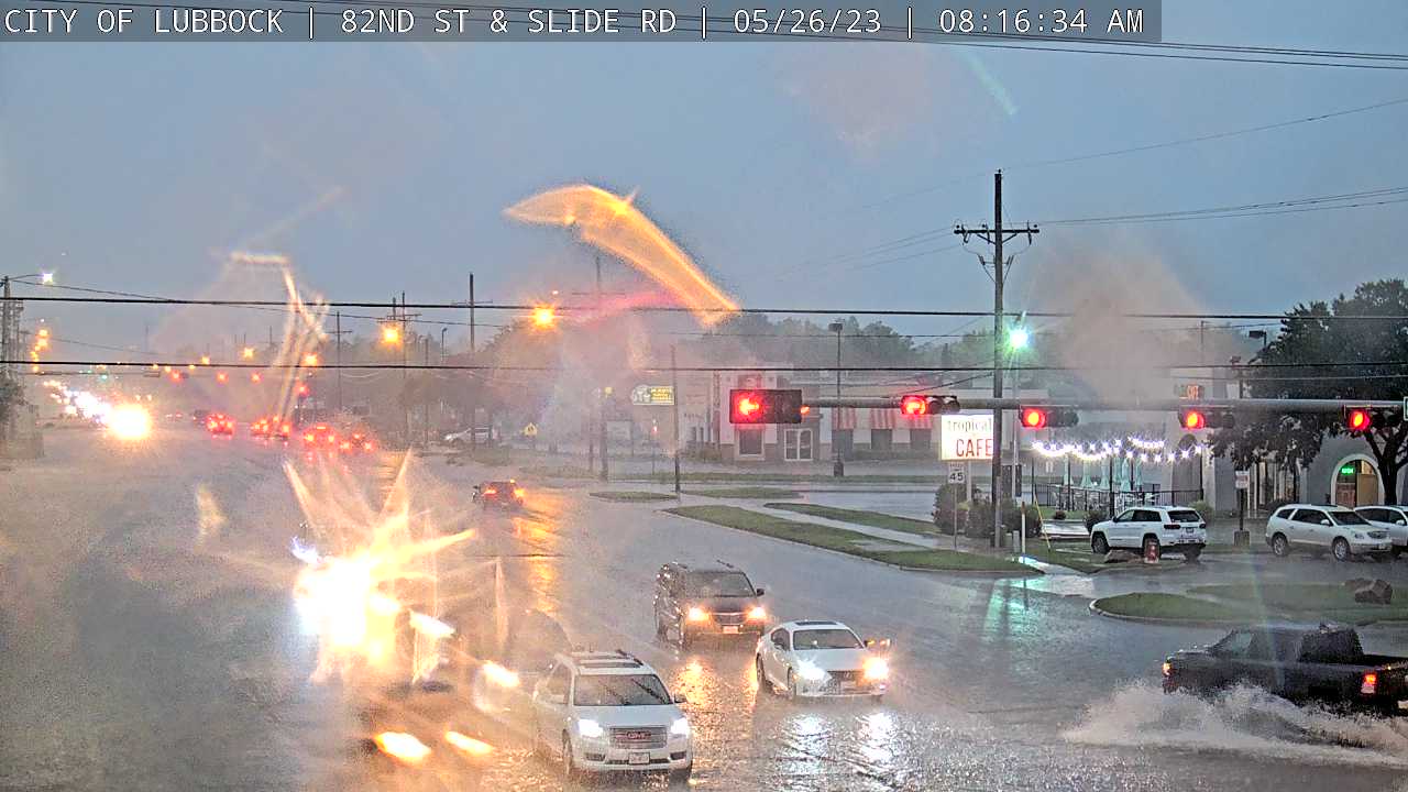
| Street flooding at the intersection of 82nd Street and Slide Road in Lubbock Friday morning (26 May 2023). The image is courtesy of the City of Lubbock. | |
| The many rounds of rain, often heavy at times, did bring widespread and significant precipitation to all of the southern Texas Panhandle, South Plains and Rolling Plains. This welcome rain helped ease drought concerns while also fueling a nice green-up. | |
 |
|
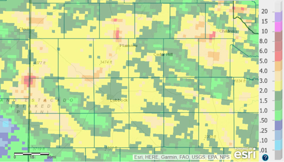
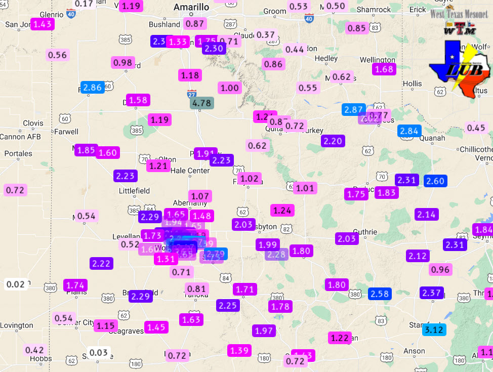
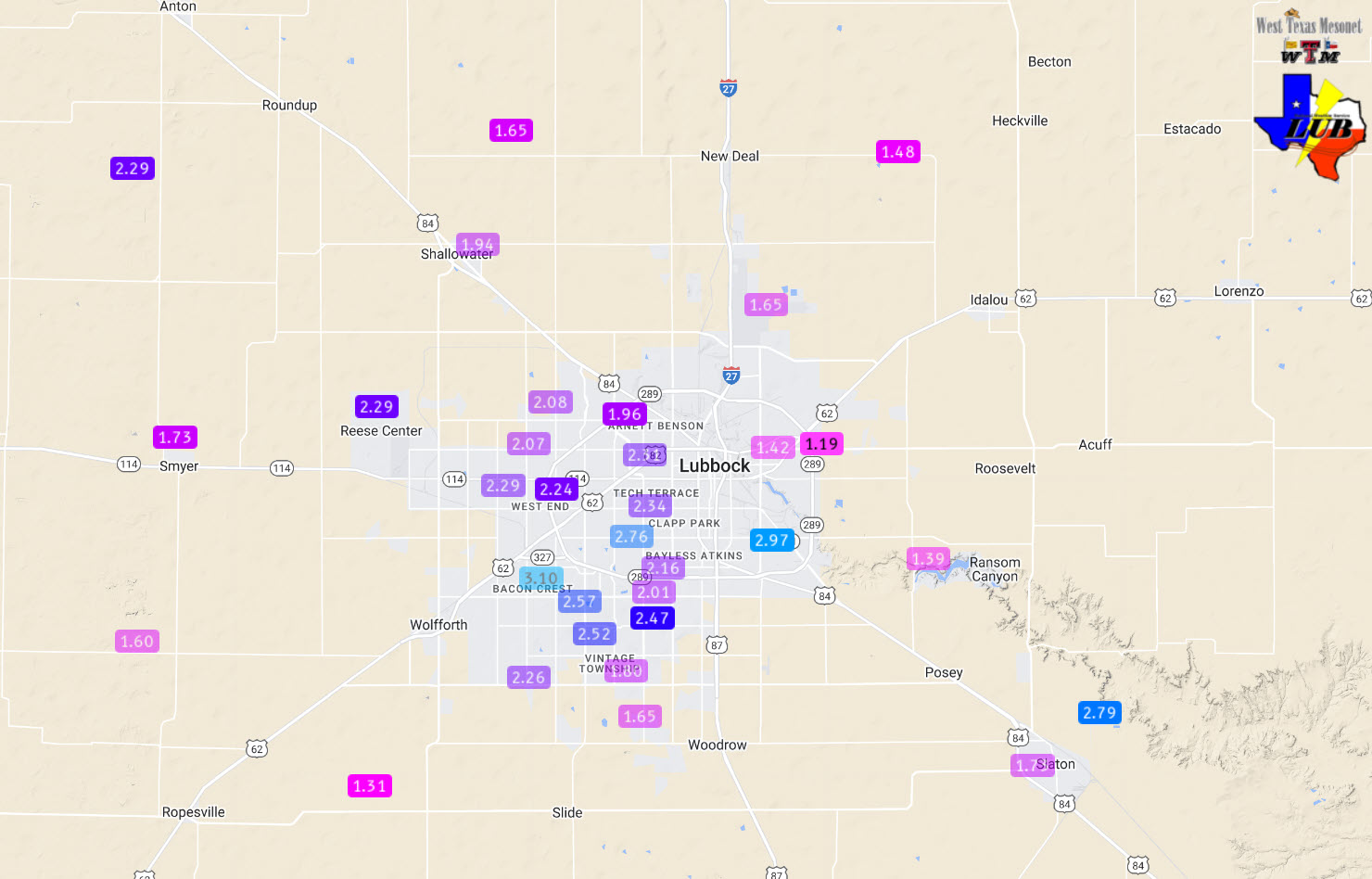
| 7-day radar-estimated and bias-corrected rainfall ending at 7 am on Thursday (25 May 2023). 5-day West Texas Mesonet (WTM) measured rain totals ending at 11 am on the 25th can be FOUND HERE. A close up of the Lubbock area 5-day rain totals can be VIEWED HERE. | |
|
Collectively, the rounds of thunderstorms provided 1 to 3+ inches of rain for much of the region over the active week. In fact, as the above graphic illustrates, many spots saw at least 2 inches of rain, with pockets of 3 to 5+ inches. Officially, the Lubbock Airport tallied 4.67 inches of rain in May through noon on the 26th, boosting the year-to-date (YTD) total to 5.53 inches, which is only 0.29 inches shy of normal. Even more impressively, the Childress Airport measured 6.47 inches in May through noon on the 26th, lifting their YTD total to 8.80 inches (0.78 inches above normal). |
|
 |
|
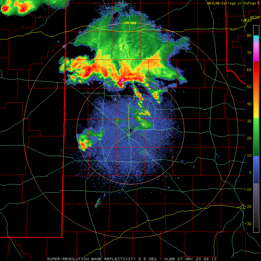
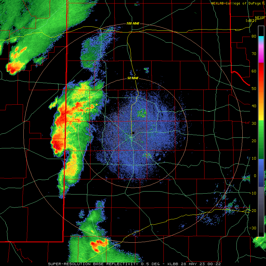
| Lubbock WSR-88D radar animation valid from 3:13 am to 9:36 am on Saturday (27 May 2023). Additional radar animations can be viewed at: 12:25 pm to 6:28 pm on Saturday (27 May); and 7:22 pm to 10:23 pm on Saturday (27 May). | |
| Additional rounds of thunderstorms affected northwest Texas through much of Memorial Day Weekend, before quieter conditions finally prevailed on Memorial Day. The remainder of Friday (26 May), after the morning bout of storms, was largely quiet. However, another complex of thunderstorms that developed in northeast New Mexico and parts of the Texas Panhandle Friday evening, swept southeastward early Saturday, bringing strong winds and more heavy rain to all but the southwestern South Plains. The intense rain, falling on top of already saturated soils, created flash flooding in spots, including around Summerfield as well as along Interstate 27 between Tulia and Kress. | |
 |
|
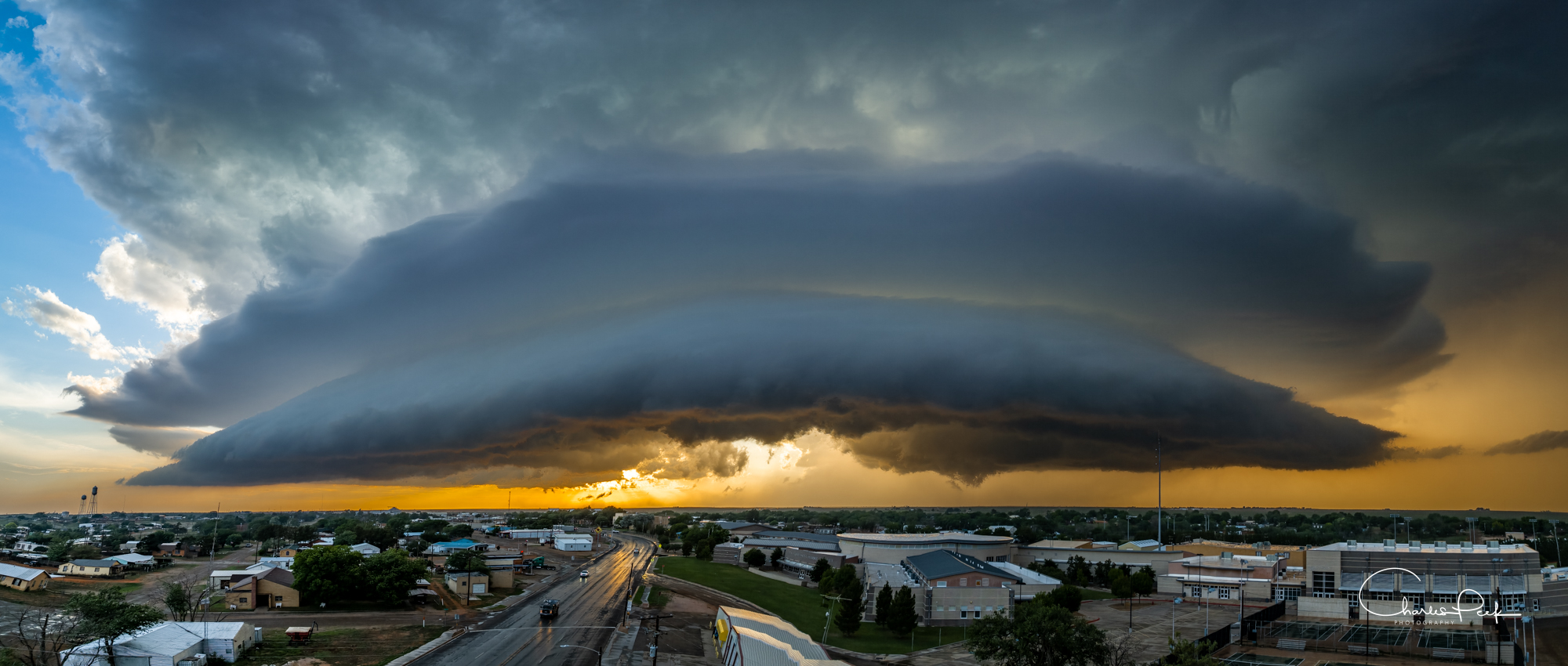
| Supercell thunderstorm moving over the city of Plains, TX, Saturday evening (27 May 2023). The picture is courtesy of Charles Peek. | |
|
Saturday afternoon provided additional scattered showers and thunderstorms, before concluding the day with a couple of supercells that moved out of eastern New Mexico and into the western South Plains. One of the rotating storms tracked over the southwest South Plains Saturday evening. This storm made for an ominous sight as it overspread the city of Plains shortly before sunset (above). The storm produced at least one brief tornado northwest of town and dropped quarter size hail in town before it diminished shortly after sunset southeast of town. Thankfully, the short-lived tornado occurred over open land and inflicted no known damage. |
|
 |
|
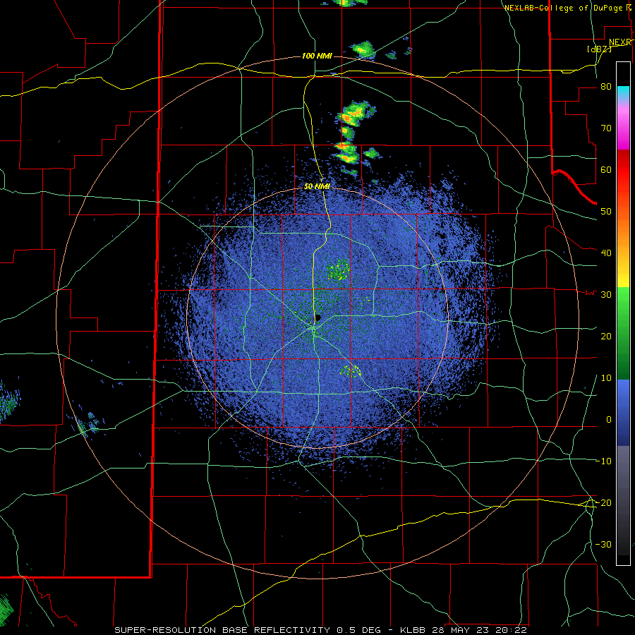
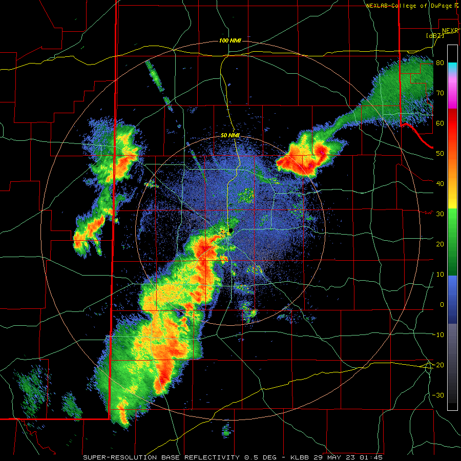
| Lubbock WSR-88D radar animation valid from 3:22 pm to 7:00 pm on Sunday (28 May 2023). An additional radar animation can be viewed at: 8:55 pm to 9:33 pm on Sunday (28 May). | |
| The next day, Sunday (28 May) provided more active weather, including isolated to widely scattered supercell thunderstorms during the afternoon and evening. One nearly stationary storm set up shop near Mackenzie Reservoir where it produced a brief tornado over open field, golf ball sized hail and torrential rainfall. A separate supercell generated a peak wind gust to 79 mph as it tracked across the West Texas Mesonet site 6 miles west-northwest of Denver City Sunday evening. More widespread thunderstorms evolved late Sunday evening into Sunday night while tracking from west-to-east over much of the South Plains and Rolling Plains. | |
 |
|
| Lightning over Lubbock, TX, Saturday night (27 May 2023). The picture is courtesy of Charles Peek. | |
| Preliminary storm reports from this active May stretch of weather can be found below: | |
PRELIMINARY LOCAL STORM REPORT
NATIONAL WEATHER SERVICE LUBBOCK TX
909 PM CDT SUN MAY 21 2023

..TIME...   ...EVENT...      ...CITY LOCATION...     ...LAT.LON...
..DATE...   ....MAG....      ..COUNTY LOCATION..ST.. ...SOURCE....
            ..REMARKS..

1017 PM     TSTM WND GST     1 E HAPPY               34.74N 101.84W
05/18/2023  M59 MPH          SWISHER            TX   MESONET

0650 PM     TSTM WND GST     7 S BLEDSOE             33.52N 103.02W
05/19/2023  E60 MPH          COCHRAN            TX   STORM CHASER

            ESTIMATED INFLOW WINDS

0856 PM     TSTM WND GST     3 WSW AIKEN             34.13N 101.57W
05/21/2023  M59 MPH          HALE               TX   MESONET

            MEASURED BY THE TTU WEST TEXAS MESONET

