|
Bitterly cold air pays a visit |
|
 |
|
|
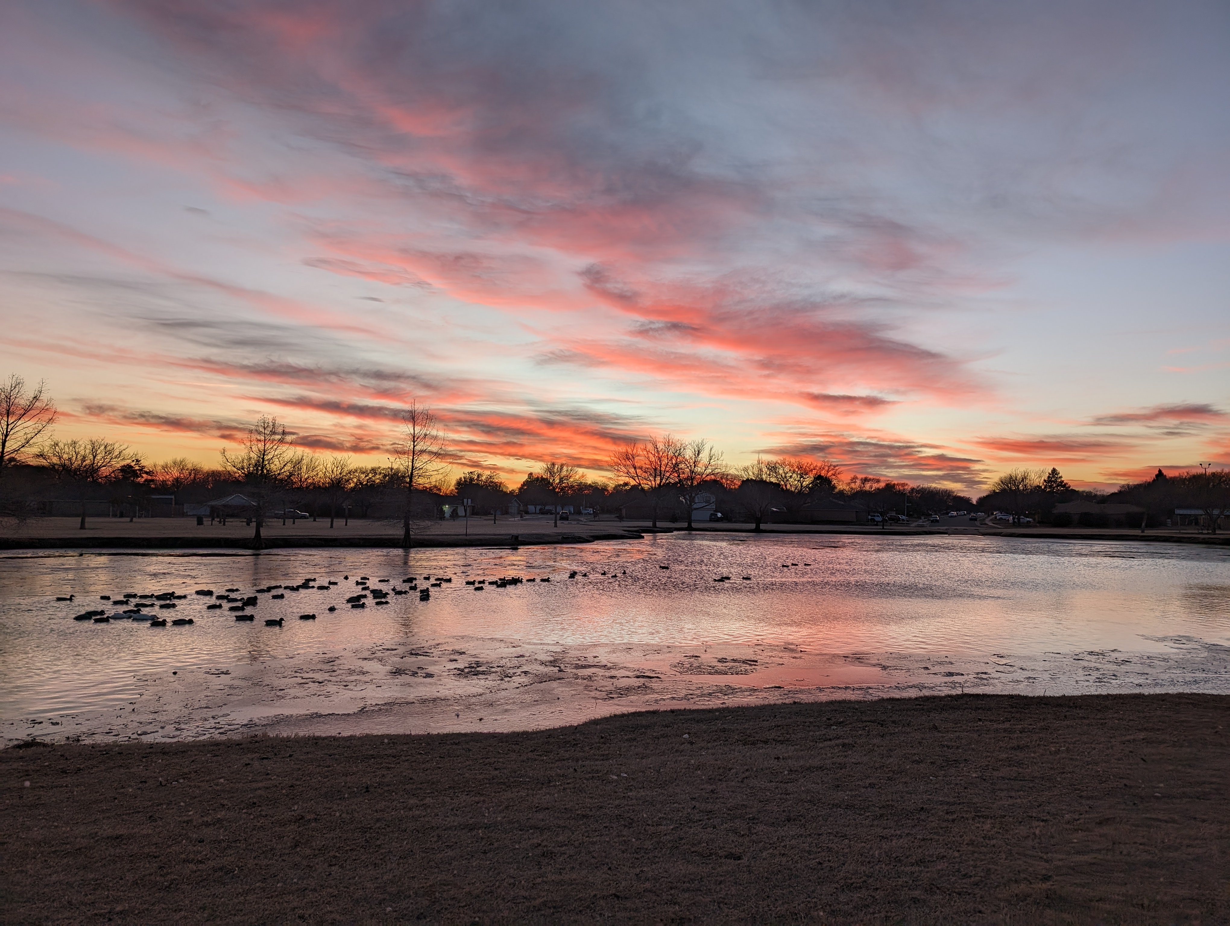
Hoel Park, in southwest Lubbock, captured on Monday evening (15 January 2024). |
|
|
Mid-January brought the first shot of the season of Arctic air to West Texas, and for that matter most of the central and eastern United States. The cold air was courtesy of our neighbors to the north, who couldn't keep the cold pent-up any longer. |
|
 |
|
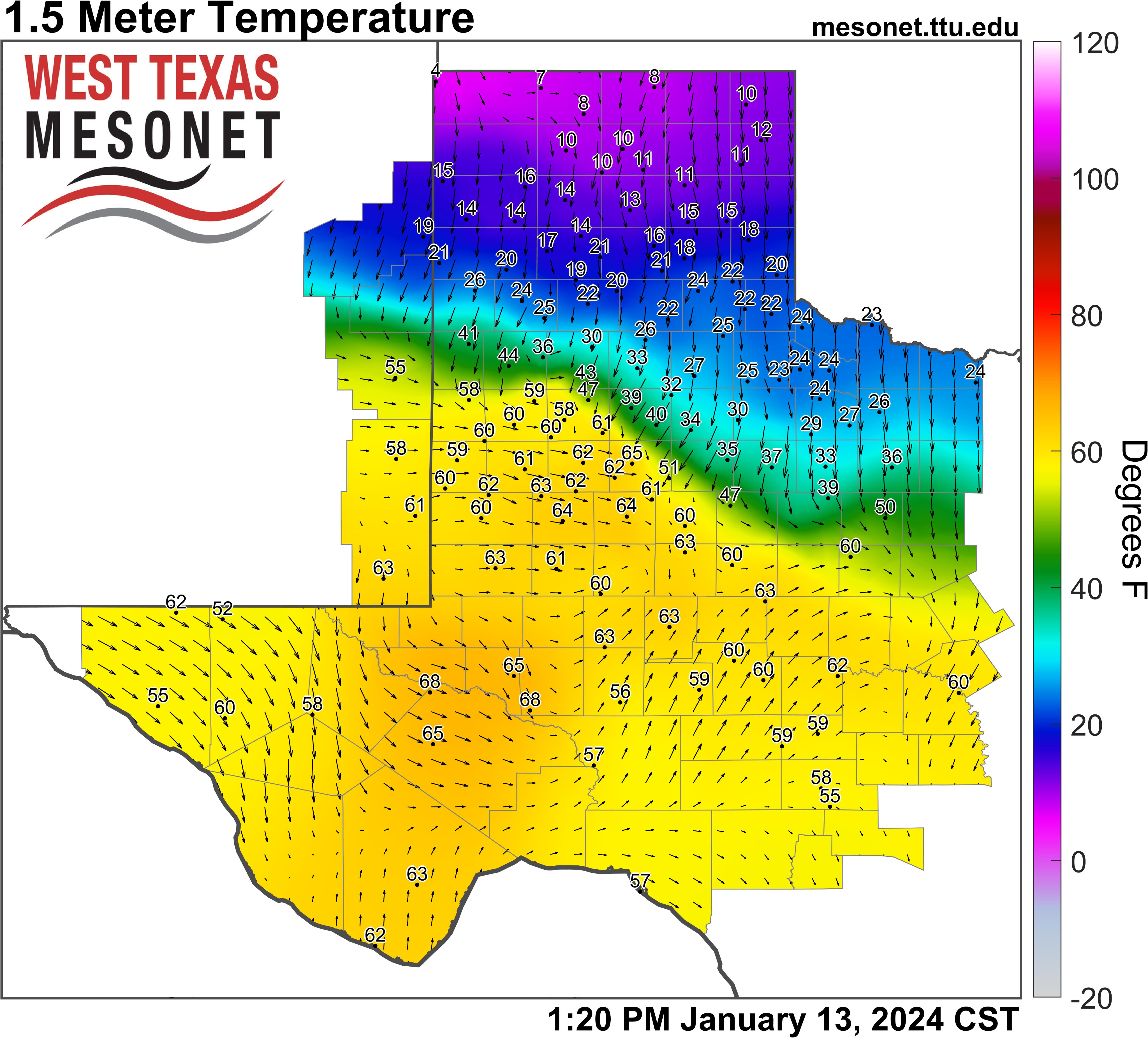
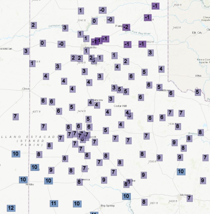
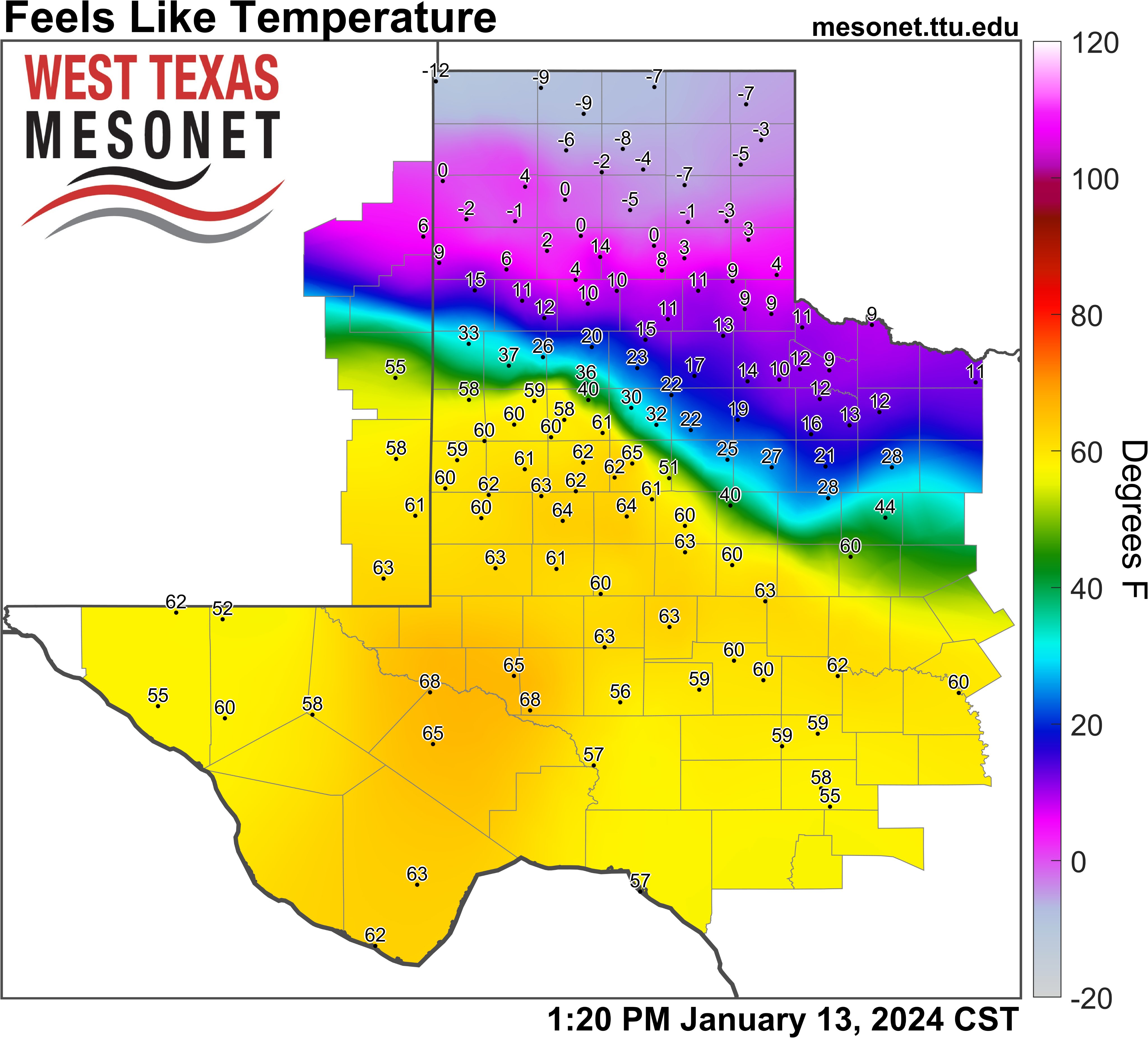
| Observed West Texas Mesonet (WTM) temperatures at 1:20 pm on Saturday, January 13th. The Feels Like Temperature (wind chill) at this same time can be FOUND HERE. View the WTM temperatures as the cold front is moving through Lubbock at 2:45 pm HERE. | |
| Ahead of the cold front that ushered in the Canadian air, mild conditions brought a false sense of the season. Temperatures warmed into the 60s and 70s in advance of the front Saturday afternoon (13 January). However, this warmth was short-lived, as lurking to the north were temperatures in the single digits and teens. Coupled with winds, it felt even colder, with sub-zero wind chills across the northern Texas Panhandle Saturday afternoon! | |
 |
|
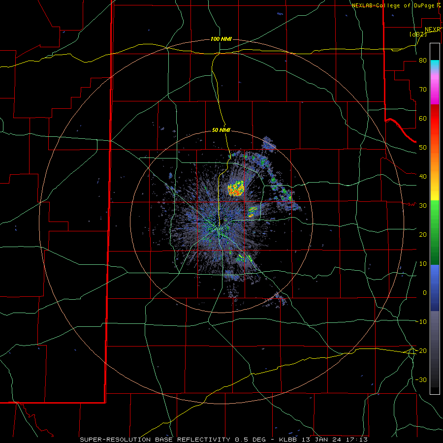
| Lubbock WSR-88D radar animation valid from 11:13 am to 2:58 pm on Saturday (13 January 2024). | |
|
The cold front plunged southwestward through the South Plains Saturday afternoon, moving through Lubbock between 2 and 3 pm. The frontal boundary was clearly visible on the Lubbock WSR-88D radar, noted as a thin line known as a "fine line." |
|
 |
|
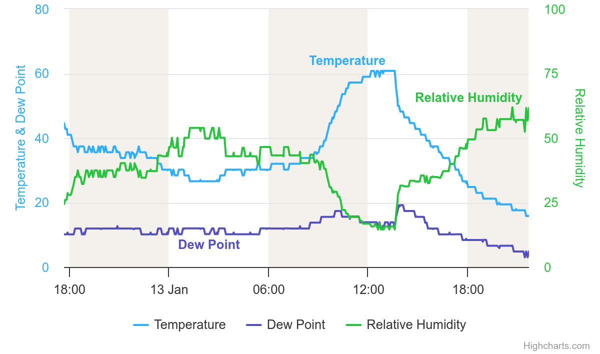
| Graph of temperature (light blue), dewpoint (purple) and relative humidity (green) for Lubbock on Saturday (13 January). | |
| Temperatures tumbled from the lower 60s into the 40s almost immediately, then steadily fell through the 30s, 20s and teens through the late afternoon and evening hours. By Sunday morning (14 January), widespread single digit readings were in place, with a few sub-zero lows across the northeastern Texas Panhandle. | |
 |
|
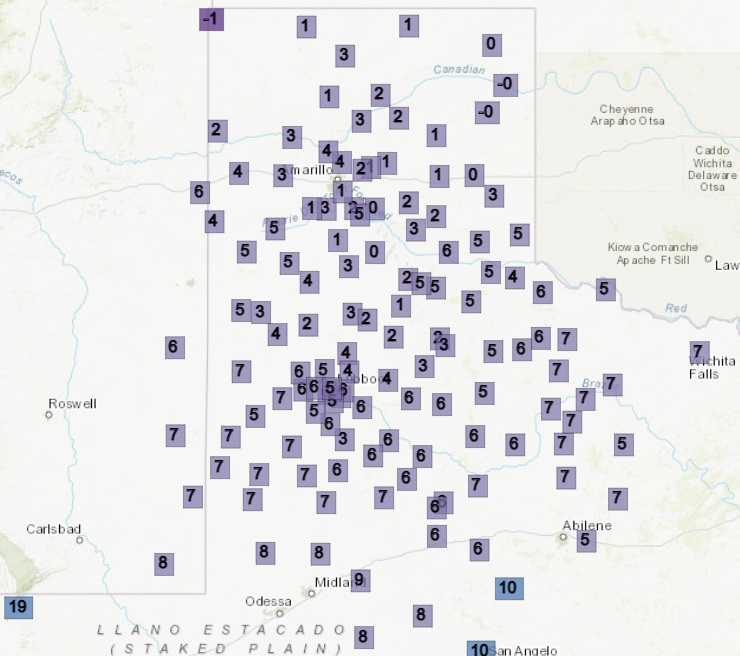
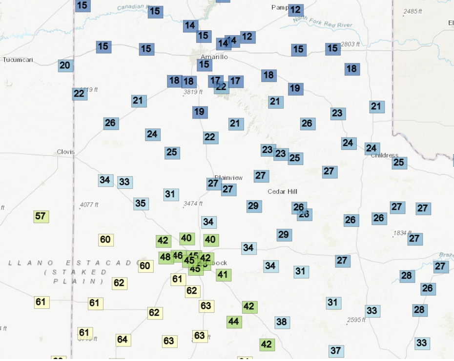
| Observed West Texas Mesonet (WTM) lows on Sunday, January 14th. | |
| In addition, a weak upper level disturbance moved across the southern High Plains Monday morning, generating plenty of cloud cover. These clouds did produce snow aloft over the eastern Texas Panhandle and Rolling Plains, but the snow largely sublimated before making it to the ground, sparing the area from a light, fluffy snow. Eventually, improved moisture did fuel light snow accumulations over parts of Oklahoma and a wintry mix into North Texas. | |
 |
|
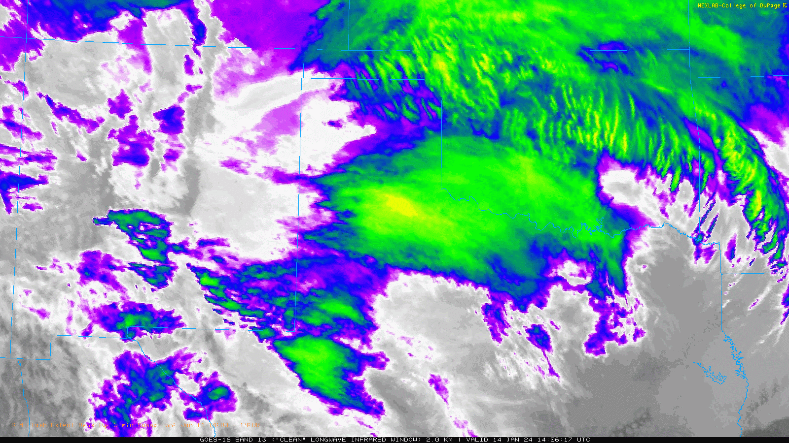
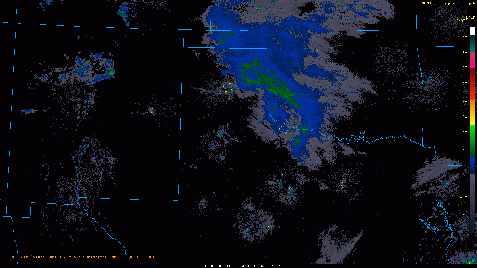
| Infrared satellite animation valid from 8:06 am to 9:36 am on Sunday (14 January 2024). A regional radar animation Sunday morning can be VIEWED HERE. | |
| Back over West Texas, skies cleared, but despite a sunny afternoon, temperatures only rebounded into the teens off the Caprock and into the eastern South Plains Sunday afternoon. More western locations, closer to the Texas/New Mexico state line and farther from the center of the sprawling Arctic high pressure, managed to "warm" into the 20s. | |
 |
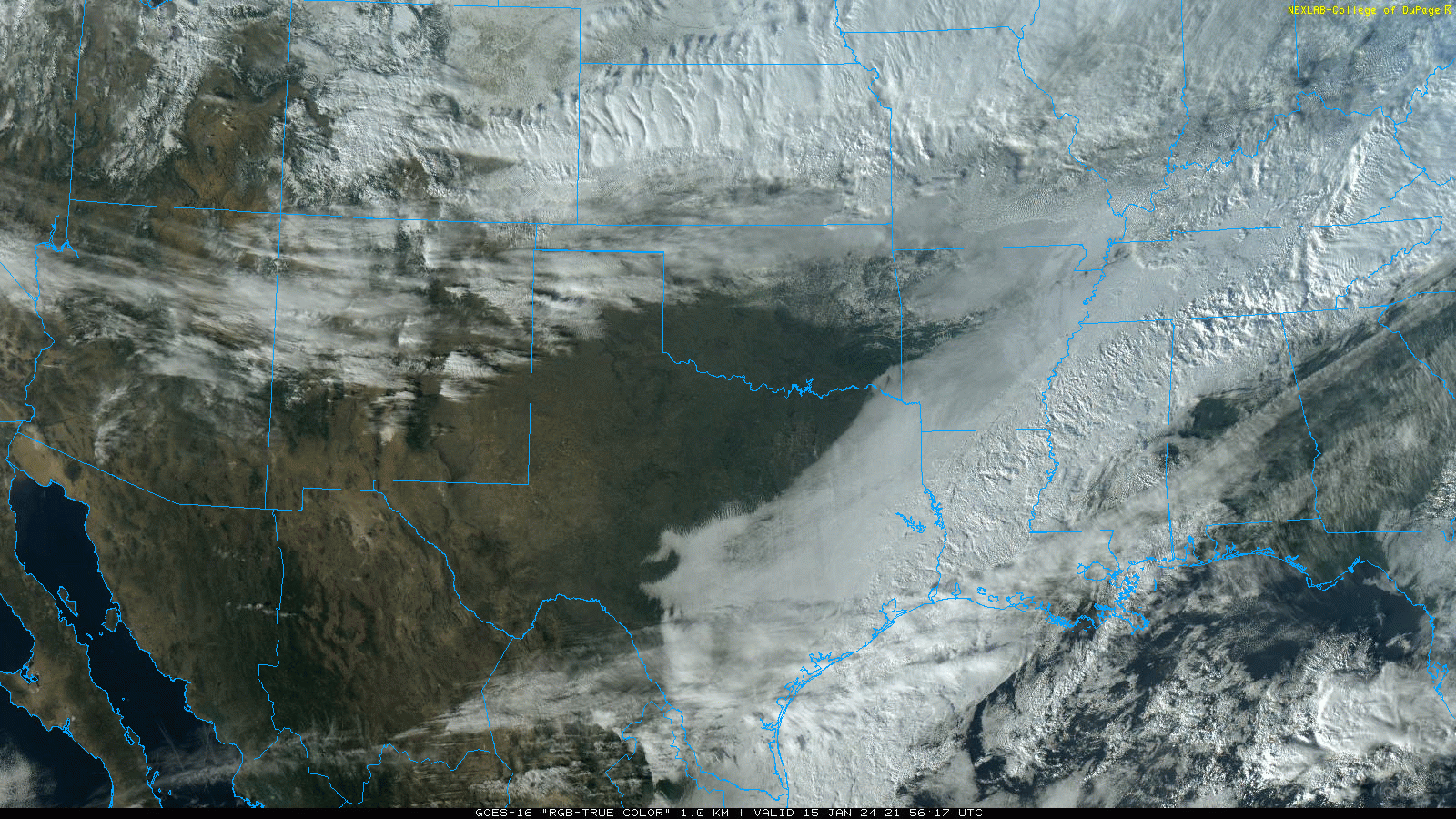 |
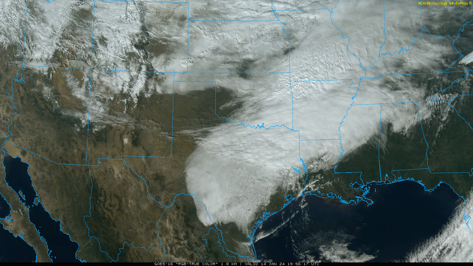
| RGB-True Color satellite image taken: (Left) Sunday afternoon (14 January); and (Right) Monday afternoon (15 January). | |
|
Unfortunately, the clear skies did allow temperatures to fall efficiently Sunday night, with lows Monday morning (15 January) back down in the single digits across the entire region. A full day of sunshine lifted temperatures into the 20s for most Monday afternoon, even higher, above freezing across the western South Plains into eastern New Mexico. |
|
 |
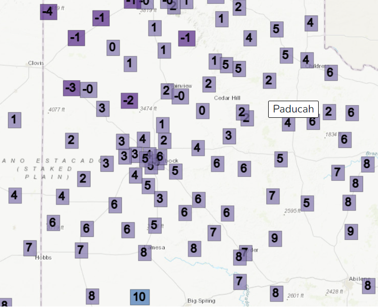 |
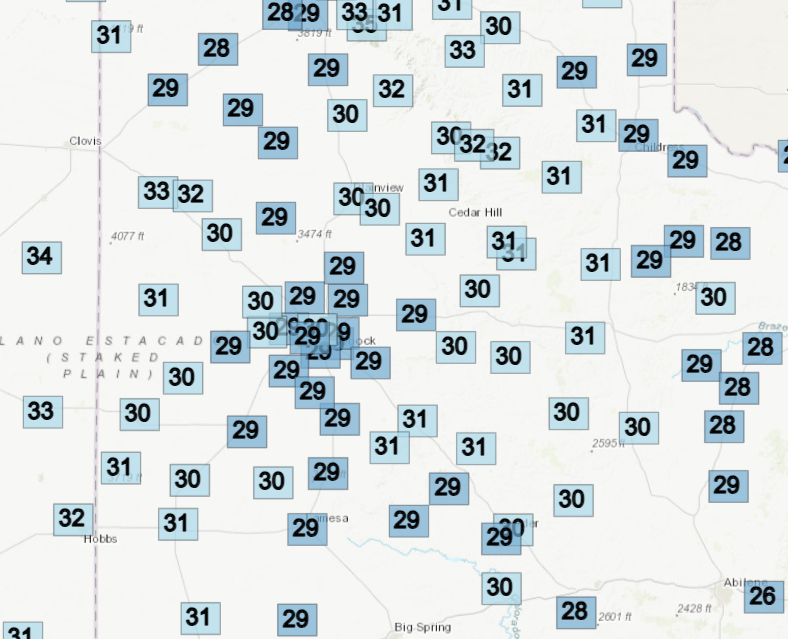
| Observed low temperatures on Monday, January 15th (left), and Tuesday, January 16th (right). The data are courtesy of the West Texas Mesonet (WTM). High temperatures recorded on the 16th can be SEEN HERE. | |
| The final bitterly cold night of the stretch occurred Tuesday morning (16 January), when single digits again visited the region. Several locations across the central and western Texas Panhandle even record sub-zero readings. Another full day of sunshine further modified the air mass, as highs reached the upper 20s and lower 30s for the entire area Tuesday afternoon. | |
 |
|
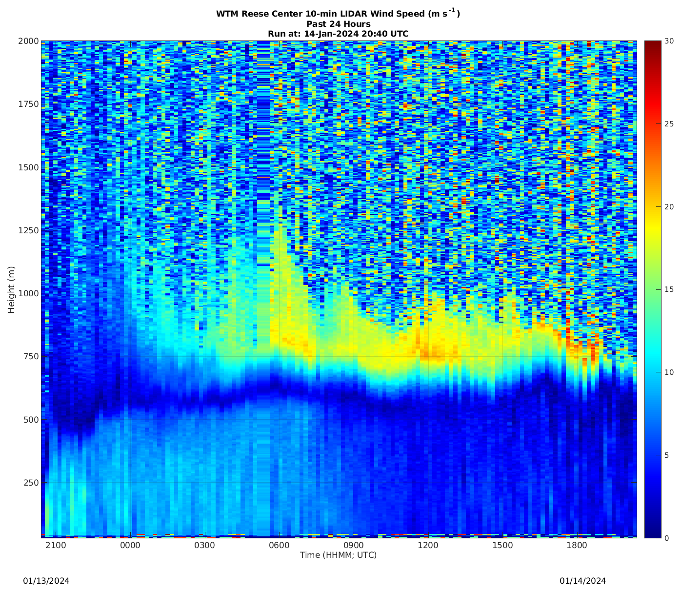
| LIDAR wind speeds remotely sensed at Reese Center Saturday afternoon into Sunday afternoon (13-14 January). The image is courtesy of the West Texas Mesonet. In addition to estimating the wind speeds in the lower atmosphere, LIDAR data are good for determining the height of the boundary layer, which in this case is the depth of the cold air. The Arctic air over this period is only about 2000 feet (600 m) thick above Reese Center. | |
|
During this cold stretch, one record low was set at Lubbock, when the mercury dipped to 5F on the morning of the 16th. This broke the previous record of 6 degrees, set back in 1930. Thankfully, travel impacts locally were minimal as dry air kept the wintry precipitation away. However, downstate, a mixture of light snow, sleet and freezing drizzle did make for tricky travel over portions of North, Central, East and even South Texas. |
|

