|
Severe thunderstorms and heavy rain visit portion of West Texas |
|
 |
|
| Dusty tornado beneath a larger wall cloud north of Nazareth Saturday evening (21 September 2024). The picture is courtesy of Corbin Voges. | |
|
The day before the Autumnal Equinox brought a bout of springlike weather to West Texas. Although most may be thinking of cooler and drier weather (and leaves beginning to change in the mountains and northern tier of the U.S.), September 21st brought warm and humid conditions to the southern High Plains. This warm and moist air provided sufficient fuel for fall thunderstorms, when coupled with the approach of a stout upper level storm system approaching via the Four Corners. |
|
 |
|
|
Water vapor satellite loop valid from 9:11 am to 9:46 am on Saturday (21 September 2024). |
|
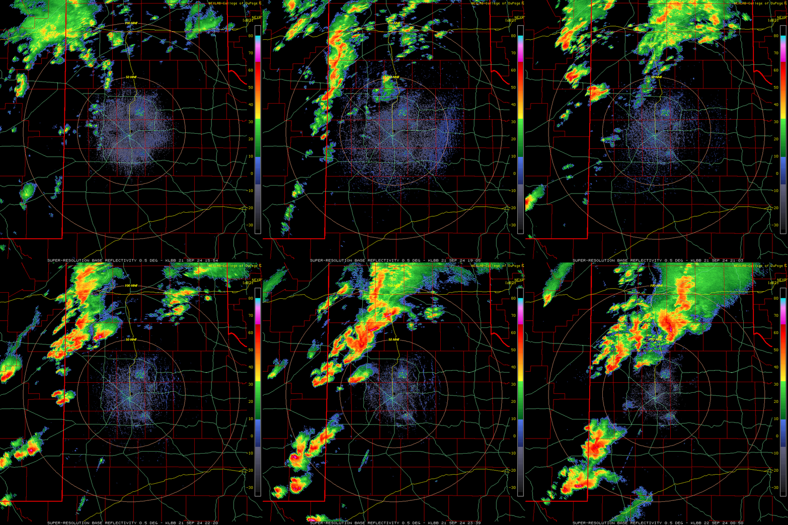
| The tightly wound system provided the lift to trigger thunderstorm development over eastern New Mexico Saturday morning. This activity expanded in coverage and intensity as it advanced eastward into West Texas Saturday afternoon and evening. | |
 |
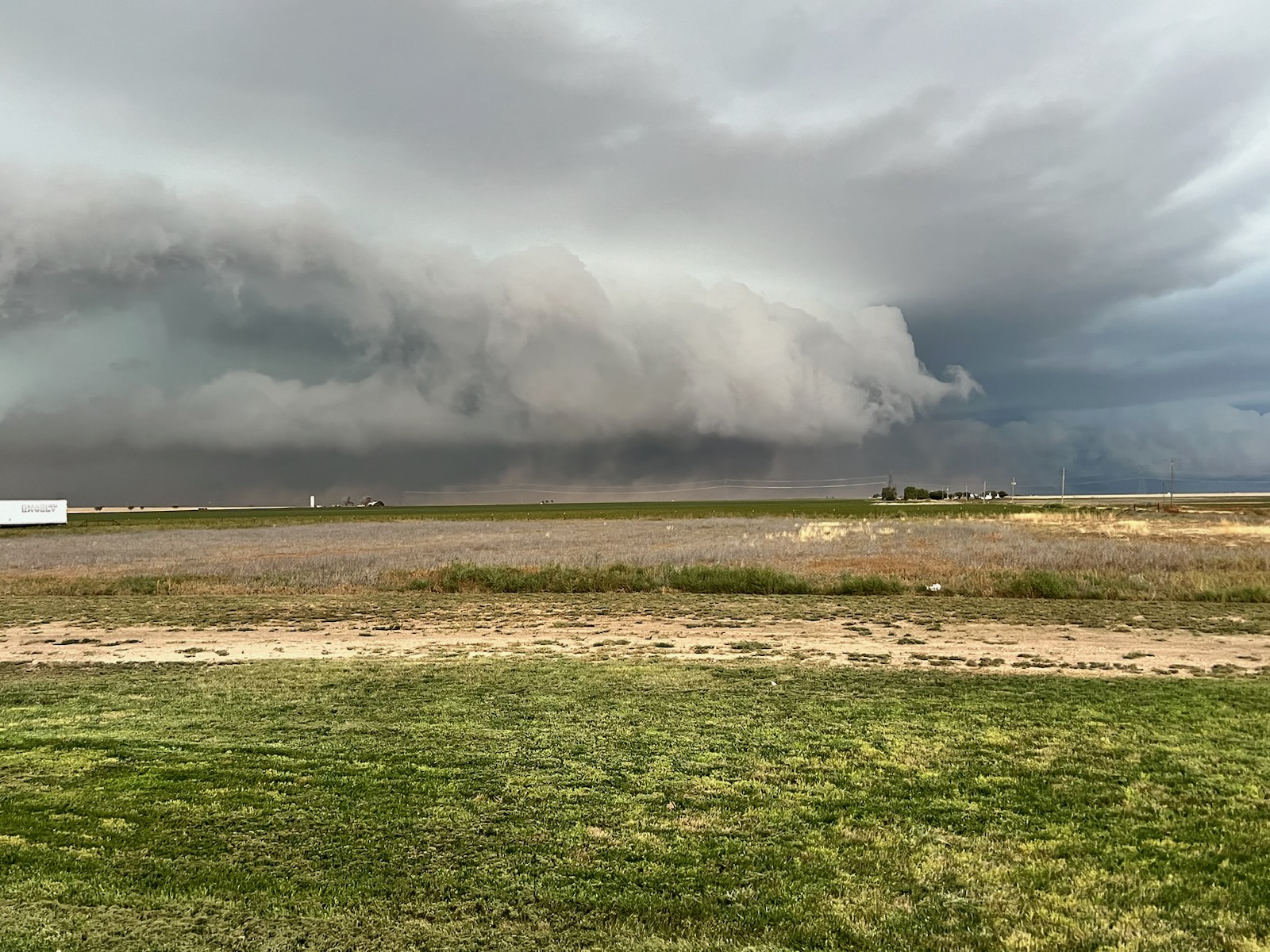 |
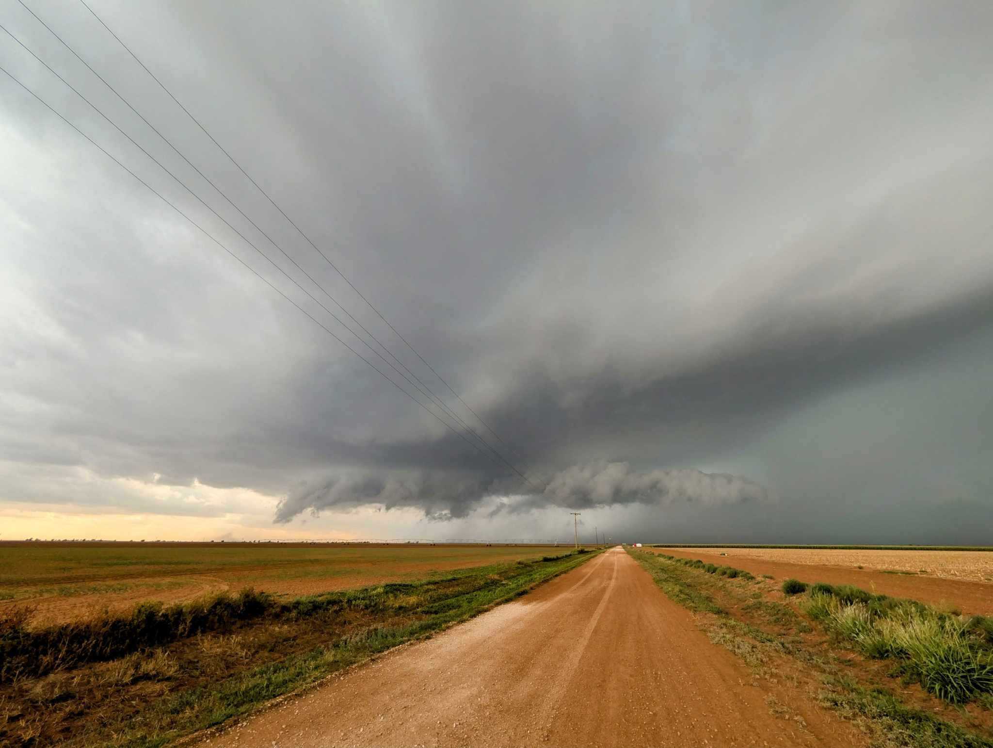
| Intense thunderstorm near Lazbuddie (left) and Kress (right) Saturday evening (21 September 2024). The images are courtesy of Corbin Voges and Darin Martin, respectively. | |
| Increasing wind shear (changing of wind speed and direction with height) associated with the approaching storm system caused several of the thunderstorms to rotate and become severe. The strongest activity produced large hail, damaging winds and torrential rain, with a brief tornado even spotted north of Nazareth. Thankfully, the tornado was over open land and inflicted no known damage. | |
 |
|
| Lubbock WSR-88D radar animation valid from 10:54 am to 7:50 pm on Saturday (21 September 2024). | |
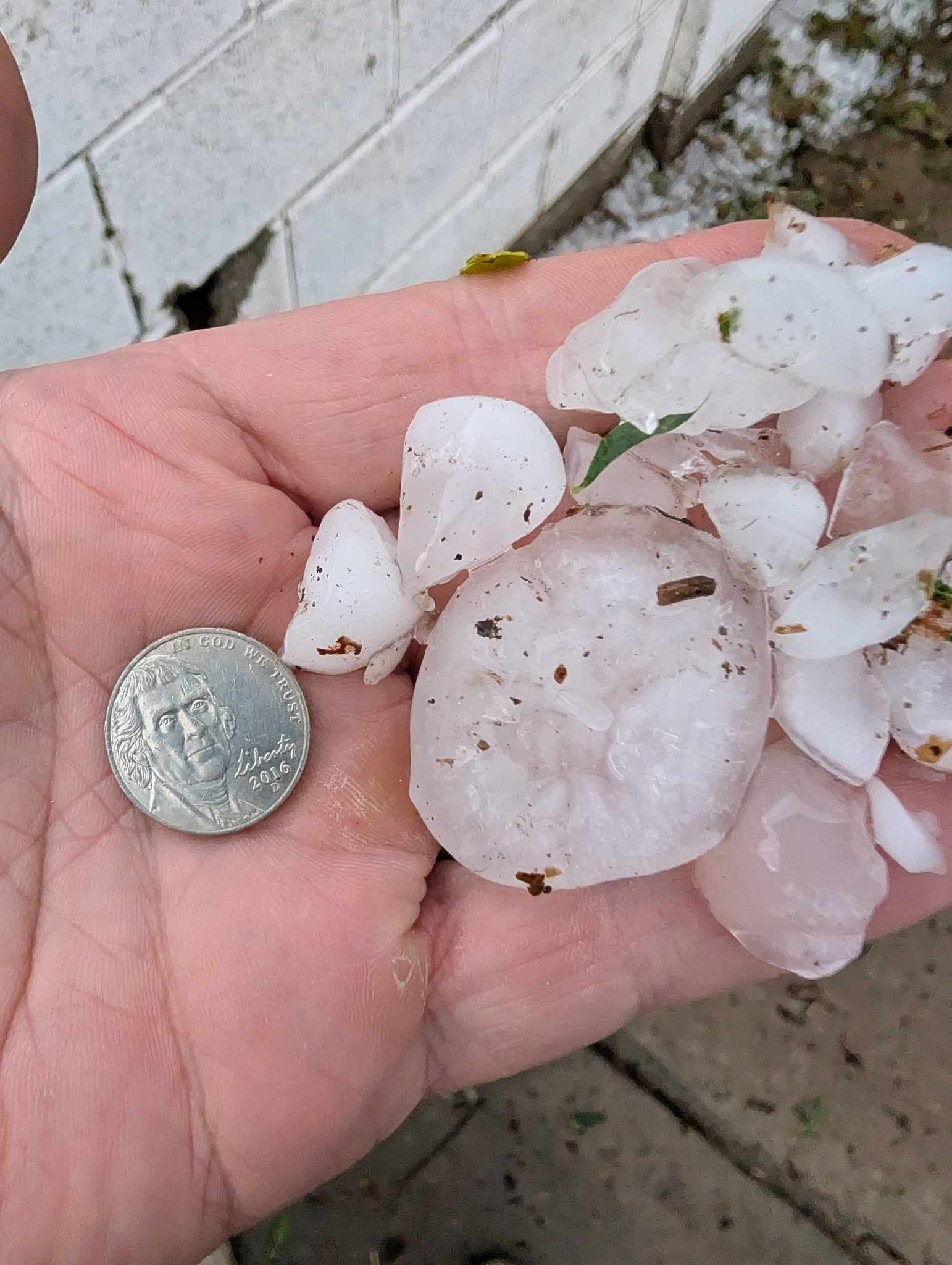
| Hail to golf ball size, even slightly larger, was observed as on storm moved over Dimmitt Saturday evening. Additional thunderstorms that tracked over the same area produced pockets of excessive rainfall and flooding in and near Dimmitt that evening too. | |
 |
|
| Large hail that fell in Dimmitt Saturday evening (21 September 2024). The image is courtesy of Corbin Voges. | |
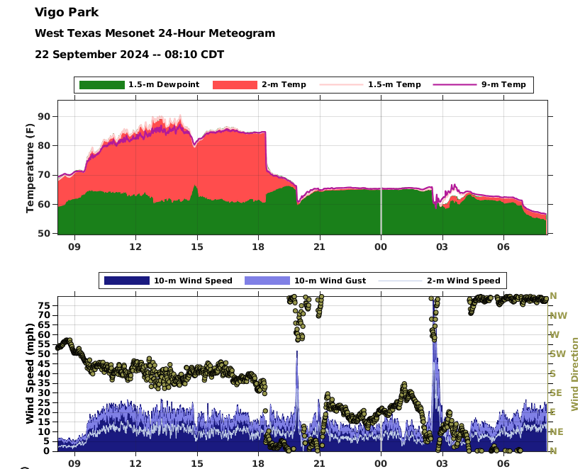
| Later that night, a robust thunderstorm traversing the southern Texas Panhandle brought damaging winds to locations in and around Vigo Park. The West Texas Mesonet (WTM) in Vigo Park measured a peak gust of 78 mph at 2:33 am on Sunday (22 September). Unfortunately, the intense winds knocked over several center pivots and many power poles/lines around Vigo Park. | |
 |
|
| Meteorgram from the Vigo Park West Texas Mesonet site Saturday into Sunday morning (21-22 September 2024). The top graph shows the temperature (red) and dewpoint (green). The bottom graph displays the wind speed and gust at the 33 foot level (blue and light blue) and the wind direction (brown dots). | |
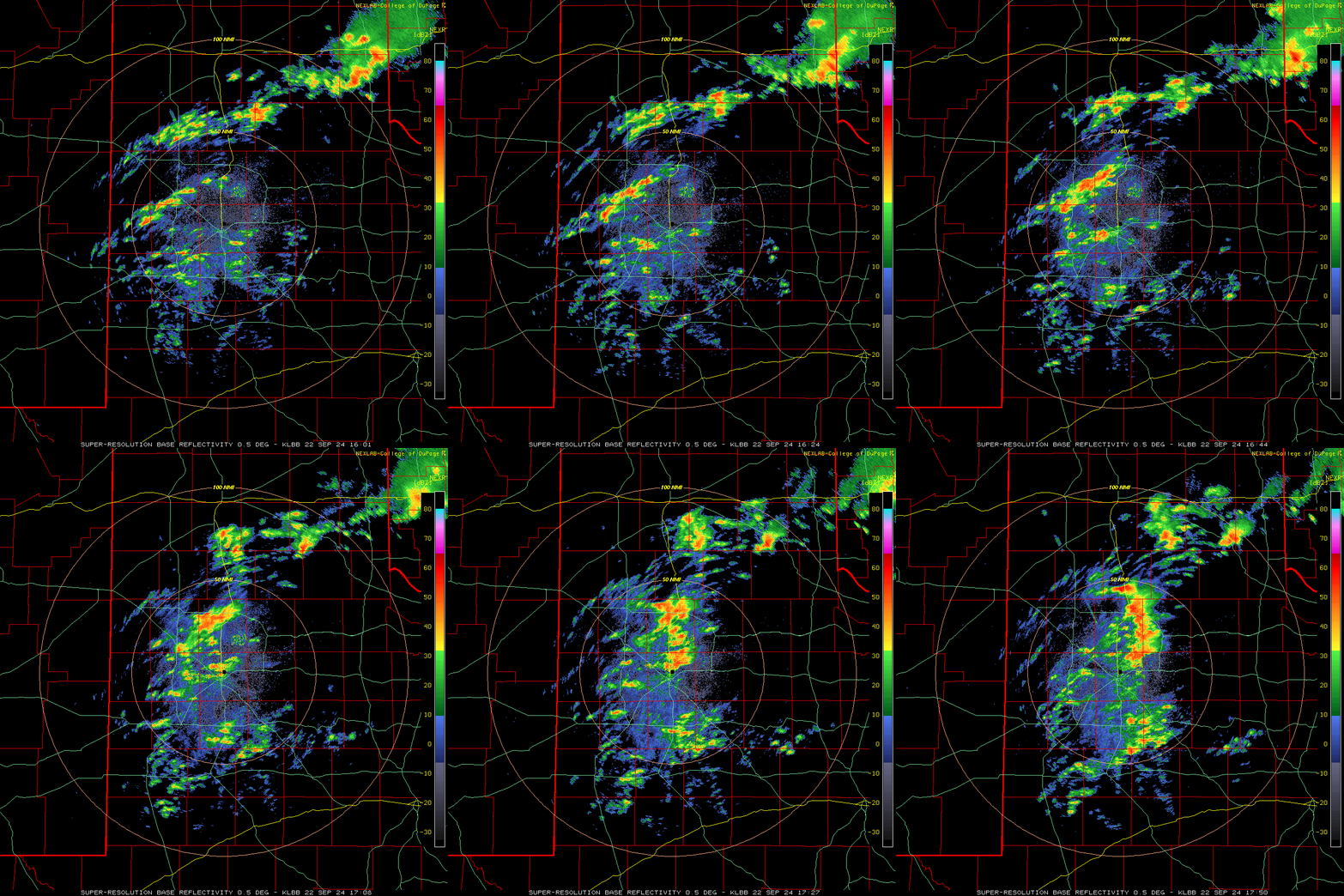
| Additional rain and thunderstorms, enhanced by a cold front passage, affected much of the South Plains and Rolling Plains through Sunday. Aside from the early-morning activity over the south-central Texas Panhandle, Sunday's activity was sub-severe, but did provide heavy rain in spots. | |
 |
|
| Lubbock WSR-88D radar animation valid from 11:01 am to 12:50 pm on Sunday (22 September 2024). | |
| Over the course of the late September weekend, rain totals of 1 to 2+ inches fell over a good chunk of the southern Texas Panhandle and northern South Plains as well as the southern Rolling Plains. Amounts through much of the central South and Rolling Plains were lighter, though everyone saw at least a little rain. | |
 |
|
| 48-hour radar-estimated rainfall from the MRMS (Multi-Radar Multi-Sensor) through 7 am on 23 September 2024. | |
|
Storm reports for September 21st can be found below: |
|
Preliminary Local Storm Report...Summary
National Weather Service Lubbock TX
1057 PM CDT Sat Sep 21 2024

..TIME...   ...EVENT...      ...CITY LOCATION...     ...LAT.LON...
..DATE...   ....MAG....      ..COUNTY LOCATION..ST.. ...SOURCE....
            ..REMARKS..

0732 PM     Tstm Wnd Gst     2 ENE Tulia             34.54N 101.74W
09/21/2024  M73 MPH          Swisher            TX   Mesonet

            Measured by TTU mesonet.

0506 PM     Hail             4 N Bovina              34.58N 102.89W
09/21/2024  E0.75 Inch       Parmer             TX   Storm Chaser


0709 PM     Hail             4 W Littlefield         33.92N 102.41W
09/21/2024  E0.75 Inch       Lamb               TX   Public

            Report from mPING: Dime (0.75 in.).

0906 PM     Flood            5 W Olton               34.16N 102.22W
09/21/2024                   Lamb               TX   Public


0525 PM     Hail             2 SW Dimmitt            34.53N 102.34W
09/21/2024  E1.75 Inch       Castro             TX   Law Enforcement


0525 PM     Hail             Dimmitt                 34.55N 102.32W
09/21/2024  E2.00 Inch       Castro             TX   Law Enforcement


0645 PM     Tornado          4 N Nazareth            34.60N 102.10W
09/21/2024                   Castro             TX   Broadcast Media


0658 PM     Tstm Wnd Gst     3 N Hart                34.42N 102.11W
09/21/2024  M69 MPH          Castro             TX   Mesonet

            Measured by the TTU mesonet.

0703 PM     Flash Flood      5 WNW Dimmitt           34.57N 102.41W
09/21/2024                   Castro             TX   Law Enforcement

            Water over the roadway along FM 2392 and FM
            1055 northwest of Dimmitt. Street flooding
            in Dimmitt.

0747 PM     Flood            11 W Muleshoe           34.23N 102.92W
09/21/2024                   Bailey             TX   Storm Chaser

            Water reported over the road.

0233 AM     Tstm Wnd Gst     Vigo Park               34.65N 101.50W
09/22/2024  M78 MPH          Swisher            TX   Mesonet

            WTM gusted to 78 MPH at 2:33 AM. Severe
            gusts from 2:33AM through 2:42AM.



 Follow us on X
 Follow us on Facebook
 Follow us on YouTube
 LUB RSS Feed


