
Dangerous heat will expand from the Gulf Coast into the Southern Plains and Desert Southwest through week's end. Additional extreme heat impacting the Pacific Northwest will shift to the northern Plains by the weekend. Tropical Storm Bertha is expected to continue to impact portions of the northern Gulf Coast from the western Florida Panhandle to southeastern Louisiana through tonight. Read More >
|
Isolated severe thunderstorms impact the southeast Texas Panhandle |
|
 |
|
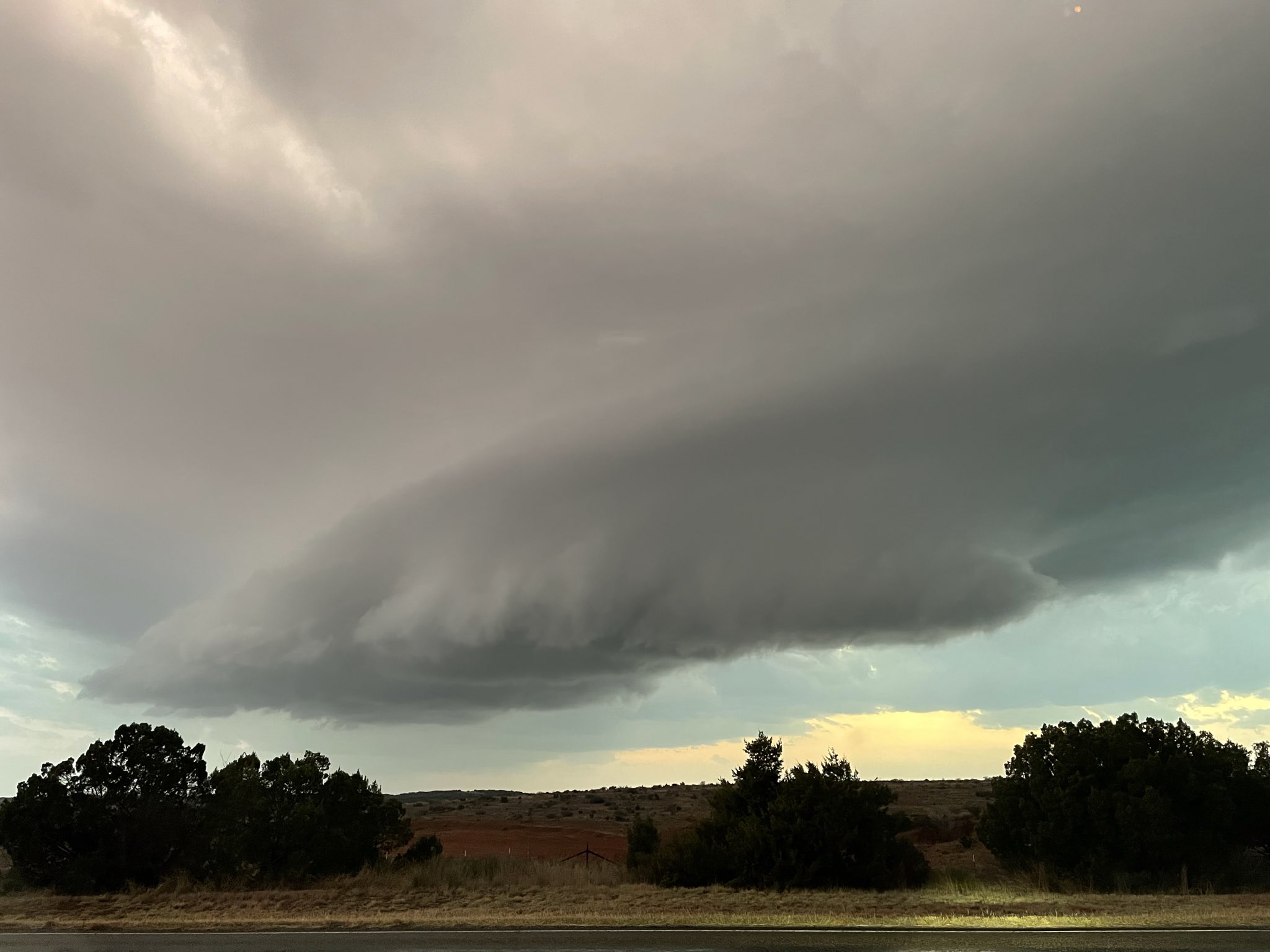
| Supercell thunderstorms near Turkey, TX, at 6:52 pm on Thursday (5 March 2026). The picture is courtesy of Spencer Dant. | |
|
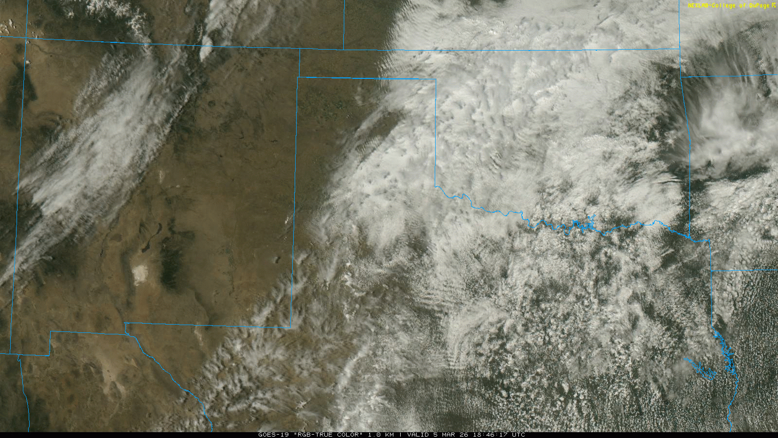
Thursday, March 5th, brought a taste of spring weather to West Texas, complete with a warm front, dryline and isolated severe thunderstorms. The day started off cool and moist, with low clouds and fog blanketing the South Plains region. These conditions were the result of Gulf moisture streaming northward into cooler air that had invaded the region behind a cold front Tuesday evening. |
|
 |
|
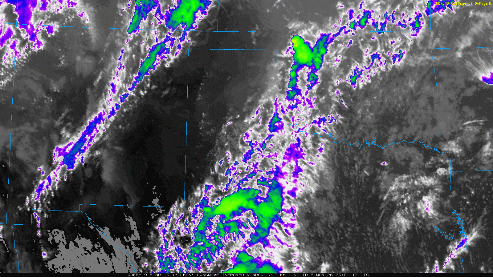
| "RGB True Color" satellite animation valid from 12:46 pm to 5:56 pm on Thursday (5 March 2026). An infrared satellite animation, valid from 5:01 pm to 8:31 pm on Thursday, can be FOUND HERE. | |
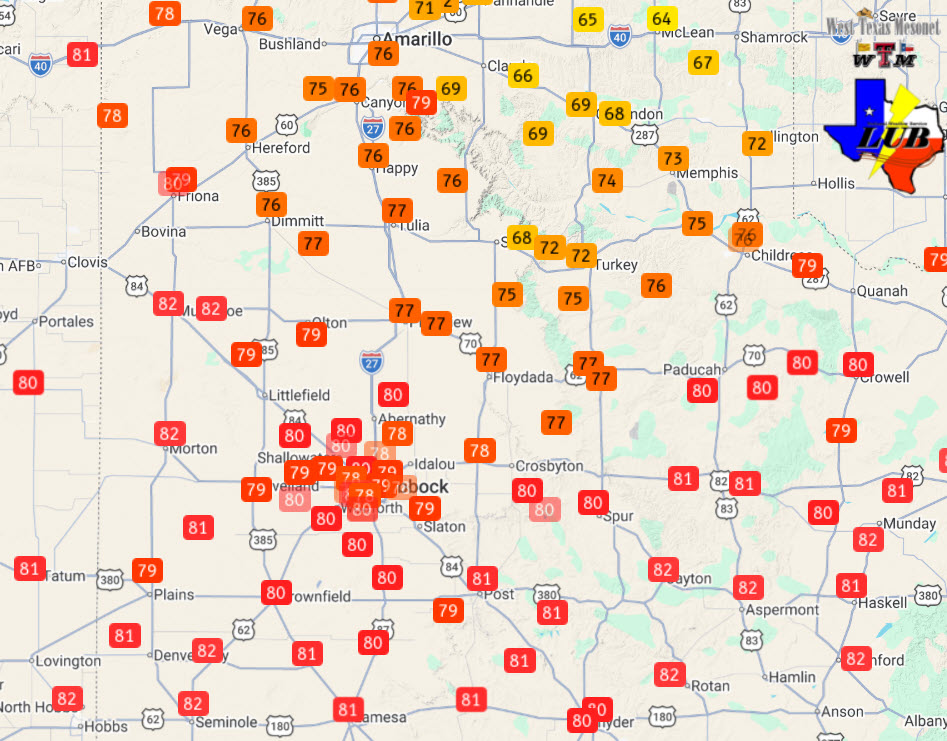
| The clouds gradually gave way to some sunshine Thursday afternoon, which in combination with dropping pressure in the lee of the Rockies (downstream of an midlevel storm system) helped lift a warm front northward and caused temperatures to rebound into the 70s and lower 80s for most spots. Where the clouds held longest and the warm front was slowest to pass, highs only reached the 60s and lower 70s over the eastern Texas Panhandle. | |
 |
|
| Observed high temperatures on Thursday (5 March 2026). The data are courtesy of the West Texas Mesonet (WTM). | |
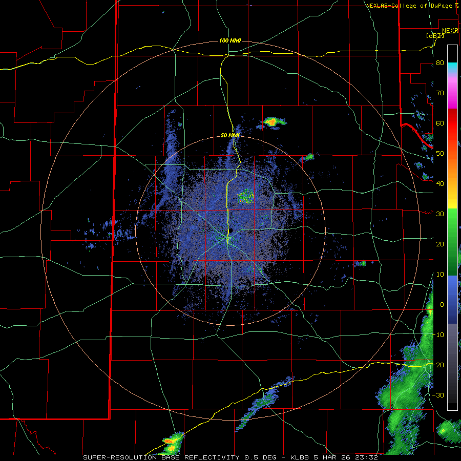
| Sufficient heating eventually led to isolated thunderstorm development along the warm front and dryline Thursday evening. The focus of the storm development was near the dryline/warm front intersection located across the southeast Texas Panhandle. Once thunderstorms formed, decent instability and relatively strong vertical wind shear caused them to quickly become organized and rotate, with right-moving (cyclonically rotating) supercells generally most favored. | |
 |
|
| Lubbock WSR-88D radar animation valid from 5:36 pm to 10:02 pm on Thursday (5 March 2026). | |
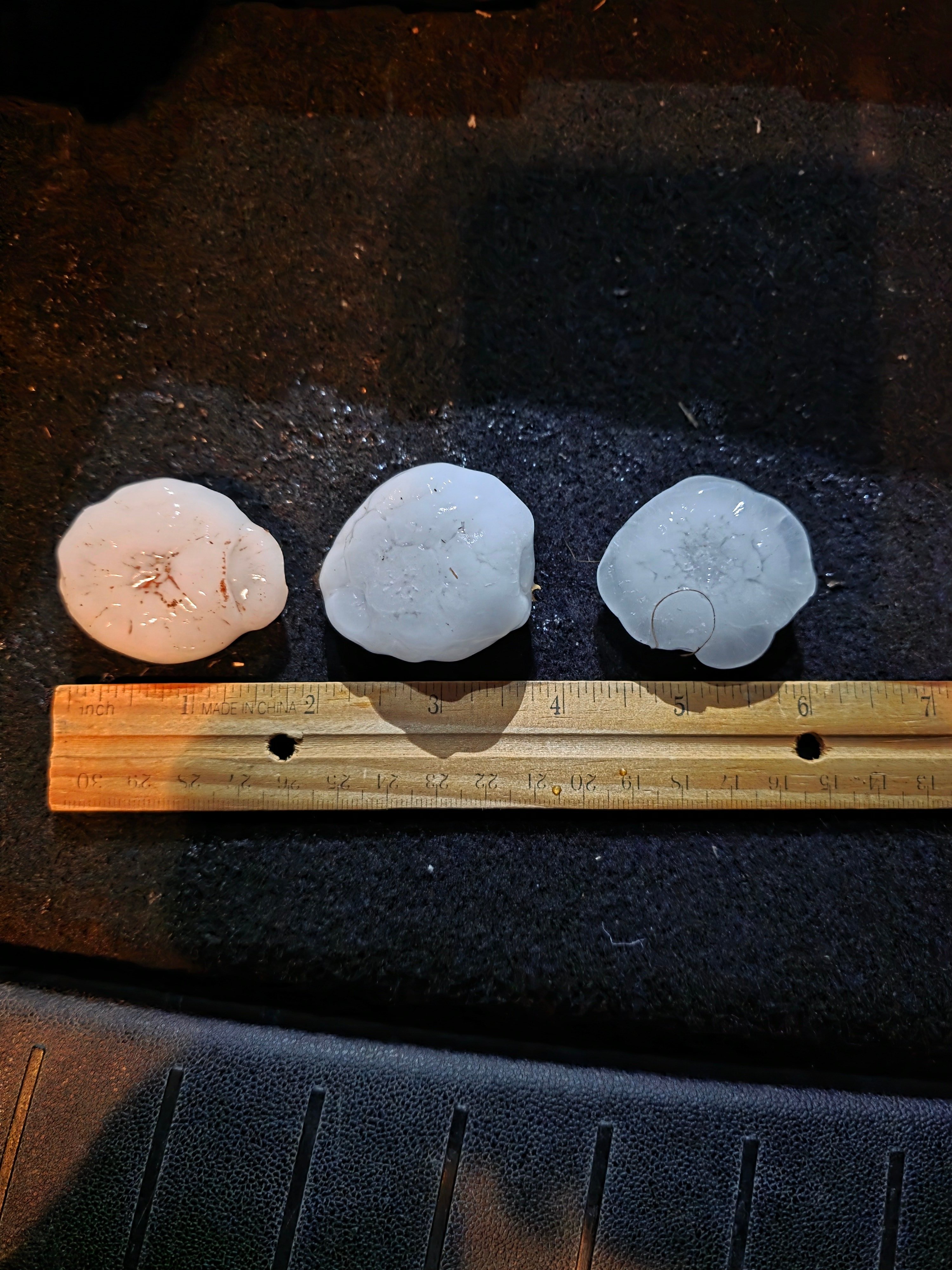
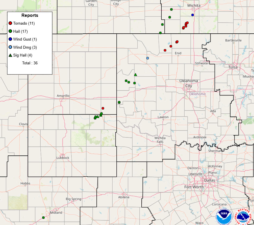
| The most intense storms produced hail, from quarter to over hen egg size, as they translated quickly to the northeast. Several reports of hail near and larger than golf balls (up to 2.25 inches in diameter) were received from near Lakeview and Memphis. | |
 |
|
| Golf ball size hail that fell 2.5 miles north of Memphis Thursday evening (5 March 2026). The image is courtesy of Jake Thompson. | |
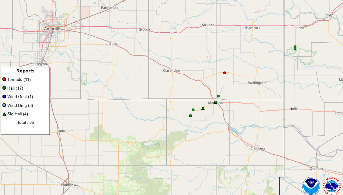
| One storm went on to produce a tornado in Amarillo's County Warning Area (CWA), observed by a storm chaser about 4 miles west of the community of Quail in Collingsworth County at 9 pm. Additional thunderstorms produced tornadoes over northwest Oklahoma and south-central Kansas, from northwest of Enid to southwest of Wichita, Thursday evening. | |
 |
|
| Storm reports gathered by the National Weather Service (NWS) and displayed by the Storm Prediction Center (SPC) on Thursday (5 March 2026). A regional view of the same graphic can be FOUND HERE. | |
|
|
|
|
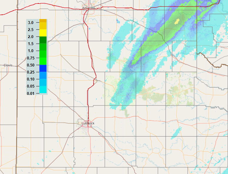
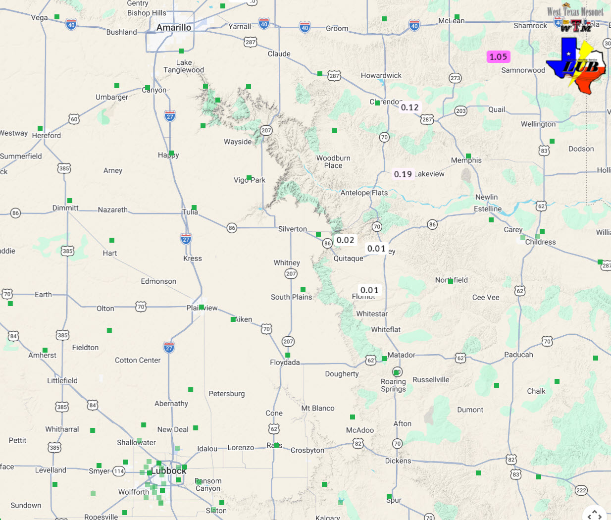
Given the limited scope of the thunderstorm coverage on Thursday evening, the rain (and hail) was also confined to narrow swaths over the southeast Texas Panhandle. In Memphis, a few instances of hail were observed, from 1 to 2 inches in diameter, but little to no rainfall. In fact, reports of measurable rainfall were tough to come by, though the WTM site near Dozier (southwest of Shamrock) did measure a quick 1.05 inches. |
|
 |
|
| Multi-Radar Multi-Sensor (MRMS) 24-hour rainfall estimate valid at 7 am on Friday (6 March 2026). Rain totals measured by the WTM over this same period can be VIEWED HERE. | |
| Preliminary storm reports collected by WFO Lubbock for this event can be found below. | |
Preliminary Local Storm Report...Summary
National Weather Service Lubbock TX
1103 PM CST Thu Mar 5 2026

..TIME...   ...EVENT...      ...CITY LOCATION...     ...LAT.LON...
..DATE...   ....MAG....      ..COUNTY LOCATION..ST.. ...SOURCE....
            ..REMARKS..

0720 PM     Hail             3 SW Lakeview           34.64N 100.74W
03/05/2026  E1.25 Inch       Hall               TX   Public

            Report from mPING: Half Dollar (1.25 in.).

0721 PM     Hail             3 SW Lakeview           34.64N 100.74W
03/05/2026  E1.25 Inch       Hall               TX   Public

            Report from mPING: Half Dollar (1.25 in.).

0727 PM     Hail             1 W Lakeview            34.68N 100.72W
03/05/2026  M1.00 Inch       Hall               TX   Storm Chaser

            Time estimated from radar.

0730 PM     Hail             3 E Lakeview            34.69N 100.64W
03/05/2026  E2.00 Inch       Hall               TX   Public

            Report from mPING: Hen Egg (2.00 in.).

0735 PM     Hail             4 E Lakeview            34.69N 100.64W
03/05/2026  E2.25 Inch       Hall               TX   Public

            Report from mPING: Hen Egg+ (2.25 in.).

0750 PM     Hail             Memphis                 34.73N 100.54W
03/05/2026  M2.00 Inch       Hall               TX   Storm Chaser

            Relayed by broadcast media. Time estimated
            from radar.

0750 PM     Hail             Memphis                 34.73N 100.54W
03/05/2026  E0.88 Inch       Hall               TX   Law Enforcement

            At sheriffs office. Time estimated from
            radar.

0751 PM     Hail             Memphis                 34.73N 100.54W
03/05/2026  E1.00 Inch       Hall               TX   Public

            Report from mPING: Quarter (1.00 in.).

