
Scattered thunderstorms with severe gusts, hail and a tornado risk are possible near a cold front from the Ohio Valley to the Mid-Atlantic tonight. Tropical Storm Bertha is expected to bring tropical storm conditions to portions of the Gulf Coast from the panhandle of Florida into Louisiana through Wednesday. Read More >
|
Widespread rain on the Caprock, with localized flooding |
|
 |
|
|
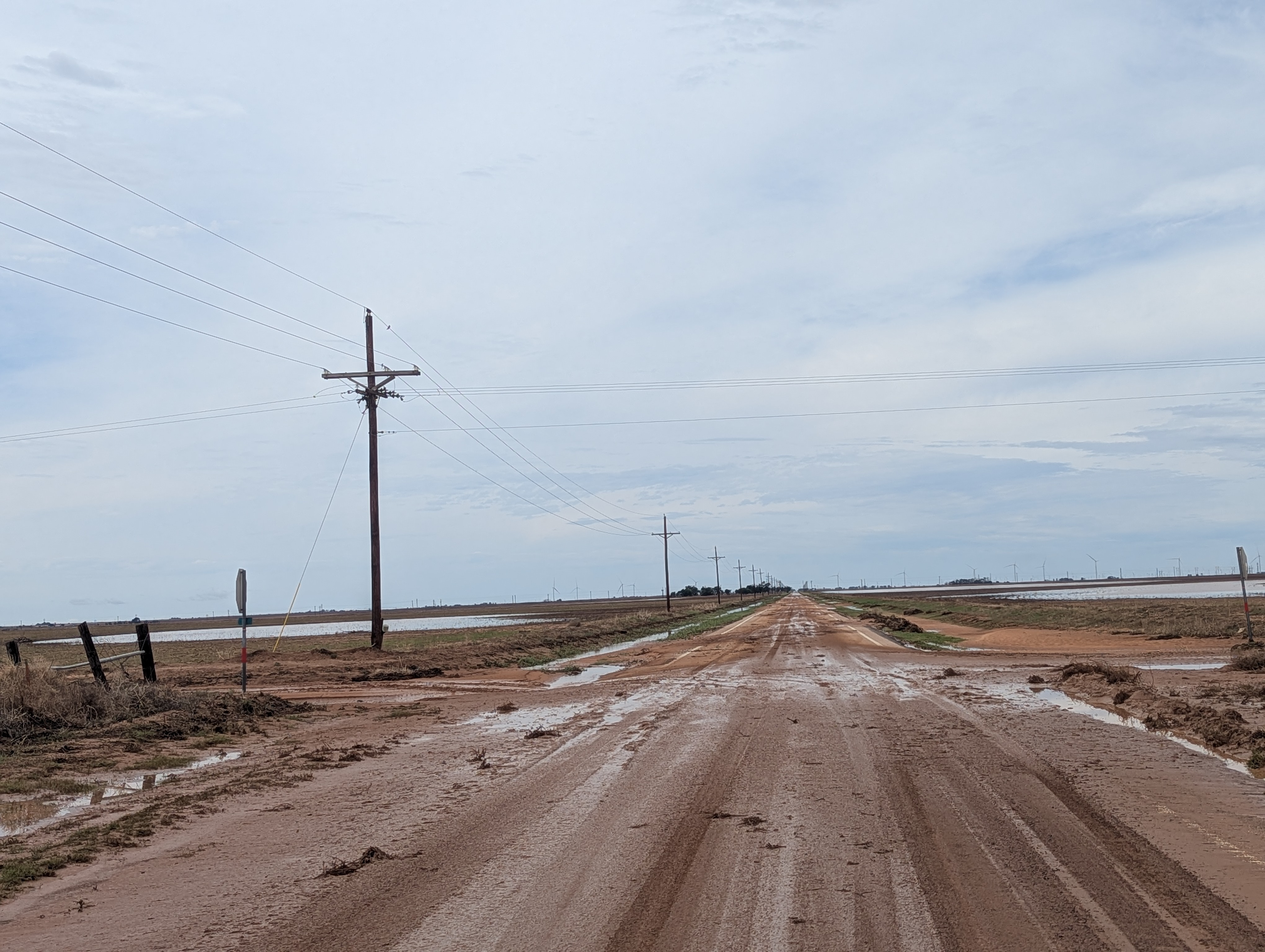
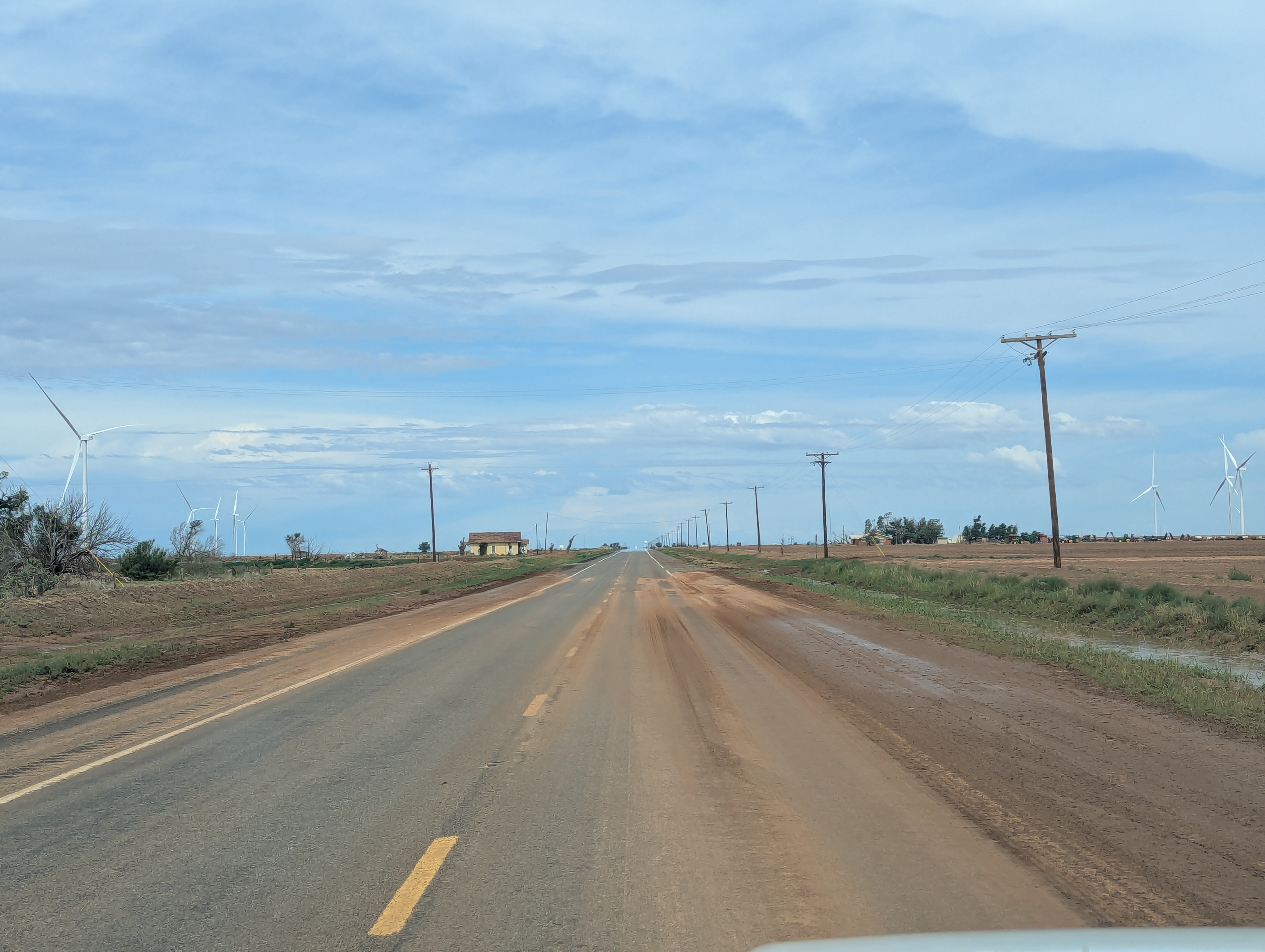
Muddy roadway in northeastern Lynn County on Wednesday (3 June 2026). The picture was taken along FM 212 about 2 miles north of Highway 380. |
|
|
The active start to June continued late on the 2nd (Tuesday) into early on the 3rd (Wednesday). Widespread thunderstorms initially developed across the higher terrain of eastern New Mexico Tuesday afternoon, fueled by abundant moisture and aided by a mid-level disturbance moving across the region. |
|
 |
|
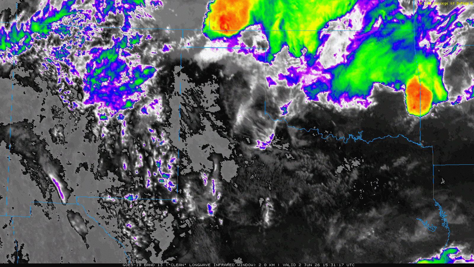
| Infrared satellite loop valid from 8:01 pm on Tuesday to 6:41 am on Wednesday (2-3 June 2026). An additional infrared satellite animation, valid from 10:41 am to 3:31 pm on Tuesday, can be VIEWED HERE. | |
| The slow-moving thunderstorms ingested deep and rich moisture, leading to widespread moderate to heavy rainfall. The large expanse of rain gradually built eastward across the Texas/New Mexico state line and into the western South Plains and Texas Panhandle through Tuesday evening. Additional storm development blossomed along a low-level boundary over parts of the central and southeastern South Plains late Tuesday evening, before being overtaken by the initial activity to the west early Wednesday morning. | |
 |
 |
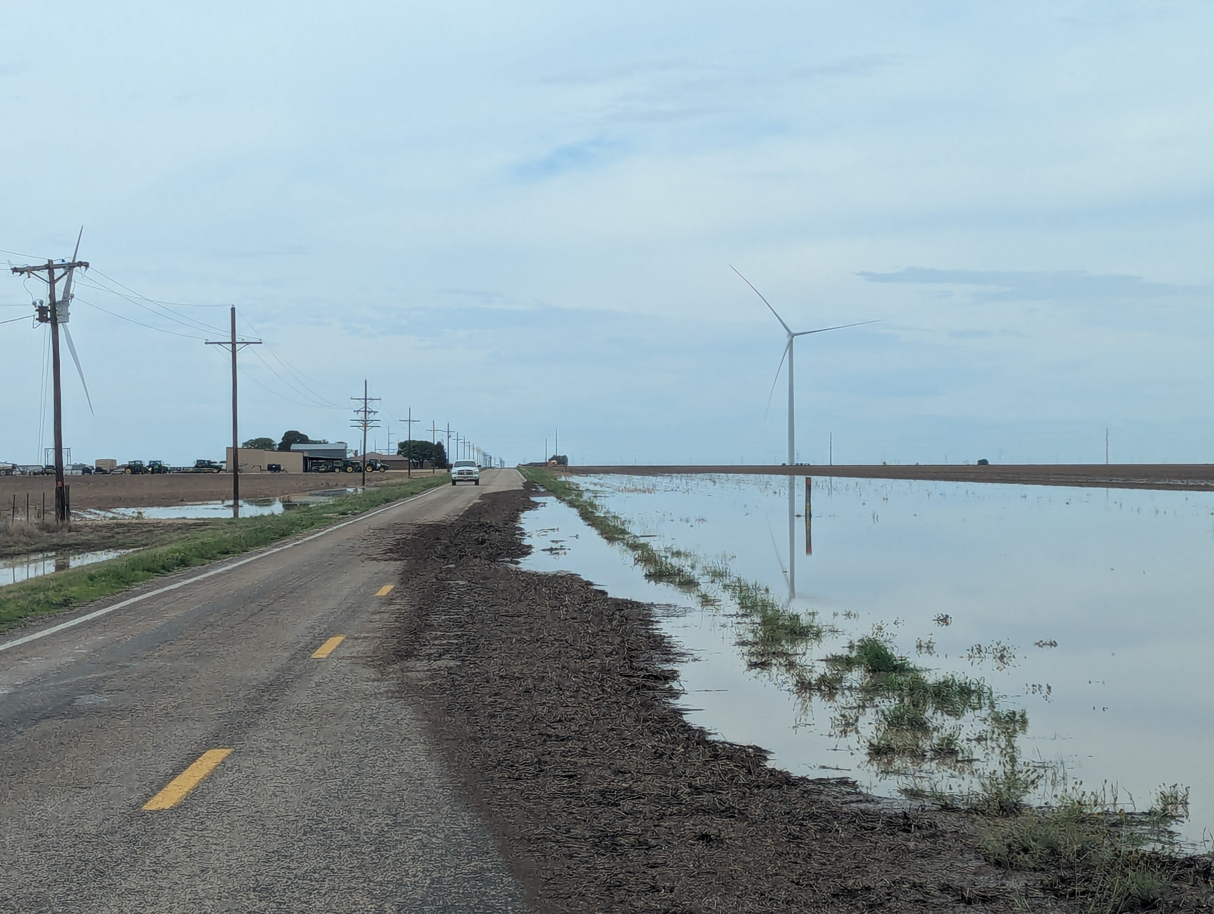
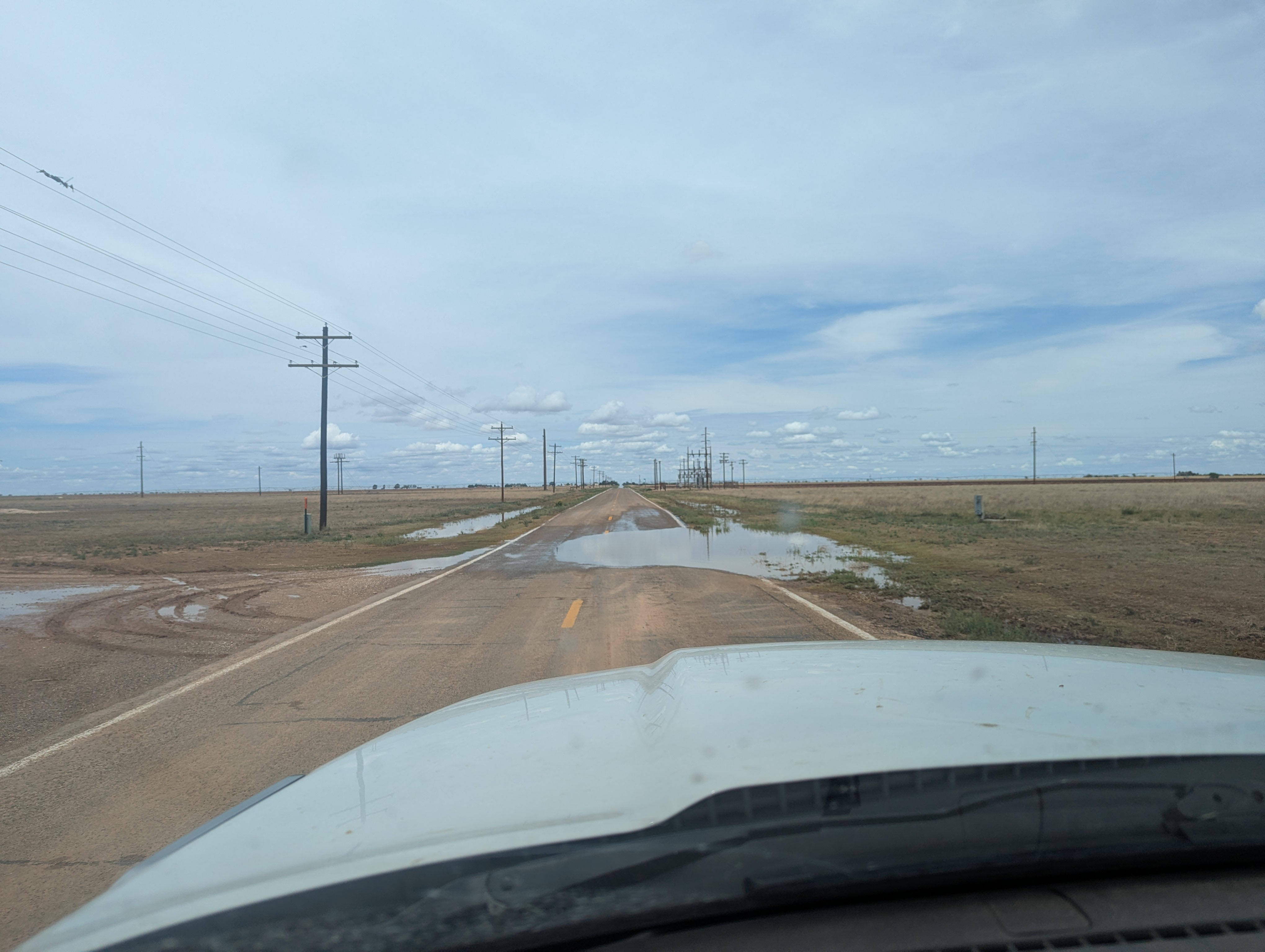
| Stretches of flooding along FM 212, between Highways 84 and 380 in northeastern Lynn County, on Wednesday (3 June 2026). | |
| Relatively weak vertical wind shear and modest instability limited overall storm strength, with no severe wind or hail reports received by the NWS. However, these same factors led to slow storm motion and torrential rainfall that resulted in rapid and excessive runoff in several locations. | |
 |
|
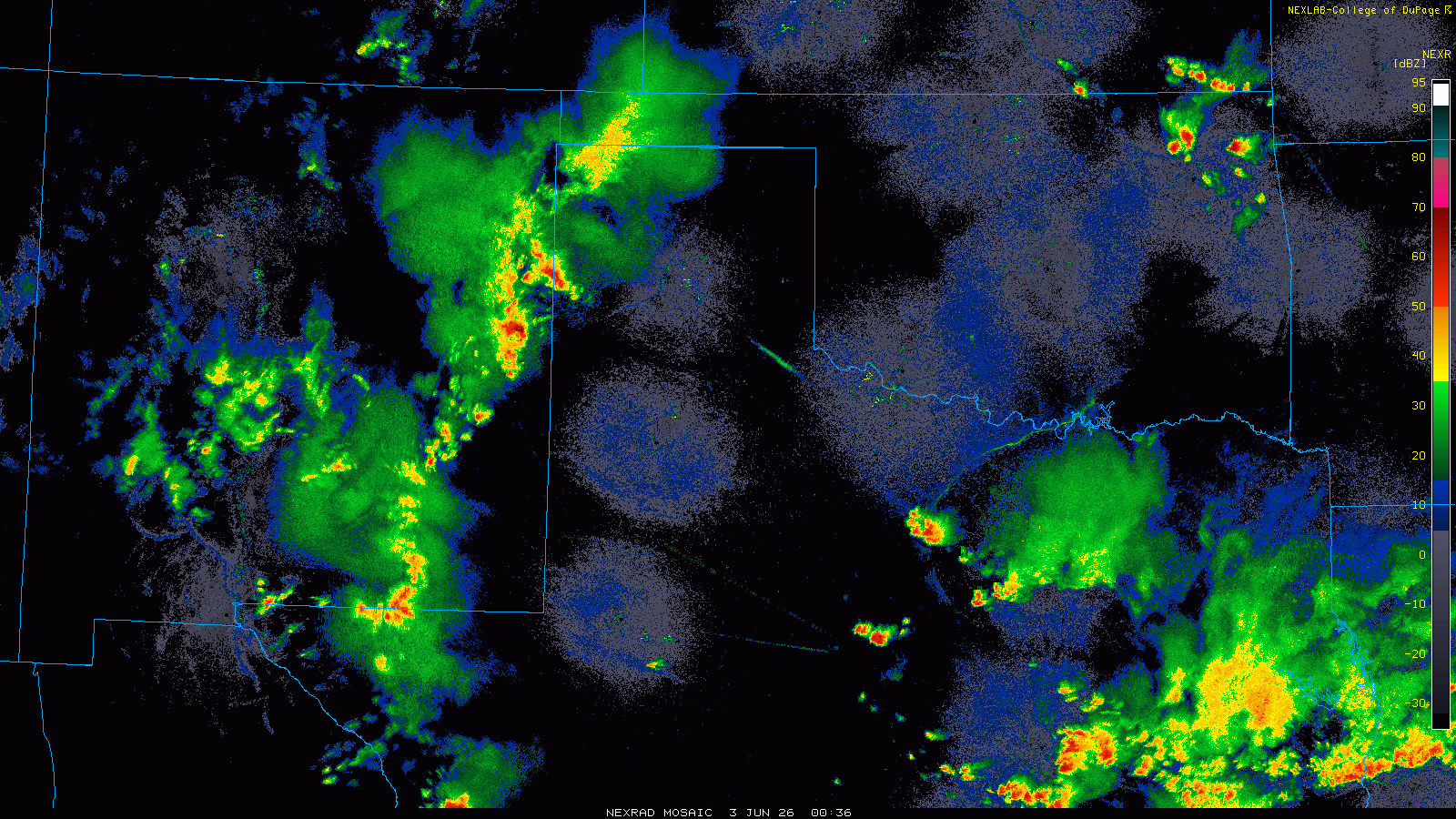
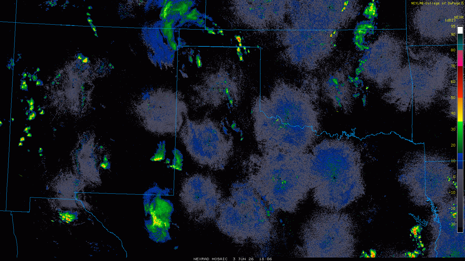
| Regional radar animation valid from 7:36 pm on Tuesday to 6:36 am on Wednesday (2-3 June 2026). | |
| Where the heaviest rain fell, portions of FM 212 and Highway 380 in eastern and northeastern Lynn County were flooded. Although the rain was not as intense north of Tahoka, it caused additional flooding problems along Highway 87, falling over that same area that experienced torrential rainfall and flooding a couple of nights earlier. | |
 |
 |
 |
|
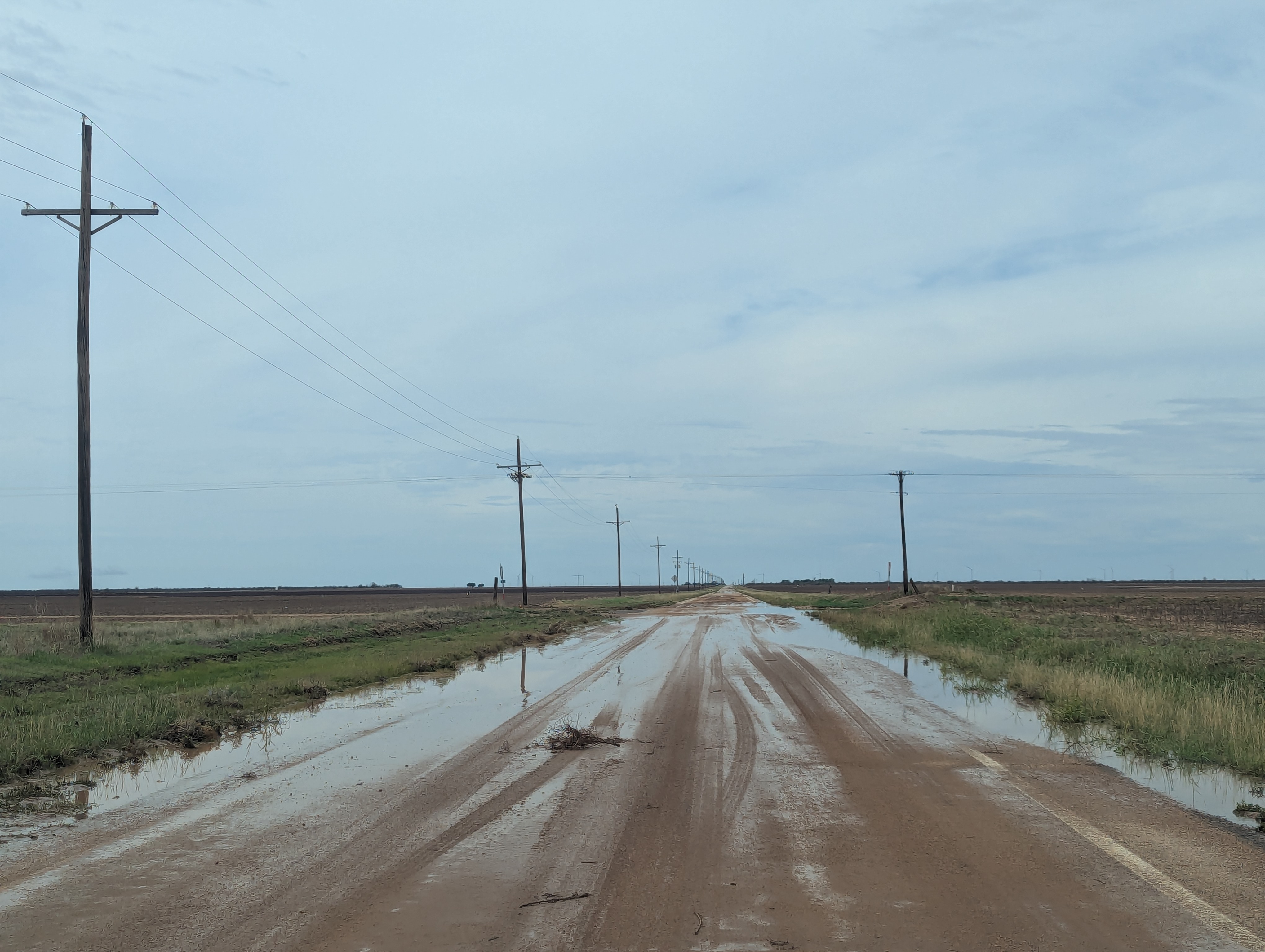
| Muddy and water-covered roadways east of Tahoka on Highway 380 (upper left) and south of Maple on FM 596 (upper right and lower images), in northern Cochran County, on Wednesday (3 June 2026). | |
| Flooding was also observed in and around Brownfield, as well over northwestern portions of Cochran County, including in a couple of locations along FM 596 south of the community of Maple. | |
 |
|
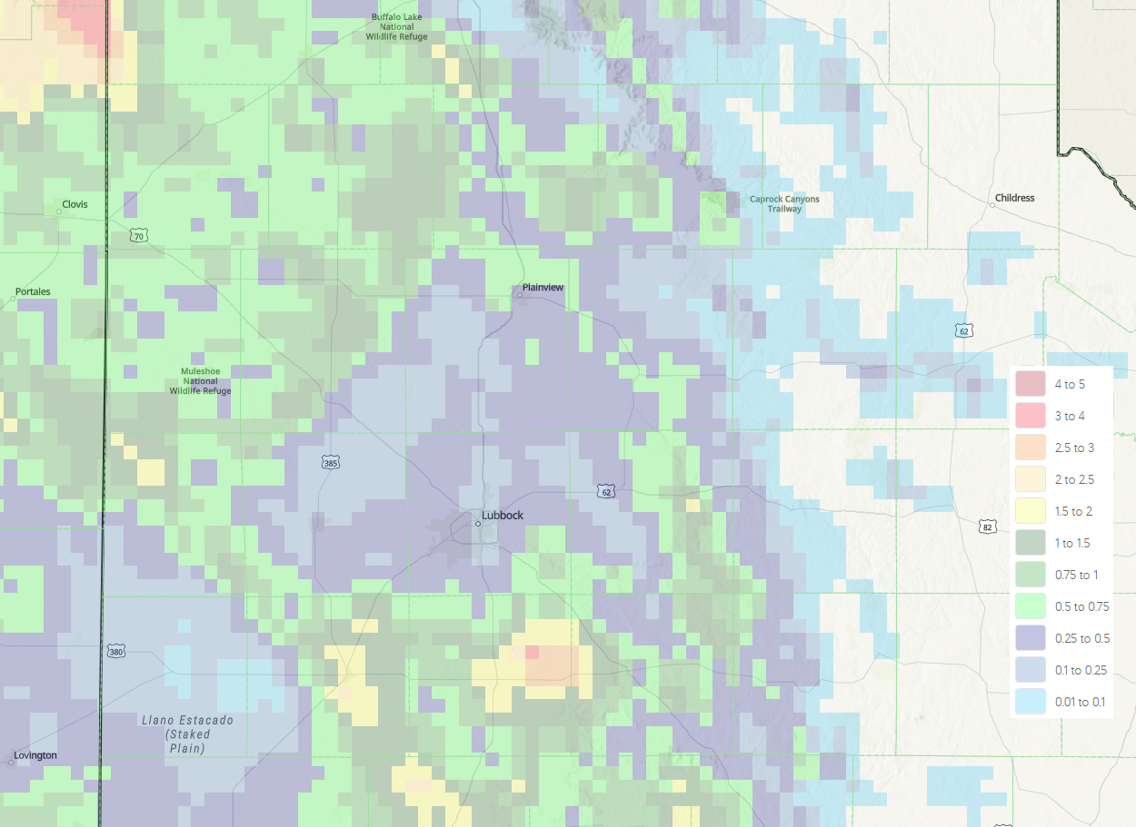
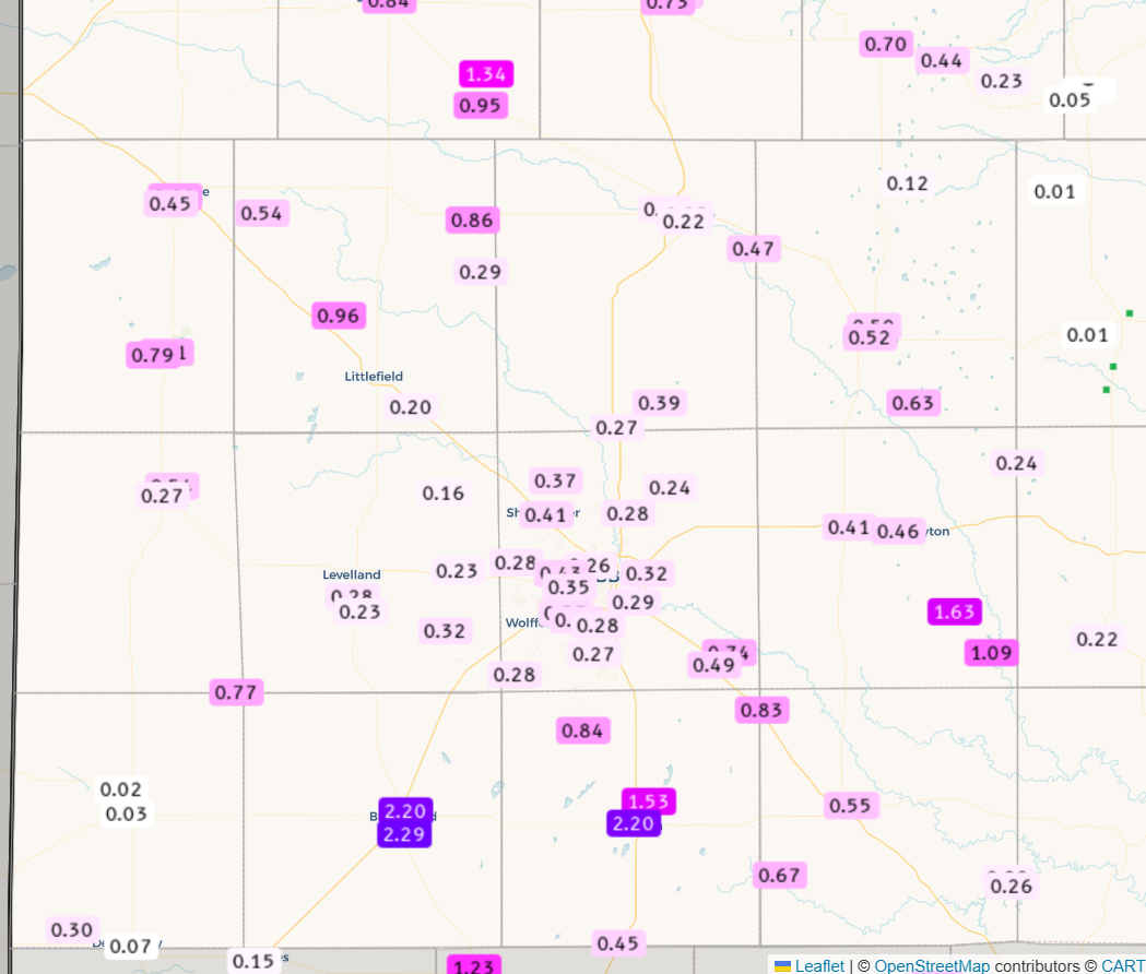
| 24-hour radar-estimated and bias-corrected rainfall ending at 7 am on Wednesday (3 June 2026). Measured 24-hour rainfall totals from the National Weather Service (NWS) and West Texas Mesonet (WTM), ending at 8 am on Wednesday, can be VIEWED HERE. | |
| The rain gradually diminished Wednesday morning, but not before dropping 1 to 2+ inches over parts of the southern and western South Plains and southwestern Texas Panhandle. A few locations in and around Brownfield and Tahoka measured over 2 inches or rain, with even higher totals likely between Tahoka and Post. Elsewhere rain totals were lighter, though nearly everyone on the Caprock saw at least a little rain. Rain totals in and around Lubbock were generally between a quarter and half inch, though the Lubbock Airport officially only measured 0.23 inches. | |
 |
|
| Lubbock WSR-88D radar animation valid from 9:27 pm on Wednesday to 7:04 am on Thursday (3-4 June 2026). An additional radar animation, valid from 1:01 pm to 4:47 pm on Wednesday, can be VIEWED HERE. A regional radar animation, valid from 1:06 pm on Wednesday to 6:51 am on Thursday (3-4 June 2026), can be FOUND HERE. | |
|
Wednesday afternoon brought new development, with isolated to scattered thunderstorms targeting locations off the Caprock. Following an evening lull, another complex of thunderstorms, this time originating in northeast New Mexico, raced southeastward, bringing widespread rain to the southwest Texas Panhandle around and after midnight. Areas of rain persisted into early Thursday morning (4 June) as it spread into the central and southern South Plains. A list of the preliminary storm reports collected on this early June day can be found below. |
|
Preliminary Local Storm Report
National Weather Service Lubbock TX
127 AM CDT Wed Jun 3 2026

..TIME...   ...EVENT...      ...CITY LOCATION...     ...LAT.LON...
..DATE...   ....MAG....      ..COUNTY LOCATION..ST.. ...SOURCE....
            ..REMARKS..

1210 AM     Flash Flood      3 NW Grassland          33.17N 101.63W
06/03/2026                   Lynn               TX   Emergency Mngr

            Water reported over the roadway at several
            locations along US-380 in eastern Lynn
            County.

1224 AM     Flash Flood      4 N Tahoka              33.23N 101.81W
06/03/2026                   Lynn               TX   Emergency Mngr

            Water reported over the roadway along US-87
            at CR-19 north of Tahoka.

0126 AM     Flash Flood      3 N Tahoka              33.21N 101.80W
06/03/2026                   Lynn               TX   Emergency Mngr

            Flash flooding continues along US-87 from
            CR-18 to FM-400. One vehicle rollover
            accident has occurred due to the flooding.

