|
Thunderstorms bring severe weather and widespread rain to the South Plains |
|
 |
|
|
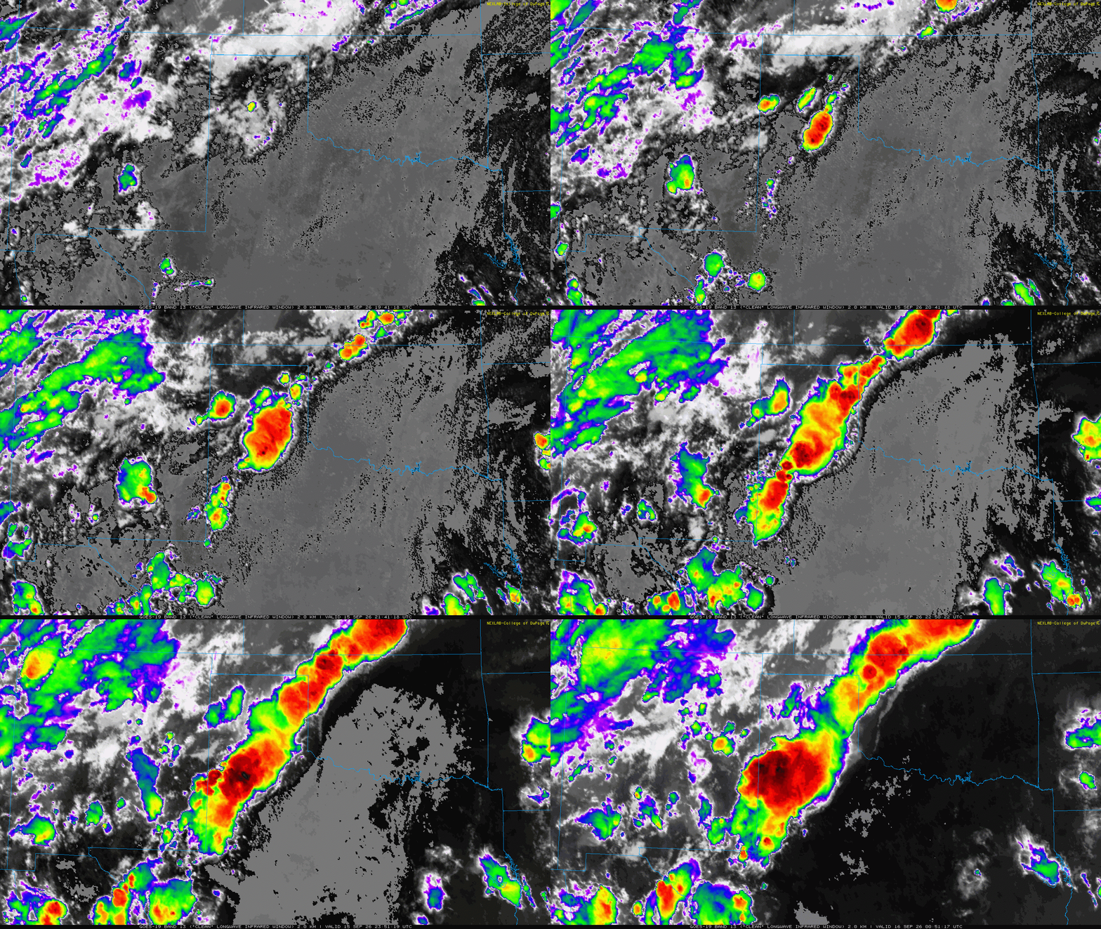
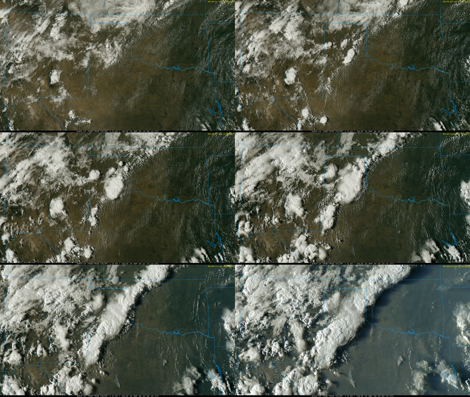
"RGB-True-Color" satellite loop valid from 2:36 pm to 6:56 pm on Tuesday (15 September 2026). An infrared satellite animation, valid from 2:41 pm to 7:57 pm on Tuesday can be VIEWED HERE. |
|
|
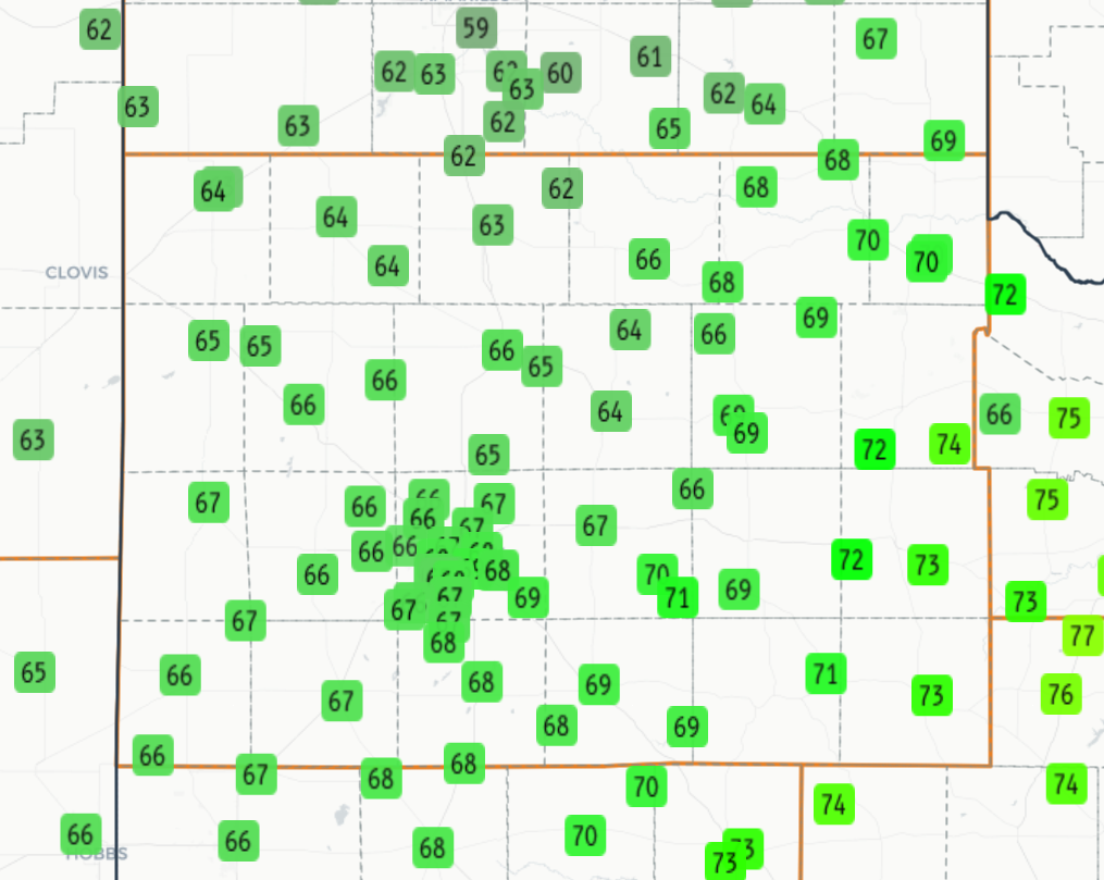
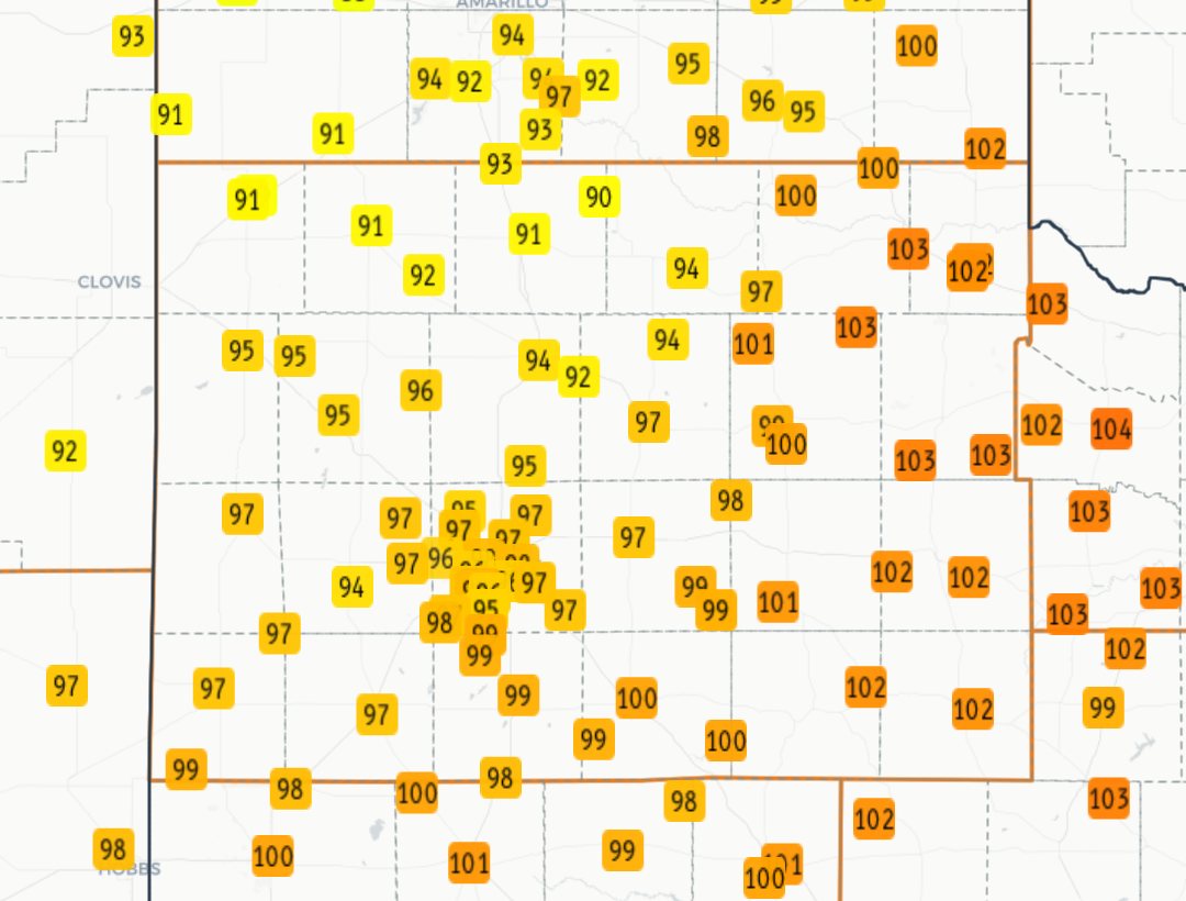
The middle of September, Tuesday the 15th, brought a welcome change to the weather for many spots on the Caprock. Despite another hot day, with highs again well above average, topping out in the 90s and lower triple digits, this heat brought more than just another warm to hot evening. |
|
 |
|
| High temperatures measured by the West Texas Mesonet (WTM) on Tuesday (15 September 2026). | |
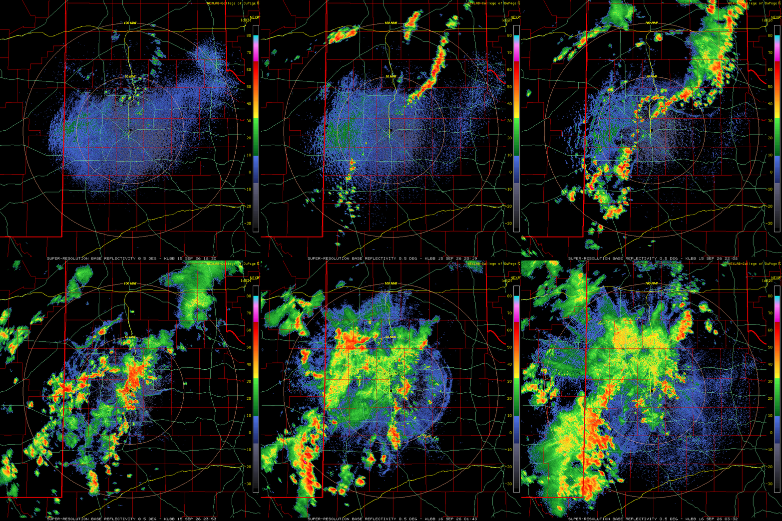
| Instead, the heat joined forces with improved low-level moisture (dewpoints in the 60s), convergence along a surface trough and improved mid-level moisture on the eastern edge of the monsoon moisture plume, to fuel the development of numerous thunderstorms Tuesday afternoon and evening. | |
 |
|
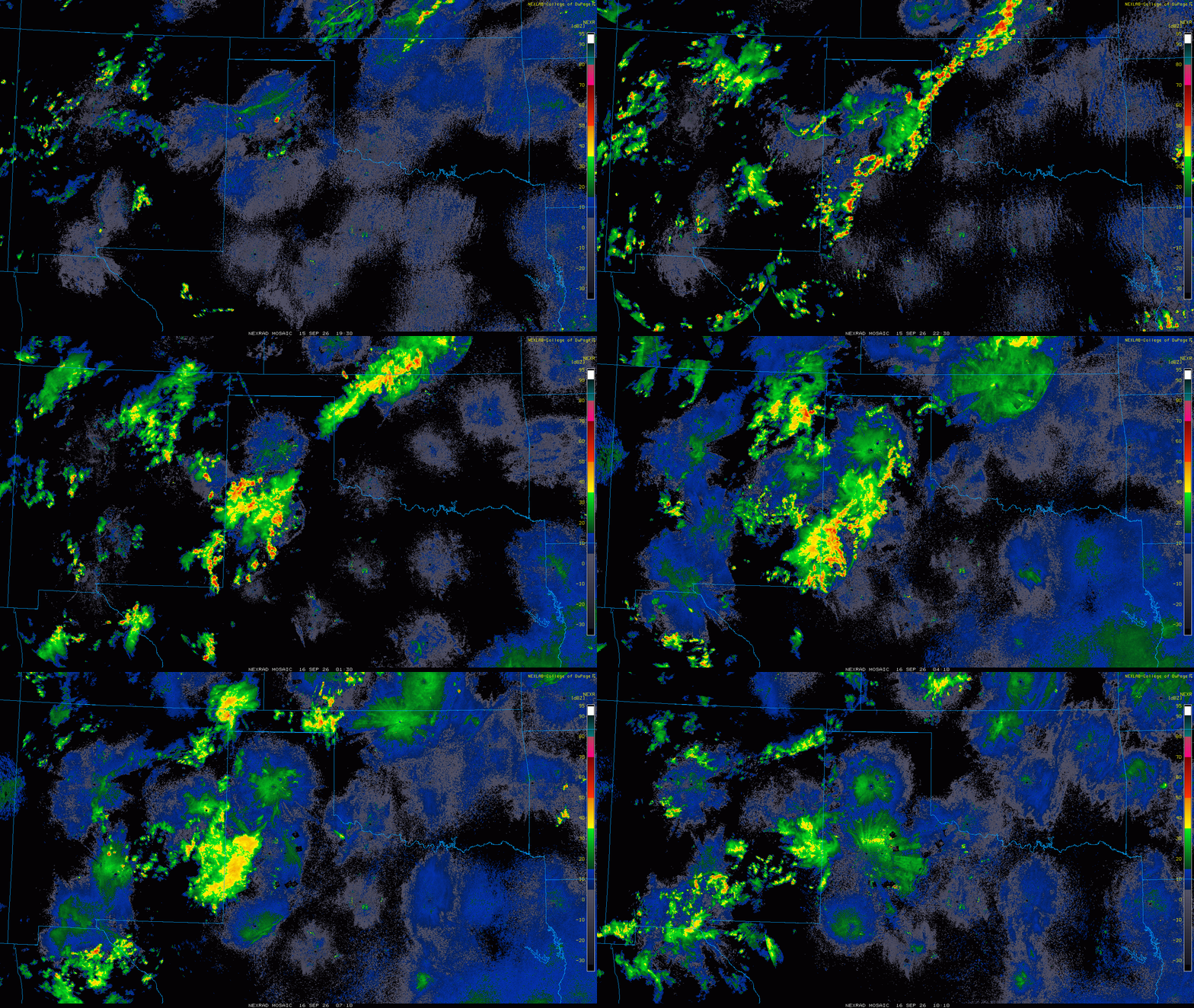
| Lubbock WSR-88D animation valid from 1:30 pm to 10:32 pm on Tuesday (15 September 2026). An additional radar animation, valid from 6:44 pm on Tuesday to 8:37 am on Wednesday (15-16 September), can be FOUND HERE. A regional radar animation, valid from 2:30 pm on Tuesday to 5:10 am on Wednesday (15-16 September), can be VIEWED HERE. | |
| The initial activity developed across the south-central Texas Panhandle mid-afternoon, then expanded into the central and western South Plains through late afternoon. Interacting thunderstorm outflows sparked new development well into the evening hours, primarily on the Caprock, where areas of rain lingered much of the overnight while shrinking in coverage and intensity. Unfortunately, farther east, less favorable conditions limited shower and storm development, with only a few isolated showers in the Rolling Plains. | |
 |
|
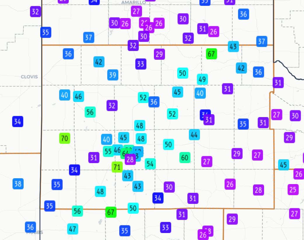
| Peak wind gusts measured by the West Texas Mesonet (WTM) on Tuesday (15 September 2026). | |
|
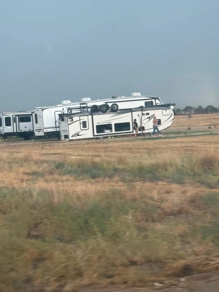
Increased moisture, in combination with the hot temperatures, supplied decent instability that allowed several of the thunderstorms to become robust. The most intense storms generated small hail and damaging wind gusts, along with torrential rain. Hail as large as quarters (1 inch in diameter) was observed in Smyer and over the northwest edge of Lubbock. These same areas experienced strong to severe wind gusts as the water-dense rain and hail cores plunged to the earth. Several spots recorded wind gusts in excess of 60 mph, including a peak gust of 71 mph by the West Texas Mesonet (WTM) site located 6 miles south of Wolfforth. Unfortunately, the severe-caliber winds did cause pockets of damage, including flipping a RV east of Smyer and downing power lines near 7th Street and Slide Road on the northwest side of Lubbock. |
|
 |
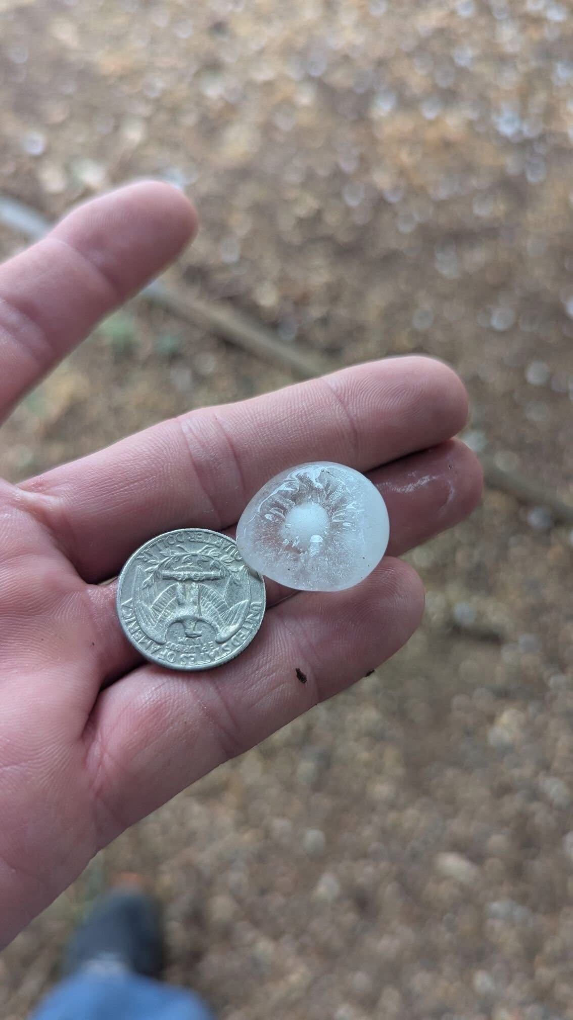 |
| (Left) Flipped RV along Highway 114 east of Smyer on Tuesday evening (15 September 2026). (Right) Quarter-size hail that fell in Smyer Tuesday evening (15 September 2026). Both images are courtesy of Jacob Riley. | |
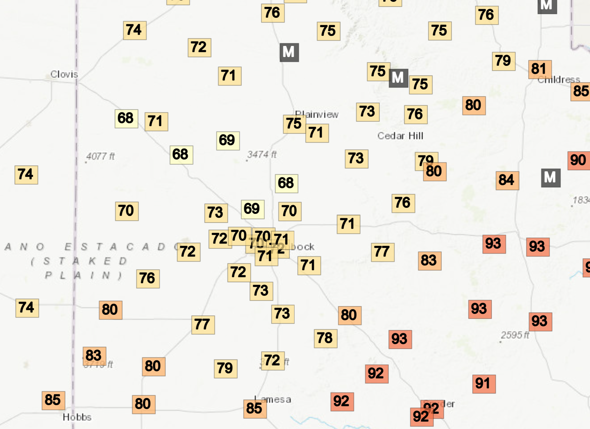
| On the positive side, the rain-cooled air dropped temperatures into the upper 60s and lower 70s for many Tuesday evening, a pleasant twist to the seemingly never-ending heat. Lows in the middle 60s were fairly common on the Caprock by Wednesday morning, though milder/warmer lower to middle 70s lingered where the rain missed altogether in the central and eastern Rolling Plains. | |
 |
|
| Temperatures measured by the West Texas Mesonet (WTM) at 8:40 pm on Tuesday (15 September 2026). The low temperatures observed by the WTM Wednesday morning (16 September) can be VIEWED HERE. | |
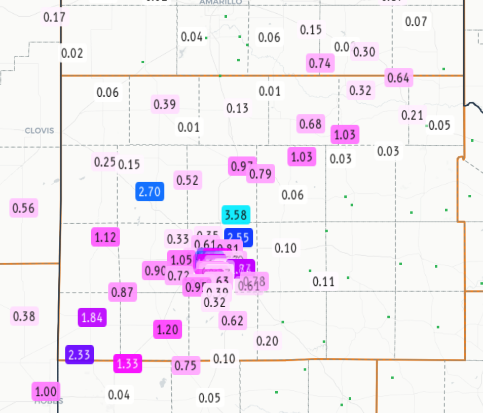
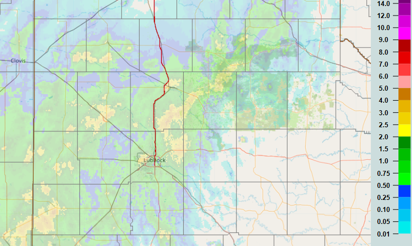
| In addition to the cooler air, the thunderstorms provided welcome rain for many locations, primarily on the Caprock, though even the parts of the southeast Texas Panhandle and northwestern Rolling Plains got in on the action. Where the heaviest rain fell, a quick 1 to 3+ inches created areas of flooding. Vehicles stalled out in high water on the northwest side of Lubbock, including at the intersection of Slide Road and Erskine Street. Elsewhere, several vehicles hydroplaned off the roadway and into the ditch east of Idalou along Highway 62/82. | |
 |
|
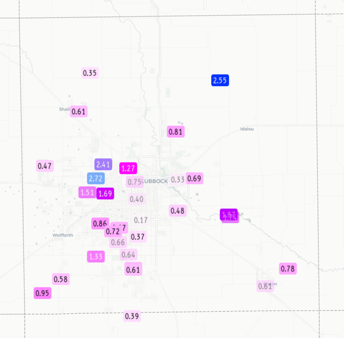
| 24-hour radar-estimated and bias-corrected rainfall (inches) ending at 8 am on Wednesday (16 August 2026). Measured rainfall, courtesy of the West Texas Mesonet (WTM) and National Weather Service (NWS), can be VIEWED HERE A closeup of the Lubbock area can be FOUND HERE. | |
|
An impressive 3.58 inches was measured by the WTM located 5 miles ENE of Abernathy! Several other locations recorded over 2 inches, including east of New Deal, the northwest side of Lubbock, around Amherst and Littlefield and from Plains to west of Denver City. Officially, the Lubbock Airport measured 0.78 inches. This boosted the annual running total to 9.60 inches, a welcome upward nudge, but still over 4 inches below the average year-to-date precipitation. A list of the preliminary storm reports collected on September 15th can be found below. |
|
Preliminary Local Storm Report...Summary
National Weather Service Lubbock TX
1216 AM CDT Wed Sep 16 2026

..TIME...   ...EVENT...      ...CITY LOCATION...     ...LAT.LON...
..DATE...   ....MAG....      ..COUNTY LOCATION..ST.. ...SOURCE....
            ..REMARKS..

0400 PM     Tstm Wnd Gst     2 S Lesley              34.65N 100.81W
09/15/2026  M67 MPH          Hall               TX   Mesonet

            Additional severe gusts of 58 to 65 mph
            measured from 401 to 402 PM.

0510 PM     Hail             Smyer                   33.58N 102.16W
09/15/2026  E1.00 Inch       Hockley            TX   Broadcast Media


0520 PM     Tstm Wnd Dmg     2 W Smyer               33.59N 102.19W
09/15/2026                   Hockley            TX   Broadcast Media

            RV flipped along 114 east of Smyer. Time
            estimated by radar.

0557 PM     Tstm Wnd Gst     6 S Wolfforth           33.42N 102.05W
09/15/2026  M71 MPH          Lubbock            TX   Mesonet


0614 PM     Tstm Wnd Dmg     5 W Lubbock             33.59N 101.93W
09/15/2026                   Lubbock            TX   Fire Dept/Rescue

            Power lines down near 7th St and Slide Rd.

0628 PM     Tstm Wnd Gst     6 W Lubbock             33.57N 101.94W
09/15/2026  M64 MPH          Lubbock            TX   Mesonet


0632 PM     Hail             4 E Reese Center        33.58N 101.95W
09/15/2026  M1.00 Inch       Lubbock            TX   Public

            Report from mPING: Quarter (1.00 in.).

0635 PM     Tstm Wnd Gst     3 WNW Lubbock           33.60N 101.90W
09/15/2026  M58 MPH          Lubbock            TX   Mesonet


0639 PM     Tstm Wnd Gst     1 ENE Morton            33.73N 102.74W
09/15/2026  M70 MPH          Cochran            TX   Mesonet


0650 PM     Flash Flood      5 ESE Reese Center      33.58N 101.94W
09/15/2026                   Lubbock            TX   Fire Dept/Rescue

            Vehicles reported stalled out in high water
            on the west side of Lubbock.

0651 PM     Tstm Wnd Gst     1 NW Lubbock Int. Airpo 33.67N 101.82W
09/15/2026  M62 MPH          Lubbock            TX   ASOS


0713 PM     Flash Flood      5 WNW Lubbock           33.61N 101.92W
09/15/2026                   Lubbock            TX   Fire Dept/Rescue

            Five vehicles stranded in high water at the
            intersection of Slide and Erskine.

0751 PM     Tstm Wnd Gst     White River Lake        33.48N 101.10W
09/15/2026  M60 MPH          Crosby             TX   Mesonet


0845 PM     Flash Flood      1 ENE Idalou            33.67N 101.67W
09/15/2026                   Lubbock            TX   Fire Dept/Rescue

            Water over the roadway east of Idalou along
            portions of Hwy 62/82. Several vehicles
            hydroplaned off the roadway and into a
            ditch.



 Follow us on X
 Follow us on Facebook
 Follow us on YouTube
 LUB RSS Feed