
Strong to severe thunderstorms will shift east on Tuesday, with damaging winds the most likely hazard, over parts of northern Florida and southern Georgia. Heavy to excessive rainfall will also be possible Tuesday over northern Florida. Read More >
Last Map Update: Tue, May. 14, 2024 at 5:13:57 am CDT

|
Text Product Selector (Selected product opens in current window)
|
|
 |
 |
 |
 |
 |
 |
| Storm Reports | Spotter Briefing | Storm Spotters | Storm Data | Tornado Statistics | Social Media |
 |
 |
 |
 |
 |
 |
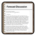
| Forecast Discussion | Hourly Forecast | Graphical Forecast | Fire Weather | Aviation | Hydrology |
 |
 |
 |
 |
 |
 |
| Observations | Air Quality | Satellite | Climate | Past Events | Weather Radio |


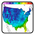
 Local Radar
 Weather Map
 Satellite