
Wildfires and poor air quality continue for the Pacific Northwest, Rockies and extended into the Plains. Severe thunderstorms possible for the northern Plains and upper Midwest on Monday along a frontal boundary. Another boundary will focus showers and thunderstorms for the eastern seaboard with localized heavy rainfall possible. For Alaska, a strong Bering Sea storm will bring winds and rainfall. Read More >
Omaha/Valley, NE
Weather Forecast Office
 |
|
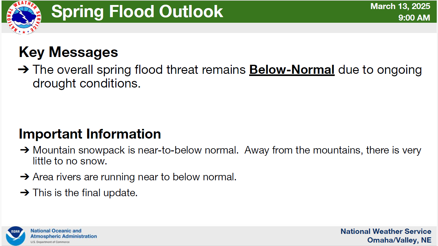
(click the image above for details) |
What is the Spring Flood Outlook?
The spring season is typically the season with the highest risk for river flooding. Thus, the National Weather Service determines flood risk across the country and provides the Spring Flood and Water Resources Outlook at this time every year. This outlook contains information about the potential for flooding throughout the spring months. The information can help decision makers and those with river interests prepare, in order to protect life and property.
Release Schedule
Additional Information:
Note that the outlooks provided by NWS Omaha address only the NWS Omaha service area of eastern Nebraska and southwest Iowa. For outlooks covering the rest of Nebraska and Iowa, refer to the following NWS offices:
Warnings/Hazards
Forecast Discussion
Winter Weather
Severe Weather
Fire Weather
Drought
Storm Prediction Center
SubmitReport
Rivers And Lakes
River Forecasts
Missouri River Overview
Platte River Overview
Elkhorn River Overview
Ice Jam Risk
Local Information
Latest Briefing Packet
Weather Monitor
Winter Monitor
Preparedness
Storm Spotters
About Us
Other Useful Links
US Dept of Commerce
National Oceanic and Atmospheric Administration
National Weather Service
Omaha/Valley, NE
6707 North 288th Street
Valley, NE 68064-9443
402-359-5166
Comments? Questions? Please Contact Us.

