
Widespread, life-threatening considerable flash flooding is expected in south-central Texas through at least Friday. Catastrophic river flooding and rapid rises on small streams, arroyos, and typically dry washes are expected in the Texas Hill Country. Wildfire smoke is impacting air quality across much of the Great Lakes region into the Northeast U.S. with Air Quality Alerts in effect. Read More >
The National Weather Service (NWS) has responsibility for the issuance of river forecasts and flood warnings. The Norman Forecast Office has river flood forecast responsibility for over 50 select locations on streams covering an area in the western two-thirds of Oklahoma (excluding the Oklahoma Panhandle) and 8 counties in western North Texas.
Why does the NWS issue river forecasts?
NWS River Forecast Centers (RFCs) use complex hydrologic computer models to generate river forecasts. The RFCs transmit the forecast guidance to local forecast offices, and the forecast offices use the information to issue river flood warnings or statements. The RFCs which provide forecasts for the NWS Norman office are the Arkansas-Red River Forecast Center (ABRFC) in Tulsa, Oklahoma, and the West Gulf River Forecast Center (WGRFC) in Forth Worth, Texas.
Most of the forecast points in the NWS Norman have telemetered river gage equipment. The U.S. Geological Survey (USGS), the U.S. Army Corps of Engineers (USACE), the Oklahoma Water Resources Board, and other cooperating agencies provide funding for these stream-gaging networks. The U.S. Army Corps of Engineers - Tulsa District Water Control Center in Tulsa, Oklahoma provides links to real-time hydrographs and reservoir data. The USGS district offices in Oklahoma City, Oklahoma and for Texas from the USGS, Austin, Texas also provide real-time data for Oklahoma and Texas, respectively.
The USGS and USACE operate most of their stream gages on a cooperative basis with other Federal, state, and local agencies that fund individual gaging stations for agency-specific projects or regulatory needs. For more information, see the USGS links, "Stream Gaging and Flood Forecasting, a partnership of the U.S. Geological Survey and the National Weather Service" and "USGS Streamgaging Network."
| OWRB Reservoir Map | TWDB Reservoir Map | Arkansas River Basin Reservoir Hydrographs | Red River Basin Reservoir Hydrographs | Brazos River Basin Reservoir Hydrographs |
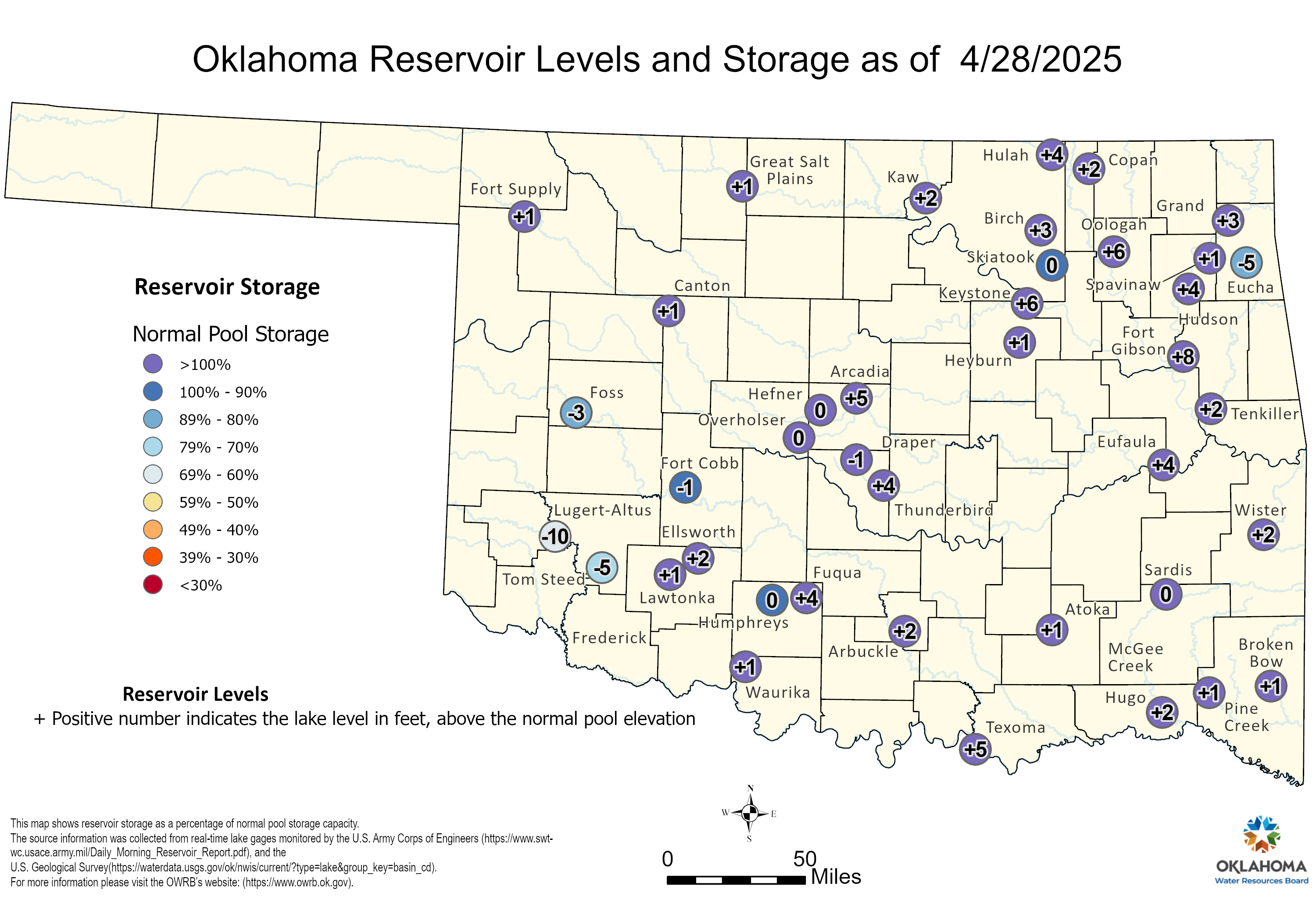
Reservoir conditions map is provided by the Oklahoma Water Resources Board.
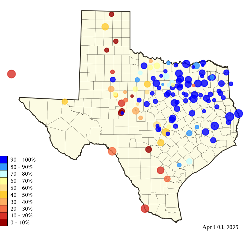
Reservoir conditions map is provided by the Texas Water Development Board.
| Fort Supply Reservoir near Fort Supply, OK | ||
|---|---|---|
 NWS Hydrograph |
 USACE Hydrograph |
|
| Canton Reservoir near Canton, OK | ||
NWS Hydrograph |
 USACE Hydrograph |
|
| Lake Arcadia near Arcadia, OK | ||
 NWS Hydrograph |
 USACE Hydrograph |
|
| Lake Hefner at Oklahoma City, OK | ||
 NWS Hydrograph |
||
| Lake Overholser near Oklahoma City, OK | ||
 NWS Hydrograph |
||
| Stanley Draper Lake near Oklahoma City, OK | ||
 NWS Hydrograph |
||
| Lake Thunderbird near Norman, OK | ||
 NWS Hydrograph |
 USACE Hydrograph |
|
| Wes Watkins Lake near McLoud, OK | ||
 NWS Hydrograph |
||
| Shawnee Reservoir at Shawnee, OK | ||
 NWS Hydrograph |
||
| Great Salt Plains Reservoir near Jet, OK | ||
 NWS Hydrograph |
 USACE Hydrograph |
|
| Kaw Lake near Ponca City, OK | ||
 NWS Hydrograph |
 USACE Hydrograph |
|
| Foss Reservoir near Foss, OK | ||
|---|---|---|
 NWS Hydrograph |
 USACE Hydrograph |
|
| Fort Cobb Reservoir near Fort Cobb, OK | ||
 NWS Hydrograph |
 USACE Hydrograph |
|
| Lake Altus at Lugert, OK | ||
 NWS Hydrograph |
 USACE Hydrograph |
|
| Lake Ellsworth near Elgin, OK | ||
 NWS Hydrograph |
||
| Lake Lawtonka near Lawton, OK | ||
 NWS Hydrograph |
||
| Tom Steed Reservoir near Mountain Park, OK | ||
 NWS Hydrograph |
 USACE Hydrograph |
|
| Truscott Brine Lake near Truscott, TX | ||
 NWS Hydrograph |
||
| Lake Kemp near Mabelle, TX | ||
 NWS Hydrograph |
 USACE Hydrograph |
|
| Diversion Lake near Dundee, TX | ||
 NWS Hydrograph |
||
| Lake Kickapoo near Archer City, TX | ||
 NWS Hydrograph |
||
| Lake Arrowhead near Henrietta, TX | ||
 NWS Hydrograph |
||
| Waurika Lake near Waurika, OK | ||
 NWS Hydrograph |
 USACE Hydrograph |
|
| Arbuckle Lake near Dougherty, OK | ||
 NWS Hydrograph |
 USACE Hydrograph |
|
| Lake Humphreys near Duncan, OK | ||
 NWS Hydrograph |
||
| Lake Fuqua near Duncan, OK | ||
 NWS Hydrograph |
||
| Lake Texoma at Cumberland Cut near Cumberland, OK | ||
 NWS Hydrograph |
||
| Lake Texoma near Denison, TX | ||
 NWS Hydrograph |
 USACE Hydrograph |
|
| Atoka Reservoir near Stringtown, OK | ||
 NWS Hydrograph |
||
| McGee Creek Reservoir near Farris, OK | ||
 NWS Hydrograph |
 USACE Hydrograph |
|
| Millers Creek Reservoir near Bomarton, TX | ||
|---|---|---|
 NWS Hydrograph |
||
|
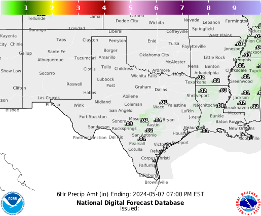
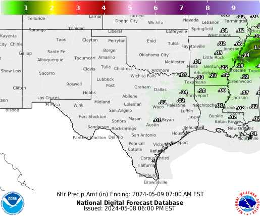
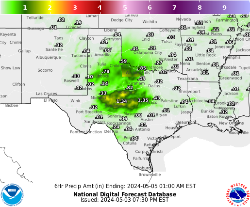
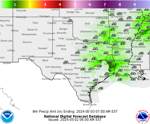
Daily RFC Precipitation Summaries
NWS Norman Precipitation Products (Issued as needed)
|
| WPC Daily QPF Graphics | |
|---|---|
 WPC Day 1 QPF |
 WPC Day 2 QPF |
 WPC Day 3 QPF |
 WPC Day 4 QPF |
 WPC Day 5 QPF |
 WPC Day 6 QPF |
 WPC Day 7 QPF |
|
| WPC Multiday QPF Graphics | |
 WPC Day 1-2 QPF |
 WPC Day 1-3 QPF |
 WPC Day 1-5 QPF |
 WPC Day 1-7 QPF |
| WPC Daily Excessive Rainfall Graphics | |
 WPC Day 1 Excessive Rainfall Graphic |
 WPC Day 2 Excessive Rainfall Graphic |
 WPC Day 3 Excessive Rainfall Graphic |
|
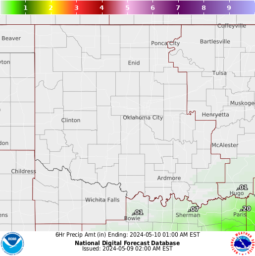
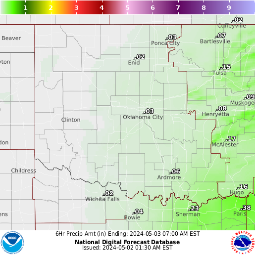
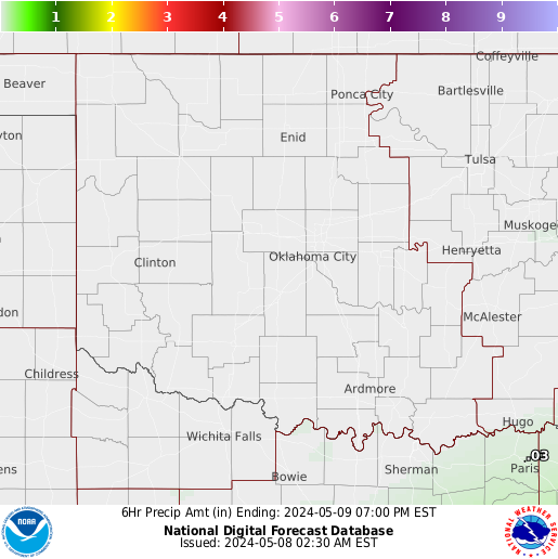
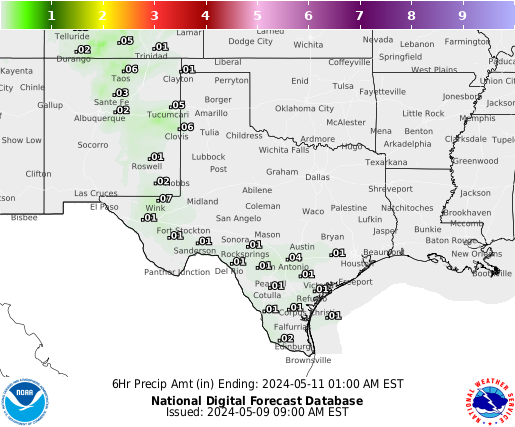
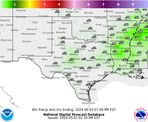
") Period 1 (0-6 hours) |
") Period 2 (6-12 hours) |
") Period 3 (12-18 hours) |
") Period 4 (18-24 hours) |
 24-hour Total |
|
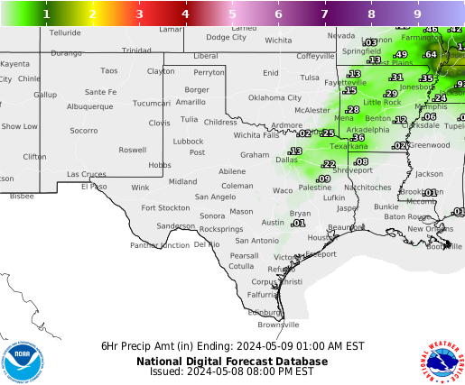
 Period 1 (0-6 hrs) Period 1 (0-6 hrs) |
 Period 2 (6-12 hrs) Period 2 (6-12 hrs) |
 Period 3 (12-18 hrs) Period 3 (12-18 hrs) |
 Period 4 (18-24 hrs) Period 4 (18-24 hrs) |
 Period 5 (24-30 hrs) Period 5 (24-30 hrs) |
 Period 6 (30-36 hrs) Period 6 (30-36 hrs) |
 Period 7 (36-42 hrs) Period 7 (36-42 hrs) |
 Period 8 (42-48 hrs) Period 8 (42-48 hrs) |
 CPC 6-10 Day Precipitation Outlook |
 CPC 8-14 Day Precipitation Outlook |
 CPC 8-14 Day Precipitation Hazards |
 CPC Week 3-4 Precipitation Outlook |
 CPC Monthly Precipitation Outlook |
 CPC Seasonal Precipitation Outlook |
")
")


