
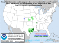
Scattered to numerous thunderstorms are likely across the region Tuesday, July 28th through Wednesday, July 29th which will bring a risk of flash flooding and severe thunderstorms across the entire region. View this briefing for the details regarding these hazards. Read More >
| K D I X |
|
|
|
||||||
| K D O X |
|
|
|
||||||
| Radars Nationwide and Additional Radar Information | |||||||||
|
|
|
|||||||
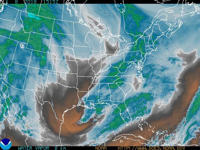
| Additional Satellite Images | |||||||||
|
|
|
|
|
|


 Coastal Flood
 Marine Forecasts
 Text Products
 Climate Information
 Skywarn
 Submit Storm Report
 Weather Event Archives
 Forecast Discussion
 Emergency Managers
 Briefing Page