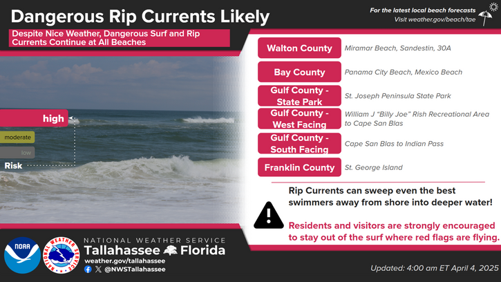
A Gale Warning is in effect through Thursday. A high risk for rip currents for Walton, Gulf, and Franklin County Beaches. Northeasterly winds of 20-25 kts are expected with gusts around 30-35 kts and seas of 5-8 feet for the Small Craft Advisory and winds of 30 kts and gusts of 35-40kts, and offshore seas of 6-11 feet for the Gale Warning.


 Florida Radar (EVX)
 Florida Radar (TLH)
 Georgia Radar (VAX)
 Satellite Imagery
 Weather Map (Interactive)
 7 Day Tropical Weather Outlook