National Weather Service United States Department of Commerce

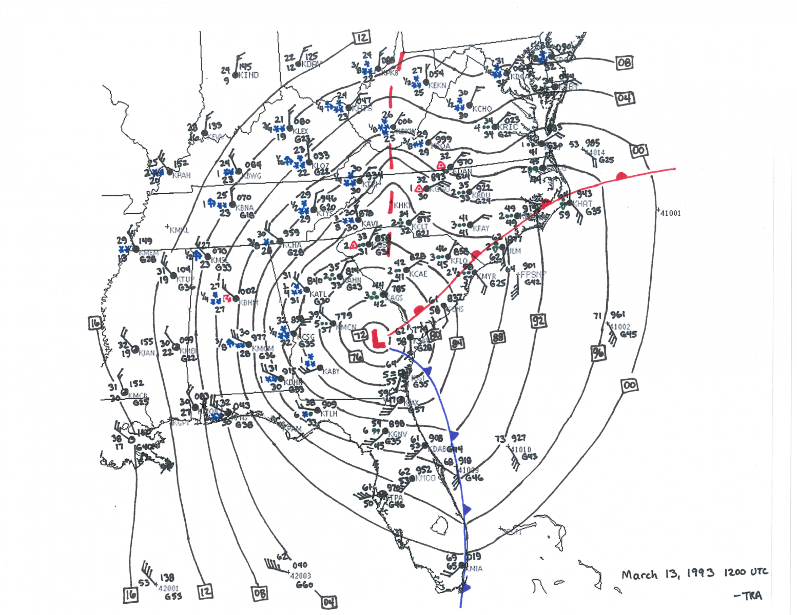
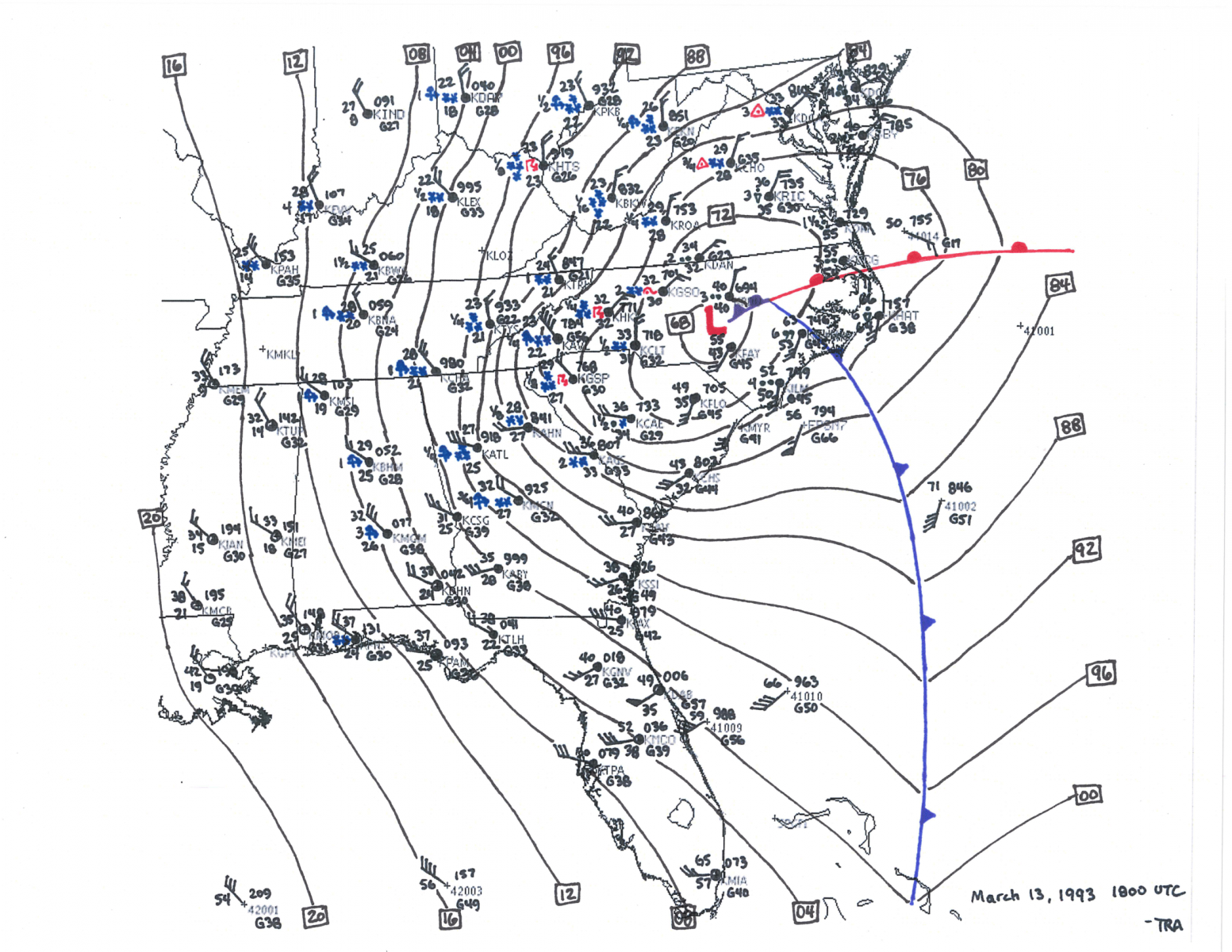
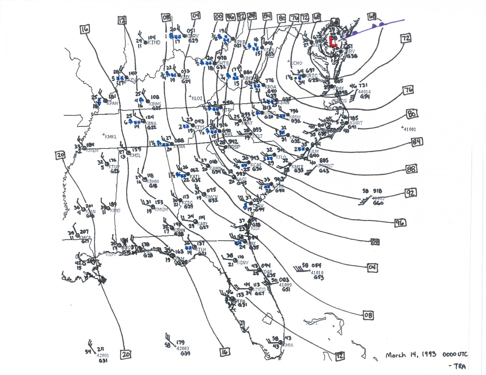
The 1993 “Storm of the Century“

Images on this page can be magnified (enlarged) by left clicking on them, and resized back to original size with a second click.

 
Infrared satellite loop of the 1993 Storm of the Century

Visible satellite loop of the 1993 Storm of the Century
 

The March 1993 “Storm of the Century” struck the gulf coast of Florida late on Friday March 12, 1993 and continued slamming Florida and states to the north on Saturday. Why was it called the Storm of the Century? To Florida residents, it was a "no-name" March hurricane creating wind gusts over 90 mph, tornadoes, and a devastatingly deadly storm surge. But it was much larger than a hurricane. To residents farther north it was called “The Blizzard of the Century” A blizzard like few had seen that dropped temperatures, dumped snow, broke trees, and knocked out power over a wide swath from Alabama and Georgia to Maine.

The Superstorm produced over $2 billion in property damage across portions of 22 eastern U.S. states. Most of the property damage occurred in Florida. Advanced warnings saved lives with less than 100 direct casualties – half of whom were on vessels in seas estimated as high as 65 feet. Another 118 people perished from indirect causes with many dying during the post storm cleanup.

Five days in advance, computer models were forecasting a rapid development of intense low pressure over the Gulf of Mexico. It was initially difficult to believe that a weak low pressure area could deepen to much lower pressures in such short a period of time. Some forecasters used the term “meteorological bomb”! As the week went on, the numerical forecast models continued showing the same unbelievable development. It was happening though. Upstream, the arctic, polar and subtropical jet streams were merging and a deep flow of tropical moisture over the Gulf of Mexico was coming north from the Caribbean Sea. These merging factors set the timer for the impending explosion.

The winds howled as the storm moved north with the strongest recorded wind gusts at these locations:
               • 110 mph Franklin County, FL
               • 109 mph Dry Tortugas, FL
               • 101 mph Flattop Mountain, NC
               • 144 mph Mount Washington, NH

The fast moving squall line produced 59,000 cloud to ground lightning strikes as it moved onshore. At least 11 tornadoes were reported with the storm as it crossed the state. The F2 tornado near Chiefland in Levy County led to 3 fatalities. Other tornado fatalities were reported in Alachua and Lake Counties.

The Superstorm created an unprecedented storm surge up to 12 feet in Taylor County well north of Tampa Bay in the Florida Big Bend. The surge drowned 13 people.


Map of Tornado and Wind Damage

1993 Storm of the Century Damage Map

Storm Surge Associated with Storm of the Century

1993 Storm of Century Surge Gulf Coast Florida


NWS Melbourne Weather Radar Loop
from 11 PM EST Friday until 1:15 AM EST Saturday

1993 Storm of the Century NWS Melbourne 88D Radar


Surface Analysis Loop
from 7 PM EST Friday to 7 PM EST Saturday

1993 Storm of the Century Surface Analysis

1993 Storm of the Century Surface Analysis at 7 PM March 13, 1993

7 PM EST
March 12, 1993

1993 Storm of the Century Surface Analysis at 1 AM March 13, 1993

1 AM EST
March 13, 1993

1993 Storm of the Century Surface Analysis at 7 AM March 13, 1993

7 AM EST
March 13, 1993

1993 Storm of the Century Surface Analysis at 1 PM March 13, 1993

1 PM EST
March 13, 1993

1993 Storm of the Century Surface Analysis at 7 PM March 14, 1993

7 PM EST
March 13, 1993


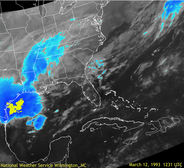
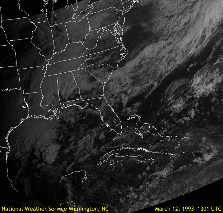
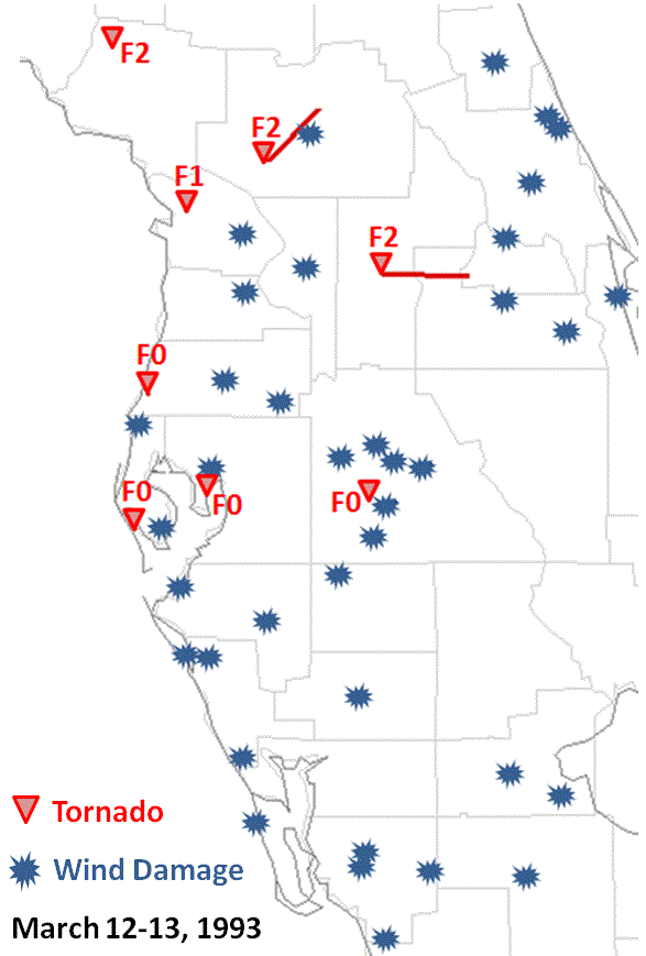
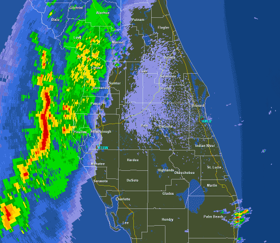
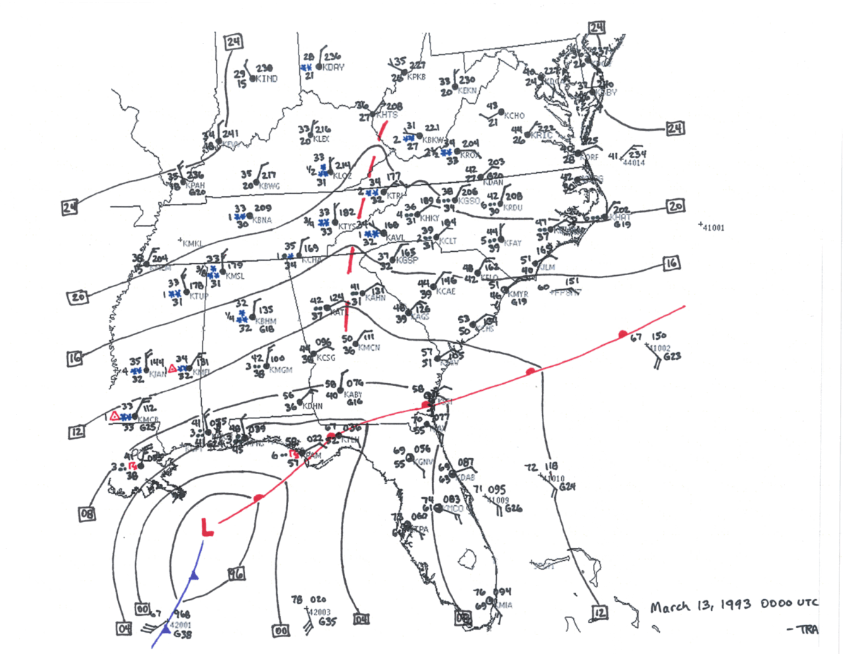
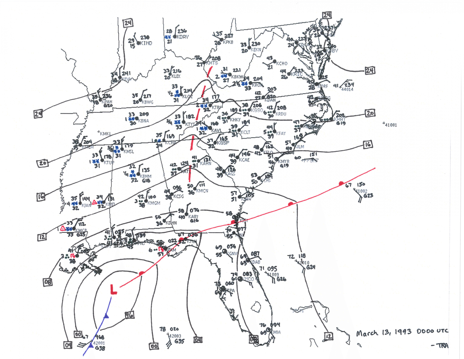
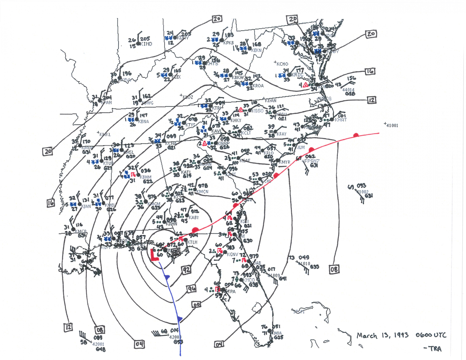
What was it like to Work the Event?

Charlie Paxton was the forecaster on duty during the day on Friday March 12, 1993 and came back that evening to issue warnings for the event. He recalls working the storm that night:

“When I arrived, the office satellite imagery showed the squall line racing east at 70 mph! Our team issued 26 warnings and lead time ranged from 30 minutes to over two hours! I upgraded wording in all of the warnings to indicate winds of over 90 mph! Standard warnings usually indicate wind gusts over 55 mph. Of the 6 tornadoes in our area...lead times were all over 20 minutes with the longest lead time of 48 minutes. Remember, we were using the old WSR-57 Radar. We didn’t have Doppler. We had a processor attached to the radar called RADAP and I had written software to make calculations on the severity of cells and that really helped.“

“We used an XT PC to send products through our main communication system called AFOS. We communicated with the Melbourne WSR-88D operator who helped identify tornadic circulations within range of their radar. We used the NAWAS line to communicate with the county Emergency Operations Centers. We also received a number of reports from the local media. We had an 800 number available to the public. Our phone didn’t stop ringing. People were shocked at the intensity of the storm and provided us with many accounts of damage.”


Technical Reports

Overview of the 12-14 March 1993 Superstorm

A Diagnostic Analysis of the Superstorm of March 1993

Natural Disaster Survey Report

The Superstorm Derecho

NCEI - On This Day: The 1993 Storm of the Century