Tonight will be the coldest night of the winter thus far in many areas, with lows in the single digits or colder in the northern mountains. Take precautions to protect people, pets, and pipes!
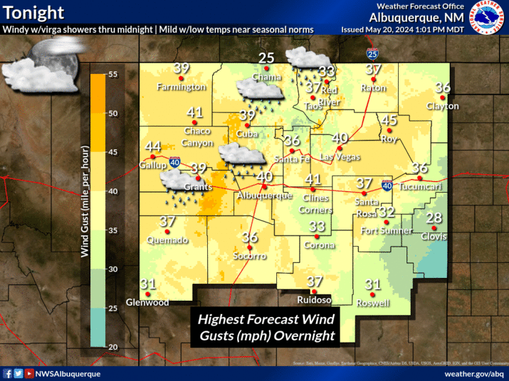
Strong northwest wind gusts will likely impact the area from the peaks and east slopes of the Sangre De Cristo Mountains to the Central Highlands on Saturday.


 Office Webcam
 Weather Map
 Satellite Imagery