National Weather Service United States Department of Commerce

Total Solar Eclipse April 8, 2024 - Review of the Event

Highlights of the 2024 Total Solar Eclipse as it crossed North and Central Texas on Monday April 8th. Read More >

Click a location below for detailed forecast.

Last Map Update: Fri, Apr. 26, 2024 at 1:02:37 pm CDT

National Weather Service Amarillo, TXNational Weather Service Norman, OKNational Weather Service Tulsa, OK
National Weather Service San Angelo, TXZoom
Out

National Weather Service Shreveport, LA
National Weather Service Austin/San Antonio, TXNational Weather Service Houston/Galveston, TXNational Weather Service Lake Charles, LA

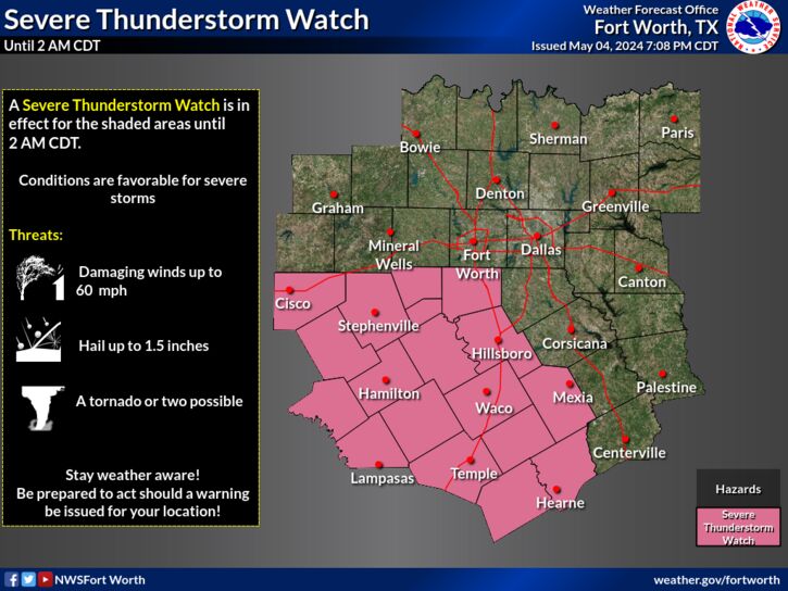
A Tornado Watch is in effect for much of Central Texas and eastern portions of North Texas (including the DFW Metroplex) through 6 PM. This means that conditions are favorable for severe weather. The main threats with any severe storms will be hail up to 2.5 inches in diameter, damaging wind gusts up to 7- mph, and a few tornadoes. Pay close attention to the weather and be prepared to shelter if a warning is issued for your location.
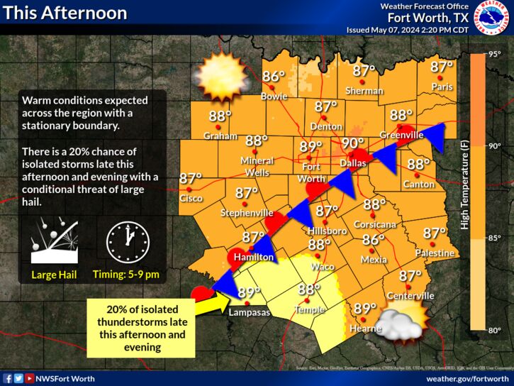
Thunderstorms will increase in coverage now through the afternoon. Severe weather is likely across parts of North and Central Texas. Hail, damaging winds, tornadoes, and flooding are all possible. Have multiple ways to receive weather alerts!
Severe storms are possible Saturday and Sunday ahead of a dryline. Large hail, damaging winds and a tornado or two will be possible. Additionally, the risk for flash flooding will increase Saturday night west of I-35 and once again through Sunday afternoon across East Texas. Given the potential for night-time flooding and severe weather, make sure you have all the necessary preparations completed before severe weather strikes!
There is an increased threat for flooding with the storms this weekend, especially Saturday night into Sunday morning. About 10% of the area will see rainfall amounts of 4-6 inches. Never drive into water of unknown depth. Remember, always Turn Around, Don't Drown! Be sure to use extra caution at low water crossings and in areas of poor drainage like construction zones.
An unsettled weather pattern will persist through much of next week with humid and warm conditions in place. Storms will be possible each afternoon with a low threat for strong to severe storms.

Text Product Selector (Selected product opens in current window)
Latest Text Products Issued (Experimental)
Safe Rooms Icon Cooperatirve Rainfall (CoCoRaHs) icon Storm Ready Icon AirNow Icon