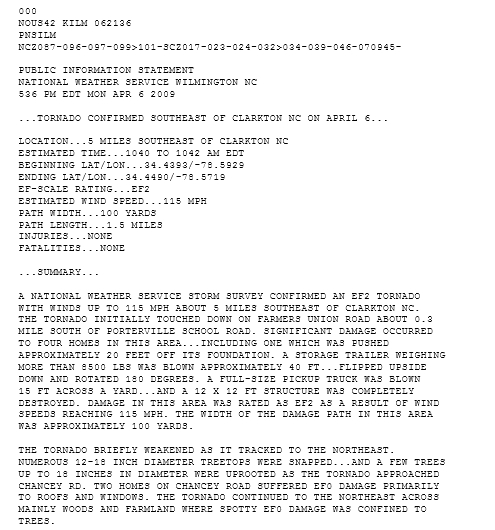
Early on the morning of Saturday November 15th two tornadoes touched down in our area. The first was rated an EF-2 tornado and touched down east of Dillon, SC at 12:50 am. The actual touchdown was in Dillon County, about 3 miles east of the city of Dillon. Maximum winds were estimated at 135 mph with a path length of 1.5 miles. The width of the tornado was estimated to be between 30 and 40 yards. The tornado was on the ground for 5 minutes
The 2nd tornado was an EF-0 and it touched down just east of St. Pauls, NC around 1:35 am. St. Paul's is located in Robeson County, about 12 miles northeast of Lumberton. This tornado was estimated to have winds of 80 mph with a path length of just over a mile and a width of 40 yards.
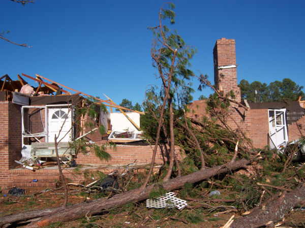
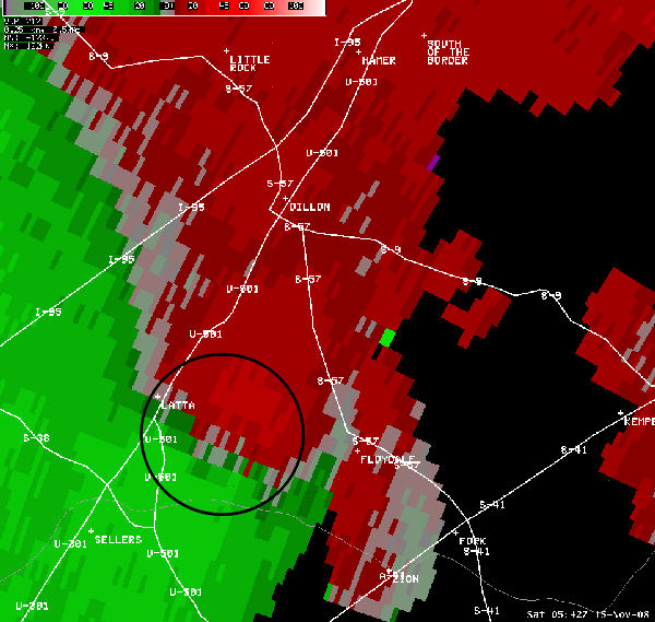
Below you will find a slideshow of the damage from the Dillon tornado. Below the storm damage slideshow you will see radial velocity images from the KLTX radar located in Shallotte, NC. Radial velocity images are one of the products we use to help determine rotation in the atmosphere. The red colors on this image are winds blowing away from the radar site. Looking at the scale at the top, the brighter red colors indicate a stronger wind speed blowing away from the radar. The other main color on this image is green and this indicates winds toward the radar. The brighter the shade of the green, the stronger the wind is blowing toward the radar. To determine strong rotation, we look for very bright red and green colors next to each other. Use the circles as a guide.
 |
KLTX Velocity Images |
 |


 Coastal Flood
  Follow us on YouTube