![]()
NOAA Weather Radio All Hazards is a free public service provided by the National Weather Service. It consists of continuous broadcasts of current weather conditions and forecasts as well as hazard (weather and non-weather) information as needed.
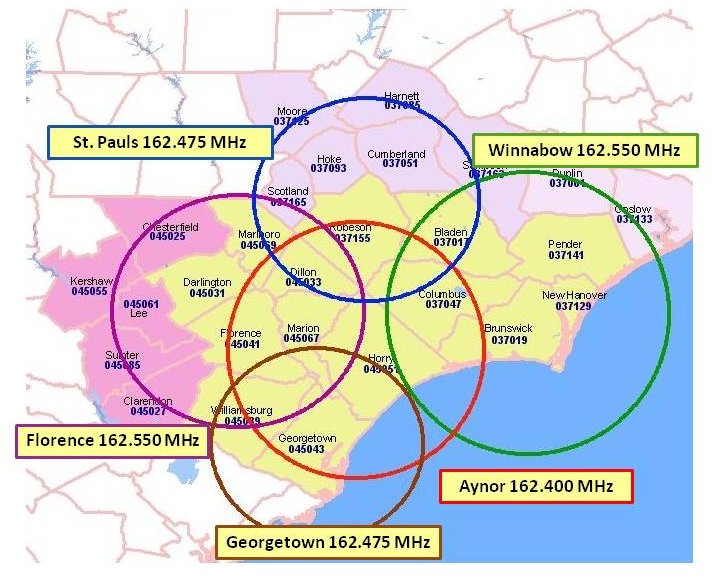
National Weather Service Wilmington, NC operates 5 weather radio transmitters serving portions of southeast NC and northeast SC. The map below displays the frequency and coverage area of each transmitter. The six-digit numbers displayed below each county name are the FIPS (Federal Information Processing System) codes used to program weather radios with the SAME (Specific Area Message Encoding) feature. More information about local NWR broadcasts can be found here.
Broadcasts are automatically generated using a computer system which translates text forecasts and other products into audio when they are issued.
Weather radios can be purchased at most electronics and department stores, or over the internet. Different models are available with a variety of features and prices. Some models can even be customized with your county FIPS code so they will only alarm for certain warnings for certain areas. For additional information, check out the NOAA Weather Radio All Hazards page.


 Coastal Flood