| The topography of the region, including the Appalachian Mountains and proximity to the Atlantic Ocean cause many complex weather phenomena across the coastal Carolinas which can present significant forecast challenges to NWS meteorologists. |
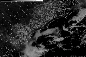
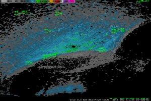
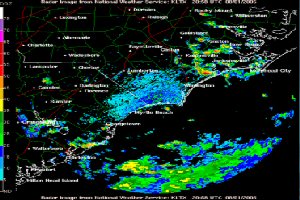
The Classic Sea Breeze occurs when a weak pressure gradient is present. The shape closely resembles the coast. There is always an inflection point with the classic sea breeze. It is often accompanied by weak showers and thunderstorms. The classic sea breeze can propagate well inland.
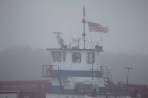 Sea fog is an advection fog that forms in warm, moist air cooled to saturation as it moves over colder water. The colder water may occur as a well-defined current, or as gradual latitudinal cooling. The dew point and the temperature undergo a gradual change as the air mass moves over colder and colder water. The surface air temperature falls steadily, and tends to approach the water temperature. The dewpoint also tends to approach the water temperature, but at a slower rate. If the dewpoint of the air mass is initially higher than the coldest water to be crossed, and if the cooling process continues sufficiently long, the temperature of the air ultimately falls to the dewpoint, and fog results. However, if the initial dewpoint is less than the coldest water temperature, the formation of fog is unlikely. Generally, in northward moving air masses or in air masses that have previously traversed a warm ocean current, the dewpoint of the air is initially higher than the cold water temperature to the north, and fog will form, provided sufficient fetch occurs. The rate of temperature decrease is largely dependent on the speed at which the air mass moves across the sea surface, which, in turn, is dependent both on the spacing of the isotherms and the velocity of the air normal to them. The dissipation of sea fog requires a change in air mass (a cold front). A movement of sea fog to a warmer land area leads to rapid dissipation. Upon heating, the fog first lifts, forming a stratus deck; then, with further heating, this cloud deck breaks up into a stratocumulus layer, and eventually into convective type clouds or evaporates entirely. An increase in wind velocity can lift sea fog, forming a stratus deck, especially if the air/sea temperature differential is small. Over very cold water, dense sea fog may persist even with high winds.
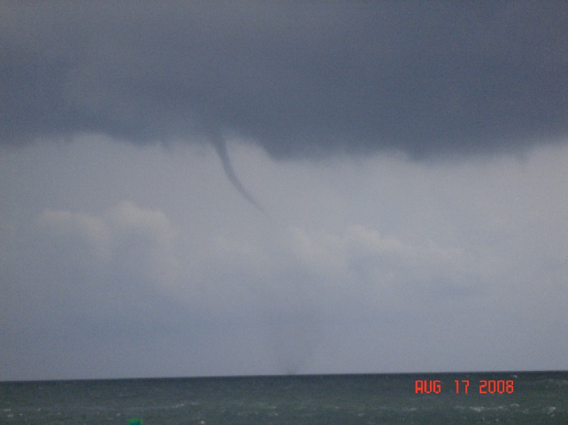 Fair-weather waterspouts are small tornado-look circulations extending from the ocean surface up into a towering cumulus or cumulonimbus cloud. Fair-weather waterspouts occasionally occur during the warm season across North and South Carolina coastal waters and are a hazard to boaters and beachgoers. Wind speeds in large waterspouts can rival that of small tornadoes and sometimes reach over 100 mph. Fair-weather waterspouts can sometimes move onshore as a tornado, but normally weaken and dissipate within a minute of reaching shore due to increased surface friction and turbulence. However, given their small size and transitory nature, even advanced doppler weather radar can be of little use in the Tornado Warning decision process.
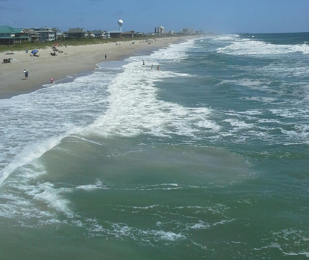 Rip currents are powerful, channeled currents of water flowing away from shore. They typically extend from the shoreline, through the surf zone, and past the line of breaking waves. Rip currents can occur at any beach with breaking waves, including the Great Lakes. A daily 3-tier (low, moderate, high) rip current outlook is included in our seasonal Surf Zone Forecast.
There are several atmospheric, oceanographic and astronomic components that go into determining the rip current risk, including wind speeds and directions, swell heights and periods, and moon phases.
The gravitational influence of the earth's moon is stronger three days either side of a full or new moon so rip currents are more likely during these times. Also, rip currents are more likely during and just after low tide compared to around times of high tide due to the water being pulled away from the coast.
Follow our seasonal Surf Zone/Beach Forecast or our beach page for the latest rip current forecast.
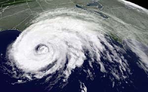 Tropical cyclones are warm-core low pressure systems that require several ingredients to develop, including warm (80+ degree F) water, little vertical wind shear, and plenty of moisture. They have the potential to bring significant hazards such as strong winds, storm surge flooding, heavy rainfall flooding, tornadoes and rip currents. The National Hurricane Center in Miami, FL is responsible for issuing tropical cyclone forecasts and coordinating with local NWS Forecast Offices when a storm threatens land. Click here for more information on the various types of dynamical and statistical forecasting models used by the National Hurricane Center.
Fortunately, track forecasting has generally been steadily improving over the last several decades, although intensity forecasts still remain quite problematic. This is mainly due to the lack of highly detailed observations in and around tropical cyclones.
Although fairly rare, winter weather across southeast NC and northeast SC can be quite a forecast challenge given the many large-scale and small-scale factors involved in producing winter precipitation, the weather model limitations of the small-scale processes and the unique geography/topography of the area.
Sometimes colder and drier (more dense) air moves south on the eastern side of the Appalachian Mountains as high pressure builds from the north, which is known as "cold air damming". Meanwhile, warmer and moister (less dense) air can ride up and over the shallow colder air near the surface and the tug-of-war between these two air masses ultimately determines the areas that receive winter precipitation. More details on winter weather across the area can be found here.
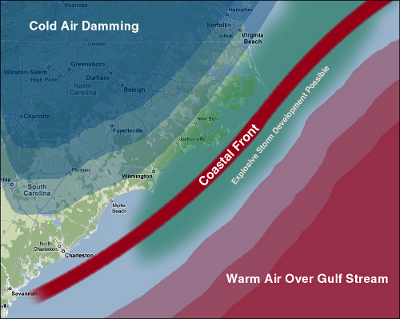
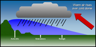
Images courtesy of the NC Climate Office.
Follow our local winter weather page for our latest winter weather forecasts.


 Coastal Flood