
Excessive heat returns for portions of the Plains today where heat indices will likely climb above the century mark. Furthermore, warm temperatures, strong winds and dry fuels may result in rapid spread of wild fires across the western High Plains today. For the east coast, lingering storm with onshore flow will bring high surf, dangerous rip currents and coastal flooding, especially at high tide. Read More >
Overview
|
During the afternoon and evening hours of May 16th, severe thunderstorms affected many locations in southeast and east-central Nebraska and southwest Iowa. These storms produced primarily damaging wind gusts and large hail with the most intense activity occurring across Douglas and Washington counties were several wind gusts in excess of 70 mph were observed. In fact, an 85 mph wind gust was recorded at the National Weather Service Office in Valley, NE. In addition to the wind and hail, the storms produced heavy rainfall with multiple reports of amounts in excess of 2.50".
|
 Caption |
Wind:
Below is a loop of reflectivity and base velocity data from the Omaha/Valley, NE radar between 5:48 PM and 6:53 PM. This imagery clearly shows the evolution of the bow echo that affected east-central Nebraska on the evening of the 16th. Note the strong velocity signature associated with the intense storm located just north of the apex of the bow, which tracked across northwest Douglas and southern Washington counties. As mentioned in the overview, an 85 mph wind gust was recorded at the NWS in Valley, NE with multiple observations of 70-75 mph winds across southern Washington county. At Omaha/Eppley Field, a gust of 63 mph was measured.
 |
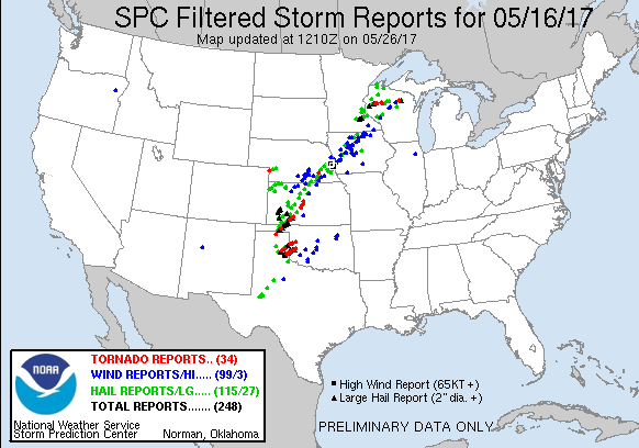
Storm Reports
| Interactive Storm Report Map | SPC Storm Reports |
 |
 |
PRELIMINARY LOCAL STORM REPORT...SUMMARY
NATIONAL WEATHER SERVICE OMAHA/VALLEY NEBRASKA
1220 AM CDT WED MAY 17 2017

..TIME...   ...EVENT...      ...CITY LOCATION...     ...LAT.LON...
..DATE...   ....MAG....      ..COUNTY LOCATION..ST.. ...SOURCE....
            ..REMARKS..

0501 PM     HAIL             TAMORA                  40.90N 97.22W
05/16/2017  E1.00 INCH       SEWARD             NE   FIRE DEPT/RESCUE

0515 PM     HAIL             SEWARD                  40.91N 97.10W
05/16/2017  M1.00 INCH       SEWARD             NE   TRAINED SPOTTER

0535 PM     HAIL             6 N VALPARAISO          41.17N 96.83W
05/16/2017  E1.25 INCH       SAUNDERS           NE   PUBLIC

            QUARTER TO HALF DOLLAR SIZED HAIL

0538 PM     HAIL             2 SSW FREMONT           41.41N 96.51W
05/16/2017  E1.75 INCH       DODGE              NE   NWS EMPLOYEE

            QUARTER TO GOLFBALL HAIL

0551 PM     HAIL             FREMONT                 41.44N 96.49W
05/16/2017  E1.75 INCH       DODGE              NE   PUBLIC

            UP TO GOLFBALL SIZED HAIL

0605 PM     HAIL             WAVERLY                 40.91N 96.53W
05/16/2017  E1.75 INCH       LANCASTER          NE   PUBLIC

            GOLF BALLS AND 50MPH WINDS

0610 PM     TSTM WND DMG     2 S YUTAN               41.21N 96.40W
05/16/2017                   SAUNDERS           NE   BROADCAST MEDIA

            MULTIPLE TREE BRANCHES DOWN AND TREE SPLIT IN HALF

0610 PM     TSTM WND GST     VALLEY                  41.31N 96.35W
05/16/2017  M85.00 MPH       DOUGLAS            NE   NWS EMPLOYEE

            74KT MEASURED GUST AT OMAHA/VALLEY NWS

0610 PM     TSTM WND DMG     VALLEY                  41.31N 96.35W
05/16/2017                   DOUGLAS            NE   PUBLIC

            SEVERAL POWER POLES DOWN IN VALLEY

0615 PM     HAIL             LINCOLN                 40.82N 96.69W
05/16/2017  E1.00 INCH       LANCASTER          NE   PUBLIC

            40TH AND OLD CHENEY

0620 PM     HAIL             6 S GRETNA              41.05N 96.24W
05/16/2017  E1.00 INCH       SARPY              NE   TRAINED SPOTTER

            FLYING J TRUCK STOP

0625 PM     TSTM WND DMG     GRETNA                  41.14N 96.24W
05/16/2017                   SARPY              NE   PUBLIC

            TREE DOWN 168TH AND GILES

0630 PM     HAIL             OMAHA                   41.26N 96.01W
05/16/2017  E1.00 INCH       DOUGLAS            NE   PUBLIC

            132ND AND GILES

0630 PM     HAIL             OMAHA                   41.26N 96.01W
05/16/2017  E1.00 INCH       DOUGLAS            NE   EMERGENCY MNGR

            QUARTERS REPORTED AT 124TH AND CENTER AND 144TH AND
            PACIFIC

0630 PM     HAIL             15 W OMAHA              41.26N 96.30W
05/16/2017  E1.00 INCH       DOUGLAS            NE   TRAINED SPOTTER

            LAKE ZORINSKY AREA

0630 PM     HAIL             OMAHA                   41.26N 96.01W
05/16/2017  E1.00 INCH       DOUGLAS            NE   PUBLIC

            178TH AND HARRISON

0630 PM     TSTM WND GST     2 WNW FORT CALHOUN      41.47N 96.06W
05/16/2017  M70.00 MPH       WASHINGTON         NE   TRAINED SPOTTER

            70MPH WINDS RECORDED BY AUTOMATED WEATHER STATION.

0634 PM     TSTM WND GST     2 SSW PAPILLION         41.13N 96.06W
05/16/2017  E80.00 MPH       SARPY              NE   TRAINED SPOTTER

            LARGE TREE LIMBS AND 2+ INCH DIAMETER BRANCHES DOWN

0635 PM     HAIL             S OMAHA                 41.26N 96.01W
05/16/2017  E0.88 INCH       DOUGLAS            NE   TRAINED SPOTTER

            NICKELS AND 50MPH WINDS

0635 PM     TSTM WND DMG     OMAHA                   41.26N 96.01W
05/16/2017                   DOUGLAS            NE   BROADCAST MEDIA

            TREES DAMAGED AT GENE LEAHY MALL AT 13TH AND DOUGLAS

0640 PM     TSTM WND DMG     OMAHA                   41.26N 96.01W
05/16/2017                   DOUGLAS            NE   BROADCAST MEDIA

            TREES DOWN AT AKSARBEN NEAR S 63RD

0640 PM     TSTM WND DMG     PAPILLION               41.16N 96.04W
05/16/2017                   SARPY              NE   PUBLIC

            LARGE BRANCH DOWN

0640 PM     TSTM WND GST     2 SSE OMAHA             41.24N 96.00W
05/16/2017  E50.00 MPH       DOUGLAS            NE   PUBLIC

            NICKEL HAIL AND 50MPH WINDS

0640 PM     HAIL             GRETNA                  41.14N 96.24W
05/16/2017  E1.00 INCH       SARPY              NE   TRAINED SPOTTER

            HWY 6 S OF HWY 370

0644 PM     TSTM WND GST     OMAHA                   41.26N 96.01W
05/16/2017  M63.00 MPH       DOUGLAS            NE   ASOS

            55KT GUST REPORTED AT OMAHA/EPPLEY

0645 PM     HAIL             UNADILLA                40.68N 96.27W
05/16/2017  E1.00 INCH       OTOE               NE   EMERGENCY MNGR

0645 PM     TSTM WND DMG     BENNINGTON              41.37N 96.16W
05/16/2017                   DOUGLAS            NE   BROADCAST MEDIA

            BLEACHERS BLOWN OVER AT BENNINGTON HIGH SCHOOL

0647 PM     TSTM WND DMG     BLAIR                   41.54N 96.14W
05/16/2017                   WASHINGTON         NE   BROADCAST MEDIA

            ROOF DAMAGE TO HOME IN BLAIR

0650 PM     TSTM WND DMG     MISSOURI VALLEY         41.56N 95.90W
05/16/2017                   HARRISON           IA   BROADCAST MEDIA

            SEVERAL LARGE BRANCHES DOWN

0655 PM     TSTM WND DMG     UNDERWOOD               41.39N 95.68W
05/16/2017                   POTTAWATTAMIE      IA   AMATEUR RADIO

            HEAVY TREE DAMAGE 23446 MAGNOLIA. BARN AND HOUSE DAMAGED.
            REPORTED POSSIBLE ROTATION

0657 PM     NON-TSTM WND DMG COUNCIL BLUFFS          41.24N 95.86W
05/16/2017                   POTTAWATTAMIE      IA   PUBLIC

            LARGE BRANCH AND POWERLINE DOWN 6TH AND WILLOW

0700 PM     TSTM WND DMG     OMAHA                   41.26N 96.01W
05/16/2017                   DOUGLAS            NE   BROADCAST MEDIA

            SMALL PLANE FLIPPED OVER AT EPPLEY

0700 PM     HAIL             WEEPING WATER           40.87N 96.14W
05/16/2017  M1.75 INCH       CASS               NE   PUBLIC

            UP TO GOLF BALL SIZE HAIL

0700 PM     HEAVY RAIN       FRIEND                  40.65N 97.28W
05/16/2017  M1.32 INCH       SALINE             NE   TRAINED SPOTTER

            RAINFALL THROUGH 7PM. SOME DIME AND NICKEL-SIZED HAIL.

0700 PM     HEAVY RAIN       WILBER                  40.48N 96.96W
05/16/2017  M1.00 INCH       SALINE             NE   TRAINED SPOTTER

            RAINFALL THROUGH 7PM.

0700 PM     HEAVY RAIN       SWANTON                 40.38N 97.08W
05/16/2017  M2.10 INCH       SALINE             NE   TRAINED SPOTTER

            RAINFALL THROUGH 7PM. SOME WIND DAMAGE 5-INCH TREE BRANCH
            BROKEN OFF.

0700 PM     HEAVY RAIN       WESTERN                 40.39N 97.20W
05/16/2017  M1.56 INCH       SALINE             NE   TRAINED SPOTTER

            RAINFALL THROUGH 7PM.

0700 PM     HEAVY RAIN       WILBER                  40.48N 96.96W
05/16/2017  M1.07 INCH       SALINE             NE   TRAINED SPOTTER

            RAINFALL THROUGH 7PM.

0702 PM     TSTM WND GST     TEKAMAH                 41.78N 96.22W
05/16/2017  E65.00 MPH       BURT               NE   TRAINED SPOTTER

0720 PM     TSTM WND DMG     SHELBY                  41.51N 95.45W
05/16/2017                   SHELBY             IA   PUBLIC

            OUTBUILDINGS DAMAGED

0725 PM     TSTM WND DMG     4 W SHELBY              41.51N 95.53W
05/16/2017                   HARRISON           IA   NWS EMPLOYEE

            LARGE TREE UPROOTED

0735 PM     TSTM WND GST     2 S HARLAN              41.62N 95.33W
05/16/2017  M60.00 MPH       SHELBY             IA   AWOS

            HARLAN AWOS

0746 PM     HAIL             2 S EAGLE               40.79N 96.43W
05/16/2017  E1.00 INCH       CASS               NE   TRAINED SPOTTER

0824 PM     TSTM WND DMG     CLATONIA                40.46N 96.85W
05/16/2017                   GAGE               NE   PUBLIC

            SEVERAL BROKEN TREES AND POWER OUTAGE
|
|
Rain Reports
PRELIMINARY LOCAL STORM REPORT
NATIONAL WEATHER SERVICE OMAHA/VALLEY NEBRASKA
1043 AM CDT WED MAY 17 2017

..TIME...   ...EVENT...      ...CITY LOCATION...     ...LAT.LON...
..DATE...   ....MAG....      ..COUNTY LOCATION..ST.. ...SOURCE....
            ..REMARKS..

0700 AM     HEAVY RAIN       7 WNW RAYMOND           41.00N 96.91W
05/17/2017  M2.93 INCH       LANCASTER          NE   COCORAHS

            RAINFALL 24 HOUR

0700 AM     HEAVY RAIN       4 SSW BELLEVUE          41.10N 95.95W
05/17/2017  M2.84 INCH       SARPY              NE   COCORAHS

            RAINFALL 24 HOUR

0700 AM     HEAVY RAIN       2 W ALVO                40.87N 96.42W
05/17/2017  M2.71 INCH       CASS               NE   COCORAHS

            RAINFALL 24 HOUR

0700 AM     HEAVY RAIN       4 NE HASTINGS           41.06N 95.44W
05/17/2017  M3.72 INCH       MILLS              IA   PUBLIC

            RAINFALL 24 HOUR
Environment
Synoptic Overview at 12z (courtesy of SPC)
 |
 |
 |
| Figure 1: 250-mb analysis | Figure 2: 300-mb analysis | Figure 3: 500-mb analysis |
 |
 |
 |
| Figure 4: 700-mb analysis | Figure 5: 850-mb analysis | Figure 6: 925-mb analysis |
Synoptic Overview at 00z (courtesy of SPC)
 |
 |
 |
| Figure 7: 250-mb analysis | Figure 8: 300-mb analysis | Figure 9: 500-mb analysis |
 |
 |
 |
| Figure 10: 700-mb analysis | Figure 11: 850-mb analysis | Figure 12: 925-mb analysis |
Surface Maps (courtesy of WPC)
 |
 |
 |
| Figure 13: 12z surface map | Figure 14: 15z surface map | Figure 15: 18z surface map |
 |
 |
 |
| Figure 16: 21z surface map | Figure 17: 00z surface map | Figure 18: 03z surface map |
Observed Soundings
 |
 |
 |
| Figure 19: 12z Omaha, NE sounding. Despite considerable mid-level moistening, an EML was present, most notably in the 800-600 mb layer. | Figure 20: 12z Topeka, KS sounding. Similar to the Omaha sounding, very steep lapse rates were sampled in the 800-500 mb layer. | Figure 21: 12z North Platte, NE sounding. Same as Omaha and Topeka, except the base of the EML is a bit higher. |
 |
 |
 |
| Figure 22: 19z Omaha, NE sounding. The boundary-layer had deepened considerably since 12z with a notable amount of mid-level drying. | Figure 23: 19z Topeka, KS sounding. While the boundary layer depth was similar to that at 12z, moistening did occur. And similar to Omaha, considerable mid-level dry had taken place since 12z. | Figure 24: 00z Topeka, KS sounding. |
Mesoscale Environment (courtesy of SPC)
 |
 |
 |
| Figure 25: Low-level lapse rates at 21z. Initial storm development occurred ahead of a weak front and within the axis of steep-lapse rates stretching from south-central into east-central Nebraska. | Figure 26: 700-500-mb lape rates at 21z. This chart simply shows the presence of a pronounced EML over the central Plains. | Figure 27: mlCAPE at 21z. The combination of steep lapse rates and modest boundary-layer moisture yielded a moderate to strongly unstable air mass ahead of the front by mid afternoon. |
 |
 |
|
| Figure 28: Effective bulk shear magnitude at 21z. While the strongest vertical shear resided within the post-frontal environment, sufficient shear magnitudes overlapped the frontal interface. | Figure 29: effective storm-relative helicity at 21z. The strongest low-level shear resided well to the east in central Iowa. Given the linear forcing along the front, the presence of a hot, deeply mixed boundary layer and strong instability, the setup was supportive of organized line segments and bowing structures capable of damaging winds and hail. |
 |
Media use of NWS Web News Stories is encouraged! Please acknowledge the NWS as the source of any news information accessed from this site. |
|

