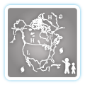
Excessive heat returns for portions of the Plains today where heat indices will likely climb above the century mark. Furthermore, warm temperatures, strong winds and dry fuels may result in rapid spread of wild fires across the western High Plains today. For the east coast, lingering storm with onshore flow will bring high surf, dangerous rip currents and coastal flooding, especially at high tide. Read More >
Philadelphia/Mt Holly
Weather Forecast Office
New Jersey Coastal Waters Model Run
These models forecasts are produced by WFO Mount Holly, NJ, using the NWPS wave models and the Real Time Ocean Forecast System.
NWPS accounts for the following physics:
In here you will see 3-hourly forecast outputs for significant wave height, peak wave direction, peak wave period, and significant swell height (heights in feet and periods in seconds). Our local version of NWPS also uses input from WAVEWATCH III for boundary conditions. NOTE: Significant Swell Height output from NWPS is the average height of the highest 1/3 of the group of waves with periods of 10 secs or longer. |
US Dept of Commerce
National Oceanic and Atmospheric Administration
National Weather Service
Philadelphia/Mt Holly
732 Woodlane Rd.
Mount Holly, NJ 08060
609-261-6600
Comments? Questions? Please Contact Us.


 Coastal Flood
 Marine Forecasts
 Text Products
 Climate Information
 Skywarn
 Submit Storm Report
 Weather Event Archives
 Forecast Discussion
 Emergency Managers
 Briefing Page