| 2018 Weather Highlights | Hydrology/Drought Status | Fire Weather | Records and Extremes | Monthly Highlights | Severe Weather |


|
Monthly Review of Weather Events Across New Mexico in 2018
|
|
|
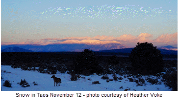
January 2018 was generally warmer and drier than normal. Only the southeast had below normal temperatures, while small of the west approached normal precipitation. The first nine days of the month were mostly dry. After a very cold start to the year, temperatures recovered to above normal by the third or fourth, and remained mild through the ninth. A significant storm system finally arrived on the tenth, bringing snow to the western and northern mountains and rain to the valleys. The east central and southeast plains missed out on the moisture. More dry and mostly above normal temperatures ensued from the 10th through 14th. A strong back door cold front delivered much colder air to the east on the 15th, which spilled into the Rio Grande Valley to the Continental Divide early on the 16th. Light snow and freezing drizzle fell over the northeast on the 15th with dense freezing fog. This made roads especially icy and dicey. Another very weak disturbance brought sprinkles and flurries in the western mountains on the 17th. A significant warm up on the 18th and 19th gave way to a disturbance on the weekend of the 20th and 21st. This was a decent storm with snow across the western and northern mountains and even into the valleys, and strong winds over the mountains and east. Very cold air also settled in on the 21st. The atmosphere settled down again from the 22nd through the end of the month. Temperatures climbed above normal for the most part, aside from a chilly spell on the 26th and 27th. |
|
|
|
February 2018 was warmer than normal over the west and central areas and near normal in the east. Precipitation was near to below normal in the north and east, and above normal in the southwest and south central. A mostly quiet first 9 days of the month with little precipitation and above normal temperatures. We finally received some much needed snow on the 10th into the 11th across the northern half of the state, primarily in the mountains. A break from the 12th to 13th was followed by a nice rain and mountain snow event from late on the 14th through the 15th. Precipitation lingered across the south through the 16th. A more active weather pattern finally set in, with another storm on the 18th into the 20th bringing strong to high winds and some mountain snow. The next storm delivered snow to the northern mountains on the 21st to 22nd. The remainder of the month was quiet aside from gusty winds and critical fire weather conditions. A weak upper level disturbance arrived on the 28th with light rain and mountain snow.
|
|
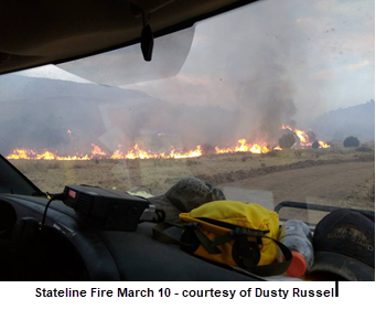
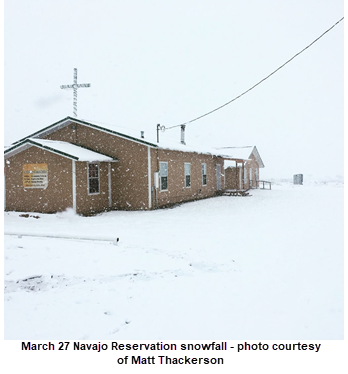
March 2018 precipitation was mostly below to well below normal. Only portions of southwest New Mexico received near normal amounts. Temperatures were near normal in the northwest, above normal elsewhere. A nice warm-up began on the 1st and continued through the 4th, before a cold front brought much cooler air in for the 5th. Strong winds accompanied the front over much of the state. Warmer and dry conditions returned from the 6th through 10th before the next storm delivered much needed rain to western and central New Mexico, and a little snow in the mountains. A disturbance brought a little more snow to the northern mountains on the 14th to 15th, with widespread strong winds. A stronger storm provided Rain, snow, strong winds and colder air to the state from the 17th to 19th. Back to dry and milder weather followed from the 20th through 25th. The final storm of the month on the 26th to 27th only produced mostly light rain and mountain snow. A quick hitting weak disturbance late on the 28th into early on the 29th delivered a little snow to the Sangre de Cristo Mountains and Northeast.
|
 |
|
|
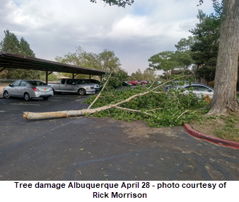
April 2018 was largely warmer and drier than normal. The exception was the eastern plains, which experienced below normal temperatures. The first week of April brought virtually no precipitation. Western and southern area temperatures were above normal, while back door cold fronts sent temperatures fluctuating wildly in the northeast, with below normal temperatures after it was all said and done. Strong to high winds struck on the 8th, with a little rain and snow across the north. The next round of wind and precipitation was more impressive, especially the wind. High and damaging winds were reported on the 12th and 13th. Much colder air blasted into New Mexico on the 13th. Rain and higher elevation snow fell over primarily the northern half of the state. More strong to high winds whipped through the state on the 17th through 19th. Quiet weather was observed from the 20th through 23rd. A potent back door cold front moved down the eastern side of New Mexico on the 24th and spilled into the Rio Grande Valley during the evening, delivering strong winds. Showers and thunderstorms impacted western and central New Mexico on the 28th, then shifted to the east on the 29th, with a few of the storms turning severe around Clovis. |
|
May 2018 was warmer and drier than normal. The first half of May was rather quiet. There were strong winds and a little bit of rain over the first 3 days of the month, then more strong winds on the 11th and 12th. A little rain and hail fell in northeast New Mexico on the 15th. The second half of the month was a little more active. Strong winds were noted on the 18th, then minor rain and hail fell in the east on the 19th. A more widespread rain and hail event was observed on the 21st to 22nd, then a major outbreak of severe weather pounded the east on the 23rd. Quiet, dry, and very warm weather ensued for the last week of the month. |
|
|
|
June 2018 produced above to well above normal temperatures, while precipitation was mixed. The western half of the state was mostly near to above normal, while the east was generally near to below normal. Widespread severe weather was reported on the 3rd, including large hail and a couple of tornadoes. Aside from that, it was quiet through the first 12 days of the month. There was isolated large hail and strong winds in Union County on the 7th. Hot and mostly dry weather was the rule from the 8th through 11th. Isolated severe weather impacted the east on the 12th through 14th. The big event of the month was the remnants from Hurricane Bud that moved through New Mexico on the 15th through early on the 17th. The tropical moisture dumped copious amounts of rain over most of the state. But, the good news was it fell over a long enough period of time that no flash flooding was reported. Thunderstorms and their downpours were held to a minimum. It was quiet from the 18th through 20th. Isolated severe weather developed during the early morning hours of the 21st in Union County. A bigger outbreak of severe storms occurred on the afternoon of the 22nd. Golf ball size hail east of Folsom and a tornado north of Mount Dora were the top stories. Other than large hail near Des Moines on the 24th, the final week of June was rather benign.
|
|
July 2018 was generally warmer than normal across New Mexico, while precipitation was mixed. A swath from southwest to northeast had above normal precipitation, while remaining areas had near to below normal precipitation. July was an active month overall, especially the second half of the month, with significant severe weather outbreaks on the 15th, 23rd and 30th. |
|
|
|
August 2018 was mostly warmer than normal, with near to below normal precipitation, except for parts of the eastern plains that were above normal. The month began with a bang as large hail pummeled portions of northeast New Mexico. Other active periods included the 7th-9th and 18th to 19th. A severe thunderstorm in the Rio Rancho/Albuquerque area on the 23rd produced flash flooding and wind damage. The remainder of the month was more tranquil |
|
August 2018 was mostly warmer than normal, with near to below normal precipitation, except for parts of the eastern plains that were above normal. The month began with a bang as large hail pummeled portions of northeast New Mexico. Other active periods included the 7th-9th and 18th to 19th. A severe thunderstorm in the Rio Rancho/Albuquerque area on the 23rd produced flash flooding and wind damage. The remainder of the month was more tranquil
|
|
|
|
October 2018 produced temperatures pretty close to normal statewide. The far west and east tended to be a little below normal while central areas were a bit above normal. Precipitation was near normal in the west, above normal central and well above normal in the east. Albuquerque, Clayton and Roswell were all within the top 15 wettest Octobers on record. The first half of October was exciting across the land of Enchantment with tropical moisture, strong cold fronts, high winds and snow all impacting portions of the state. The first significant storm impacted the state from Friday night, October 5th into Tuesday the 9th. A couple of back door cold fronts brought much chillier air to the east, and cooling to the west during this time. Meanwhile, a deep upper level closed low was taking shape over the Great Basin. It moved slowly east, gradually weakening and lifting northeast. Widespread showers and some thunderstorms erupted over NM, Dime size hail was reported near Roswell on the 6th and high winds from a thunderstorm hit Clines Corners on the 7th. Moisture from the remnants of Hurricane Sergio delivered welcome rain to southern portions of the state late on the 12th into the 13th. From tropical moisture to winter weather took place on the 14th through 18th. A powerful back door cold front, deepening storm system from the northwest, and developing storm to our west all combined to bring cold air, rain and northern high terrain snow to the state. A very wet storm system spilled widespread rain and high northern mountain snow onto NM from the 22nd through 24th. Another impressive storm closed out the month with widespread rain and mountain snow on the 30th into the early hours of Halloween. |
|
November 2018 was drier than normal across virtually all of the state, especially the southeast half. Temperatures were mostly below normal. The Halloween storm moved away from New Mexico at the start of November. It was fairly quiet through the first 10 days of the month. An impressive storm delivered snow and cold temperatures to northern and eastern NM on the 11th into the 12th. Over a foot of snow fell in the Sangre de Cristo Mountains and up to 10 inches fell around Tucumcari. The weather settled down again from the 13th through 28th, with only isolated high winds reported on the 22nd and 24th. The final day of the month turned more active with modest snow in the northern mountains and strong winds across the east on the 30th. |
|
|
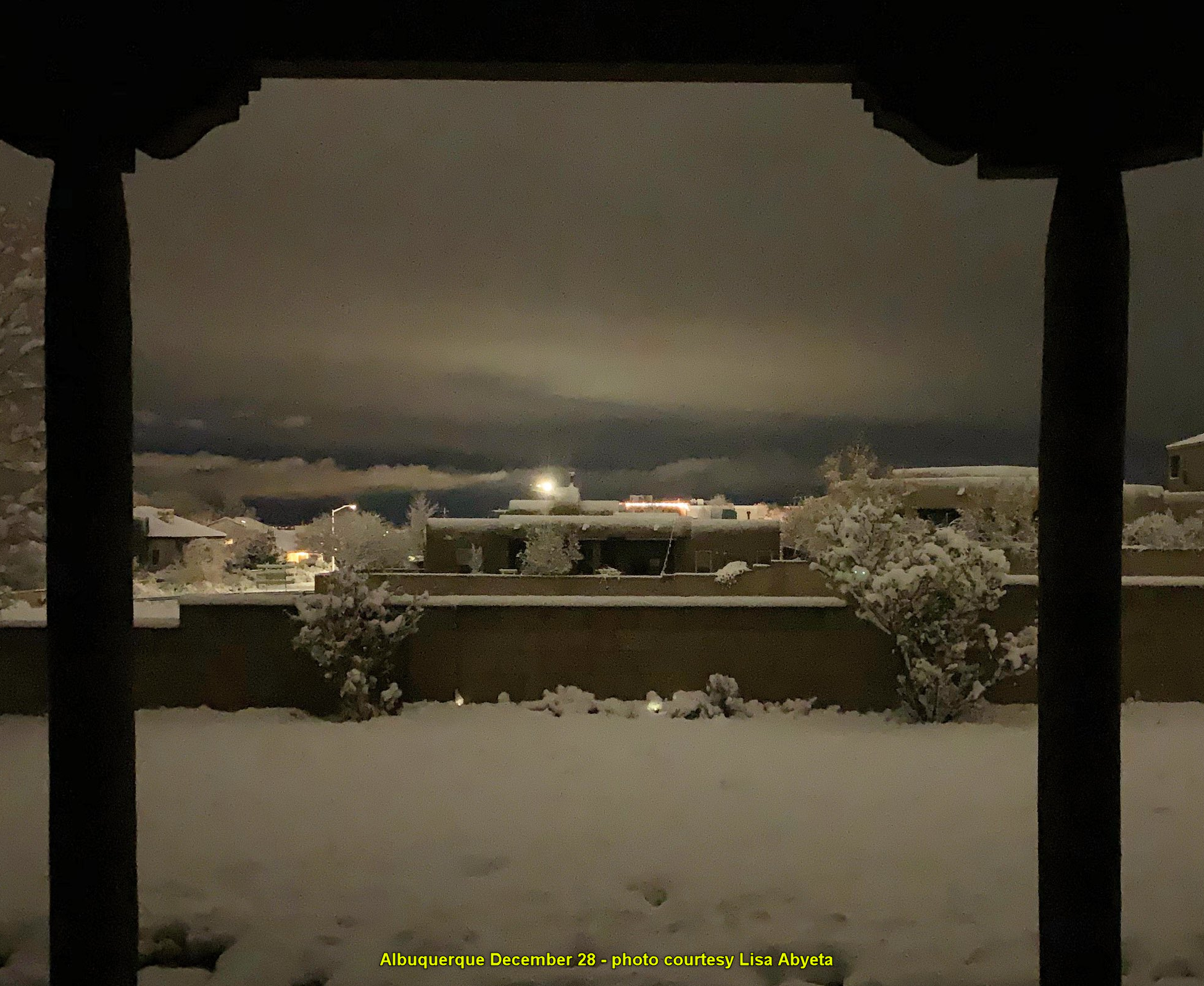 Albuquerque December 28th - photo courtesy Lisa Abyeta |
December 2018 was warmer than normal, although the month ended very cold. Precipitation was varied but not too far from normal in either direction. Two minor to moderate snow events occurred on the 2nd and 7th to 8th. Strong to high winds blasted much of the state on the night of the 12th and across the east on the 13th. It was pretty quiet from the 14th through 24th, with only one storm that brought some rain and high elevation snow over southern New Mexico late on the 17th into the 18th. The final week of December was extremely active as a major winter storm slammed New Mexico on the 27th through 28th. Another big storm arrived on New Year's Eve.
|
| (Return to the main page) |


.png)
.png)
.png)

.png)
.png)