2017 was a noteworthy year weatherwise across the lower Mid-Atlantic region. The year began...and ended...on a cold note, but overall, the year will be remembered for a handful of heavy rainfall events, as well as several noteworthy severe weather events. There was one impressive winter weather event, as well as increased tornado activity for the year. After a poll of the staff of NWS Wakefield, these are the 10 events that stood out the most.
|
Top 10 Local Weather Events for the Year 2017 |
|||||
|
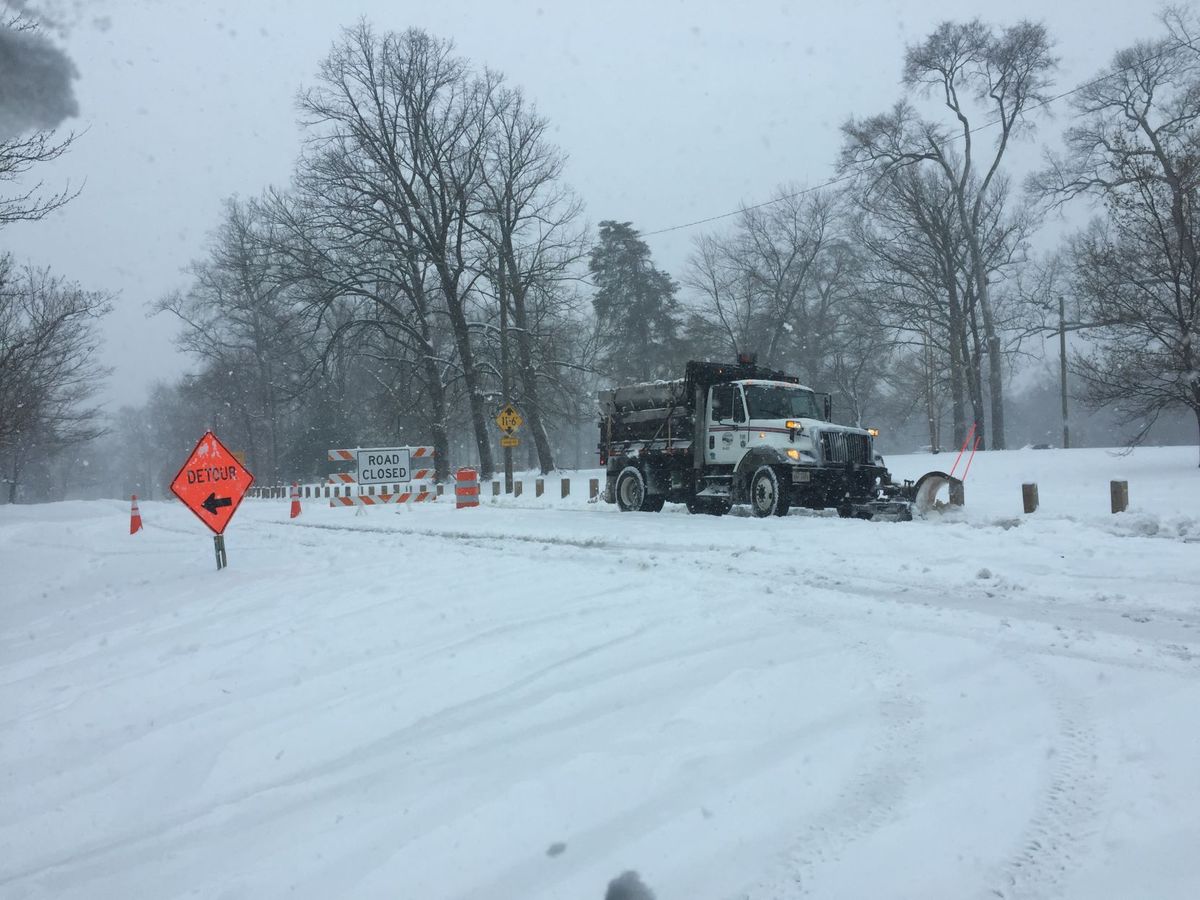
Strong low pressure moved along the east coast, spreading moderate to heavy snowfall across much of the region. Gusty winds created blizzard conditions along parts of Hampton Roads into Central Virginia. Bitterly cold air move in behind the system for the 8th and 9th. High temperatures in the 20s were noted across much of the area from the 7th through the 9th, with lows near or below zero away from the coast January 8th and 9th.
Photo: Richmond Times-Dispatch |
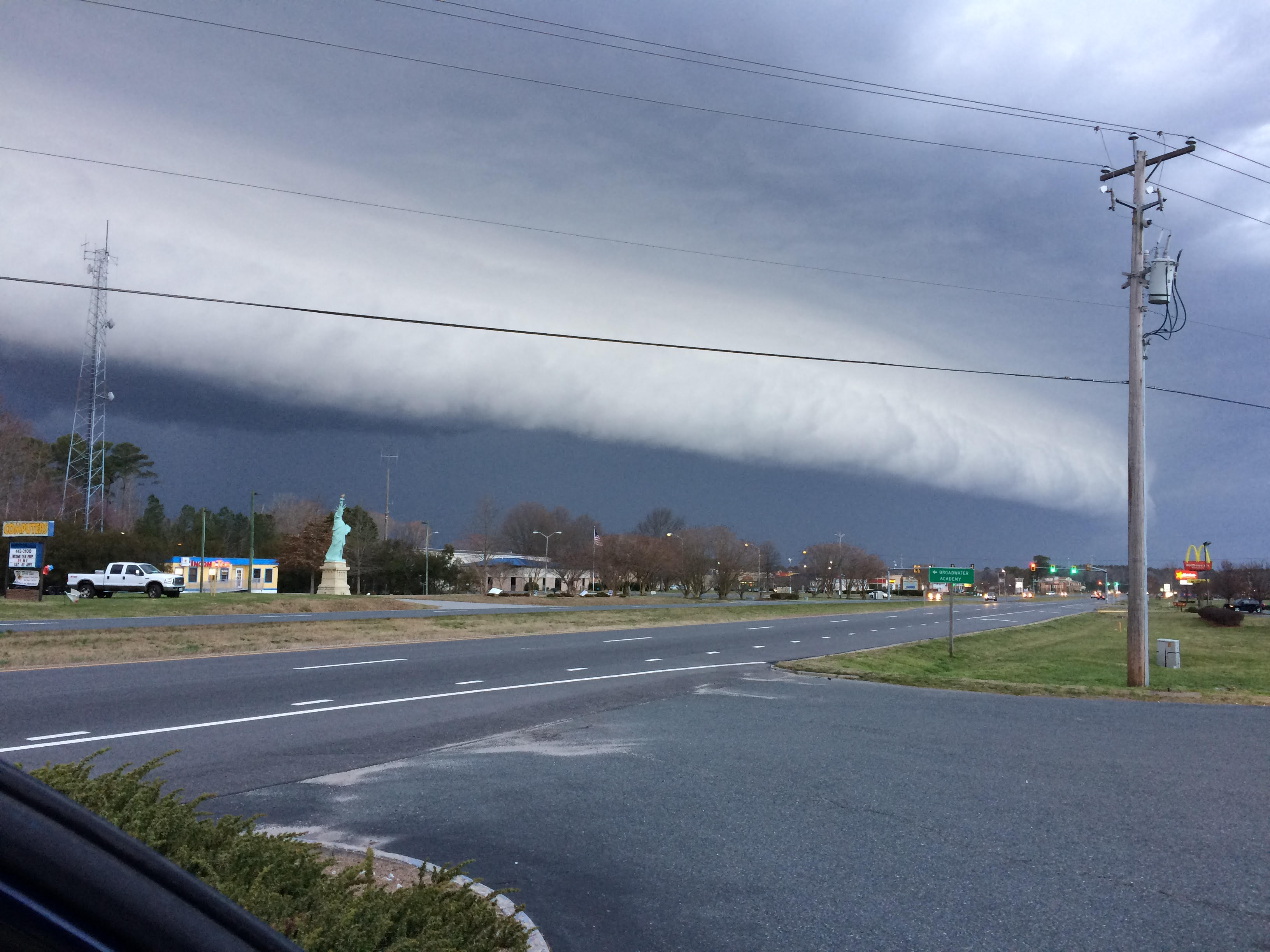
2. February 25th Hail/Wind event A strong area of low pressure lifted across the Great Lakes into Ontario. The associated strong surface front swept through and set off a round of strong to severe storms. Numerous reports of damaging winds and large hail were received across central and eastern Virginia on the afternoon and evening of February 25th.
|
||||
|
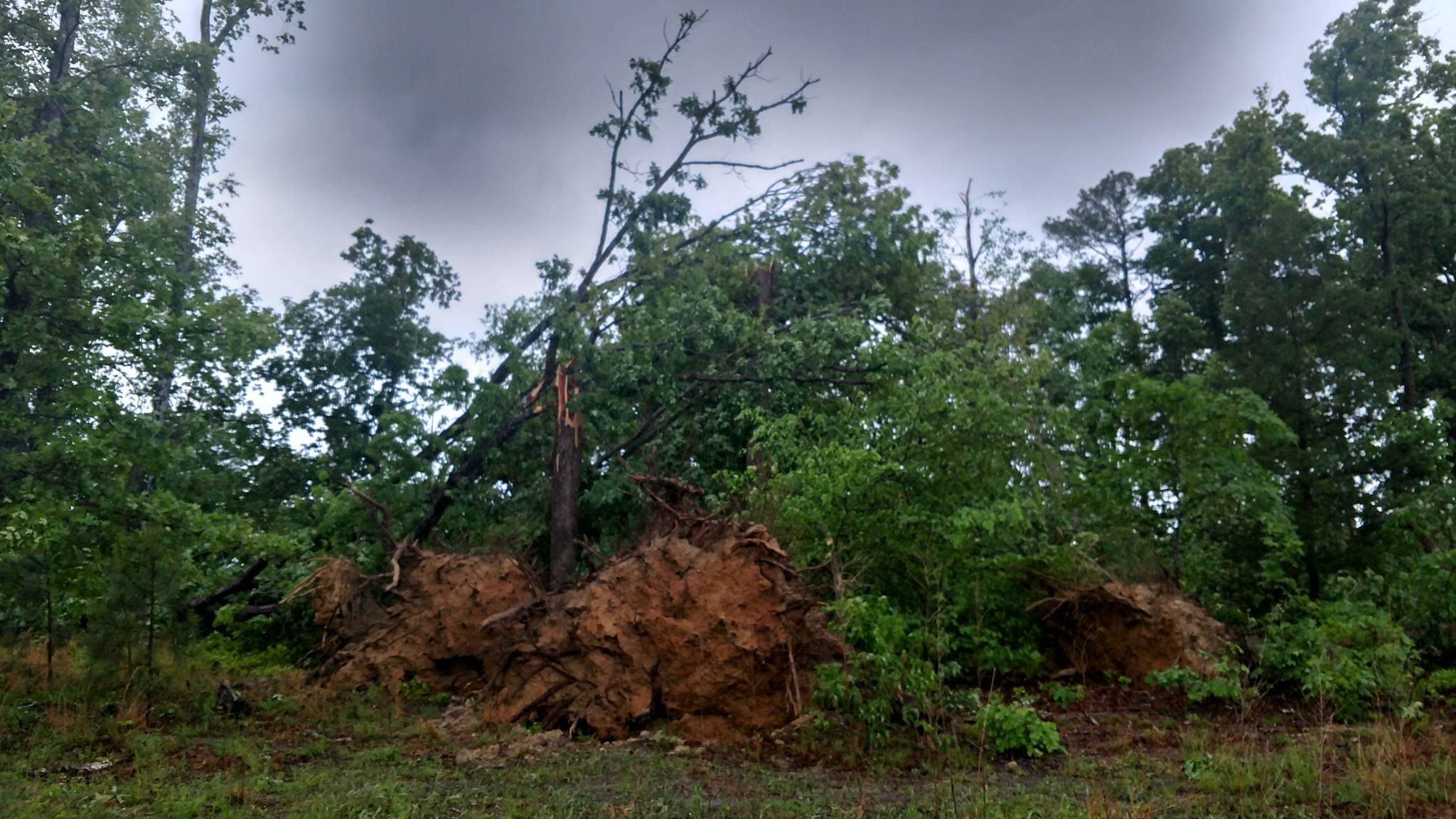
3. May 5 Severe Weather Early morning convection slid across the eastern Virginia Piedmont in the early morning hours of May 5th, in association with a warm front lifting across the region. Numerous downed trees were reported with 7 confirmed EF0/EF1 tornadoes over NE North Carolina and south-central Virginia.
Photo: Joe Jackson |
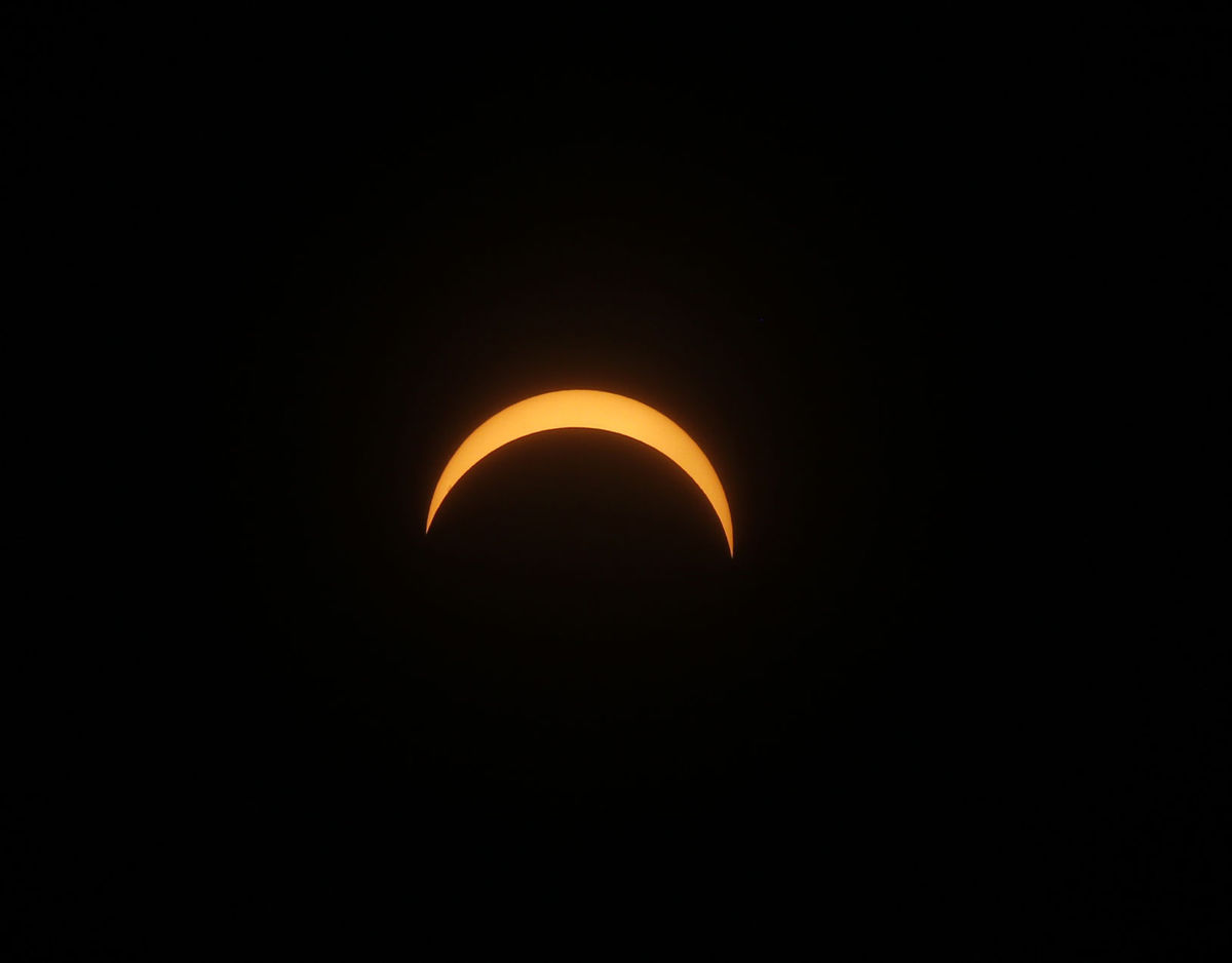
Residents of the lower Mid-Atlantic were treated to a partial eclipse on the afternoon of August 21st. While we were not in the path of totality, some beautiful, eerie views were enjoyed across our area. The picture below was taken at the Ginter Botanical Garden in Richmond.
Photo: Lewis Ginter Botanical Garden, Richmond |
||||
|
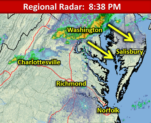
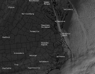
A potent area of low pressure lifted across the Ohio Valley into the northeast. The associated surface cold front swept through the area, bringing a round of severe weather to the Tidewater area into northeast NC. Numerous reports of large hail were received from the Southampton/Franklin/Chesapeake areas, with 4 confirmed tornadoes, fro Suffolk to Chesapeake and Virginia Beach down into Bertie County, NC.
Photo: NWS Wakefield
|
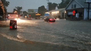
6. Mid to late July Heavy Rains (mainly E VA/MD Eastern Shore) A persistent warm and humid airmass, along with several rounds of heavy rainfall, brought some hefty rainfall amounts to the lower eastern shore of Maryland and E VA through the latter half of July. The first heavy rain event occurred on the evening of July 14. Another round of heavy rainfall occurred on the evening of the 22nd and 23rd of July, with the 3rd round of heavy rainfall on the 28th, in which 3-6" of rainfall fell across the region. Salisbury Airport (SBY) received more than 11" of rain during the month of July, which was good enough to secure the distinction of the wettest July on record at SBY.
Photo: Mike Seidel |
||||
|
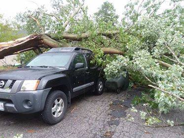
7. August 7-8 Heavy Rainfall and Severe Weather Multiple lines of storms marched across Central Virginia toward the Delmarva, bringing another round of heavy rainfall to central and Eastern Virginia, over to the eastern shore of Maryland. 3 to 6 inches of rainfall occurred across the local area, with numerous reports of wind damage confirmed over the northern neck and eastern shore. An EF1 tornado was confirmed in Salisbury on the evening of the 7th near the campus of Salisbury University.
Photo: April Jackson |
8. August 12 Heavy Rainfall (mainly MD/ E VA/ NE NC) After a very wet month of July, and an event just a few days prior, the last thing the eastern shore needed was another heavy rain event. But that's exactly what occurred, thanks to convection erupting out ahead of an approaching cold front. A line of training thunderstorms moved across the lower eastern shore of Maryland, bringing another 3 to 6 inches of rainfall to the coastal plain of E VA, NE NC, and the lower Maryland Eastern Shore. A CoCoRaHS observer in Parsonburg, MD reported more than 7.5" inches of rain on the night of the 12th into the early morning hours of the 13th!
|
||||
|
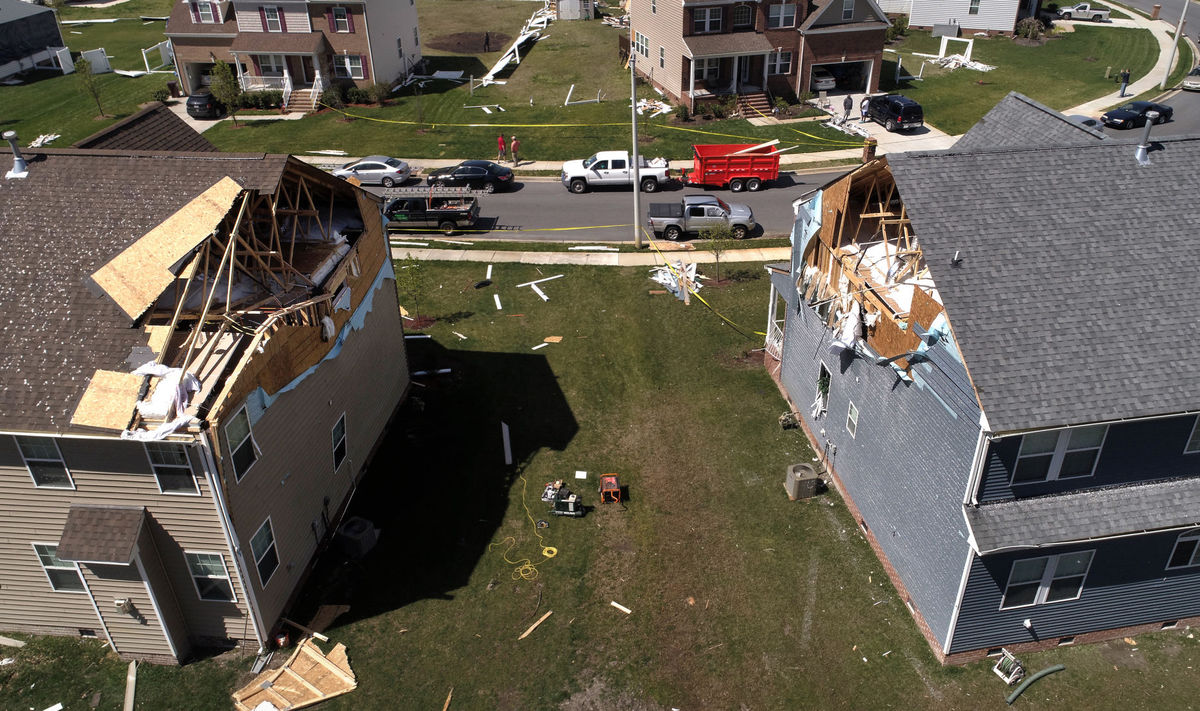
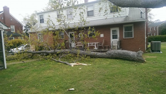
Numerous thunderstorms erupted in the warm sector ahead of an advancing cold front in the late morning and afternoon of April 6th. Scattered wind damage was reported across the region, with 2 tornadoes confirmed in Lancaster, and the cities of Chesapeake. Some particularly strong straight-line winds at Sandbridge (Virginia Beach) were also surveyed in the aftermath of these storms.
Photo: WAVY-TV |
10. 2017 Closes on a cold note! Record low Max temperatures were recorded at Richmond, Salisbury and Elizabeth City on December 29th, with temperatures well below normal from the 26th through 28th. There was even a few relatively rare Bay Effect Snow Showers on the morning of the 28th. The highs on the 28th represented highs about 2 standard deviations below normal!
|
||||


 Coastal Flood
 Heat
Heat 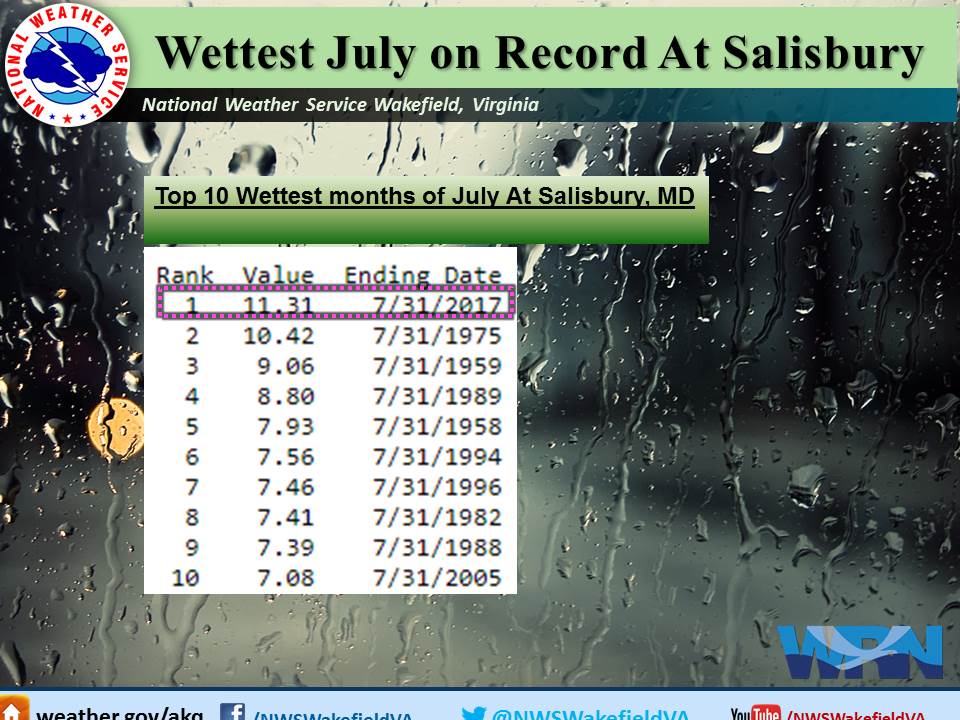