Overview
|
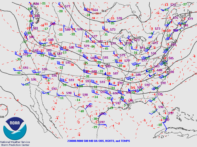
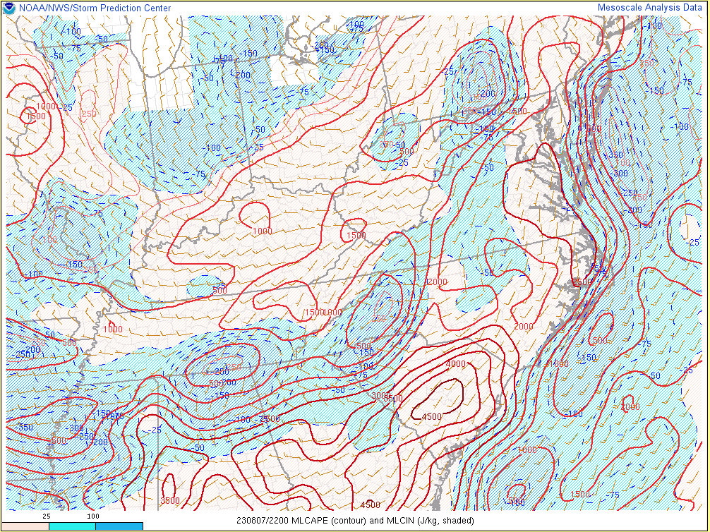
On Monday, August 7th, 2023, an anomalous trough (for early August) moved from the Upper Ohio Valley to the Mid-Atlantic. Embedded within the trough was a pair of 500-mb speed maxima of around 50 knots. One over the Mid-South and the other from eastern Kentucky and Tennessee into western Virginia and North Carolina. Notably, a 300mb jet became divergent over Virginia/North Carolina with a maxima of 70 knots at 00z (8 pm) over far southwest Virginia. At the surface, winds were generally southerly over the local area and southeasterly from northern Virginia north due to a warm front lifting into Pennsylvania and New York. In the wake of morning convection, clouds cleared with stratus (due to warm air advection) lingering into the early afternoon to the lee of the mountains in the Piedmont. This led to MLCIN (aided by a weak EML around 900 mb). MLCIN eroded everywhere by the mid-afternoon with the most persistent area in north-central North Carolina. This CIN in the southern Piedmont into north-central North Carolina likely aided in the split of storms to the north (where the greater forcing was located) and to the south (where the greater CAPE was located). This area tends to see splits like this in situations where forcing lifts north while convection in the Carolinas cuts off the inflow for central Virginia. Once the sun came out, the radiative heating allowed for a deepening of the lee trough, aided by the large scale trough approaching the area. By mid-afternoon storms initiated over the mountains of western Virginia and gradually moved east-northeast.
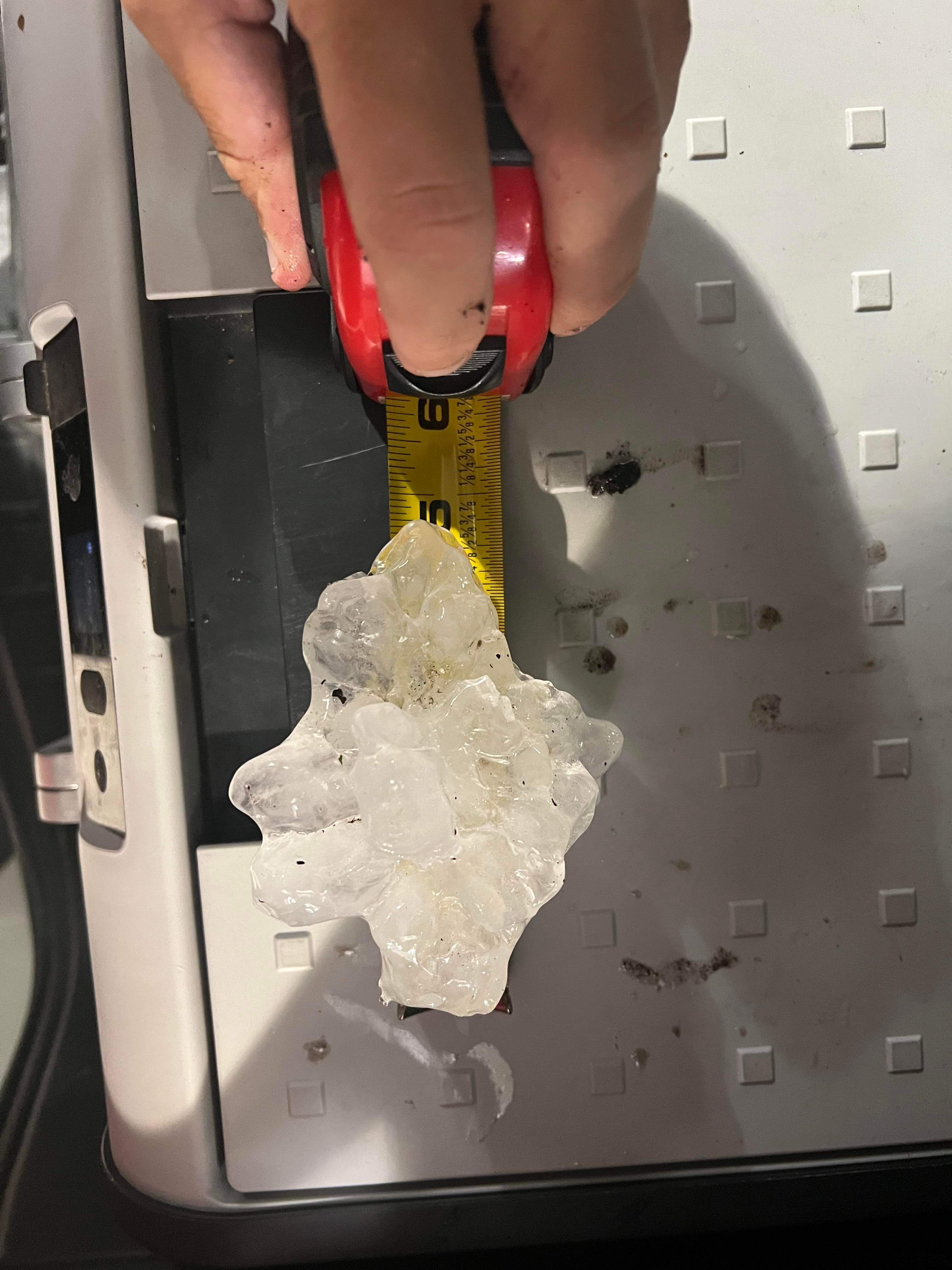
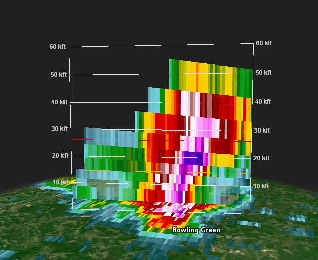
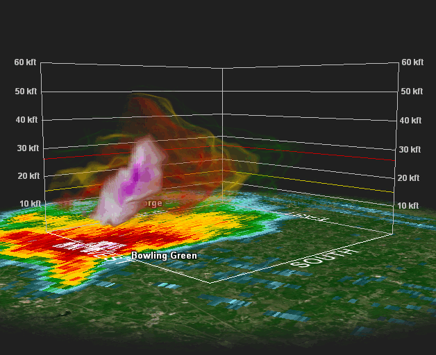
A supercell developed over Bath County just after 3 PM, quickly becoming severe warned. This supercell moved northeast before turning right in Augusta County. From this point on, this supercell moved East-northeast, passing north of the city of Charlottesville in Albemarle County. This initial supercell produced 3” (baseball sized) hail in Augusta County and 2.5” (tennis ball sized) hail in Albemarle County. Meanwhile, a second storm developed over southwestern Nelson County at 4 PM and moved northeast into northwestern Louisa County. This storm stayed rather weak, splitting in Albemarle County. The left split merged with the initial supercell north of Charlottesville while the right split struggled until it reached Louisa County. The Louisa storm quickly strengthened and became a supercell as it approached Route 33 around 5:50 PM. The supercell exhibited a BWER (bounded weak echo region) just after it crossed Route 33 with a VROT of 39 knots. At this point, a tornado warning was promptly issued for Louisa. The supercell continued to move east-northeast while the low level mesocyclone moved east-southeast. Part of the reason for this is because the storm finally began merging with the now two storms to the north (including the initial supercell). The rotation peaked at 5:59 PM with a VROT of 42.7 knots gate-to-gate but did not produce a tornado. The cell merger completed over Spotsylvania County as it began to exhibit the classic kidney bean supercell structure on reflectivity as cloud tops reached 55,000 ft tall. Broad rotation continued to be evident aloft with another tornado warning issued for Caroline County. The VROT aloft (1.3 degree tilt) peaked at 47 knots. A wall cloud and funnel was spotted from a storm chaser, however, the hook never tightened enough for a tornado. As the powerful supercell approached Bowling Green, the hook continued to weaken and it became apparent that the near-term tornado threat was over. However, the supercell remained a very impressive 55,000 ft tall and reflectivity took on a flying eagle (V-notch) structure. At its peak near Bowling Green, 48 dbz reached 50,000 ft, 62 dbz reached 40,000 ft, 66 dbz reached 35,000 ft, and 70 dbz reached 27,000 ft. For reference, the freezing line (0 C) was 15,000 ft with the -20 C line at 26,000 ft. This is very impressive for a Mid-Atlantic storm. MESH reached around 3” with MRMS hail estimates of 2.09”. As such, the severe thunderstorm warning was upgraded to a considerable tag with 2” hail in the warning. However, not even the MESH (which commonly overestimates hail size) was close to how large the hail actually got. Several 4-4.5” giant hailstones were found just south of Fort A.P. Hill with one hailstone measuring in at a whopping 4.75”. This is the largest hailstone ever found in our CWA and the 3rd largest ever in the state of Virginia. The largest hailstone ever recorded in Virginia was 5” recorded both on April 23rd, 1968 in Lee County and July 2nd, 1968 in Loudoun County. That makes this the largest hailstone measured in Virginia in 55 years and the first time since May 9th, 2003 (in Sussex County) that our region recorded a hailstone greater than 4” in diameter. A truly remarkable event.
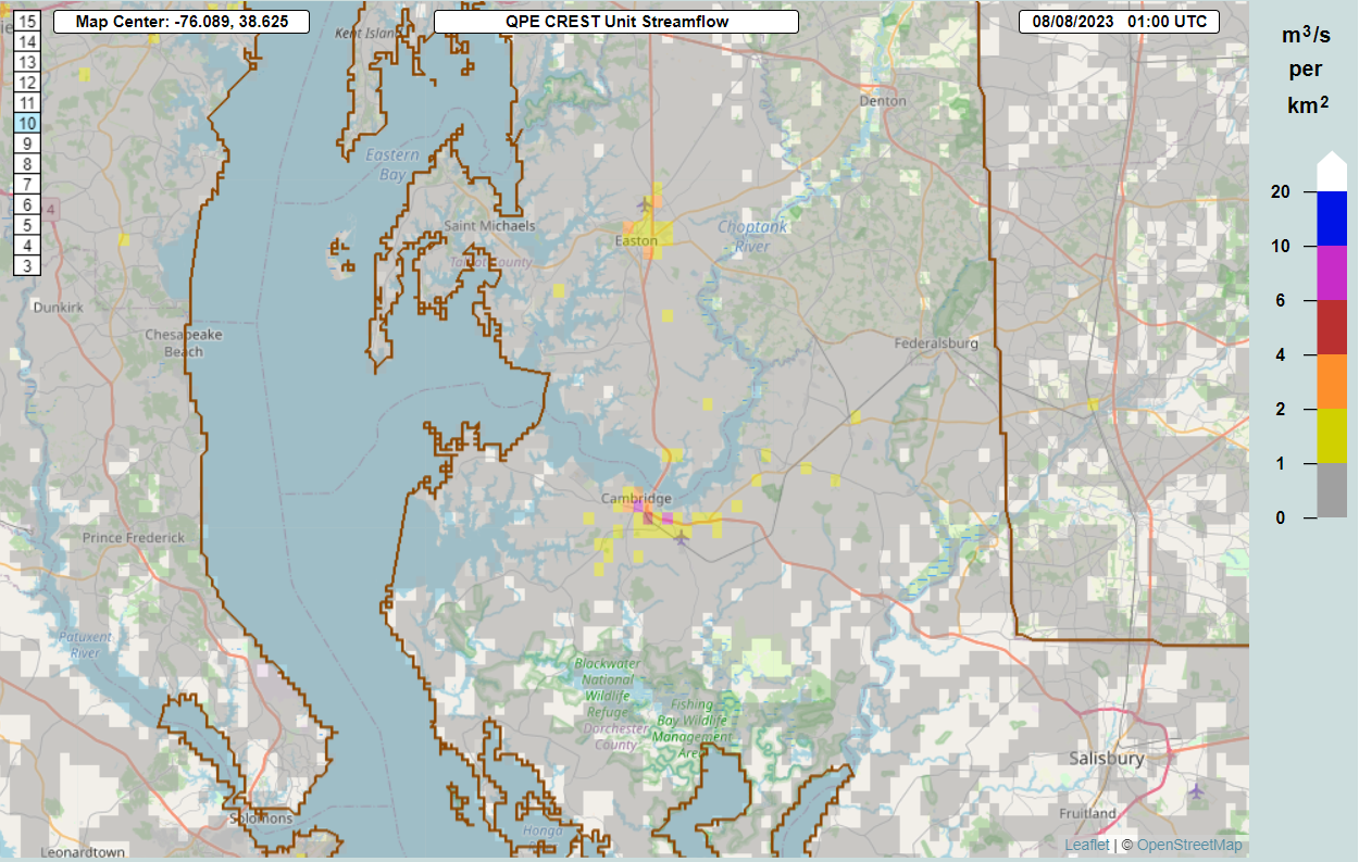
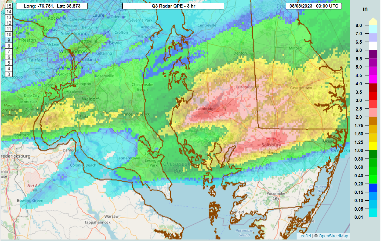
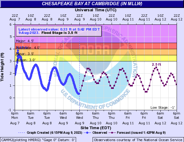
Additionally, very heavy rain fell across the Maryland Eastern Shore due to training storms which resulted in significant flash flooding in Cambridge. MRMS estimates of 2.5-3.0” of rain fell within three hours in Wicomico County (including Salisbury) and 3.5-4.0” of rain in Dorchester County around Cambridge. A Flash Flood Emergency was issued for Cambridge due to knee to waist deep water along portions of Washington Street and numerous road closures requiring multiple swift water rescues around Cambridge. Flooding also occurred in Wicomico with two cars stranded. Additionally, a mesonet station in Cambridge measured 4.11” of rain between 8 and 11 PM with 3.55” of that total occurring in just one hour between 8 and 9 PM. |
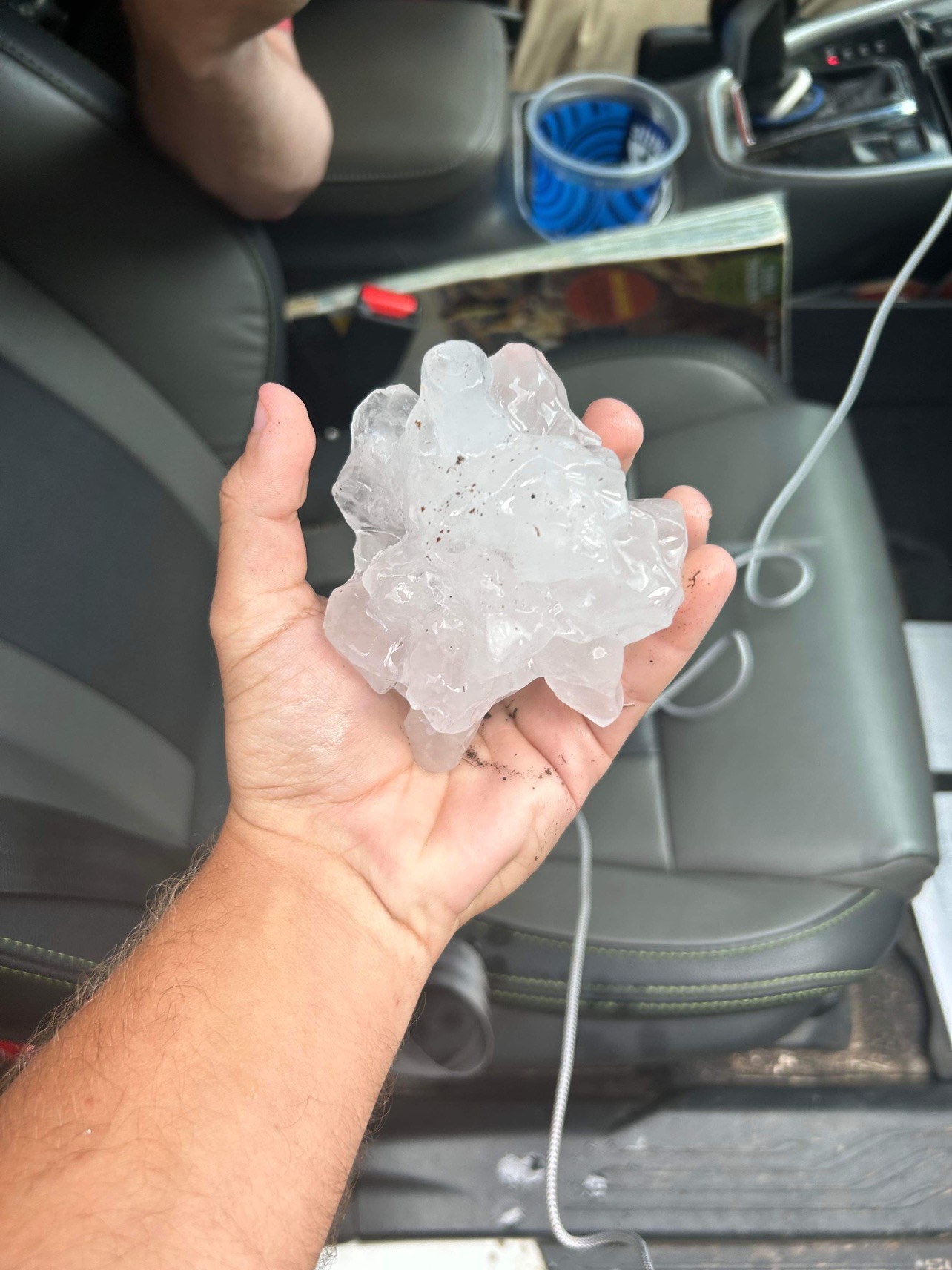 Harry Thomas holding the giant hail |
Wind & Hail:
Hail
Storm chasers were able to follow behind the storm and retrieve several giant hailstones measuring between 4-4.75" in diameter just south of Fort Walker (formerly known as Fort A.P. Hill).
|
 |
 |
 |
| Harry Thomas Holding the Giant Hail | Measurement of the 4.75" Hail | Multiple Giant Hailstones | Cody Poche's View of the Storm From Richmond, VA |
Flooding
Flooding was reported in Dorchester and Wicomico counties with the worst flooding in Cambridge where a Flash Flood Emergency was issued with numerous road closures and swift water rescues taking place. Cambridge measured 4.11” of rain between 8 and 11 PM with 3.55” of that total occurring in just one hour between 8 and 9 PM. Additionally, the hydrograph at Cambridge (CAMM2) briefly reached minor flood stage on the evening of August 7th, potentially indicating that the flooding was due to a combination of tidal flooding and very heavy rainfall.
MRMS Data/Hydrograph
 |
 |
 |
| MRMS FLASH Guidance | MRMS Rainfall Estimates | Cambridge Hydrograph Showing Flood Stage |
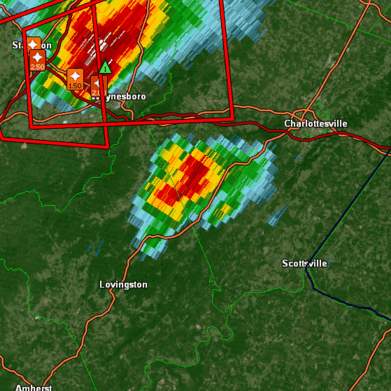
Radar
Cross Sections
|
|
 |
 |
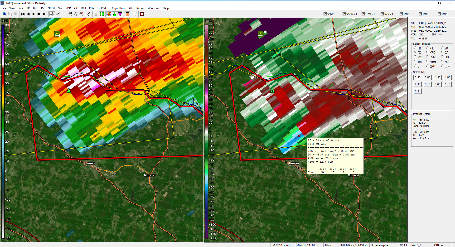 |
| Radar Loop | 2D Scan | 3D Radar Loop | Peak Rotation In Louisa |
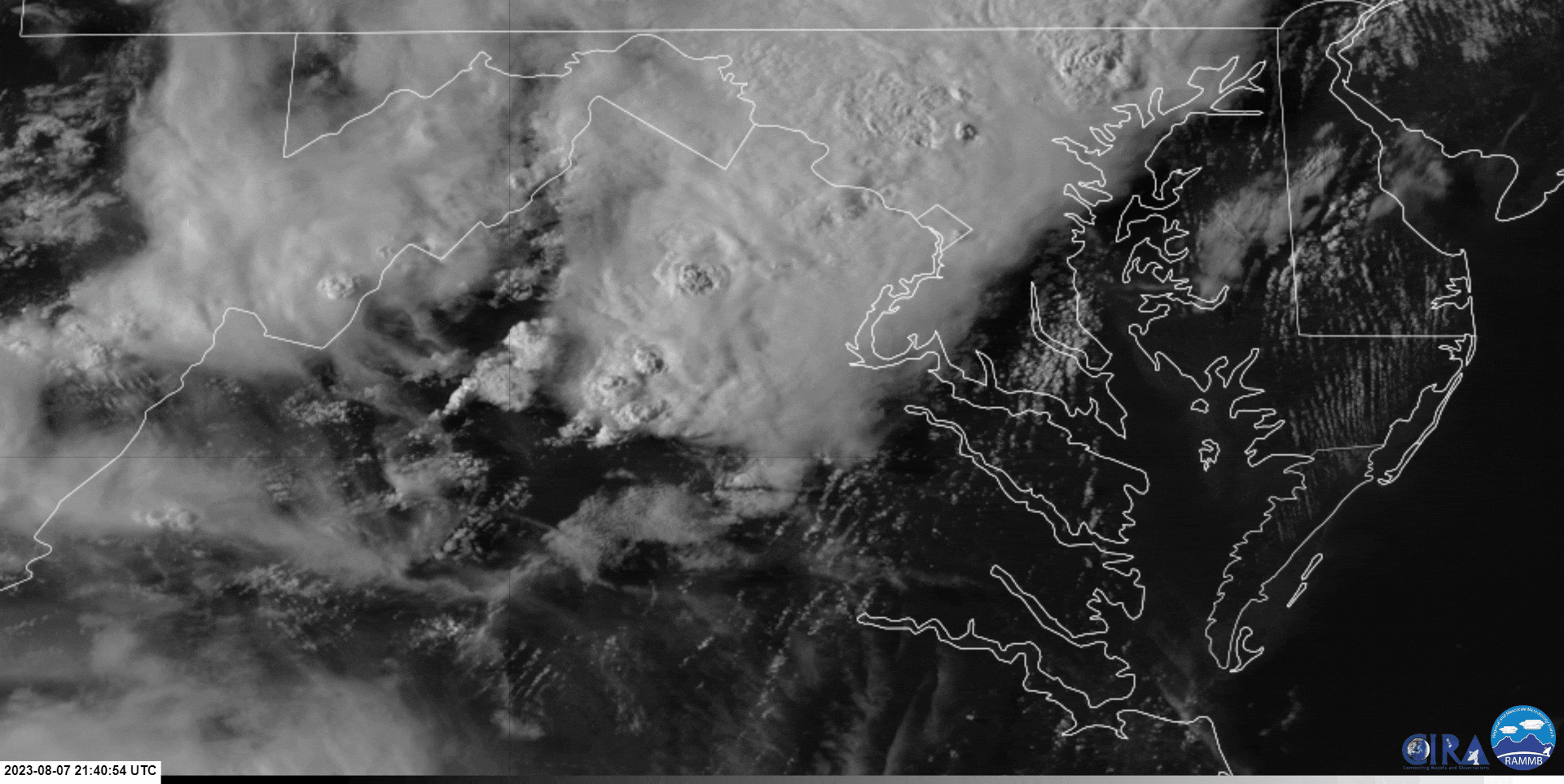
Satellite
|
|
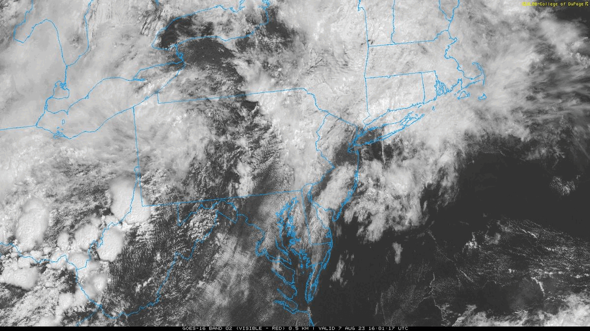 |
| Satellite Loop (Zoomed) | Satellite (Wide View) |
Environment
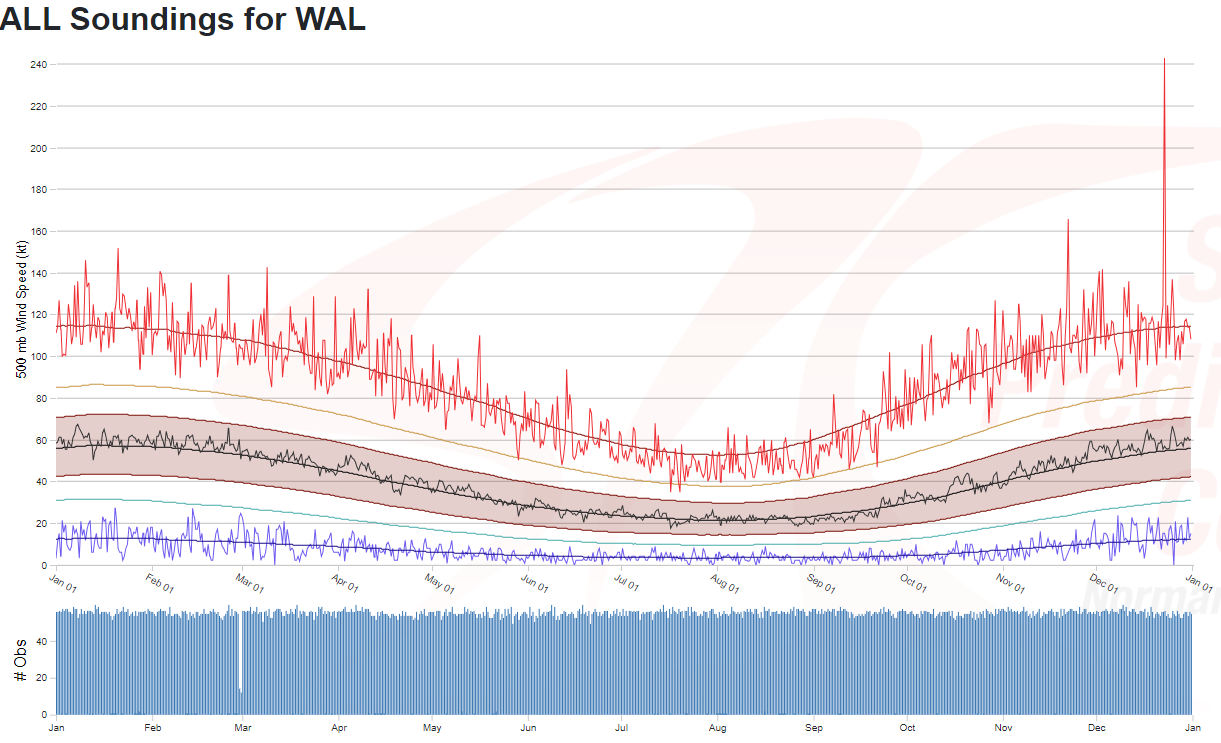
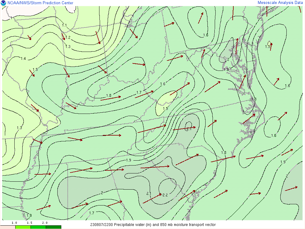
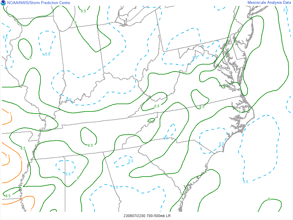
An anamalously strong trough for early August moved into the area, bringing some of the strongest 500mb winds to the region seen in early August (when climatologically, the 500mb wind speeds are at an annual low). The split in PWATs seen below is indicative of the split in regions of convection with the greatest forcing (and associated PWATs) lifting north while the greatest moisture remained south in the Carolinas. The supercell developed in the region in between both areas of convection (and on the southern end of the northern forcing) which allowed it to remain discrete in an area of weak capping. This plus dry air entrainment and 6.5 degree Celsius mid-level lapse rates helped the supercell to remain mostly LP (low precipitation) and allowed hailstones aloft to avoid early melting as the core of the storm was mainly hail instead of hail mixed with heavy rain (which melts the hailstones more quickly before they reach the ground). Ultimately, this sweet spot from a synoptic and mesoscale perspective allowed for the largest hail in 55 years to fall over Caroline County.
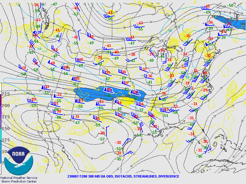 |
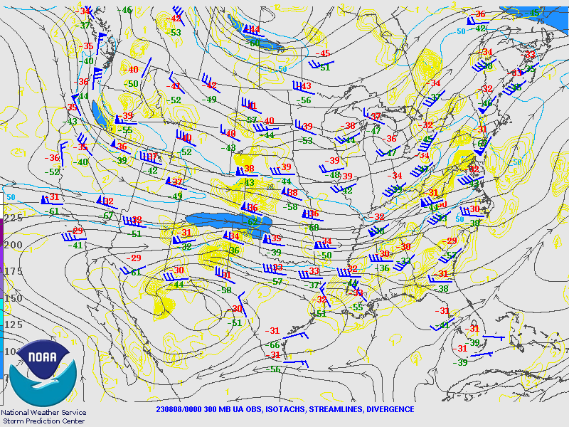 |
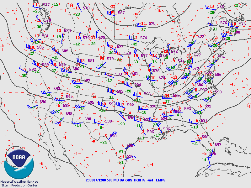 |
 |
| 12z 300mb | 00z 300mb | 12z 500mb | 00z 500mb |
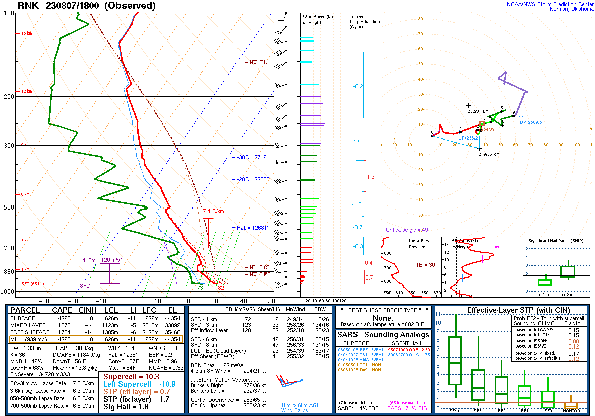 |
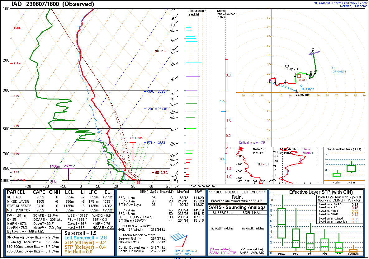 |
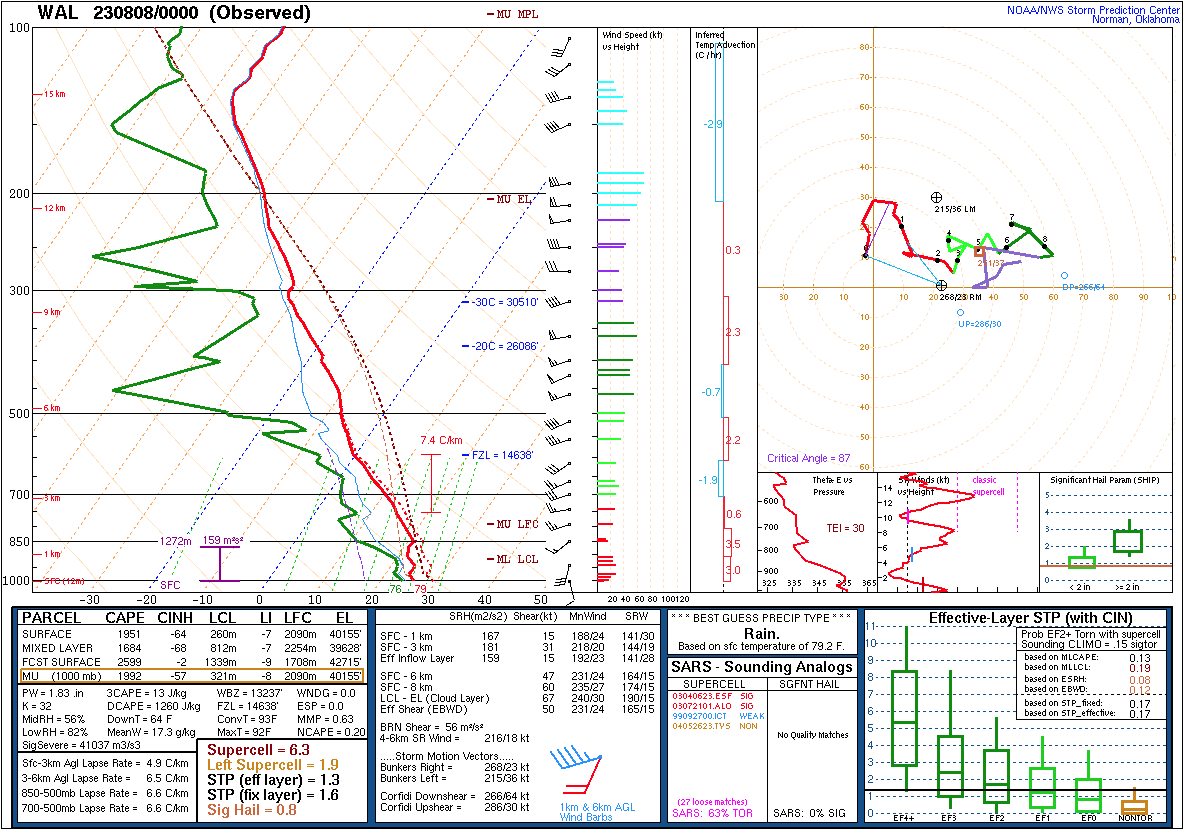 |
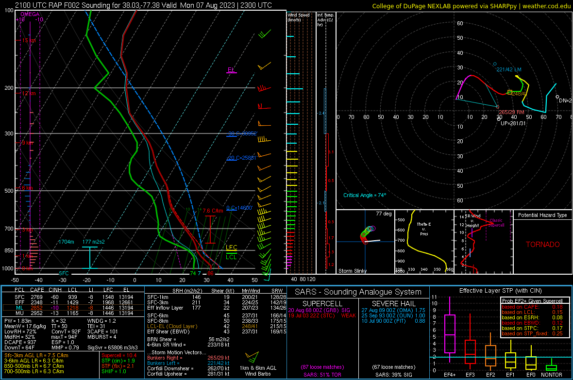 |
| 18z RNK | 18z IAD | 00z WAL | 21z RAP Proximity Sounding Valid 23z |
 |
 |
 |
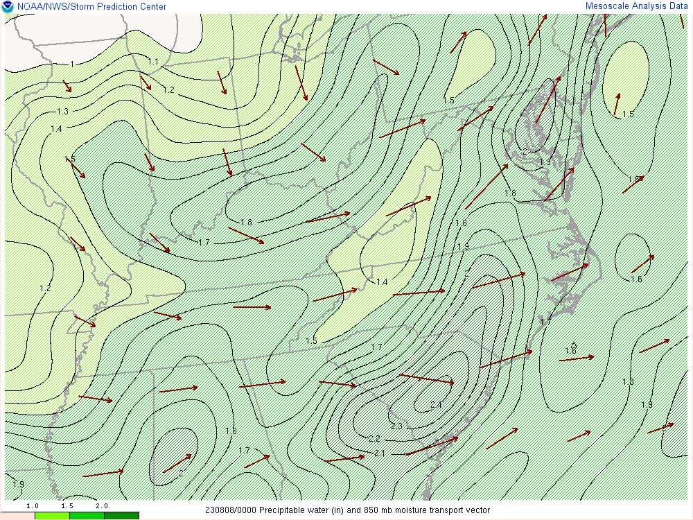 |
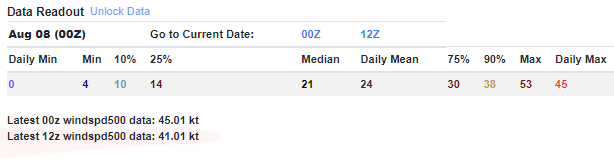
| WAL 500mb Wind Speed Climatology | WAL 500mb Daily Wind Speed Climatology Valid 00z August 8th | 22z PWATs | 00z PWATs |
 |
 |
 |
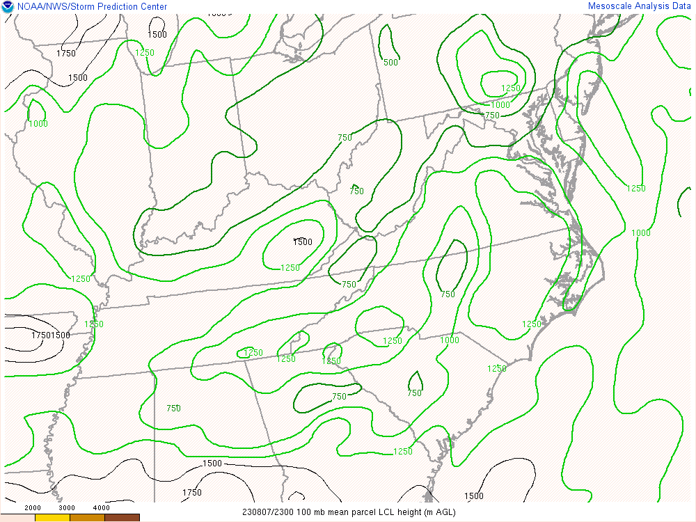 |
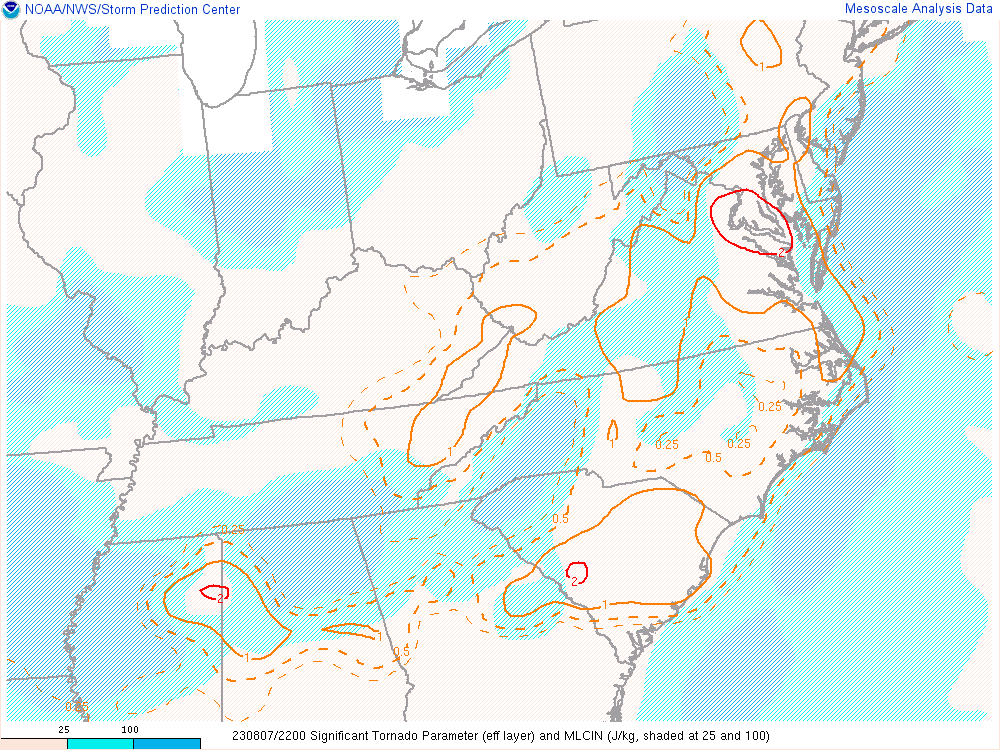
| 22z 700-500mb Lapse Rates | 22z MLCAPE | 22z STP | 23z LCLs |
 |
 |
 |
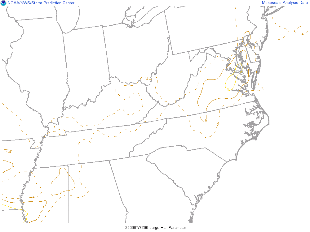 |
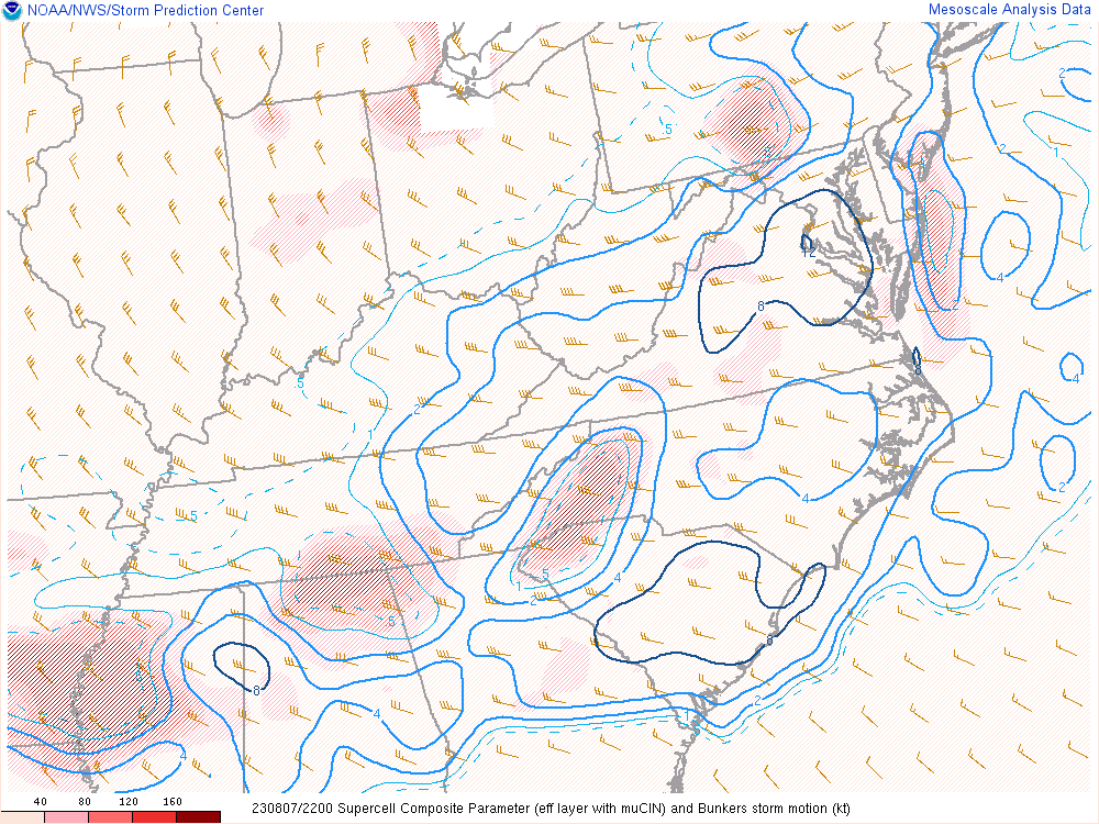
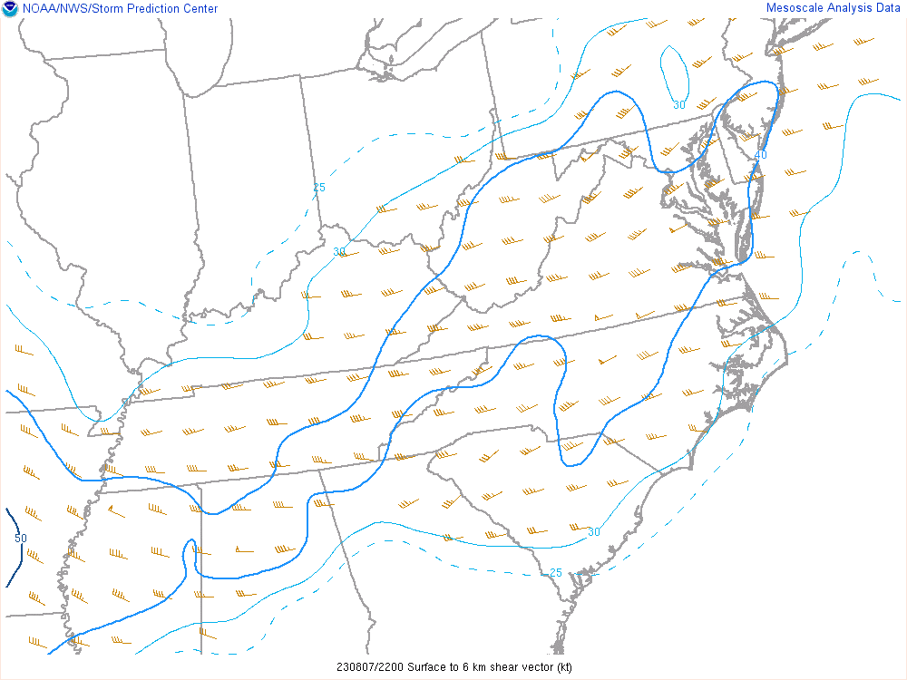
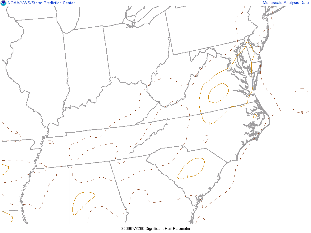
| 22z Supercell Composite | 22z 0-6km Shear | 22z Sig Hail | 22z LHP |
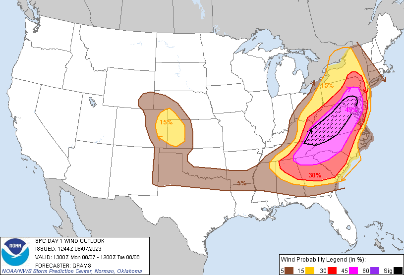
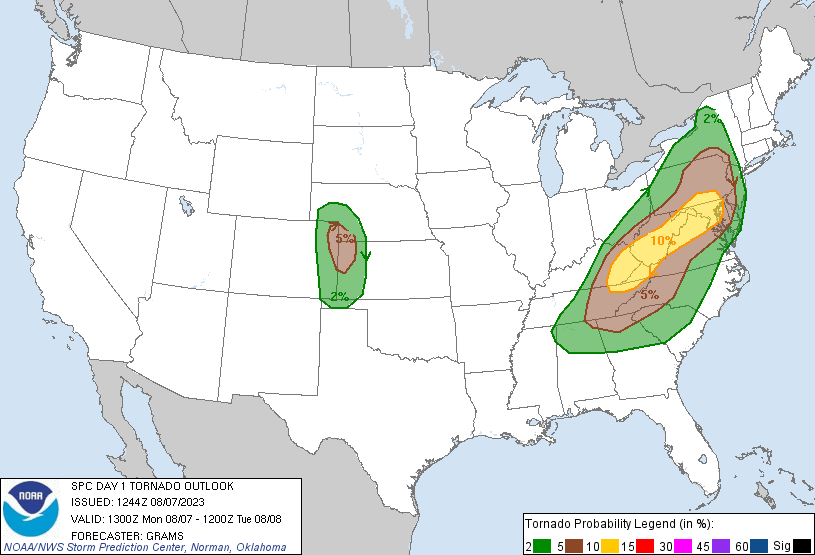
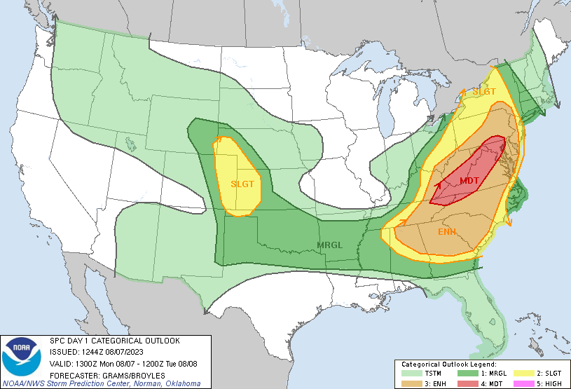 |
 |
 |
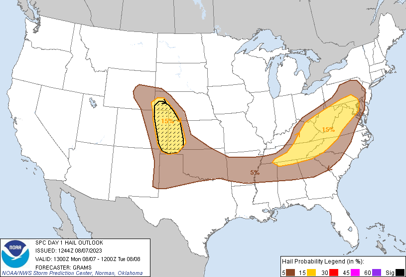 |
| SPC Outlook | Wind Probabilities | Tornado Probabilities | Hail Probabilities |
 |
Media use of NWS Web News Stories is encouraged! Please acknowledge the NWS as the source of any news information accessed from this site. |
|


 Coastal Flood
 Heat
Heat