Overview
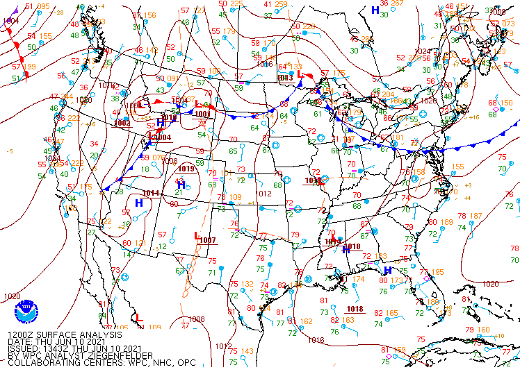
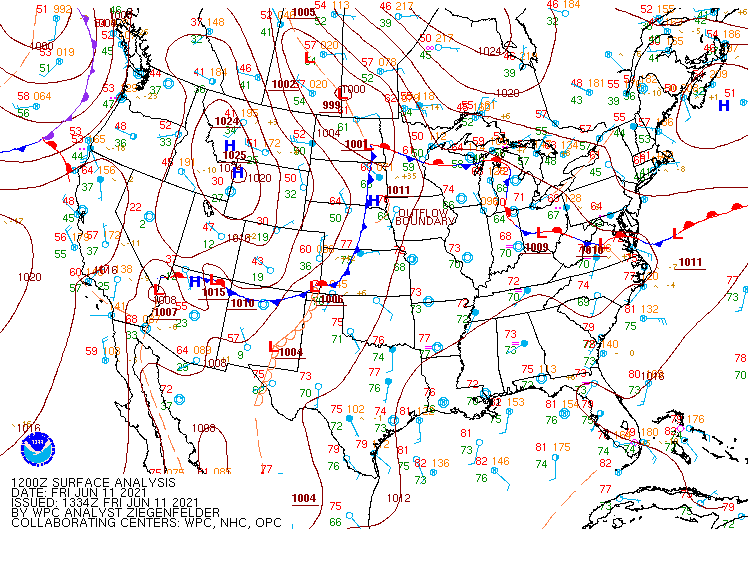
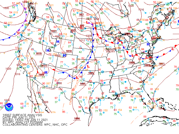
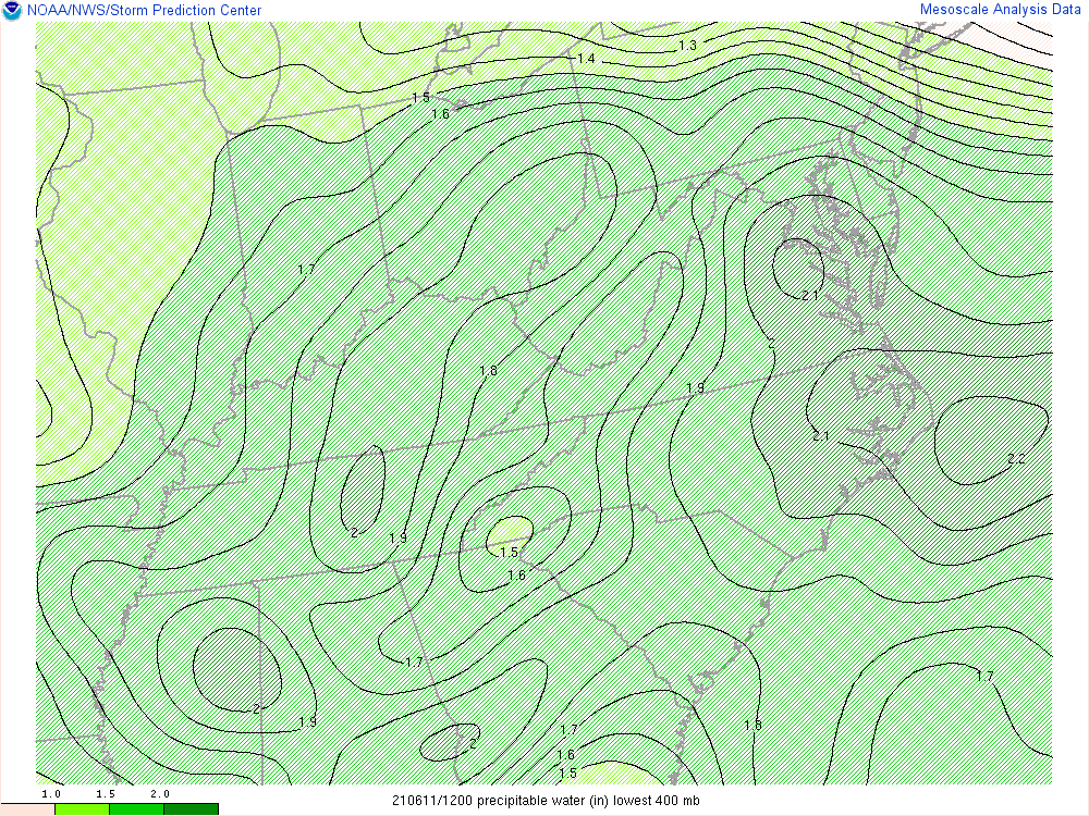
From Wednesday through Friday (6/9-11), an upper shortwave slowly approached the area from the west before crossing the area late Friday into early Saturday morning. At the surface, a cold front remained just to the north of the area on Wednesday. That front crossed the Lower MD Eastern Shore on Thursday before stalling in the vicinity of the Virginia Northern Neck late Thursday through midday Friday. The front finally crossed the remainder of the area from Friday afternoon through the first part of Friday night. The pre-frontal environment was characterized by fairly deep south to southwesterly flow, which was responsible for transporting anomalous amounts of moisture toward the area. Precipitable water values were around 2.0-2.1" from Wednesday through Friday before slowly falling after the cold frontal passage.
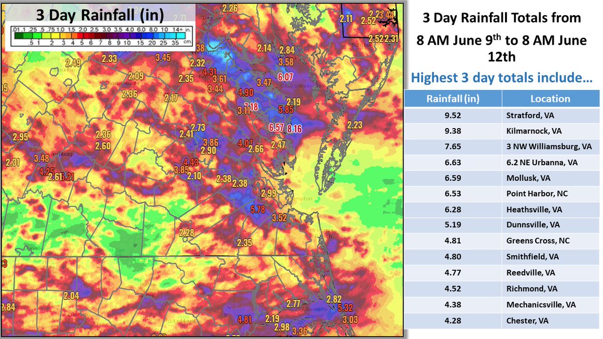
On Wednesday and Thursday, scattered to numerous afternoon/evening showers and thunderstorms resulted in multiple instances of flooding, including (in total) over 20 water rescues in the City of Richmond. However, the worst of the flooding occurred from Friday morning into the afternoon across the Virginia Northern Neck. Showers and thunderstorms with torrential rainfall kept developing and slowly training along that stalled front (thanks in part to the very weak steering flow). The heaviest showers/storms slowly moved south across the area during the afternoon and evening, roughly following the cold front. This prompted additional Flash Flood Warnings for parts of central VA. In total, some areas in the VA Northern Neck received ~10 inches of rain! Also, there was a dam failure at Chandlers Mill Pond just west-southwest of Montross, VA. This resulted in a water rescue on Peach Grove Lane (near Chandlers Mill Pond). In addition, Flash Flood Warnings were issued for the City of Richmond for three consecutive days! See the Rainfall section for more details regarding specific rain totals. The Environment section contains images related to the meteorological setup of the event.
Selected Flash Flood Reports
..TIME...   ...EVENT...      ...CITY LOCATION...     ...LAT.LON...
..DATE...   ....MAG....      ..COUNTY LOCATION..ST.. ...SOURCE....
            ..REMARKS..

0501 PM     FLASH FLOOD      3 ENE DOWNTOWN RICHMOND 37.54N 77.43W
06/09/2021                   CITY OF RICHMOND   VA   911 CALL CENTER

            MULTIPLE REPORTS OF VEHICLES STUCK IN HIGH
            WATER IN THE CITY OF RICHMOND.
0517 PM     FLASH FLOOD      2 NNE RICHMOND          37.50N 77.46W
06/09/2021                   CITY OF RICHMOND   VA   BROADCAST MEDIA

            TWO CARS STRANDED IN HIGH WATER ON THE SOUTH
            SIDE OF RICHMOND NEAR THE INTERSECTION OF
            MAURY AND BLAKE STREET. REPORT FROM
            BROADCAST MEDIA TWITTER ACCOUNT.
0531 PM     FLASH FLOOD      2 SE DOWNTOWN RICHMOND  37.52N 77.45W
06/09/2021                   CITY OF RICHMOND   VA   PUBLIC

            VEHICLE STRANDED IN HIGH WATER AT 20TH AND
            BAINBRIDGE STREET. APPROXIMATELY 2 TO 3 FT
            OF WATER ON ROADWAY.
0445 PM     FLASH FLOOD      2 NNE RICHMOND          37.51N 77.46W
06/09/2021                   CITY OF RICHMOND   VA   FIRE DEPT/RESCUE

            TWO VEHICLES STRANDED IN HIGH WATER. WATER
            UP TO THE DOOR HANDLES.
1200 PM     FLASH FLOOD      1 ESE OAK GROVE         38.18N 76.98W
06/11/2021                   WESTMORELAND       VA   PUBLIC

            WATER OVER ROUTE 3 NEAR COLONIAL BEACH.
1205 PM     FLASH FLOOD      1 NW TEMPLEMAN          38.08N 76.79W
06/11/2021                   WESTMORELAND       VA   911 CALL CENTER

            911 CENTER IS REPORTING NUMEROUS ROADS FROM
            MONTROSS DOWN TO THE RICHMOND COUNTY LINE
            WERE FLOODING AND IMPASSIBLE.
0215 PM     FLASH FLOOD      CALLAO                  37.97N 76.56W
06/11/2021                   NORTHUMBERLAND     VA   DEPT OF HIGHWAYS

            VDOT CLOSING ROUTE 202 / HAMPTON HALL RD AT
            CALLAO. VEHICLES BECOMING STRANDED IN FLOOD
            WATERS.
0220 PM     FLASH FLOOD      1 ENE GIBEON            37.97N 76.60W
06/11/2021                   NORTHUMBERLAND     VA   911 CALL CENTER

            VALLEY DRIVE FLOODED. VEHICLES STRANDED.
0250 PM     FLASH FLOOD      2 WSW MONTROSS          38.08N 76.85W
06/11/2021                   RICHMOND           VA   DEPT OF HIGHWAYS

            PEACH GROVE LANE CLOSED DUE TO THE DAM
            FAILURE AT CHANDLERS MILL POND. CAT POINT
            CREEK WILL THREATEN PEACH GROVE LANE.
0310 PM     FLASH FLOOD      1 E CALLAO              37.97N 76.54W
06/11/2021                   NORTHUMBERLAND     VA   EMERGENCY MNGR

            WATER RESCUE FROM A VEHICLE STRANDED IN
            ABOUT 3 FT OF WATER JUST SOUTH OF CALLAO.
0330 PM     FLASH FLOOD      MOLLUSK                 37.73N 76.54W
06/11/2021                   LANCASTER          VA   TRAINED SPOTTER

            WIDESPREAD FLASH FLOODING NEAR THE MOLLUSK
            AREA. ROUTE 354 IS COVERED WITH HIGH WATER
            AND DITCHES ARE OVERFLOWING IN MANY
            LOCATIONS.
0350 PM     FLASH FLOOD      3 NW MONTROSE           37.54N 77.42W
06/11/2021                   CITY OF RICHMOND   VA   FIRE DEPT/RESCUE

            WATER RESCUE ON MOSBY ST.
0350 PM     FLASH FLOOD      2 WSW EAST HIGHLAND PAR 37.56N 77.42W
06/11/2021                   CITY OF RICHMOND   VA   FIRE DEPT/RESCUE

            WATER RESCUE FROM A STRANDED VEHICLE ON
            MAGNOLIA ST.
0450 PM     FLASH FLOOD      2 WSW MONTROSS          38.08N 76.85W
06/11/2021                   RICHMOND           VA   BROADCAST MEDIA

            WATER RESCUE ON PEACH GROVE RD DUE TO FLOOD
            WATERS ON CAT POINT CREEK RESULTING FROM THE
            FAILURE OF CHANDLERS MILL POND.
0531 PM     FLASH FLOOD      2 NNW PETERSBURG        37.23N 77.40W
06/11/2021                   CITY OF PETERSBURG VA   911 CALL CENTER

            NUMEROUS ROADS AROUND PETERSBURG
            EXPERIENCING FLOODING AND ARE IMPASSABLE.
            ONE WATER RESCUE UNDERWAY.
0845 PM     FLASH FLOOD      CENTRAL HILL            36.91N 76.74W
06/11/2021                   ISLE OF WIGHT      VA   911 CALL CENTER

            FLOODING OF ROADS REPORTED NEAR ISLE OF
            WIGHT AND CENTRAL HILL. ROADS WERE BEING
            CLOSED IN THE AREA DUE TO FLOODING.
Photos
Selected Photos
 |
 |
 |
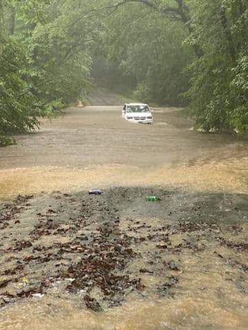 |
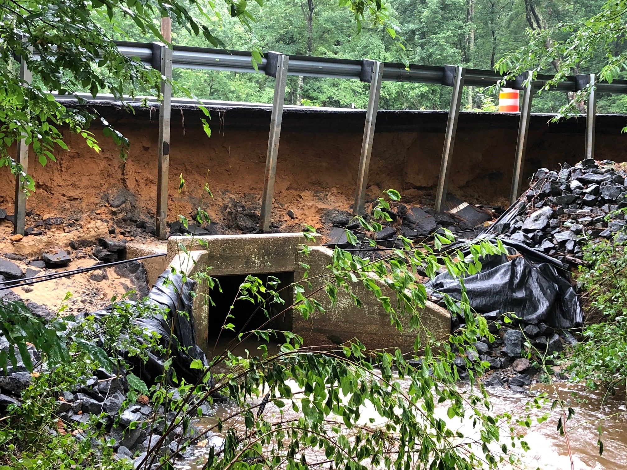
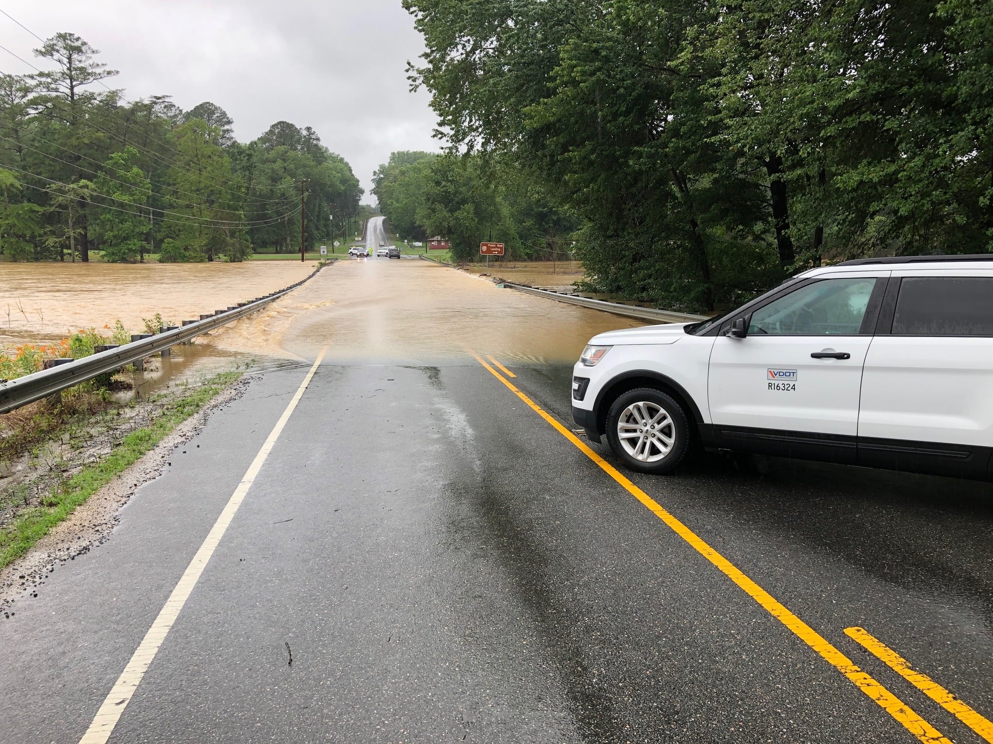
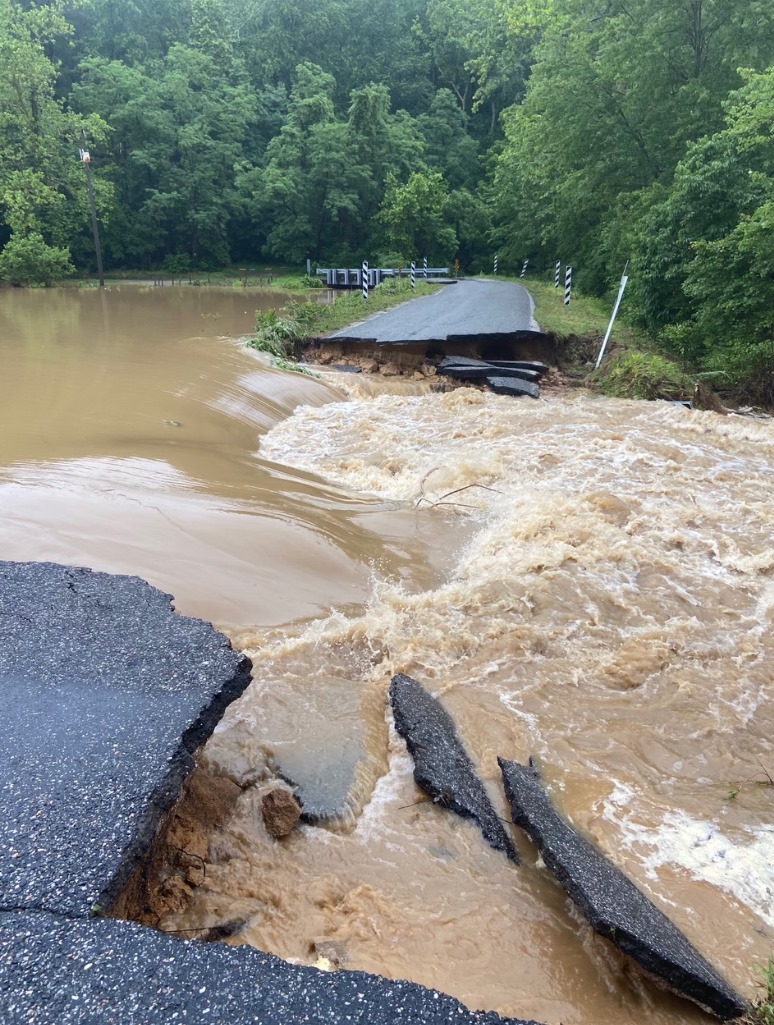
| Hampton Hall Road (Northumberland) (source: VDOT) |
Chandlers Mill Pond Flash Flooding (Westmoreland) (source: VDOT) |
Kissinger Springs Rd (Northumberland) (source: VDOT) |
High Water on Valley Dr (Northumberland) (source: VDOT) |
Radar Loop
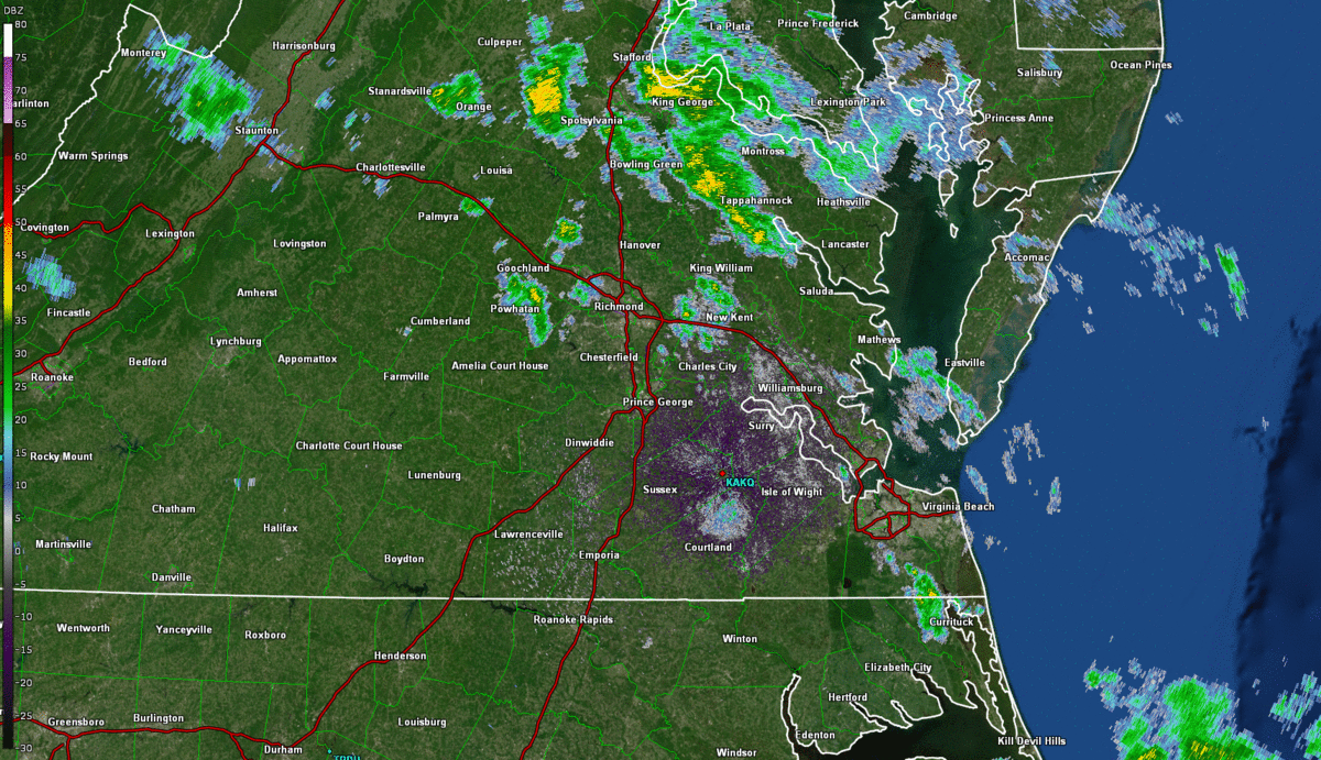 |
| Loop from 8 AM to 5 PM on 6/11 in ~30 minute increments. The green polygons represent Flash Flood Warnings. |
Map of Rainfall Reports
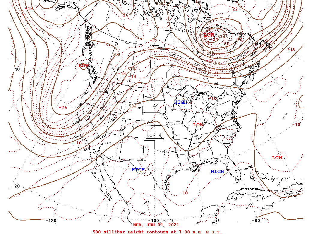
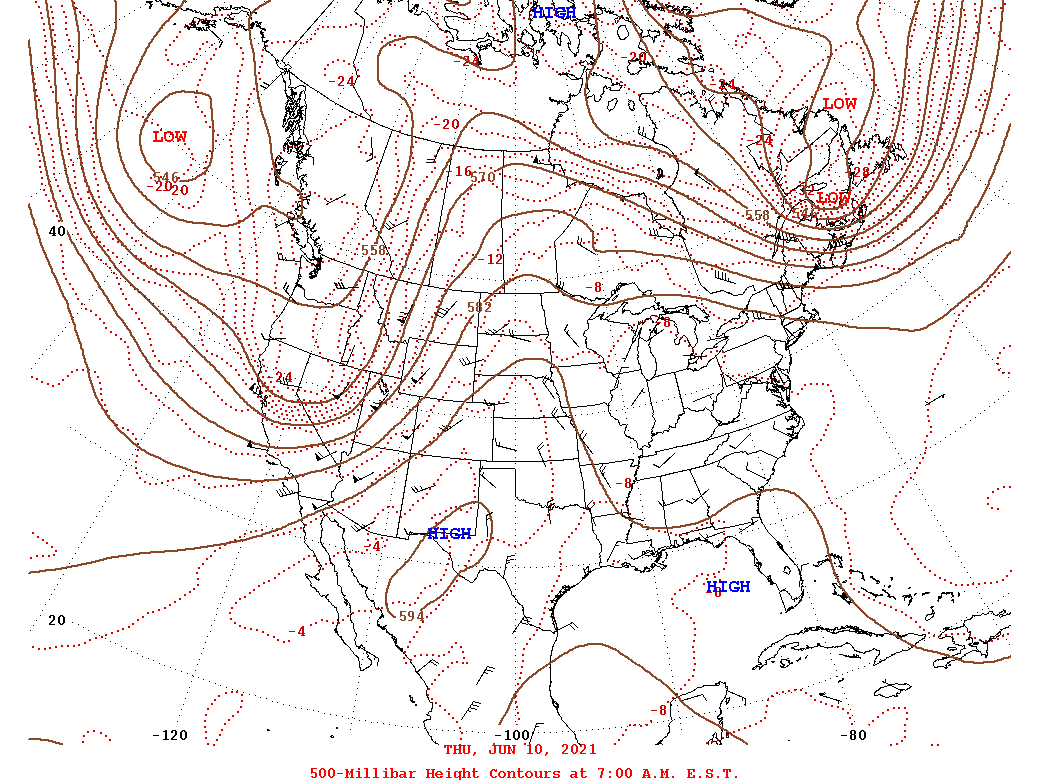
Environment
Upper Level synoptic summary.
 |
 |
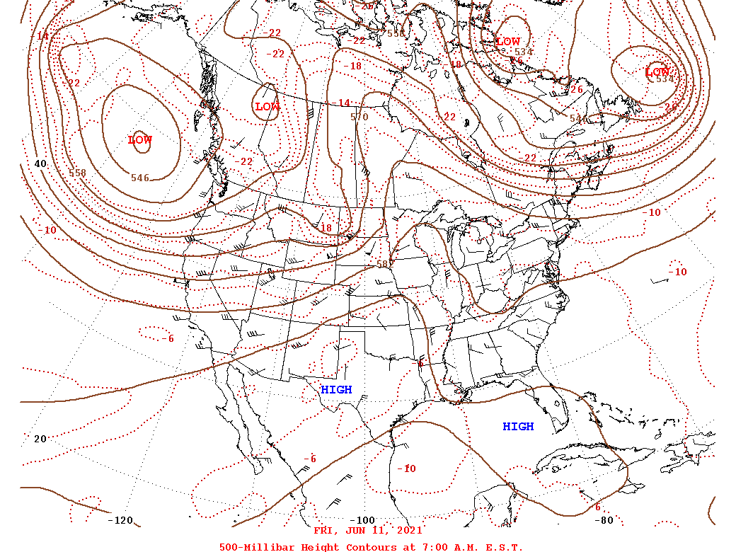 |
| 6/9 12z/8 AM 500 mb Analysis | 6/10 12z/8 AM 500 mb Analysis | 6/11 12z/8 AM 500 mb Analysis |
Synoptic surface summary.
 |
 |
 |
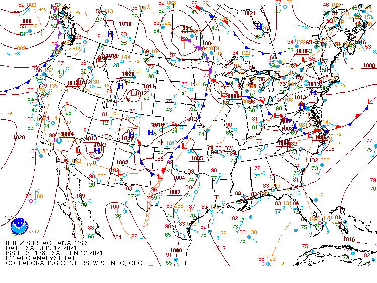 |
| 6/10 12z/8 AM WPC Surface Analysis | 6/11 12z/8 AM WPC Surface Analysis | 6/11 18z/2 PM WPC Surface Analysis | 6/11 8 PM WPC Surface Analysis |
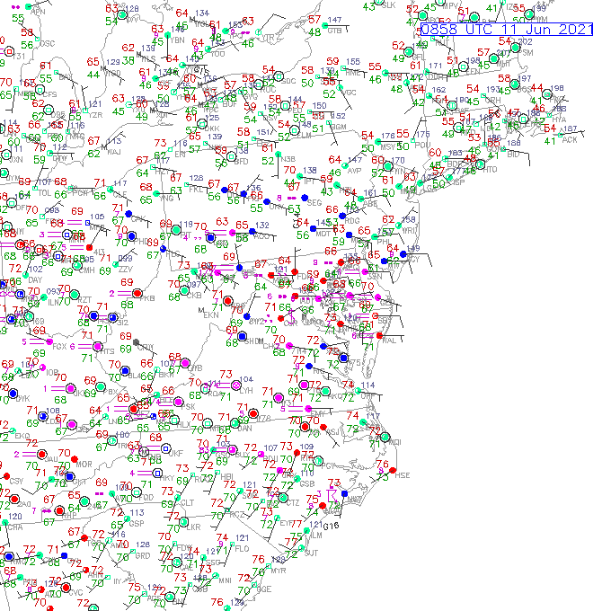
Additional environmental data.
 |
 |
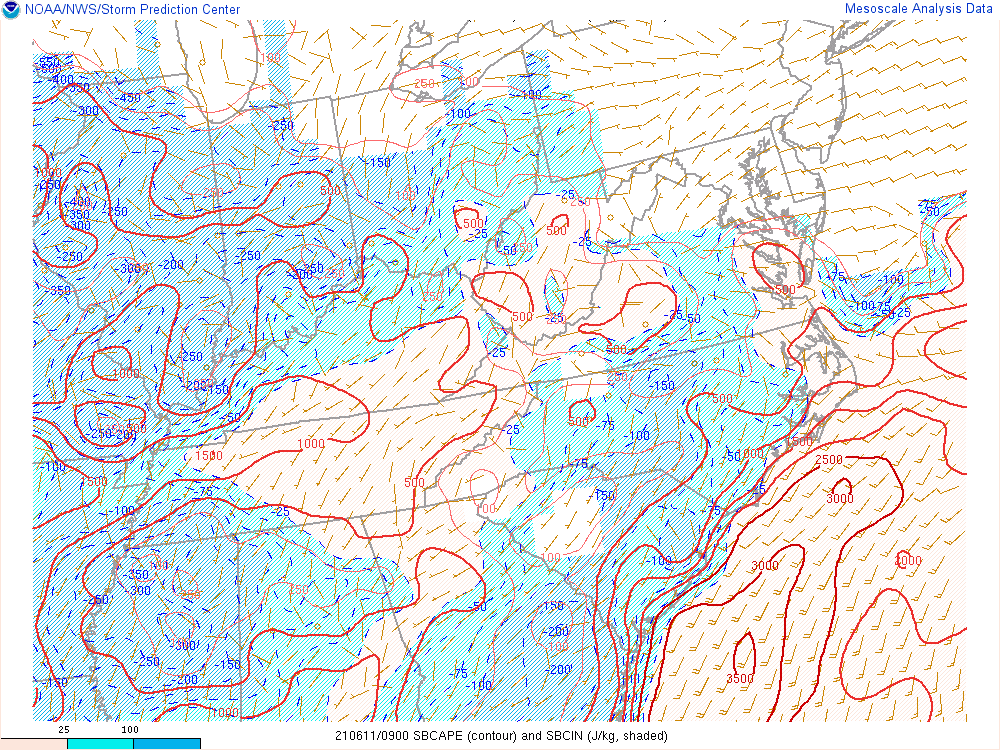 |
| 6/11 12z/8 AM Precipitable Water Values | Loop of Surface Observations on 6/11 from 5 AM to 8 PM in 3 hour increments | Loop of SBCAPE (to more easily see the progression of the cold front) from 2 AM to 8 PM on 6/11 in 3 hour increments |
 |
Media use of NWS Web News Stories is encouraged! Please acknowledge the NWS as the source of any news information accessed from this site. |
|


 Coastal Flood
 Heat
Heat