Overview
A dampening shortwave tracked from the Ohio Valley to the northern Mid-Atlantic on Monday, May 3. Meanwhile, at the surface, a fairly strong area of low pressure tracked NE across the Midwest. Its associated warm front extended ESE into the Mid-Atlantic, and this front quickly surged northward during the day on Tuesday. By early afternoon, the warm front was to the north of the AKQ CWA. Scattered convection moved across a good portion of the area during the morning (except for SE VA/NE NC), and this did not allow temperatures to rise higher than the 70s, despite warm/moist advection and low-level SSW flow. Another round of scattered convection moved across the area during the afternoon and evening. All of this was sub-severe, except for one lone rotating cell that produced an EF-2 tornado in Northumberland County. This was quite an unusual setup for a strong tornado, with only modest instability present where the tornado occurred, the warm front being well to our north, and no discernable boundaries nearby. There was some 0-1 km speed and directional shear across the southern Mid-Atlantic, but a lot less than is typically observed when we have EF-2+ tornadoes in the AKQ CWA. But even then, this will go down as one of the most unusual EF-2+ tornado setups in the AKQ CWA.
Tornado Track/Information:
|
Tornado - Northumberland County
Track Map 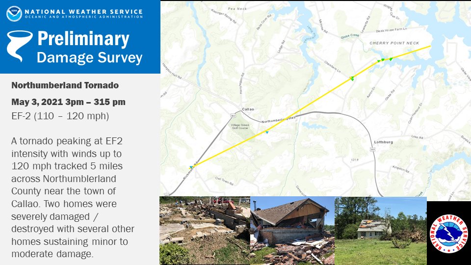 
|
||||||||||||||||
The Enhanced Fujita (EF) Scale classifies tornadoes into the following categories:
| EF0 Weak 65-85 mph |
EF1 Moderate 86-110 mph |
EF2 Significant 111-135 mph |
EF3 Severe 136-165 mph |
EF4 Extreme 166-200 mph |
EF5 Catastrophic 200+ mph |
 |
|||||
Photos
NWS Storm Survey Photos
 |
 |
 |
|
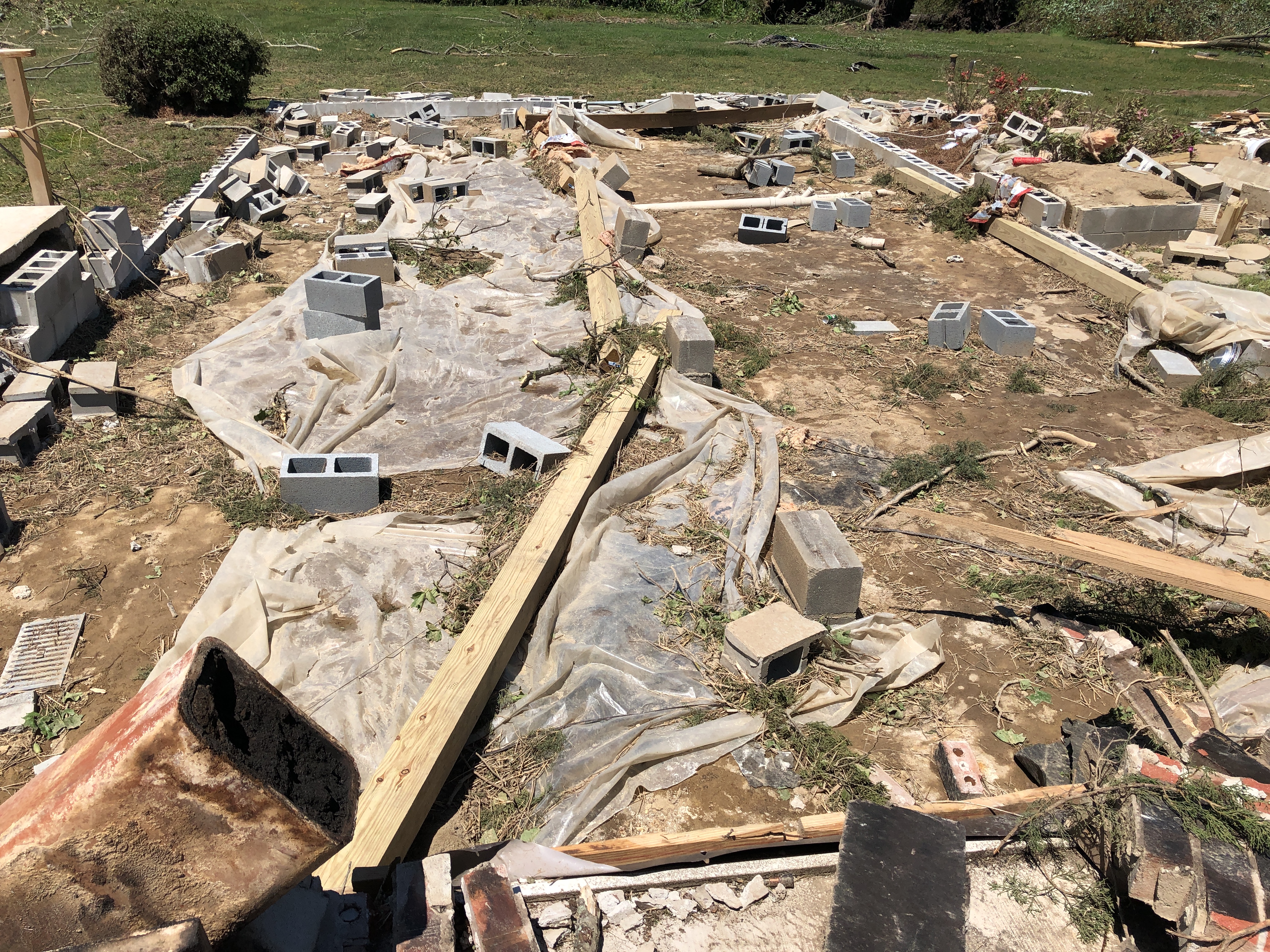
| Home Destroyed on Chambers Lane (source: NWS Storm Survey) |
Home Destroyed on Chambers Lane (source: NWS Storm Survey) |
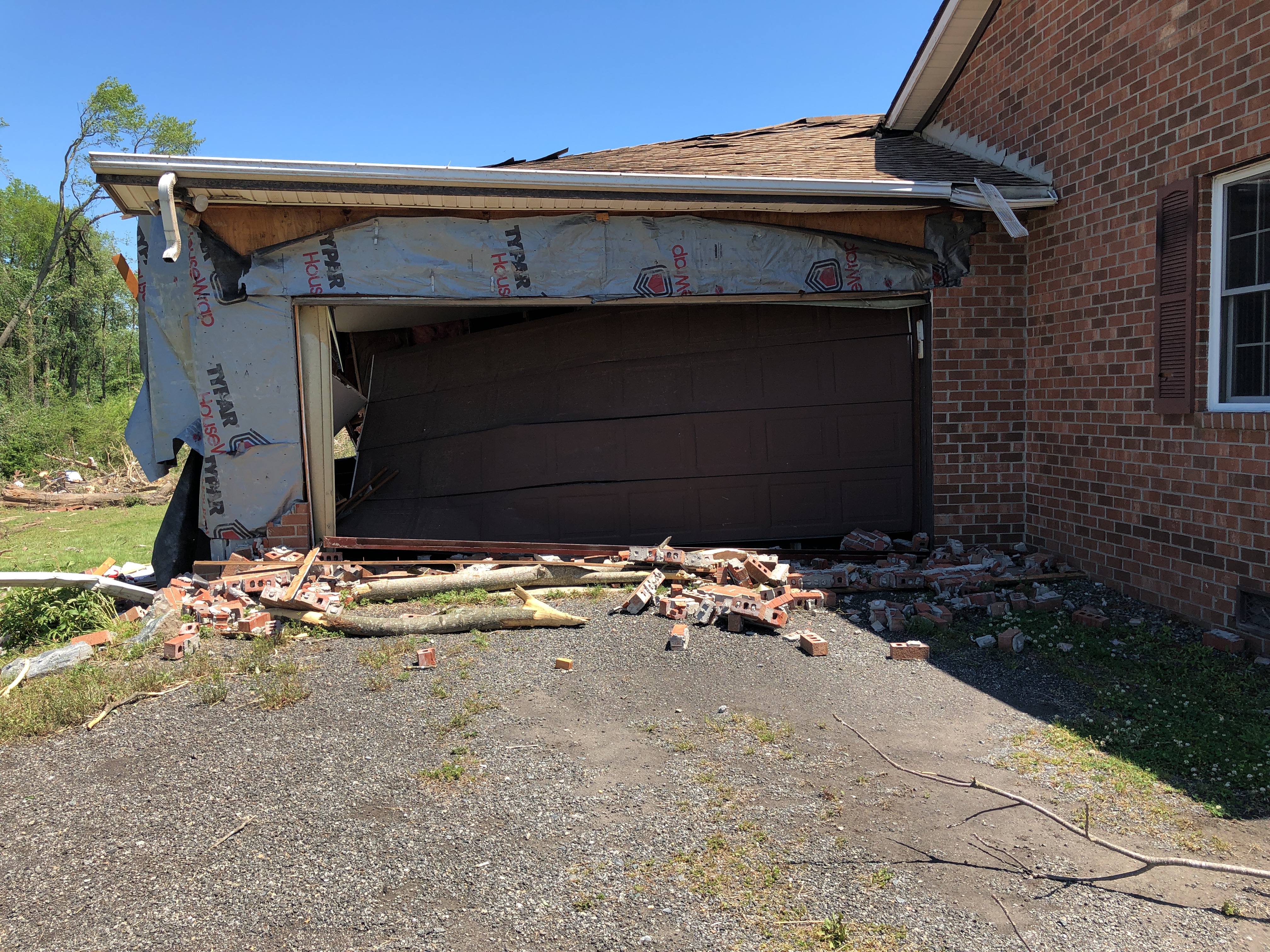
Garage Destroyed on Chambers Lane (source: NWS Storm Survey) |
Caption (source) |
Radar
0.5° Base Reflectivity/Velocity Loop of Cell that Produced the Tornado in Northumberland County
 |
| Caption |
Environment
5/3/2021 Synoptic Surface Summary (from WPC) |
 |
 |
 |
| 12z/8 AM | 15z/11 AM | 18z/2 PM | 21z/5 PM |
Near-storm environment summary.
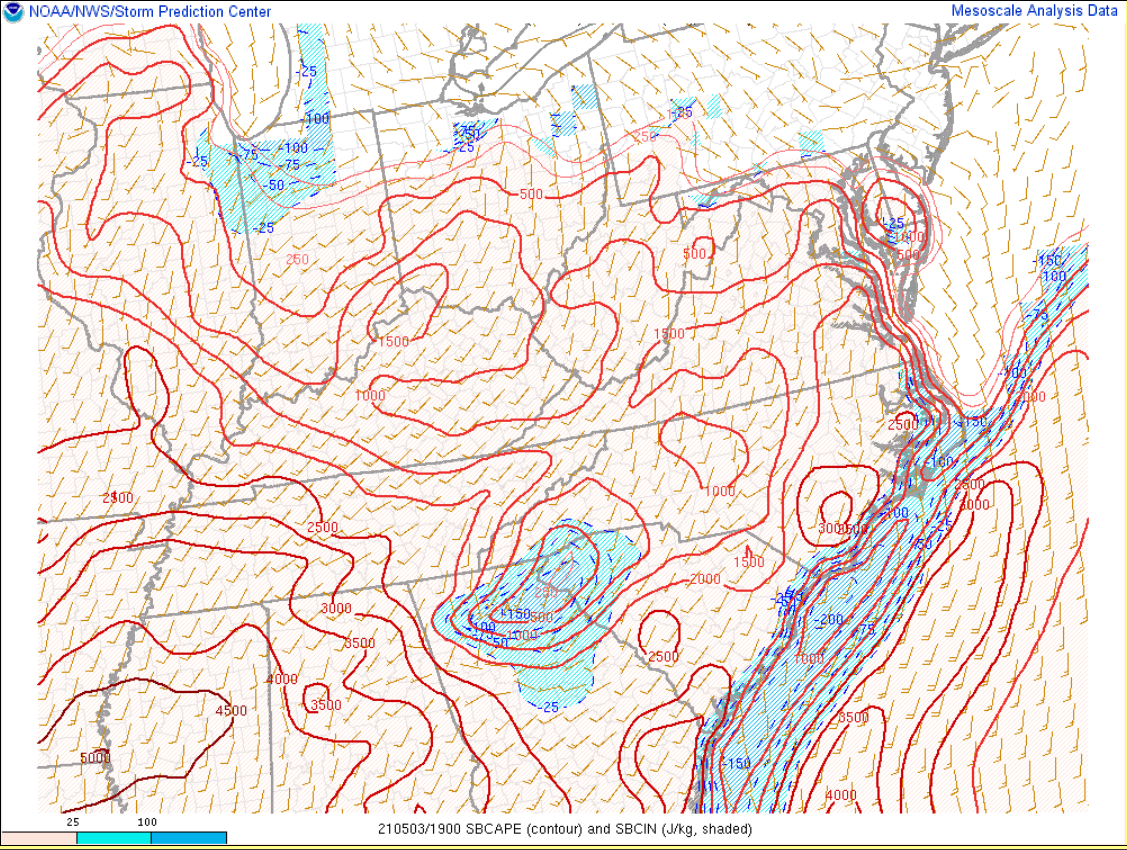 |
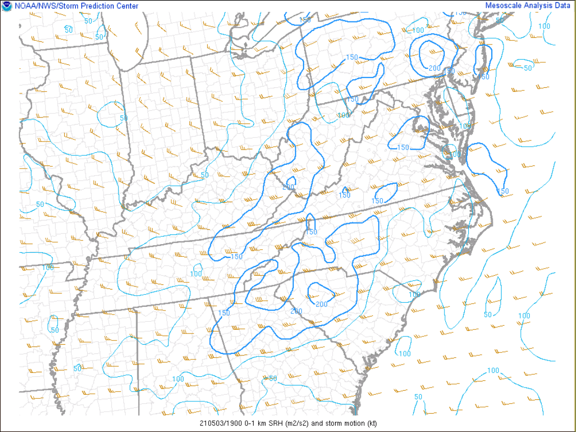 |
| 19z/3 PM SBCAPE/CIN | 19z 3 PM 0-1 km SRH |
Environmental Sounding Data.
 |
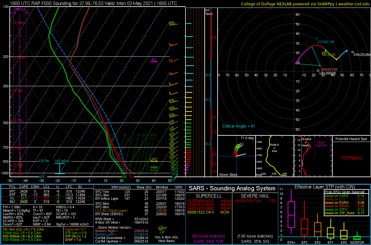 |
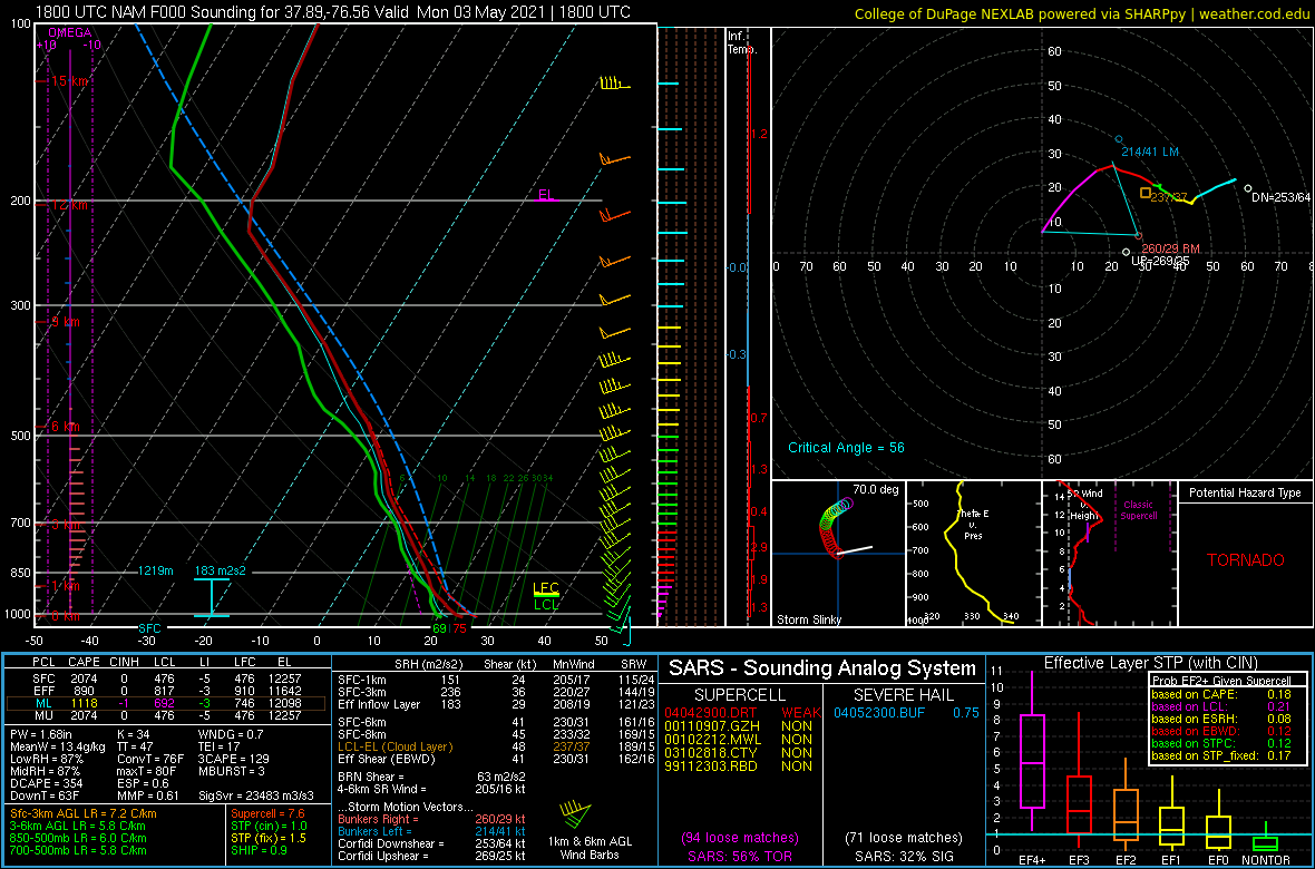
| 18z/2 PM NAM Analysis Sounding from Northumberland County | 18z/2 PM RAP Analysis Sounding from Northumberland County |
 |
Media use of NWS Web News Stories is encouraged! Please acknowledge the NWS as the source of any news information accessed from this site. |
|


 Coastal Flood
 Heat
Heat