Overview
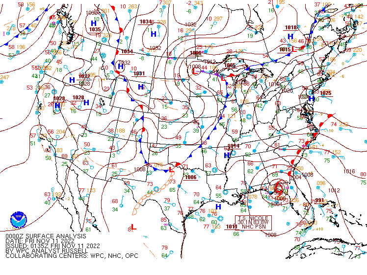
Tropical Cyclone Nicole made landfall in Florida during the early morning hours on Thursday, November 10th. Nicole quickly became extratropical and turned sharply to the NNE as it interacted with an upper trough approaching from the west. Nicole tracked from the southern to central Appalachians on Friday. The associated warm front moved well to the north of the local area by midday Friday. Given that this was a remnant tropical system, near record levels of deep-layer moisture advected into the area. In fact, the 12z WAL sounding reported a Precipitable Water value of 1.8", which is quite impressive for the middle of November! Temperatures rose into the mid-upper 70s by early afternoon, with dew points in the low 70s area-wide (again, very impressive for the middle of November). As is often the case with remnant tropical systems, the low-level (975-850mb) wind fields were strong. In this case, surface winds were out of the SE with S-SSW winds of 40-50 knots from 950-850mb. With modest (500-1000 J/kg) of MLCAPE in place as well, scattered thunderstorms formed during the afternoon, and nearly all of the storms exhibited some degree of rotation. Several of the storms had rotational velocities of 30-50 knots measured a few thousand feet above ground level by our KAKQ radar. However, only 2* tornadoes were observed, despite the favorable instability/shear parameters. While it is hard to pinpoint the exact reason for this, observed soundings give a couple of clues. ACARS soundings from KRIC show a bit of a capping inversion around the 850mb layer, which resulted in a small (~60 J/kg) amount of MLCIN. This may have played a part in the lack of tornadoes. In addition, there was a lack of mid level dry air in the sounding and there were also no frontal boundaries near the area (at the time of the event). For example during, both of these features were present during Isaias (2020) with a subtle warm front near the Richmond Metro with the tornado outbreak of 9/2018 (due to the remnants of Florence). Of course, there were likely other limiting factors at play as well that are not discussed here. *All tornado information is preliminary and subject to change.*Tornadoes:
|
Tornado - Sparta Road
Track Map 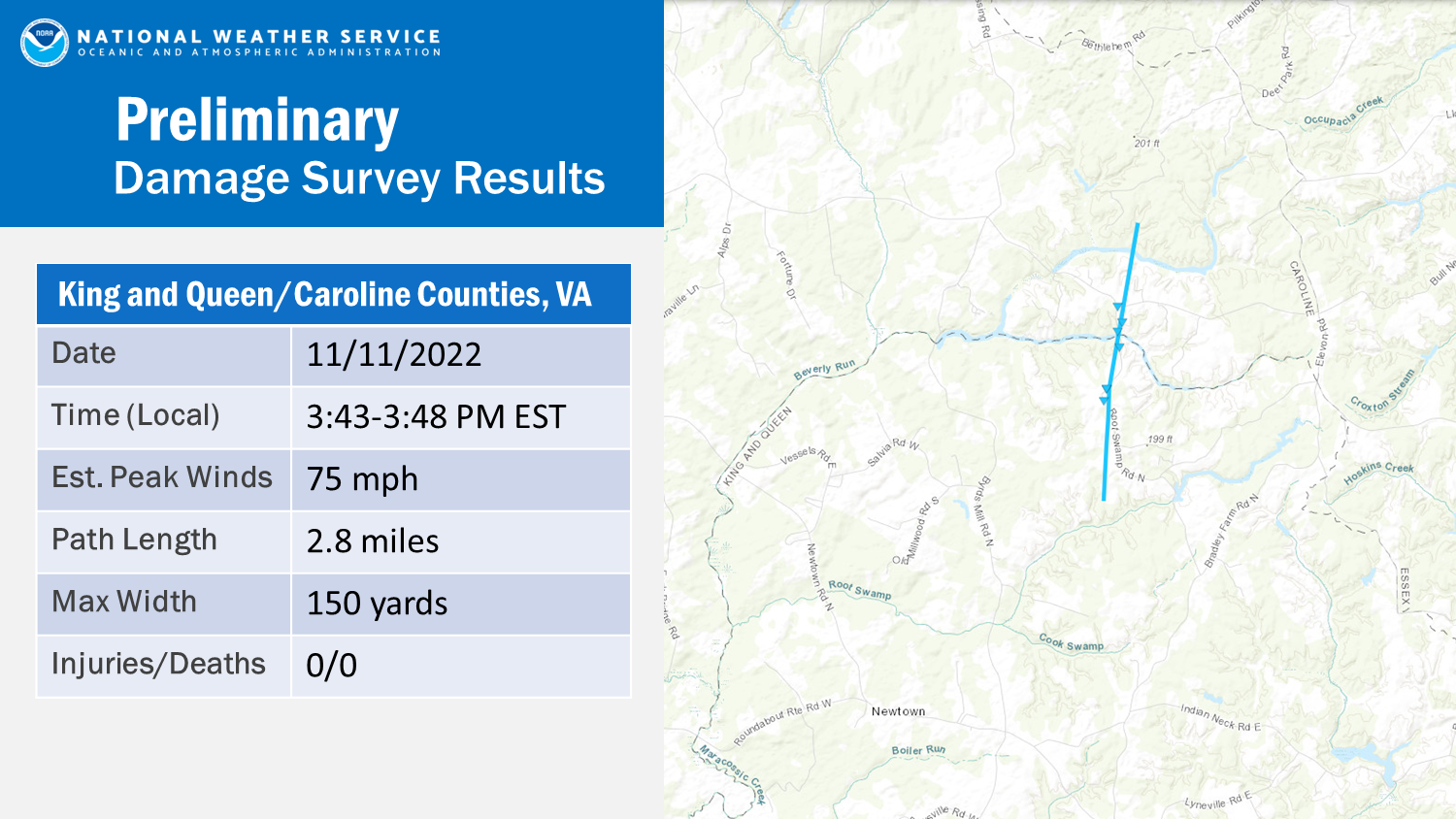 
Downloadable KMZ File |
||||||||||||||||
|
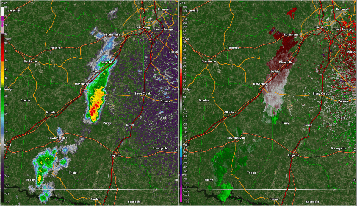
Tornado - near McKenney
Track Map 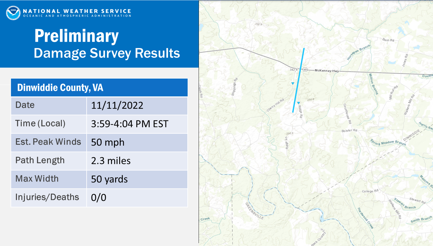
Downloadable KMZ File |
||||||||||||||||
The Enhanced Fujita (EF) Scale classifies tornadoes into the following categories:
| EF0 Weak 65-85 mph |
EF1 Moderate 86-110 mph |
EF2 Significant 111-135 mph |
EF3 Severe 136-165 mph |
EF4 Extreme 166-200 mph |
EF5 Catastrophic 200+ mph |
 |
|||||
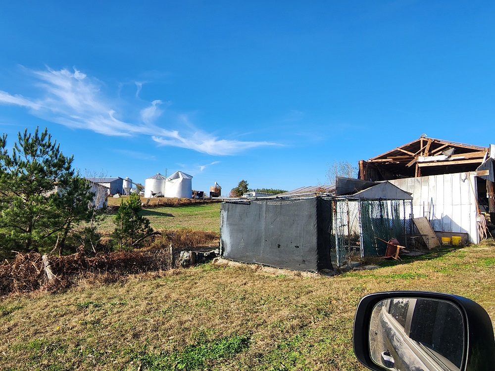
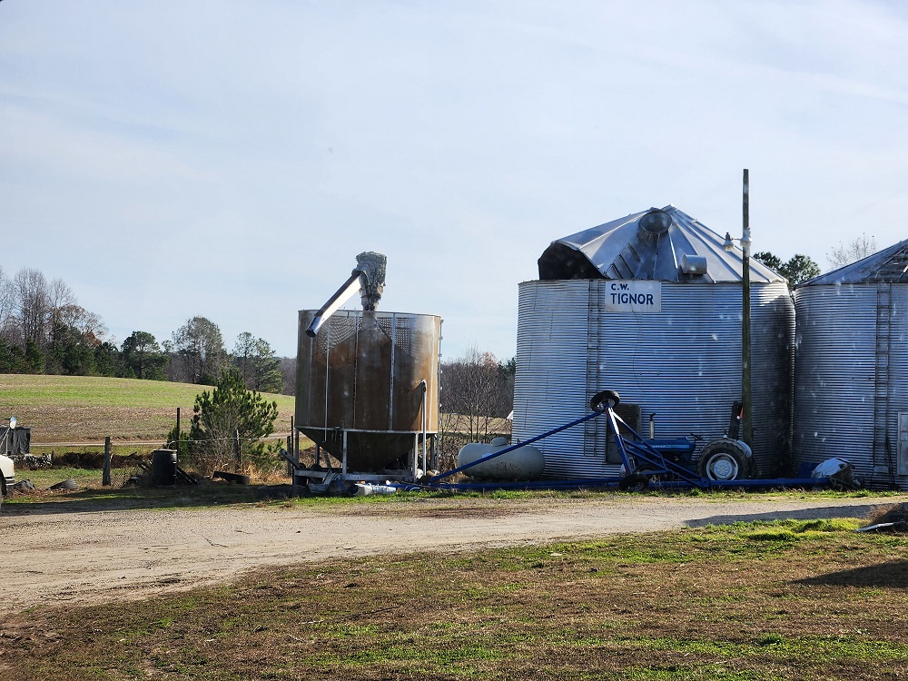
Photos
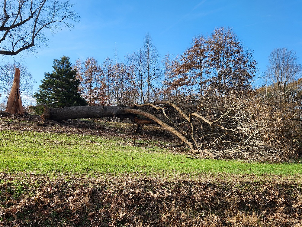
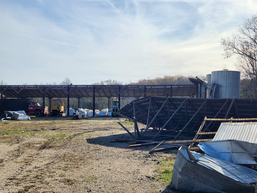
Storm Survey Photos from Caroline County
 |
 |
 |
 |
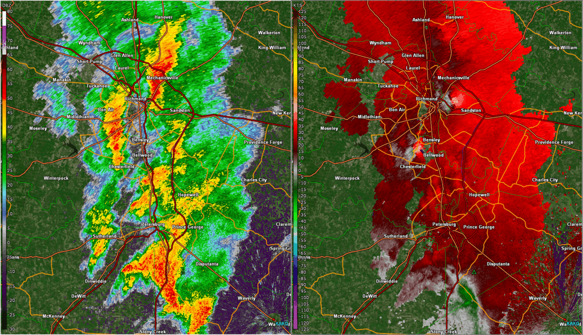
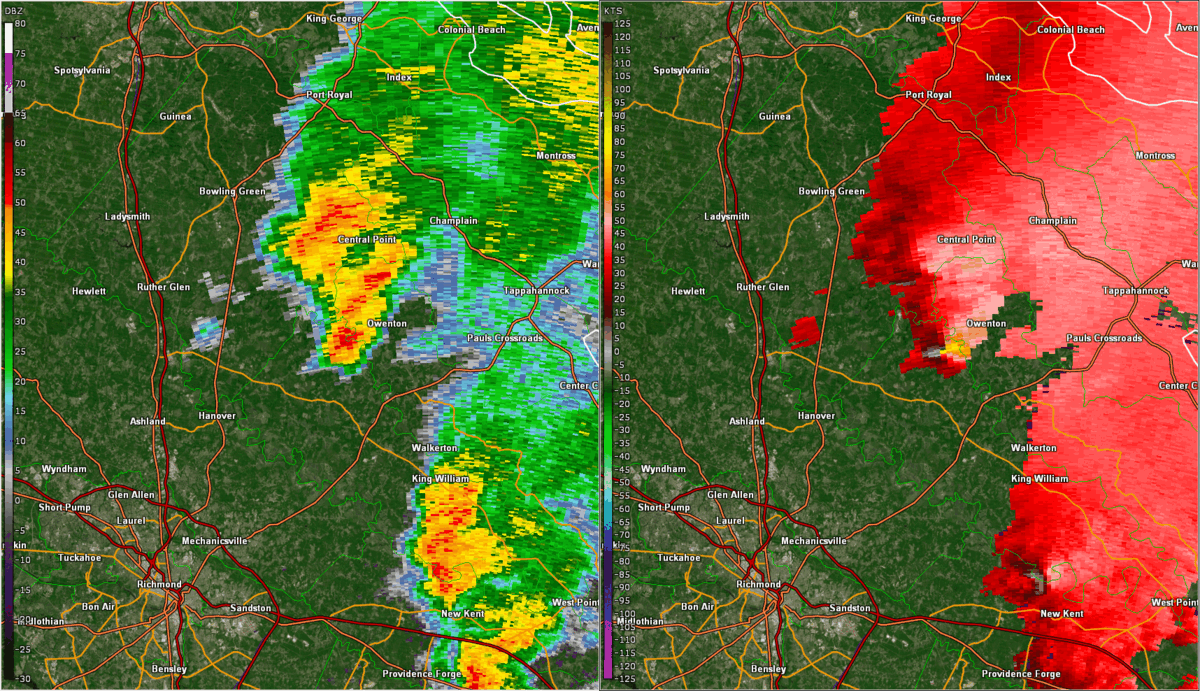
Radar
Selected Radar and MRMS Rotation Track Images/Loops
 |
 |
 |
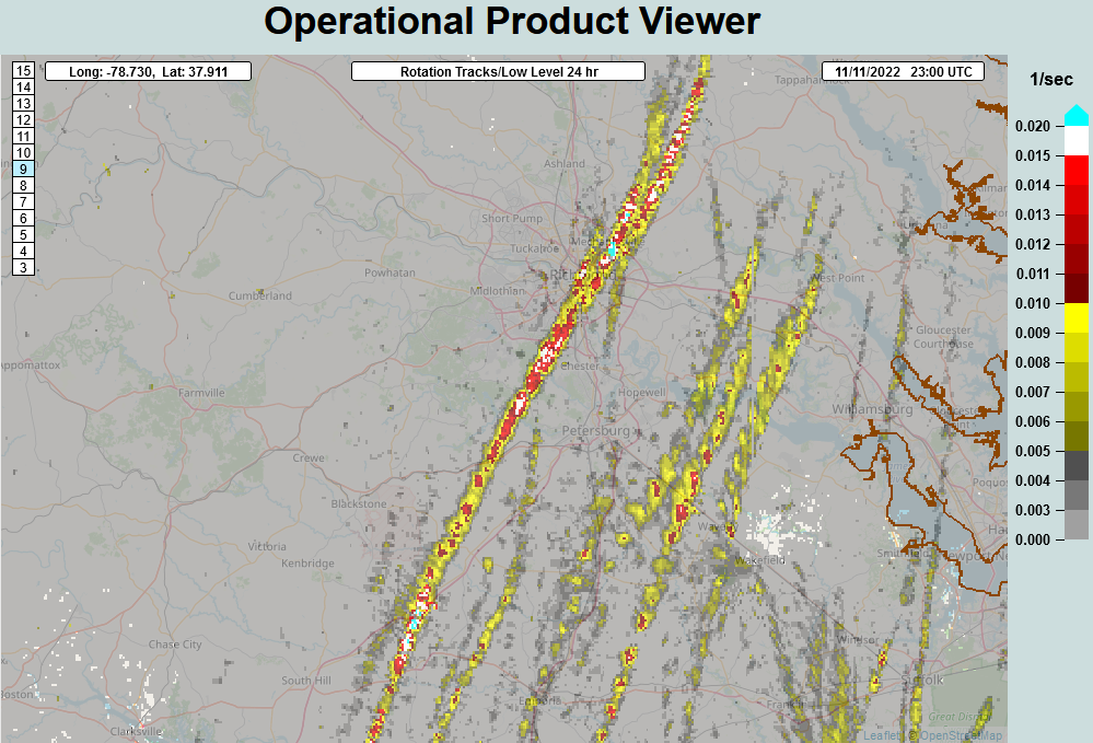 |
| Radar Loop of supercells in Richmond Metro from ~2:20 to 3:10 PM | Loop of storm that caused the EF-0 in King and Queen/Caroline Counties (loop goes from ~3:30 to 3:55 PM) | Loop of storm that caused the EF-0 in Dinwiddie County (loop goes from ~3:45 to 4:10 PM) | MRMS Rotation Tracks |
Environment
Synoptic summary.
 |
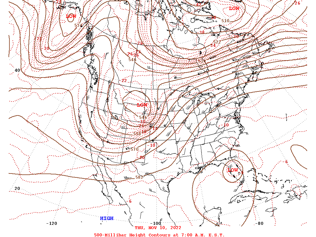 |
| Loop of WPC Surface Analysis from 7 PM on 11/10 to 7 PM on 11/11 in 3 hour increments | Loop of 500mb analysis from 12z/7 AM on 11/10 to 12z/7 AM on 11/12 |
Near-storm environment summary.
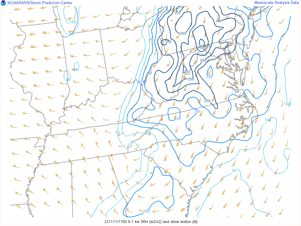 |
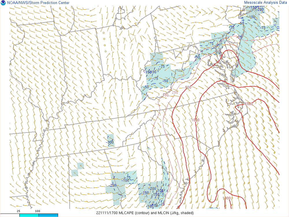 |
| Loop of 0-1 km SRH from noon (17z) to 5 PM (22z) | Loop of MLCAPE/MLCIN from noon (17z) to 5 PM (22z) |
ACARS Sounding data from Richmond (KRIC).
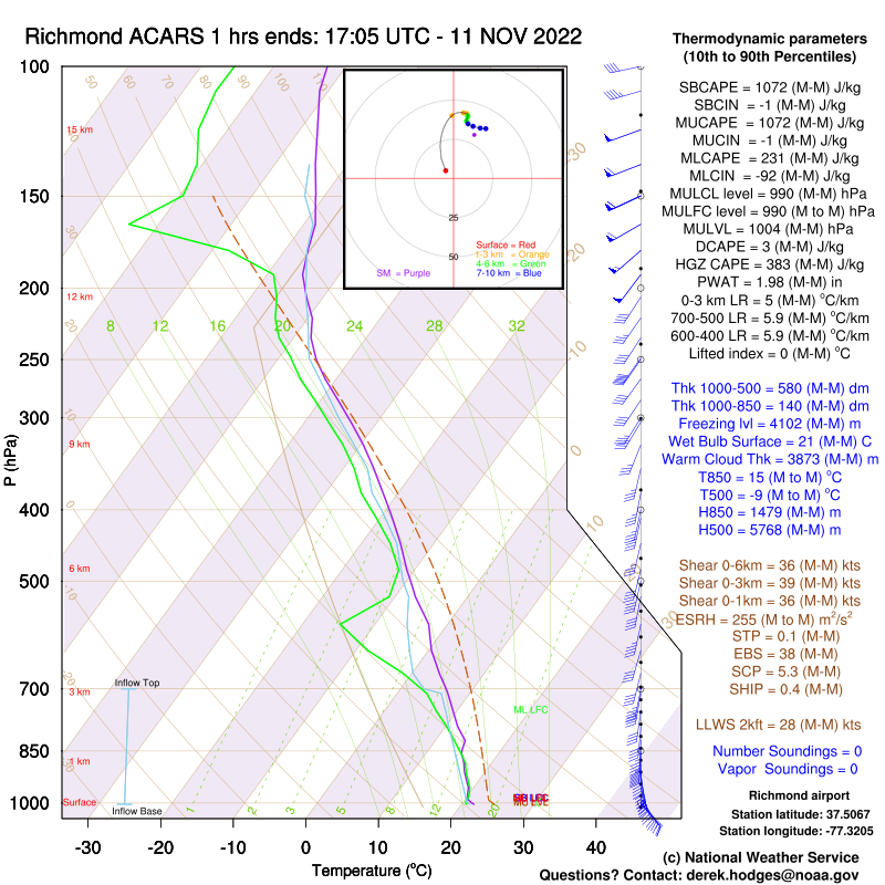 |
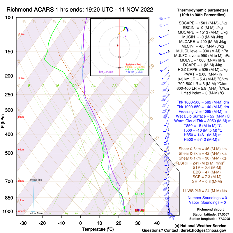 |
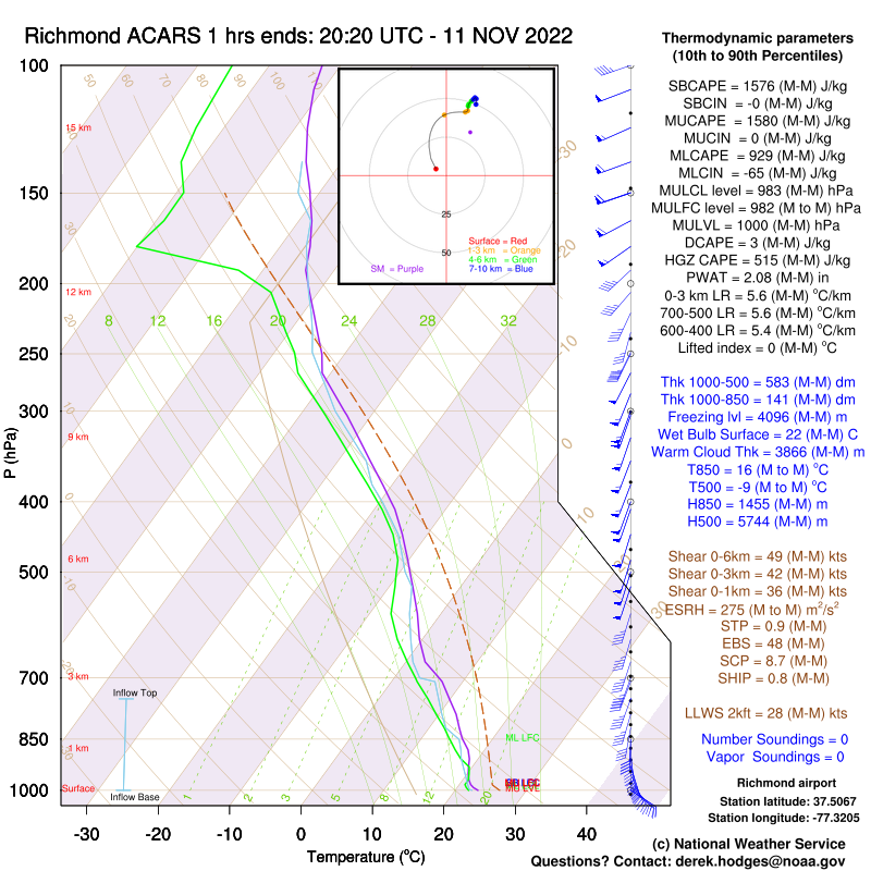 |
| 17z/noon | 19z/2 pm | 20z/3pm |
 |
Media use of NWS Web News Stories is encouraged! Please acknowledge the NWS as the source of any news information accessed from this site. |
|


 Coastal Flood
 Heat
Heat