Jeff Boyne, NWS La Crosse, WI
| Main Page | Weather Pattern | Sea Level Pressure | Winds | Snowfall | Marine | ||
| Media Accounts | Personal Accounts | Photos | Aftermath | Computer Simulation | Acknowledgements | ||
A few days earlier a strong weather system moving into the Pacific Northwest had taken down the Tacoma Narrows Bridge. Until the collapse on November 7, 1940 the bridge had been the 3rd longest suspension span in the world. The Tacoma Narrows Bridge, an engineering wonder, had already acquired the name Galloping Gertie due to its motion in the wind. A four mile an hour breeze could start oscillations in the bridge while stronger breezes often had no effect. On November 7, 1940 winds of 35 to 45 mph caused center span to undulate 3-5 feet and the bridge failed before the center of the storm system reached shore. On November 8, 1940 storm center remained off the Washington coast producing gale force winds. Meanwhile pressure was falling over the Pacific Northwest.
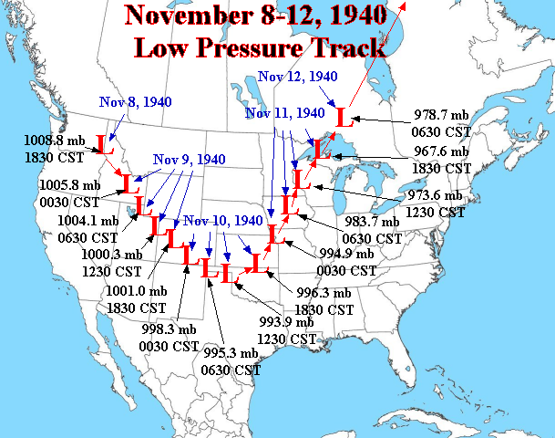
Location of the cyclone center (low pressure), and the lowest pressure
reported at 6-hour intervals from November 8-12, 1940
By November 10th the storm system had moved across the Rocky Mountains to redevelop over Trinidad Colorado (Knarr, 1941). Initially the system pushed east then it curved northward into the central United States where it would leave a path of icy destruction. During the next 6 hours the storm center moved to vicinity of Iowa Falls, Iowa. West of the center blizzards raged across South Dakota and a widespread ice storm across Nebraska left hundreds of people impacted by the storm. East of the center a broad swath of warm air streamed up the Mississippi Valley.
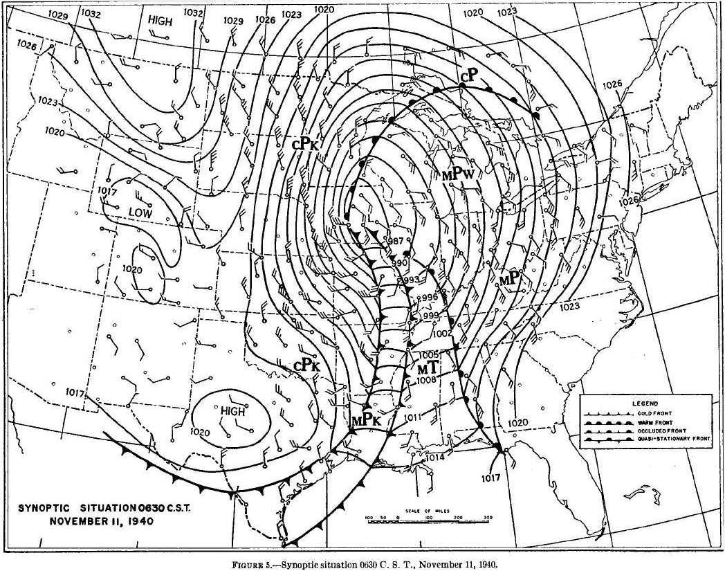
Weather Map from November 11, 1940 at 6:30 AM CST
During the day and into the night severe weather erupted across much of the Midwest. A tornado was reported one mile west of Davenport Iowa, 2-3 inches of heavy rain fell over the Mississippi Valley, and heavy snow began to fall across Minnesota and Western Iowa. Gale velocities were measured at 80 mph at Grand Rapids, Michigan, and were estimated to be even higher over the lakes. By the time the storm was centered over Lake Superior, the barometer reading had plummeted to 28.57 inches of mercury.
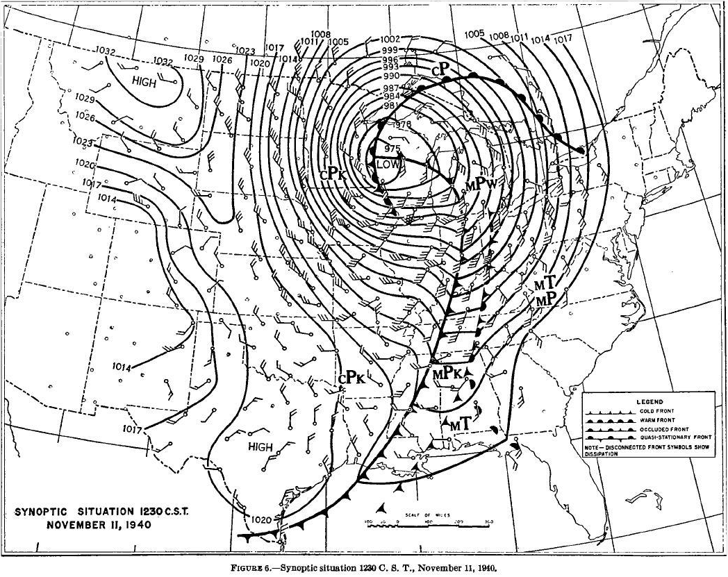
Weather Map from November 11, 1940 at 12:30 PM CST


 Weather Story
 Weather Map
 Local Radar