Overview
The National Weather Service and the New York State Office of Emergency Management is promoting winter safety to all New Yorkers during Winter Weather Awareness Week which runs from October 29 through November 4.
Sunday:
...Winter Weather Awareness Week in New York...
The National Weather Service and The New York State Office of Emergency Management is promoting winter safety to all New Yorkers during Winter Weather Awareness week October 27 through November 2. You can help protect yourself and your family by following these safety tips.
During major winter storms, it is usually best to remain at home rather than venturing outdoors. If a storm is occurring or about to begin, consider postponing travel until conditions improve. If you must travel, remain on well traveled main routes or highways, and slow down and drive carefully. Let someone at your destination know that you are on your way, and tell them your estimated time of arrival. If you get stuck, stay in or near your vehicle. It is easy to get lost or disoriented in a blinding snowstorm or blizzard. Also, rescue personnel can find you much more easily if you stay put.
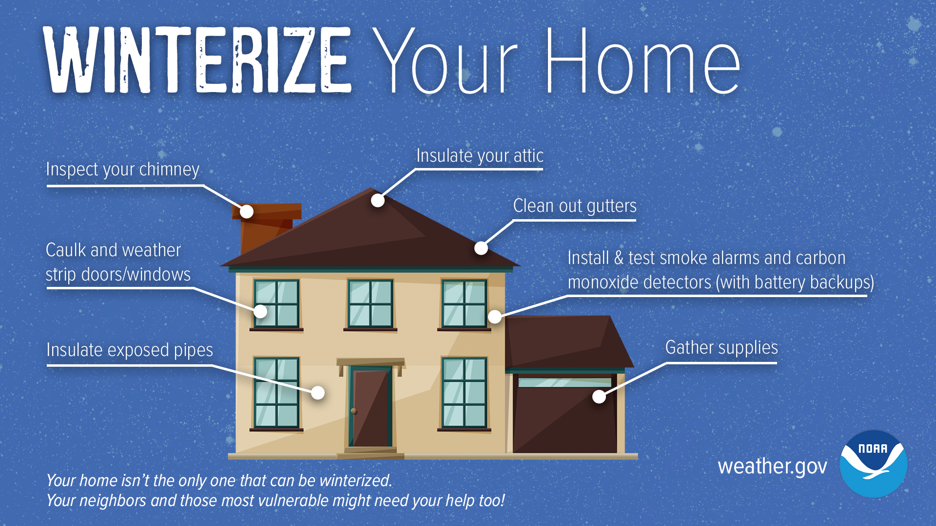
Your primary concerns at home include the possible loss of heat, electricity, and telephone service. Remember, if you lose power, you will probably also lose your primary source of heat as most furnaces need electricity to function. If you do have an alternate heat source such as a fireplace or wood stove, make sure that it is in good condition. Stove pipes, flues, and chimneys should be inspected and cleaned. Be sure your smoke and carbon monoxide alarms and fire extinguishers are in good working order.
You should keep at least a three day supply of non perishable food which requires no cooking or refrigeration. Have a non electric can opener available. Store one gallon of water per person, per day. Your disaster supplies for the home should also include a first aid kit along with essential prescription medication, a battery operated radio, a NOAA weather radio, flashlights, extra batteries, and several blankets.
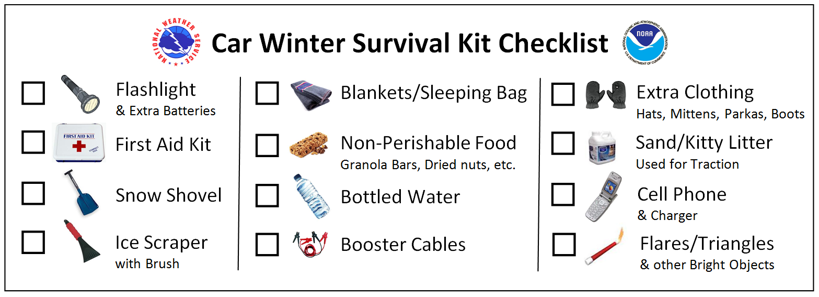
Be sure your vehicle is ready for the winter driving season. Have your engine tuned up, your battery checked, and your engine coolant tested to see if it can withstand extreme cold. Install new wiper blades to increase your visibility, and be sure your tires are properly inflated and have enough tread to grip the road. Prepare a survival kit for your vehicle, especially if you drive in rural areas. Include a blanket or sleeping bag along with a supply of non perishable food, a first aid kit with prescription medication if necessary, and bottled water or juice. If you become stuck or stranded, your chances of survival will be greater. Also include a shovel, sand or cat litter, booster cables, an ice scraper, and a snow brush.
When outdoors, dress properly for the cold. Wear several layers of warm, loose fitting clothing. The layers help trap your body heat better than one heavy layer, and a few layers can be removed as needed to avoid perspiration and subsequent chill. The outer layer should also be water repellent. Also, wear a hat to shield yourself from the cold since a significant loss of body heat occurs from your head. Mittens are also better than gloves at protecting your fingers from the cold.
Stay informed by paying attention to the news and checking the latest National Weather Service forecasts, warnings, and statements. Know your local radio and television stations that can provide you with up to date official information during an emergency.
You can also always get the latest weather information by tuning into NOAA Weather Radio. The Buffalo National Weather Service Forecast Office broadcasts 24 hours a day from seven stations serving western and north central New York. Forecast information is also available online, and on social media.
New Yorkers can also be notified immediately of threatening conditions through a state program called New York Alert. By signing up for N Y Alert, you can receive warnings and emergency information via the web, your cell phone, email and other technologies. Visit www.alert.ny.gov
Throughout the week we will be highlighting ways that you can be ready for all types of winter weather conditions. You can find out more about winter weather safety on our website at www.weather.gov/safety
Sunday: Intro to New York Winter Weather Awareness Week
Monday: Heavy Snow
Tuesday: Snow Squalls
Wednesday: Ice Storms
Thursday: Flooding and Ice Jams
Friday: Watches, Warnings, and Advisories
Saturday: New York Winter Weather Awareness Week Review
Anyone who needs information on winter storms in New York should contact their nearest National Weather Service office.
Buffalo:
Binghamton:
Burlington:
Albany:
New York:
Graphical information slide. Click for a larger view.
 |
 |
Monday:
...Heavy Snow...
The National Weather Service and the New York State Office of Emergency Management is promoting winter safety to all New Yorkers during Winter Weather Awareness Week October 27 through November 2.
Heavy snow can immobilize a region and paralyze a city, stranding commuters, closing airports, stopping the flow of supplies and disrupting services. Accumulations of snow can cause roofs to collapse and knock down trees and power lines. Homes and farms may be isolated for days. The cost of snow removal, repairing damages, and the loss of business can have severe economic impacts on cities and towns.
Heavy snow in Western and Northern New York is defined as 7 inches or more falling in a 12 hour period, or 9 inches or more falling in a 24 hour period.
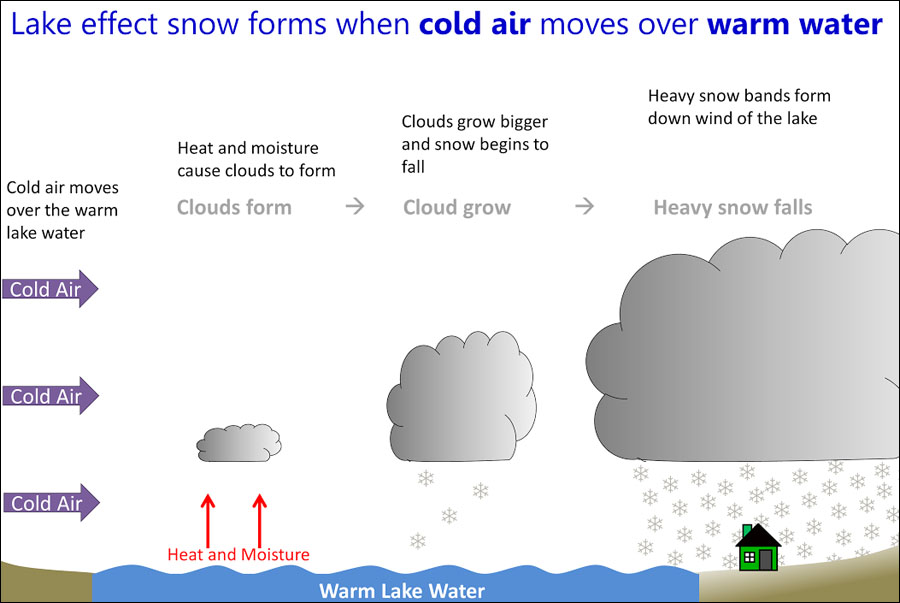
Most heavy snow in Western and Northern New York is caused by lake effect. As arctic air sweeps across the relatively warm waters of Lakes Erie and Ontario, heavy snow forms and falls downstream. Snowfall rates can exceed 4 inches an hour which is enough to overwhelm most snow removal crews and equipment. Strong winds often accompany lake effect snow which cause deep drifts and reduce visibility.
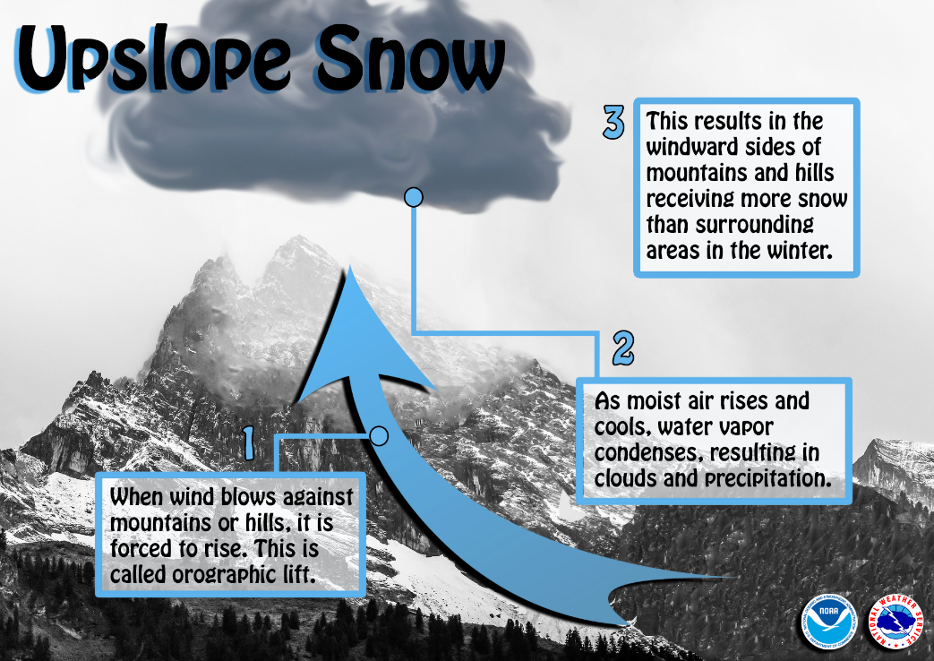
Heavy snow can also fall as the result of large storms called Nor Easters which move up the Atlantic Coast. Whereas lake effect snow usually falls in narrow bands, snow from Nor Easters can blanket thousands of square miles.
Looking back at the historical record, Western and Northern New York has had its share of dangerous winter storms. For a reminder of how dangerous early season winter storms can be, one only has to think back to November of 2022 and 2014, when almost seven feet of snow fell across the southern parts of the Niagara Frontier, and snowfall rates reached three to six inches per hour. As is often the case with many of our heavy lake effect snow events, thunder and lightning accompanied the intense lake effect snow.
Among all storms, the Blizzard of 1977 ranks as one of the worst. While only about a foot of snow fell from January 28th to February 1st, wind gusts up to 75 miles an hour in Niagara Falls and 69 miles an hour in Buffalo whipped up snow drifts over 20 feet deep, nearly topping telephone poles. Thousands of people were stranded away from their homes as roads became clogged and impassable. Twenty-nine people died, many frozen to death in their buried cars. President Carter proclaimed a federal disaster over a seven county area.
Still all too fresh in the minds of many, the historic Christmas weekend blizzard and lake effect snowstorm of 2022 also produced devastating impacts across the Buffalo and Watertown areas. The combination of wind gusts over 70 miles per hour and heavy lake effect snow made travel impossible and stranded thousands away from their homes and families for the Christmas holiday. Power outages were widespread, and over 50 inches of snow was recorded between the onset of the storm on December 23rd and the end of the lake snows on the 27th, with 47 people losing their lives across Niagara and Erie counites in western New York.
People living in and around Rochester will not soon forget the Blizzard of March 4, 1999. Over two feet of snow accompanied by strong winds forced the closing of the New York State Thruway and the stranding of thousands of motorists. The National Guard was called on to help remove cars and rescue the motorists. Power outages affected over 10,000 customers.
You can always get the latest information on threatening winter storms, 24 hours a day, by tuning into NOAA weather radio the voice of the National Weather Service.
The National Weather Service encourages you to prepare now for heavy snows and the effects it may have on the region.
You can find out more about winter weather safety on our website at www.weather.gov/safety
Graphical information slides. Click for a larger view.
 |
 |
Tuesday:
...Snow Squalls...
The National Weather Service and The New York State Office of Emergency Management is promoting winter safety to all New Yorkers during Winter Weather Awareness week October 27 through November 2.
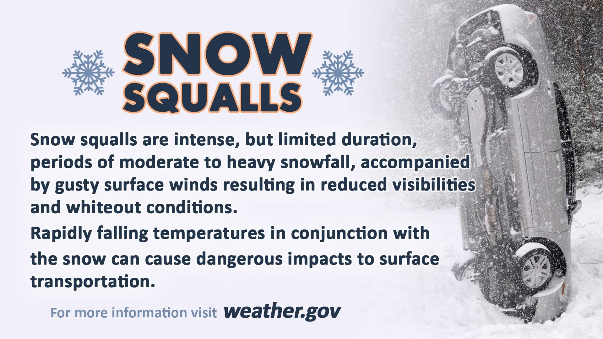
Snow squalls are often associated with strong cold fronts and are a dangerous winter weather hazard. In a snow squall, fair weather and dry roads can rapidly give way to heavy snow, gusty winds and falling temperatures, leading to sudden whiteout conditions and icy roads in a matter of just a few minutes.
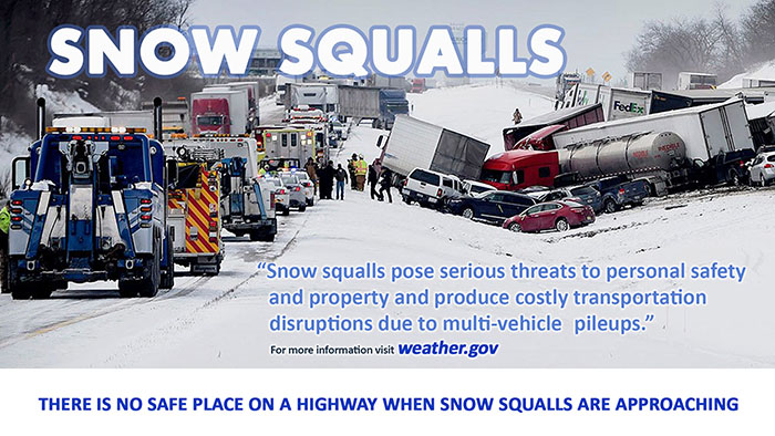
The sudden change in conditions brought on by a snow squall often catches drivers by surprise, and is what makes them so dangerous. The rapid transition from clear to partly cloudy skies to near zero visibility and snow and ice covered roads is the biggest cause of multi-vehicle pileups on limited access highways, freeways, and interstates.
Like summertime thunderstorms, snow squalls can develop suddenly, and can be somewhat random in their locations. Similar to Severe Thunderstorm Warnings, the National Weather Service monitors weather radar for signatures that indicate dangerous snow squalls, and issues Snow Squall Warnings when a snow squall is imminent or occurring.
When a Snow Squall Warning is issued for your location, you can expect a rapid onset of heavy snow and gusty winds, leading to whiteout conditions and icy roadways. If possible, avoid or delay travel until the squall passes. Even if it looks safe outside, visibility can quickly drop to near zero almost instantly. The combination of rapidly falling temperatures along with melting snow on high traffic roads can also lead to a flash freeze, in which untreated roadways quickly turn into a sheet of ice.
If you get caught in a Snow Squall while driving, stay in your lane, reduce your speed, turn on your headlights, and avoid slamming on your brakes. Multi-vehicle pileups are part of what make snow squalls so deadly. If you become involved in a pileup, if possible drive slowly forward to the front of the pileup. Whatever you do, do not stand outside your vehicle on or near the roadway, as doing so could put you at great risk of being struck by another vehicle. If you can do so safely, get as far away from the roadway as possible. If you cannot safely exit your vehicle, remain inside with your seatbelt on. /p>
You can find out more about winter weather awareness on our website at weather.gov/safety
Graphical information slide. Click for a larger view.
 |
 |
Wednesday:
...Ice Storms...
The National Weather Service and the New York State Office of Emergency Management is promoting winter safety to all New Yorkers during Winter Weather Awareness Week October 27 through November 2.
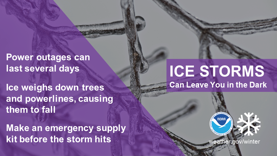
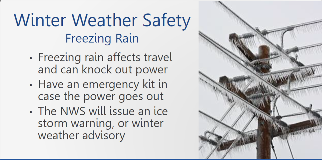
Ice storms are one of winters most dangerous hazards. Heavy accumulations of ice can bring down trees and power lines, as well as topple utility poles and communications towers. This can disrupt power and communications for days or even weeks while crews repair extensive damage. Even small accumulations of ice can be extremely dangerous to motorists and pedestrians. Bridges and overpasses are particularly dangerous because they freeze before other surfaces.
Freezing rain is the result of a temperature inversion which forms in the atmosphere. Rain falls in the warmer air well above the surface. However if temperatures are below freezing at the surface, the rain freezes on impact with objects and creates a coating of ice. A thick layer of ice adds tremendous weight to objects such as trees and power lines causing them to break under the stress. Even thin layers coating road surfaces are hazardous since they are very slippery.
Unfortunately, New York experiences some of the highest frequencies of freezing rain nationwide. Warm air blowing from the south is frequently deflected aloft above and within the mountains, trapping the cold air in the valleys.
In 2013, an ice storm struck the North Country with accumulations of up to an inch of ice. While one of the most dangerous and devastating storms struck the North Country from January 8 through 11 in 1998 where ice up to four inches thick brought down trees and power lines. Hundreds of thousands of people were without power for periods that exceeded a week in some instances. In Jefferson County alone, power outages affected over 75 percent of the customers. The dairy industry was devastated as the loss of power prevented the milking of cows.
In 1991, an ice storm struck Western and Northern New York from Jamestown to Watertown. In all, 20 counties were affected, 13 of them under a federal disaster declaration. Rochester was especially hard hit with schools and many businesses closed for a week. Once again, thick ice accumulations from freezing rain knocked out power. In all, almost 325,000 customers were without power. It was the costliest storm ever to strike New York State, exceeding the destruction caused by Tropical Storm Agnes.
As you can see, all New Yorkers must be prepared for the worst winter has to offer. Preparation is the key to a safe cold weather season. Your National Weather Service has many tips to help residents be ready if severe winter weather strikes. You can find this information by visiting our website at www.weather.gov/safety
Graphical information slides. Click for a larger view.
 |
 |
Thursday:
...Flooding and Ice Jams...
The National Weather Service and the New York State Office of Emergency Management is promoting winter safety to all New Yorkers during Winter Weather Awareness Week October 27 through November 2.
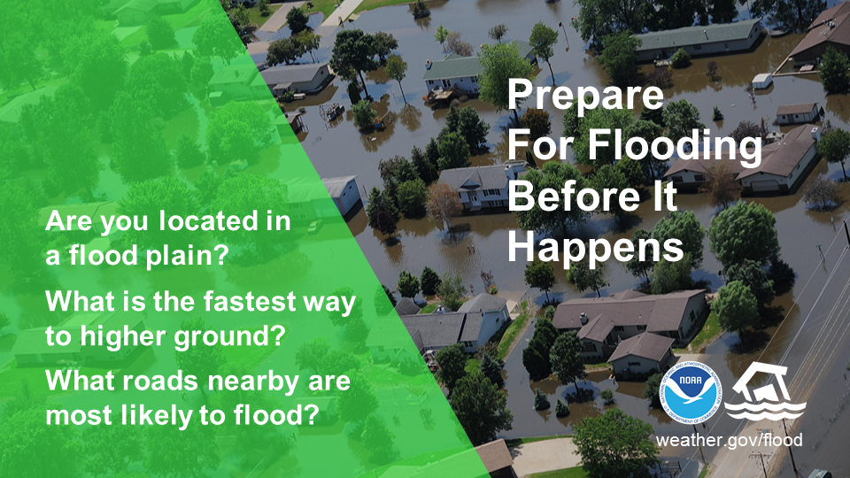
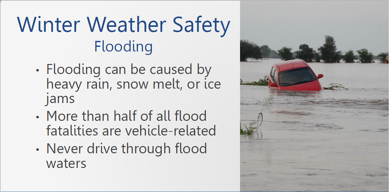
Although it may seem odd to the casual observer, flooding is actually a common hazard in New York during the winter months. There are periods of thaw which can produce enough snowmelt to saturate the ground and increase the river flows. If that is combined with a significant rainfall, then flooding can occur. That is what happened in January, 1996 over much of Western New York. A rapid snowmelt on January 17 reduced a 2 foot snowpack to bare ground and released more than 3 inches of water. That combined with a 1 to 2 inch rainfall to produce major flooding along the Allegheny and Upper Genesee rivers.
Significant flooding also occurred in Western New York in January, 1998. While the North Country was suffering from a major ice storm, major flooding occurred along the Allegheny and Genesee rivers. In addition to the ice storm, record flooding occurred along the Black River at Watertown.
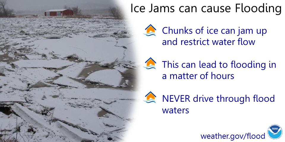
Another winter flood hazard is caused by ice jams in rivers and streams. Often during the winter, ice will form on a river or stream. The ice can become several inches thick during a prolonged cold spell. If the river flow were to suddenly increase due to snowmelt or heavy rain, the ice can break up into large slabs and move downstream until it reaches an obstruction such as a river bend, island or bridge. The resulting ice jam acts much like a dam blocking the flow of water and causing flooding upstream. In some cases the jam can suddenly break and release a surge of water and ice downstream.
While ice jams tend to form near the same locations every year, it is nearly impossible to predict exactly when they will form or when they will break. People need to remain alert for sudden changes in water levels.
Your National Weather Service and local emergency management officials work in partnership to monitor the formation of ice jams and assess the potential for flooding. Flood watches are issued when the flood potential increases, and they are upgraded to flood or flash flood warnings when flooding is imminent or occurring.
If you live or travel near a river or stream you must remain alert for the possibility of flooding during the winter months and heed the advice of emergency management officials.
You can find more information about winter weather safety on our website at www.weather.gov/safety
Graphical information slides. Click for a larger view.
 |
 |
 |
Friday:
...Watches, Warnings, and Advisories...
The National Weather Service and the New York State Office of Emergency Management is promoting winter safety to all New Yorkers during Winter Weather Awareness Week October 27 through November 2.
The National Weather Service will keep you informed of any hazardous weather threatening New York this upcoming winter season. Hazardous weather outlooks issued daily by your local office will highlight the potential for severe winter weather up to 7 days in advance of a storm.
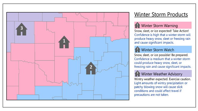
If the chance of hazardous weather increases...a winter storm watch would be issued in advance of a storm. Watches are issued for the possibility of heavy snow, 7 inches or more in a 12 hour period (9 inches or more in a 24 hour period), for possible severe icing due to freezing rain, or for possible blizzard conditions defined as the dangerous combination of snow, blowing snow, and wind. A winter storm watch will also be issued for the potential of heavy lake effect snow generated by cold air moving across the great lakes. Lake effect snow usually occurs in narrow bands, affecting some areas and leaving nearby communities untouched.
Winter storm warnings are issued when there is a high probability of heavy snow, severe icing of one half inch or more, or the combination of heavy snow, sleet, or freezing rain within the next 48 hours or so. Lake effect snow warnings usually pinpoint the location of the localized heavy snow while blizzard warnings, the most dangerous of winter storms, are issued for widespread, blinding snowstorms.
Winter weather advisories are issued for winter weather conditions which pose a significant inconvenience but are not normally consider life threatening if the proper precautions are taken. Advisories may be issued for between 4 and 6 inches of snow, for freezing drizzle or light freezing rain, for blowing or drifting snow, or for dense fog. The greatest hazard is often to motorists and pedestrians.
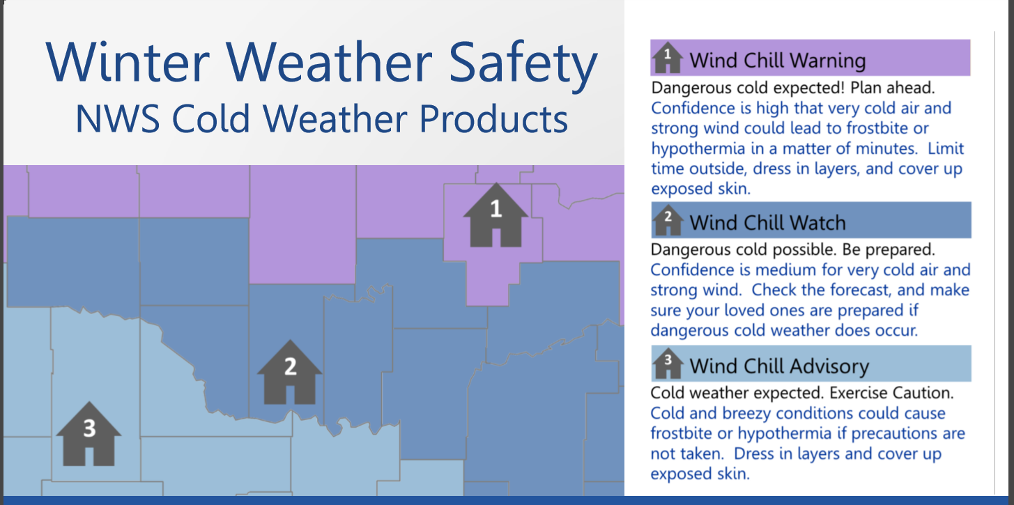
For extremely cold and windy weather, your National Weather Service will issue extreme cold warnings for equivalent wind chill temperatures of minus 25 degrees or lower except minus 30 degrees or lower in North Country counties of Jefferson and Lewis. Cold weather advisories will inform you of equivalent wind chill readings of minus 15 degrees (minus 20 degrees in Jefferson and Lewis counties).
A high wind warning is issued when sustained winds are expected to reach 40 miles an hour or if wind gusts reach 58 miles an hour. A wind advisory is issued for sustained winds from 31 to 39 miles an hour or for wind gusts of 46 to 57 miles an hour.
You can always rely on NOAA weather radio, the voice of the National Weather Service, for the latest forecasts, warnings and statements this winter as well as throughout the year.
You can find out more about winter weather awareness on our website at www.nws.noaa.gov/safety
Graphical information slides. Click for a larger view.
 |
 |
Saturday:
...Winter Weather Awareness Week in Review...
The National Weather Service and the New York State Office of Emergency Management is promoting winter safety to all New Yorkers during Winter Weather Awareness Week October 27 through November 2.
Winter in New York State can be a time of unsurpassed beauty. It is also a time when winter storms and sub zero temperatures pose a threat to disrupt our daily lives.
An emergency, be it a natural disaster or emergency such as a winter storm, flood, power outage or a terrorist act, can occur quickly and without warning. By taking three simple steps, you can become better prepared to protect yourself and your family by following this safety information. Develop a family emergency plan. Stock up on emergency supplies. Be aware.
New Yorkers can be notified immediately of threatening conditions through a state program called New York Alert. By signing up for NY Alert, you can receive warnings and emergency information via the web, your cell phone, email and other technologies. Visit NY Alert
You can also always get the latest information on threatening winter storms, 24 hours a day, by tuning into NOAA Weather Radio the voice of the National Weather Service. Radio stations serving Western New York include:
Buffalo KEB98 broadcasting on 162.550 MHZ,
Rochester KHA53 broadcasting on 162.400 MHZ,
Spencerport WNG539 broadcasting on 162.525 MHZ,
Watertown WXN68 broadcasting on 162.475 MHZ,
Frewsburg WNG541 broadcasting on 162.525 MHZ,
Little Valley WWG32 broadcasting on 162.425 MHZ, and
Lyons WZ2536 broadcasting on 162.475 MHZ.
You can find out more about winter weather safety on our website at www.weather.gov/safety
Prepare now...then enjoy the winter in New York State.