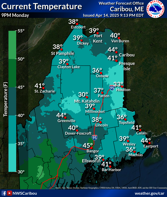
Current Temperatures
 |
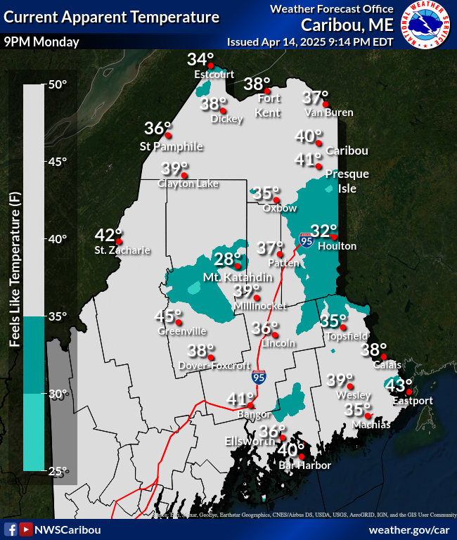
Current Heat Indices
 |
Max Temperature vs Heat Index
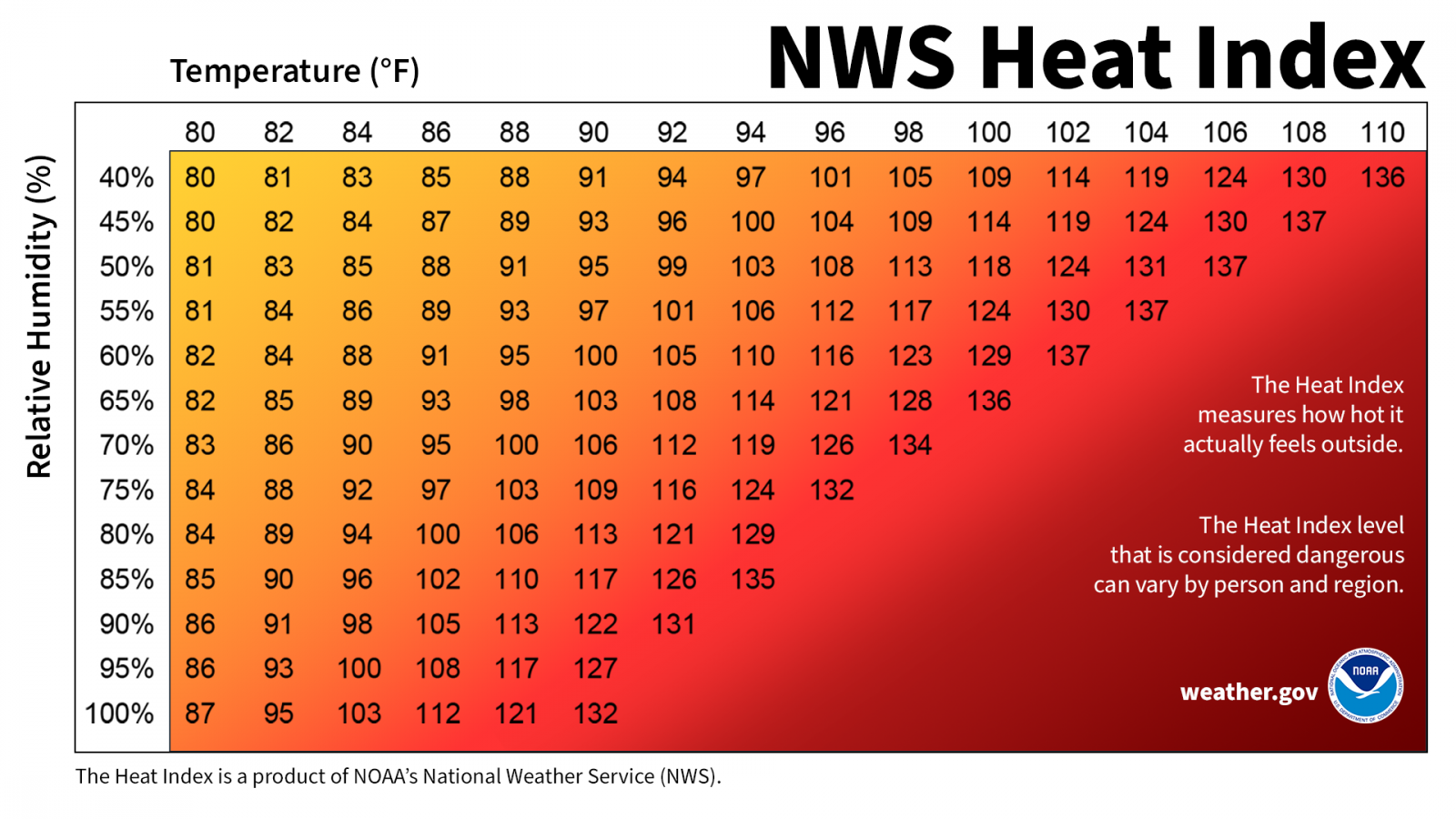
The Heat Index is a measure of how hot it really feels when relative humidity is factored in with the actual air temperature. To find the Heat Index, look at the Heat Index Chart above or check our Heat Index Calculator. As an example, if the air temperature is 96°F and the relative humidity is 65%, the heat index--how hot it feels--is 121°F. The red area without numbers indicates extreme danger. The National Weather Service will initiate alert procedures when the Heat Index is expected to exceed 105°-110°F (depending on local climate) for at least 2 consecutive days.
Compare the Max Temperature and Heat Index
(Prototype -- availability not guaranteed)
* (Experimental) National WBGT Display *
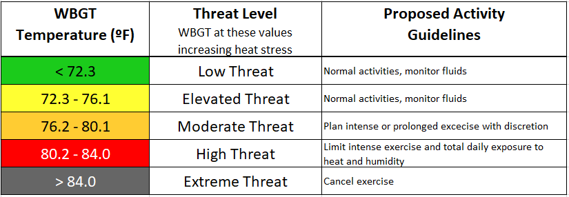
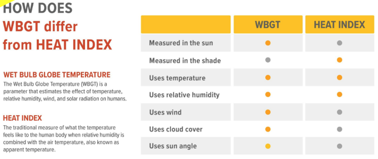
The Wet Bulb Globe Temperature (WBGT) is a measure of heat stress in direct sunlight, which is based on temperature, humidity, wind speed, sun angle, and cloud cover (solar radiation). This differs from the heat index, which is based only on temperature and humidity and is calculated for shady areas.
Scroll down for latest forecasts.
Resources
* National Heat Risk Display *
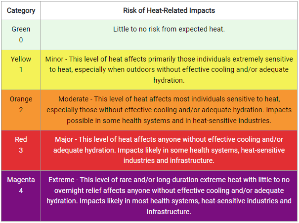
The NWS HeatRisk is an experimental color-numeric-based index that provides a forecast risk of heat-related impacts to occur over a 24-hour period.
HeatRisk takes into consideration:
- How unusual the heat is for the time of the year
- The duration of the heat including both daytime and nighttime temperatures
- If those temperatures pose an elevated risk of heat-related impacts based on data from the CDC
- This index is supplementary to official NWS heat products and is meant to provide risk guidance for those decision makers and heat-sensitive populations who need to take actions at levels that may be below current NWS heat product levels.
Resources
WBGT vs Heat Index
What's the Difference?
Compare the WBGT and Heat Index
Heat Safety
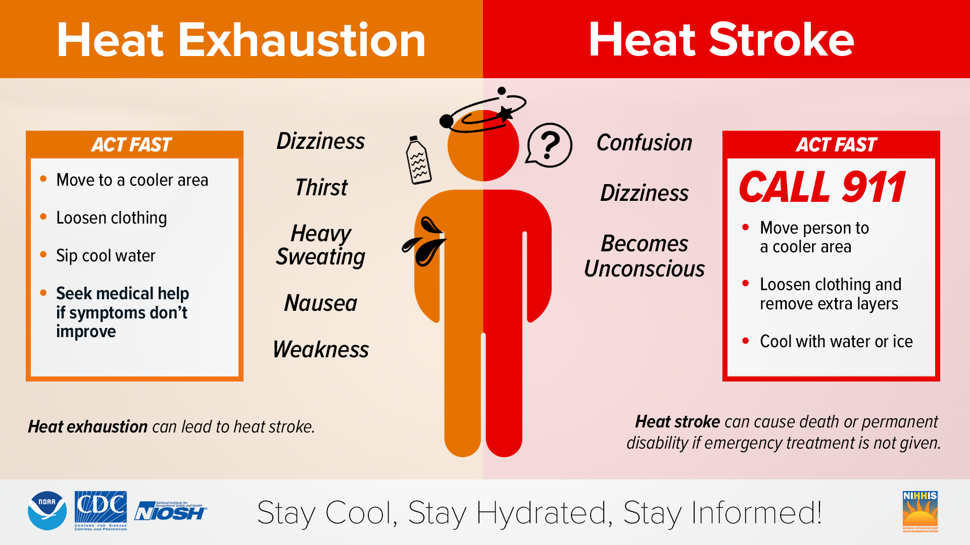
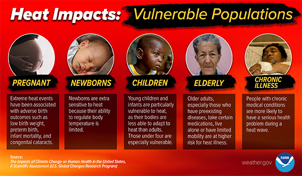
During extremely hot and humid weather, your body's ability to cool itself is challenged. When the body heats too rapidly to cool itself properly, or when too much fluid or salt is lost through dehydration or sweating, body temperature rises and you or someone you care about may experience a heat-related illness. It is important to know the symptoms of excessive heat exposure and the appropriate responses. The Centers for Disease Control and Prevention (CDC) provides a list of warning signs and symptoms of heat illness, and recommended first aid steps. Some of these symptoms and steps are listed below.
Heat Cramps
Heat cramps may be the first sign of heat-related illness, and may lead to heat exhaustion or stroke.
- Symptoms: Painful muscle cramps and spasms usually in legs and abdomen and Heavy sweating.
- First Aid: Apply firm pressure on cramping muscles or gently massage to relieve spasm. Give sips of water unless the person complains of nausea, then stop giving water.
Seek immediate medical attention if cramps last longer than 1 hour.
Heat Exhaustion
- Symptoms: Heavy sweating, Weakness or tiredness, cool, pale, clammy skin; fast, weak pulse, muscle cramps, dizziness, nausea or vomiting, headache, fainting,
- First Aid: Move person to a cooler environment, preferably a well air conditioned room. Loosen clothing. Apply cool, wet cloths or have person sit in a cool bath. Offer sips of water. If person vomits more than once,
Seek immediate medical attention if the person vomits, symptoms worsen or last longer than 1 hour
Heat Stroke
- Symptoms: Throbbing headache, confusion, nausea, dizziness, body temperature above 103°F, hot, red, dry or damp skin, rapid and strong pulse, fainting, loss of consciousness.
- First Aid: Call 911 or get the victim to a hospital immediately. Heat stroke is a severe medical emergency. Delay can be fatal. Move the victim to a cooler, preferably air-conditioned, environment. Reduce body temperature with cool cloths or bath. Use a fan if heat indicies are below the high 90s. A fan can make you hotter at higher temperatures. Do NOT give fluids.
Resources



 Radar
Radar Current Weather
 Rivers & Lakes
 Satellite
 Forecast Maps
 Hour by Hour Forecast
 Tropical Weather
 Graphical Hazards
 Winter Weather
 Marine Forecasts
 Coastal Flood
 Weather Hazard Briefing
 Recreational Forecast
 Climate Plots
 NOAA Weather Radio
 Skywarn
 Submit Storm Report
 Text Products
 Follow us on X
 Follow us on Facebook
 Follow us on YouTube
 CAR RSS Feed