Severe weather and flooding threats will continue for portions of the central U.S. through Thursday, focused from the central High Plains to the Mid-Mississippi Valley. Hot and dry conditions will fuel fire weather concerns for the Intermountain West, and dry thunderstorms may spark additional wildfires. Dangerous heat will build across the southern U.S. Friday into the weekend. Read More >
| WFO CRP Office Training Plan for October 2019 - March 2020 | NWS LMS |
| Required Grids | Time | ISC Collaboration Thresholds (if applicable) | ||
| MaxT/MinT/T/Td | Days 1-8 | 5 degrees | ||
| ApparentT/HeatIndex/WindChill | Days 1-8 | 7 degrees | ||
| PoP | Days 1-8 | 20% | ||
| Sky | Days 1-8 | 25% | ||
| Wx | Days 1-8 | N/A | ||
| Hazards | Days 1-8 | N/A | ||
| QPF | Days 1-4 | 0.25 inch | 0.50 inch | 1.0 inch |
| QPF < 1.5 inches | QPF < 3.0 inches | QPF >= 3.0 inches | ||
| Wind/WindGust | Days 1-8 | 10 knots | 15 knots | 45 degrees |
| Winds 13-19 knots | Winds >= 20 knots | Winds >= 12 knots | ||
| RH/MaxRH/MinRH | Days 1-8 | 5% | 10% | 15% |
| RH < 20% | RH 20-24% | RH 25-49% | ||
| 20% | 25% | |||
| RH 50-74% | RH 75-100% | |||
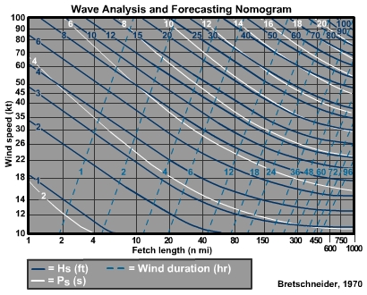
| WaveHeight | Days 1-7 | 2 feet | 3 feet | 4 feet |
| Waves > 2 & < 6 feet | Waves < 12 feet | Waves < 16 feet | ||
| 5 feet | 6 feet | 7 feet | ||
| Waves <20 feet | Waves < 24 feet | Waves < 28 feet | ||
| 8 feet | ||||
| Waves < 32 feet | ||||
| Wind20ft | Days 1-8 | N/A | ||
| MixHgt | Days 1-3 | N/A | ||
| TransWind | Days 1-3 | N/A | ||
| LAL | Days 1-3 | N/A | ||
| Haines | Days 1-3 | N/A | ||
| Wetflag | Days 1-2 | N/A | ||
| Period | Days 1-2 | N/A | ||
| RipCurrentRisk | Days 1-2 | N/A | ||
| UVIndex | Days 1-2 | N/A |
| Winter Grids | Time | ISC Collaboration Thresholds (if applicable) | ||
| SnowAmt | Days 1-3 | 2 inch | 4 inch | 6 inch |
| Snow < 6 inches | Snow < 12 inches | Snow >= 12 inches | ||
| IceAccum | Days 1-3 | 0.1 inch | 0.2 inch | 0.4 inch |
| Ice < 0.5 inches | Ice < 1.0 inch | Ice >= 1.0 inch | ||
| SnowRatio | Days 1-3 | N/A |
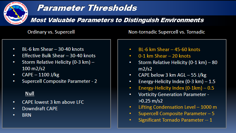
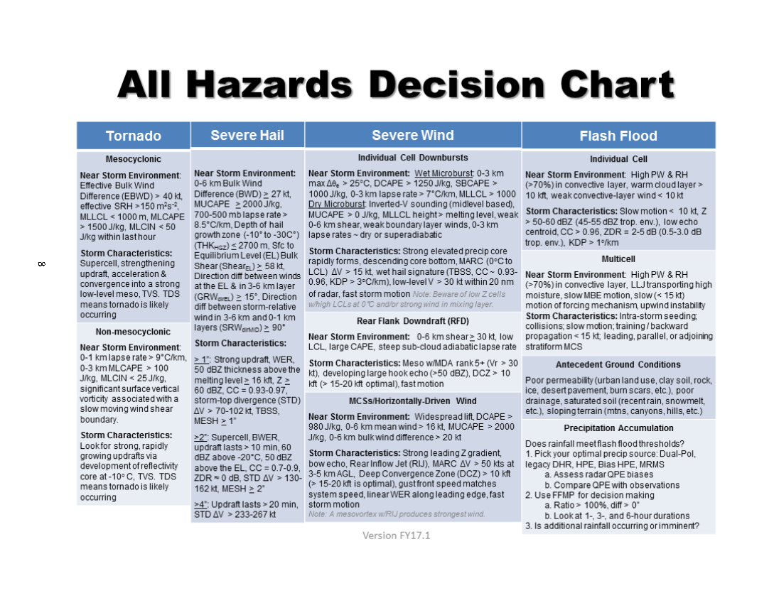
| Severe Weather Parameters | Severe Weather Warning Techniques | Convection Allowing Models | Warngen Training |
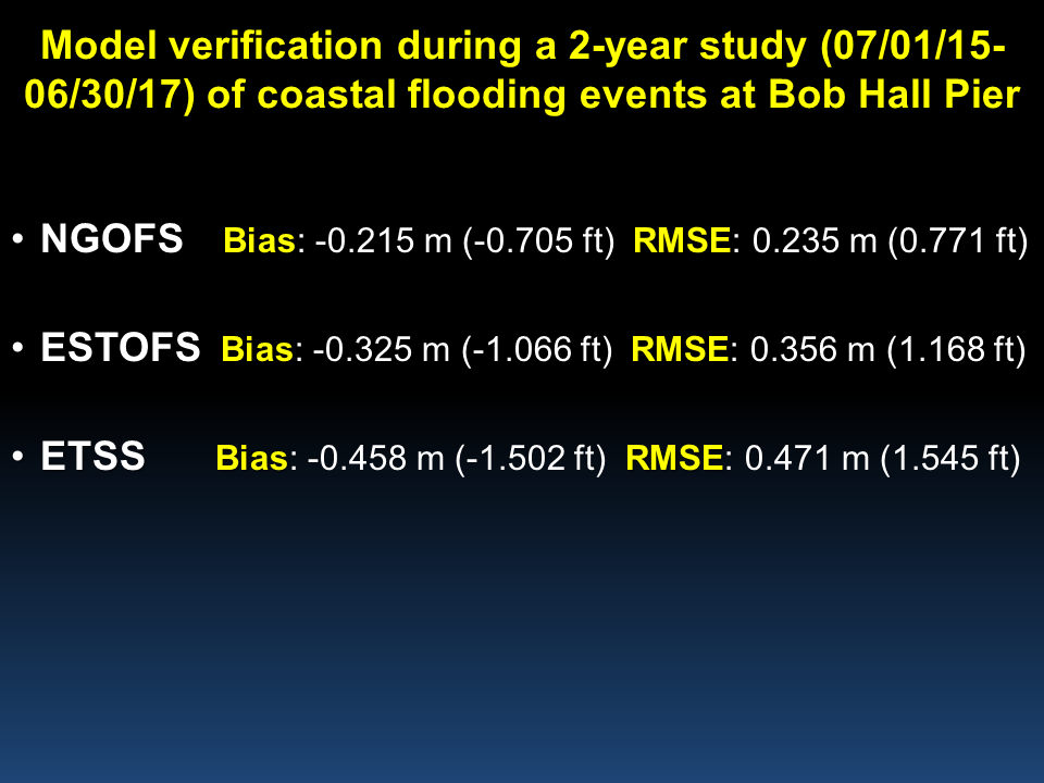
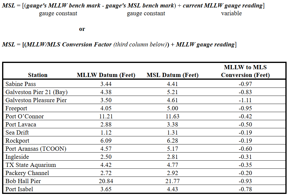
| Unique Meteorology of the Middle Texas Waters | Coastal Currents and Waves | Marine Models |
| Operational NWP Models | Ensembles, Anomalies, and Analogs |
| Synoptic Patterns Associated with the 6-8 January 2017 South Texas Cold Air Outbreak Event |
| Tropical GFE Cheat Sheet | Tropical Tornado Warning Aid |
| 2017 NHC Forecast Verification Report | Hurricane Model Summary |
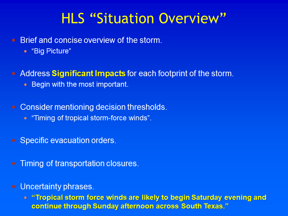
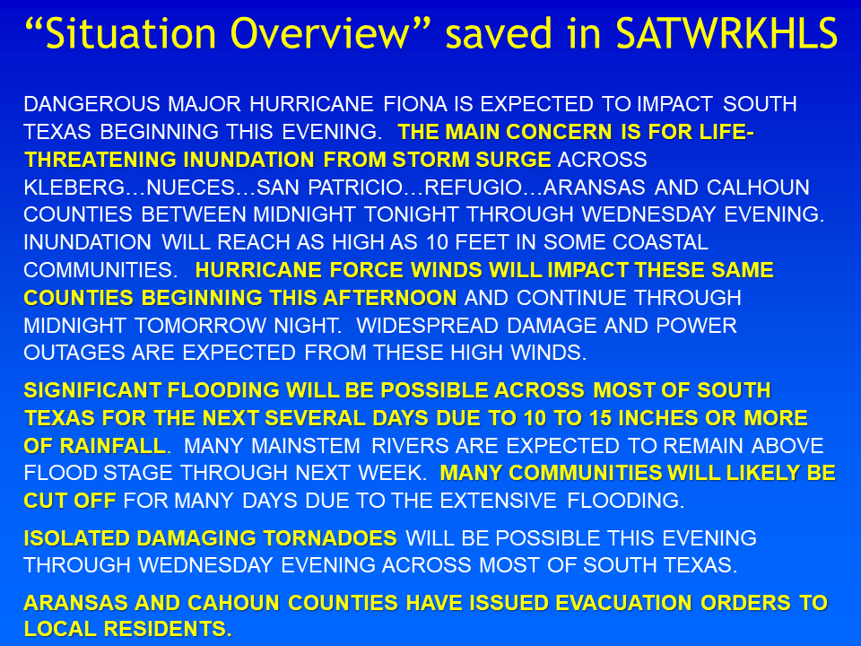
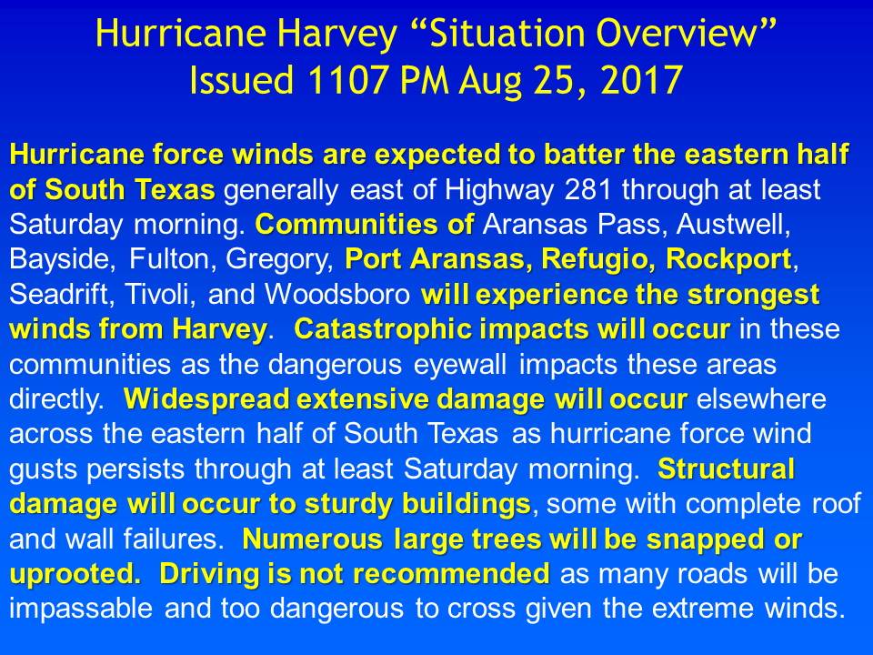
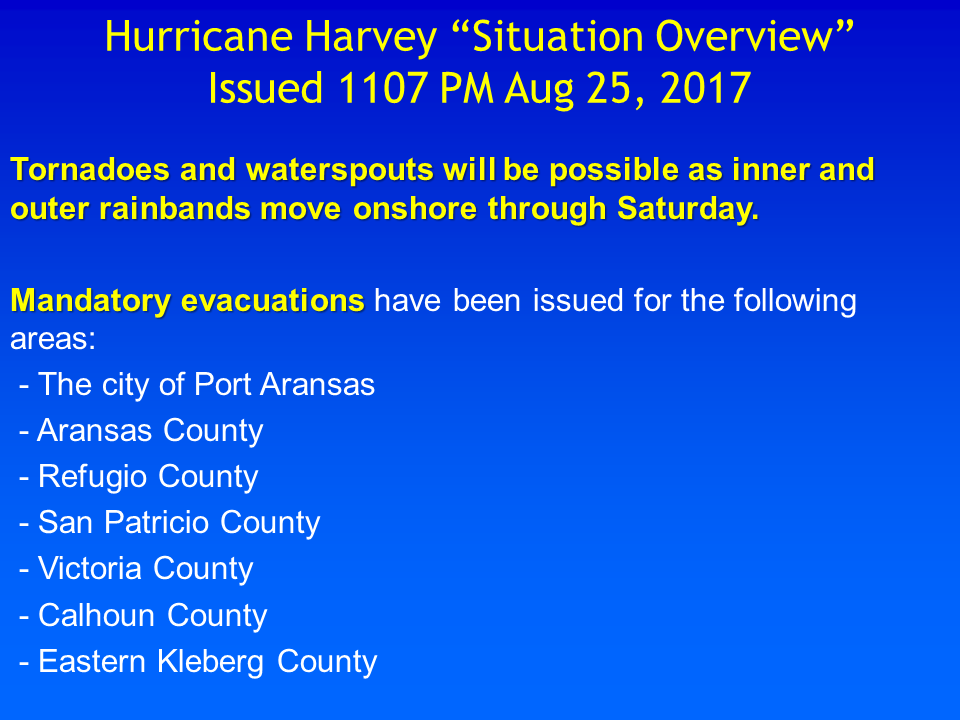
| What's in the HLS Situation Overview | HLS Situation Overview Example |
|---|---|
 |
 |
 |
 |
 |
 |
 |
 |
 |
 |
 |
 |
 |
| WDTD Suggested Warning Methodology |
 |
 |

| WDTD Tornado Warning Guidance | Mesovortex Warning Guidance | Confidence Builders and Nudgers |
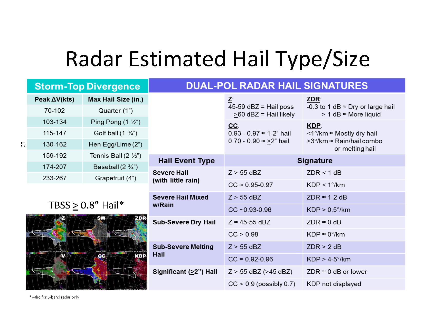
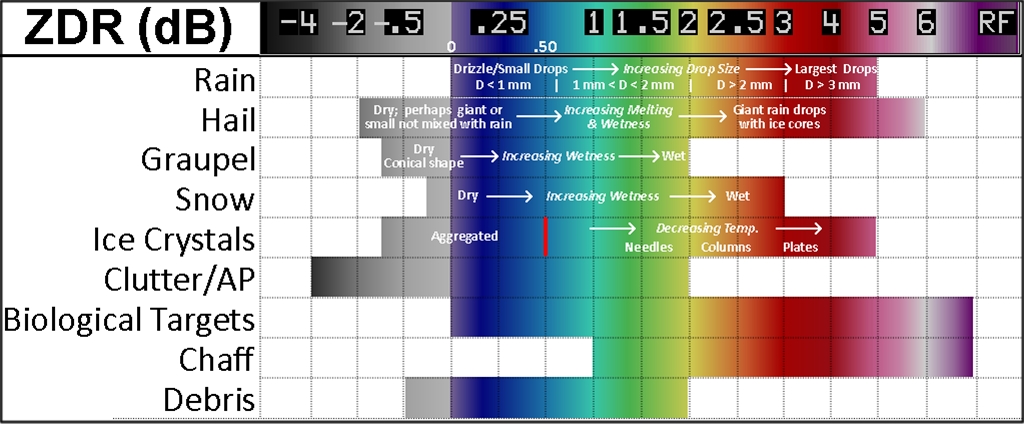
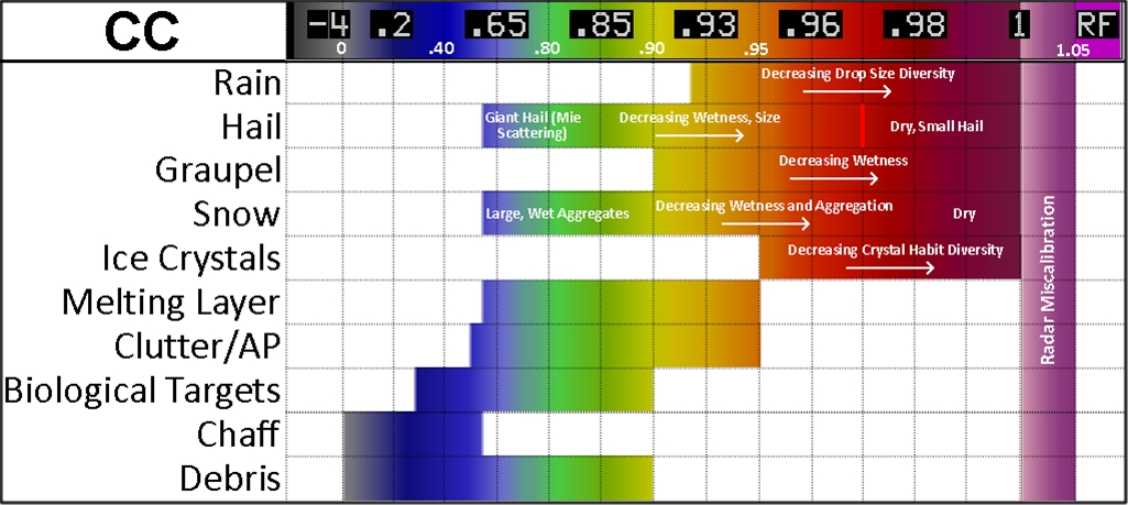
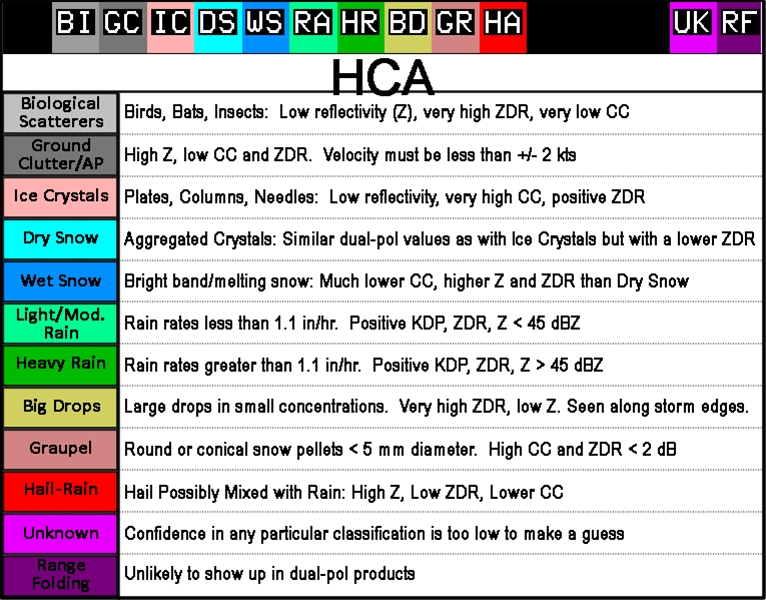
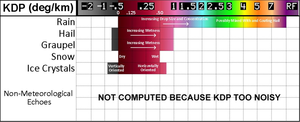
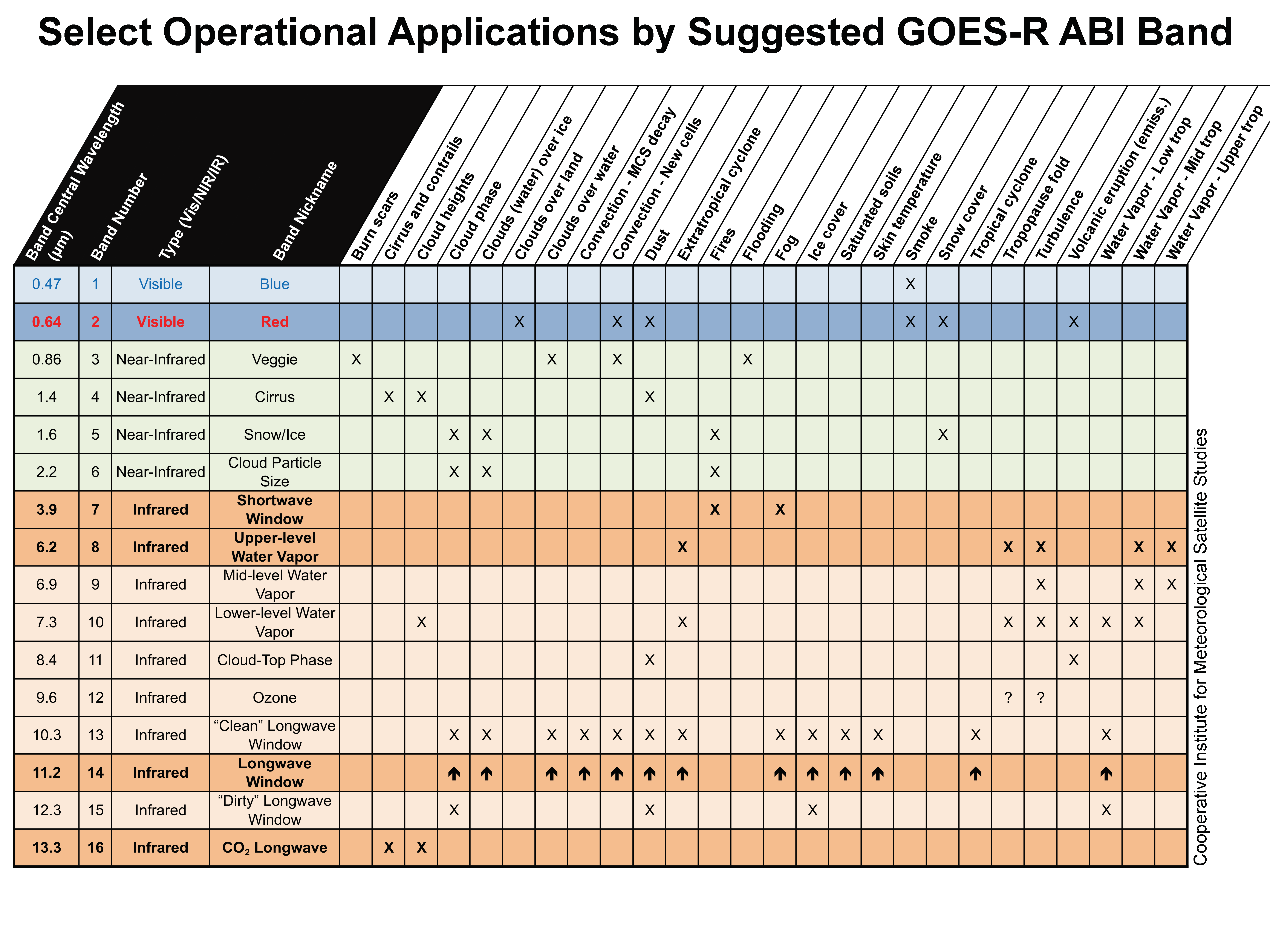
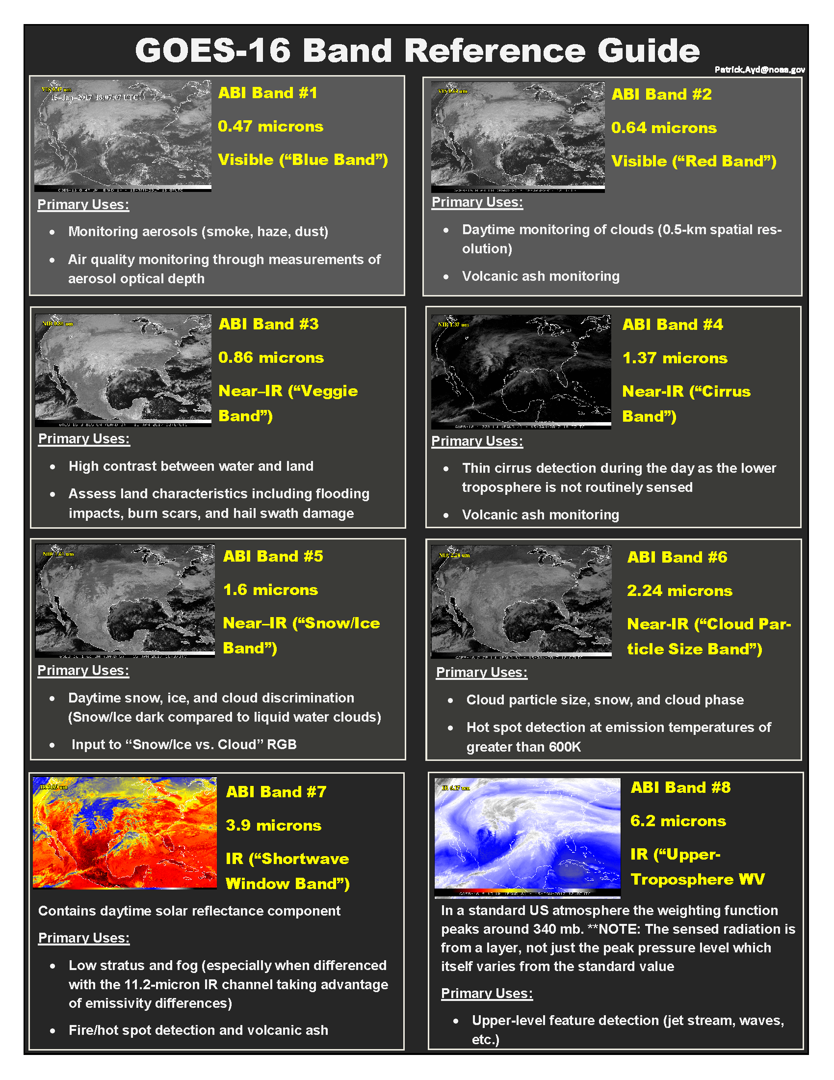
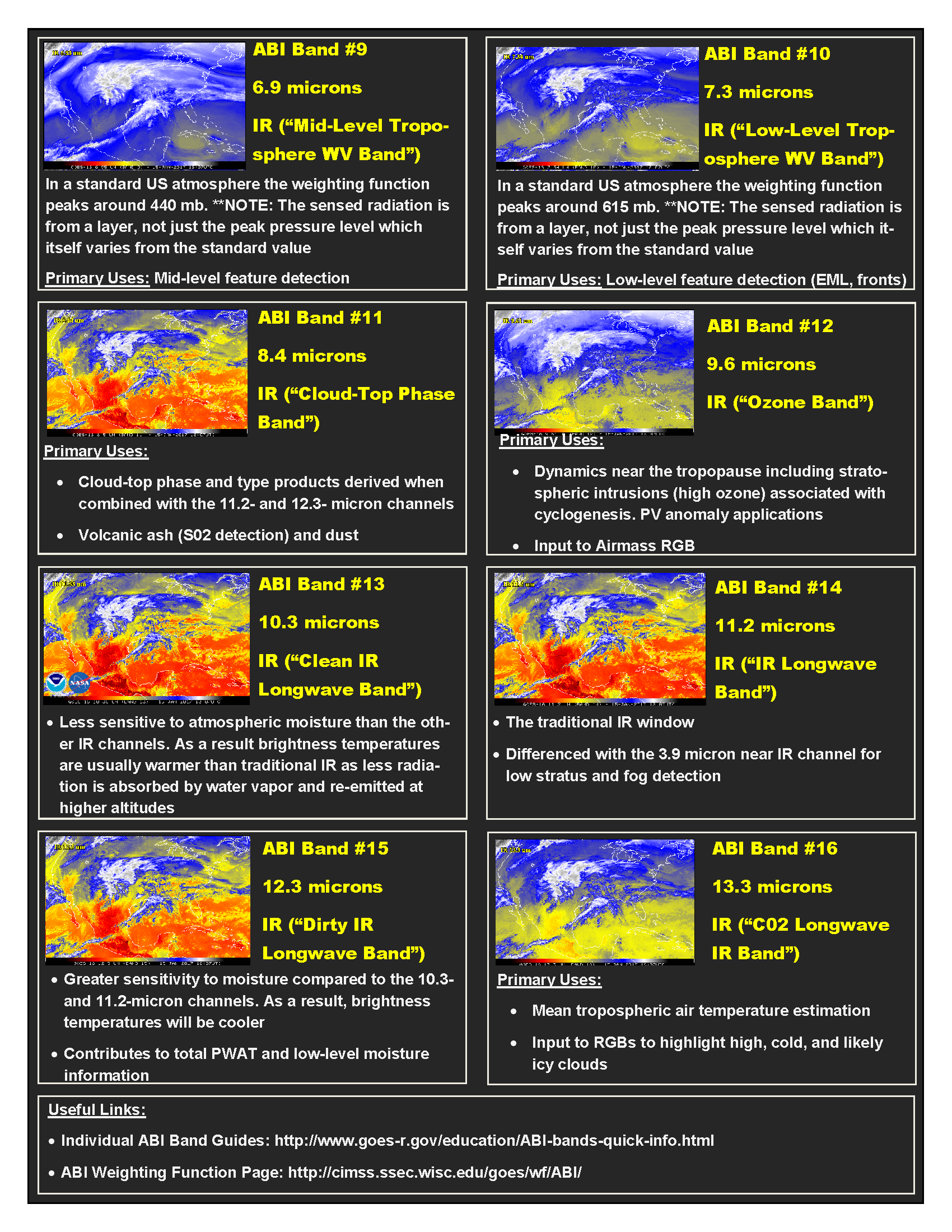
| Dual-Pol Reference Guide (OU) | Dual-Pol Reference Guide (WDTB) |
 |
|
 |
|
 |
|
 |
|
| Click the image above or the images below to view them in full-size. | |
 |
 |
 |
 |