National Weather Service United States Department of Commerce

Total Solar Eclipse April 8, 2024 - Review of the Event

Highlights of the 2024 Total Solar Eclipse as it crossed North and Central Texas on Monday April 8th. Read More >

Click a location below for detailed forecast.

Last Map Update: Sat, May. 4, 2024 at 1:38:37 pm CDT

National Weather Service Amarillo, TXNational Weather Service Norman, OKNational Weather Service Tulsa, OK
National Weather Service San Angelo, TXZoom
Out

National Weather Service Shreveport, LA
National Weather Service Austin/San Antonio, TXNational Weather Service Houston/Galveston, TXNational Weather Service Lake Charles, LA

Thunderstorms will increase in coverage today and tonight with a threat for severe weather mainly west of I-35. Very heavy rainfall may result in some flash flooding overnight across parts of North and Central Texas.
Storms are expected to increase in coverage later this evening and especially overnight. Thunderstorms will move into North and Central Texas late this evening and continue pushing into East Texas by early Sunday morning.
Showers and thunderstorms will increase across the region today and especially tonight as a complex is expected to move across North and Central Texas. Widespread rainfall amounts of 1 to 3 inches will be possible with an increasing threat for flooding to the southwest of the Metroplex.
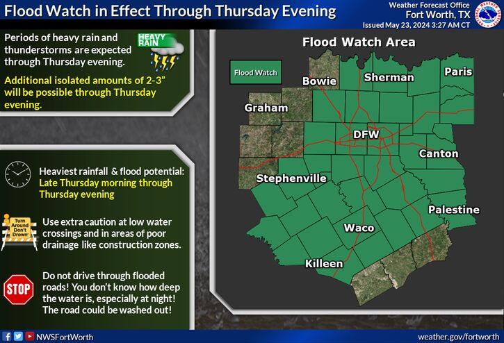
A Flood Watch is in effect for all of North and Central Texas through 1pm Sunday. Possible Impacts: Flooding may occur in low-lying, urban, and poor drainage areas. Rapid rises will be possible on creeks, streams, and rivers. Actions to Take: Those living in areas prone to flooding should be prepared to take action should flooding develop. Rainfall Amounts: Rainfall totals of 1 to 3 inches, with isolated higher amounts of 5 inches possible in parts of Central Texas.
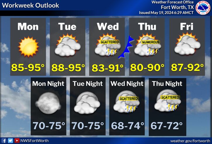
Periodic chances for showers and thunderstorms will continue through next week. Strong to severe thunderstorms and heavy rainfall will be possible at times, particularly Monday and Wednesday afternoon/evening. High temperatures in the mid 80s to near 90 degrees are expected by Tuesday/Wednesday of next week. A late week cold front will bring temperatures closer to normal for Mother's Day weekend.

Text Product Selector (Selected product opens in current window)
Latest Text Products Issued (Experimental)
Safe Rooms Icon Cooperatirve Rainfall (CoCoRaHs) icon Storm Ready Icon AirNow Icon