During the late afternoon of Friday, March 20th, thunderstorms developed over South Carolina east of Columbia. These storms intensified and became severe as they moved northeast across northeast South Carolina and southeast North Carolina during the evening. The combination of a favorable wind shear profile, unstable air and the approach of a cold front contributed to the severity of the storms. A tornado was reported with one of the storms in Robeson county. Numerous reports of large hail were also received along with a couple of wind damage reports. In addition, these storms contained very heavy rain and doppler radar estimated the rainfall amounts between 1 and 2.5 inches.
Between 7 and 9 PM, these storms produced large hail as they tracked across northeast South Carolina. The largest hail size reported was golf ball size at Society Hill in Darlington county. Other reports of three quarter to one inch hail were received from several locations in Darlington, Florence, Marion, Marlboro and Dillon counties. The hail covered the ground at Society Hill and Florence. Between 8:45 and 9:15 PM, these storms produced large hail and damaging winds across Robeson and western Bladen counties of southeast North Carolina. The largest hail size reported was 1.25 inches at Proctorville in Robeson county. Wind damage occurred at Lumberton and a tornado was sighted in the vicinity of Proctorville. This tornado threw a trailer off its foundation and carried it for a distance of a half mile. In addition, the tornado knocked a tree down on a house. Only minor injuries were reported.
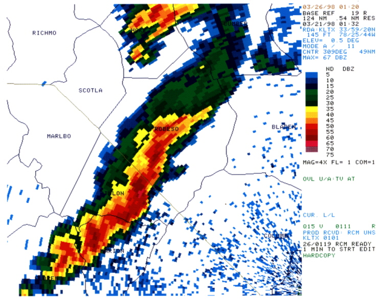
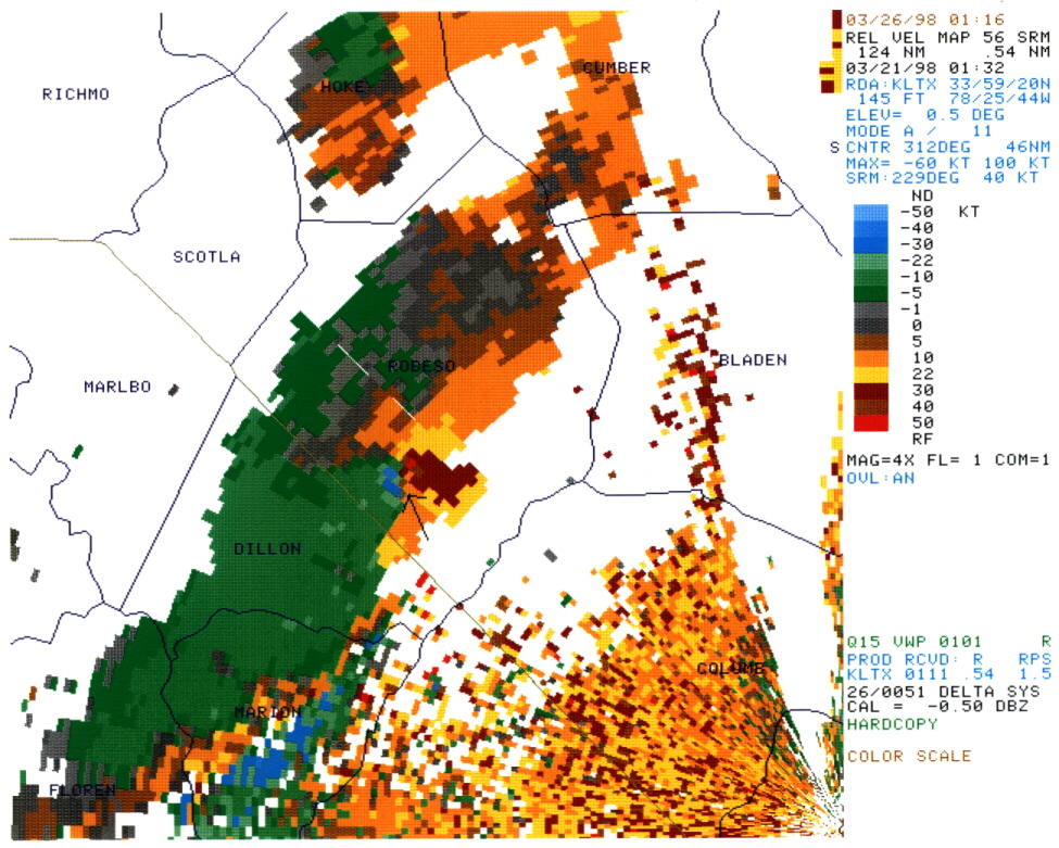
The reflectivity image below is from the Wilmington doppler radar at 8:20 PM 3/20/98. A cluster of severe thunderstorms was over part of northeast South Carolina and southeast North Carolina at this time. The storm over southeast Robeson county produced the tornado in the vicinity of Proctorville. Below the reflectivity image is a velocity image from the Wilmington doppler radar at 8:20 PM. The arrow indicates where rotation was identified. The area shaded in red indicates radar estimates of wind movement away from the radar while the blue area immediately to the southwest indicates wind movement toward the radar.


 Coastal Flood