A line of thundestorms developed ahead of the cold front from the Ohio Valley to the Gulf Coast on May 5th. These storms moved east overnight and crossed the mountains during the morning on May 6th. As the storms continued to move east, they strenghtened along a trough of low pressure that extended from the Piedmont sections of North Carolina into north central South Carolina. By late morning severe weather was occurring with the storms in central and western South Carolina. The storms moved into the eastern sections of the Carolinas during the afternoon and continued to produce severe weather in the form of large hail, damaging winds and isolated tornados.
The most impressive reports of damage occurred in Darlington, Florence and Horry counties. In Hartsville, strong winds blew down numerous trees around 425 PM. Just a short while later, a wind gust to 91 MPH occurred at the Darlington airport blowing 78 foot by 16 foot doors off a hangar and also blew a hole in the roof of the hangar. Around 455 PM, the high winds moved into the New Hope community south of Florence and partially blew the roofs off of two homes. As the storms rolled into Horry county, a small tornado developed near Aynor tearing part of a roof off a home and damaging numerous trees. The path of the tornado was estimated to be 50 to 70 yards wide and three quarters to a mile long.
|
|
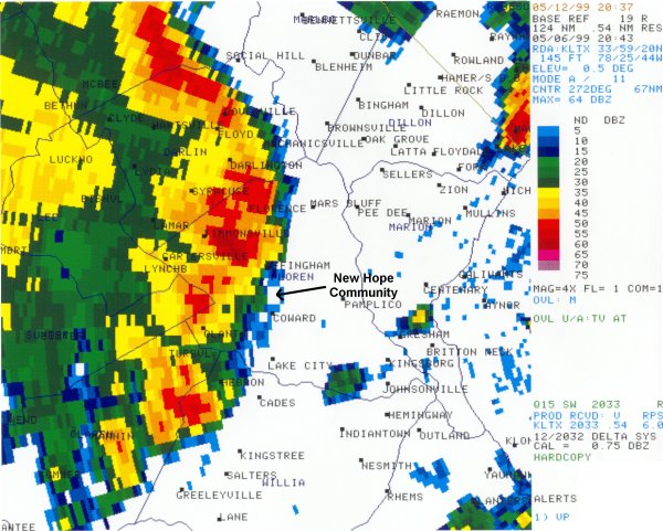
Reflectivity image at 443 PM. The line of storms just recently moved through Darlington and are approaching New Hope. |
|
|
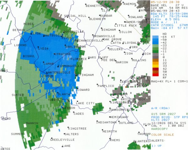
Velocity image at 443 PM. The large area of blue indicates radar estimates of wind speeds in excess of 48 miles an hour. |
|
|
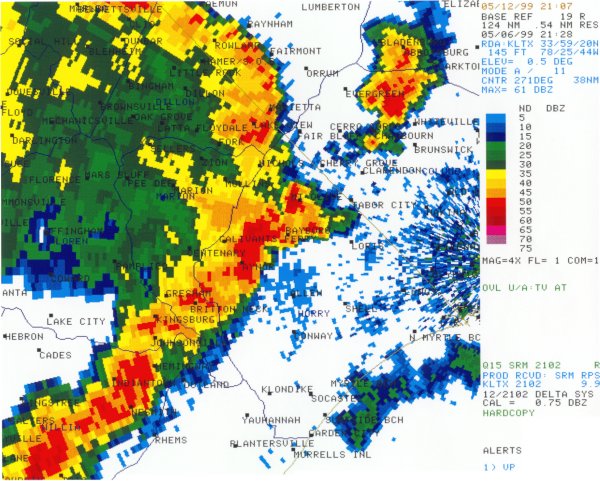
Reflectivity image at 528 PM. The line of storms was moving through Aynor. |
|
|
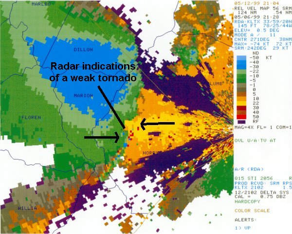
Storm relative velocity image at 528 PM. The area of yellow indicates movement away from the radar while the green and blues show movement toward the radar. Where the yellow and green are right next to each other is where the weak tornado formed. |


 Coastal Flood