Severe thunderstorms developed across southeast North Carolina, producing hail up to 1.75 inches in diameter from Interstate 95 east to the coast during the mid and late afternoon hours. A total of 10 severe thunderstorm warnings were issued for 6 counties in NWS Wilmington's county warning area.
The thunderstorms developed during the afternoon as an upper level low pressure system moved directly over the area. The main severe weather threat was large hail as very cold air aloft was associated with the upper level low. The first report of large hail was received around 2:30 PM as 1.75 inch diameter hail fell just south of Fairmont in Robeson county. As other storms developed, several reports of dime to quarter sized hail were received from Bladen and Columbus counties. By 3:30 PM, the storms merged into a solid line extending from southern Pender county into Brunswick county. As this line advanced east, 1 inch hail was reported in Leland around 4:30 PM and nickel size hail fell in the Myrtle Grove area of New Hanover county before the line moved off the coast.
Widely scattered thunderstorms continued to develop behind this line of storms during the late afternoon hours. Another round of severe weather occurred across Robeson county as 3/4 inch hail fell in Red Springs. The event ended with a rainbow over New Hanover county.
The images below show the base reflectiviy and vertical integrated liquid (VIL) products from the Wilmington NWS radar around the time of the large hail near Fairmont and Leland. The VIL product gives a look at the total amount of water in a thunderstorm and large values indicate the possibility of large hail.
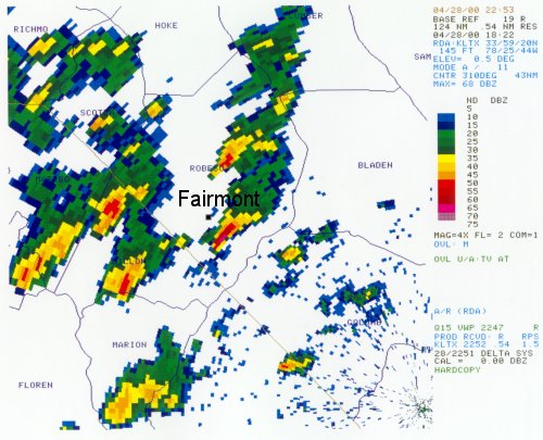
Radar reflectivity image from 2:22 PM. The storm that produced 1.75 inch diameter hail was just south of Fairmont in southern Robeson County, NC
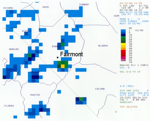
Radar VIL (Vertically Integrated Liquid) image from 2:22 pm.
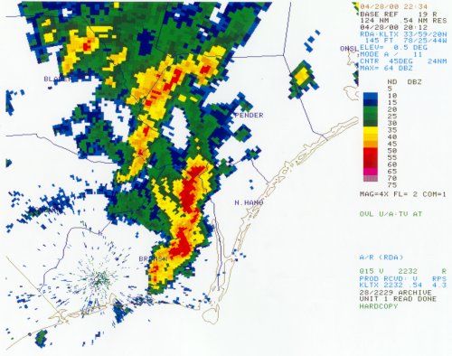
Reflectivity image from 4:12 pm. The line of storms stretched from Southern Pender County, NC into Brunswick County and dropped 1 inch diameter hail in Leland, NC.
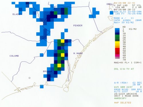
Radar VIL image from 4:12 pm.
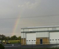
NWS meteorologists spotted this rainbow east of the NWS office in Wilmington after the storms.


 Coastal Flood