Technical Event Summary
A strong cold front crossed through the eastern Carolinas during the evening hours of April 3, 2006, producing an outbreak of severe weather. At the upper levels strengthening wind fields and unclimatologically steep lapse rates from an elevated mixed layer originating across the southwestern United States helped produce an environment conducive for deep convection. Wind fields were uniformly southwest during the afternoon hours, becoming more westerly during the evening. Damaging wind gusts became more of a factor during the evening as a 700 mb wind max over 50 knots rotated across North Carolina. Shear and helicity values were never tremendous during the event; lapse rates and CAPE were the two indicies which were most useful in forecasting the potential of a severe weather outbreak.
Surface dewpoints were initally quite moist during the morning of April 3rd, ranging from the upper 50s to lower 60s across the forecast area.
Early morning convection associated with the back edge of mid level warm advection across North Carolina produced a synoptic area of outflow winds containing quite dry air. This modified airmass spread south into much of inland North Carolina and north-central South Carolina during the mid morning hours. As temperatures warmed during the day, what moisture remained was mixed out and diluted with drier air from aloft causing surface dewpoints to plunge into the 40s from Columbia, SC through Florence and Lumberton. It appeared for a time this would be enough to cap soundings and prevent widespread convection from developing.
Around 3 p.m. convection began developing along the eastern slopes of the mountains across upstate South Carolina, likely in association with convergence into the lee side surface trough. Convection quickly developed east of the mountains across much of north central South Carolina over the next two hours as soundings apparently became uncapped from a combination of surface temperatures rising well into the 80s and increasing lift through much of the atmospheric column. Severe weather was initially limited to large hail, but later transitioned to both hail and wind as the stronger mid-level winds arrived. Very dry air above 850 mb helped aid entrainment of this high-momentum air into the storm downdrafts, enhancing the occurrence of damaging surface wind gusts. Storm motions increased to nearly 70 mph toward the end of the event.
The atmospheric quickly stabilized as the front crossed the area before midnight, ending the severe weather threat.
Storm Reports
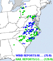
View text of over 40 hail and wind reports
| Northeast South Carolina | Southeast North Carolina |
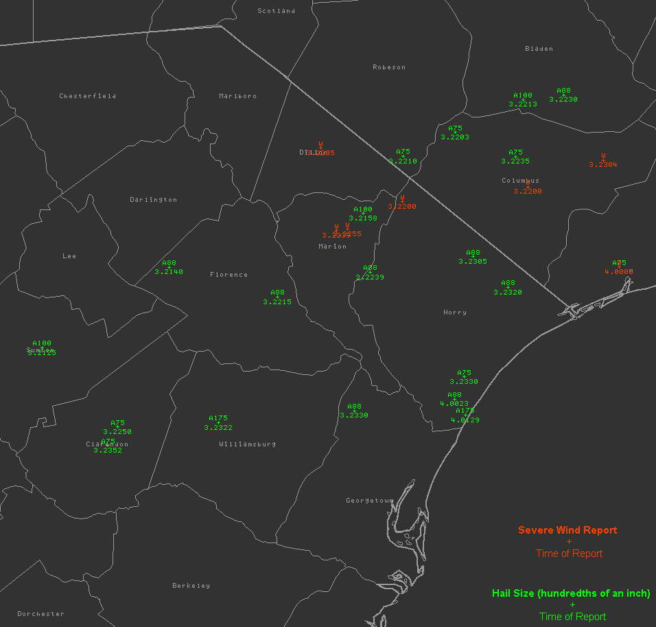 |
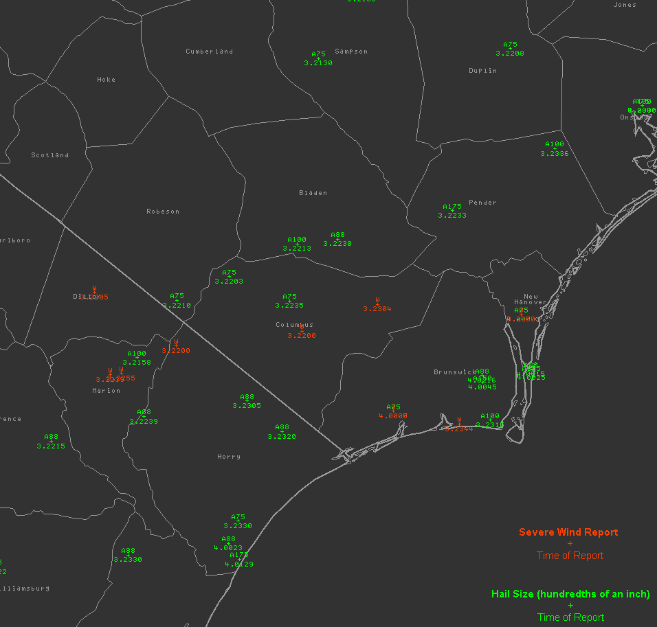 |
| (click to enlarge) | (click to enlarge) |


 Coastal Flood