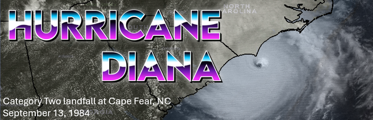
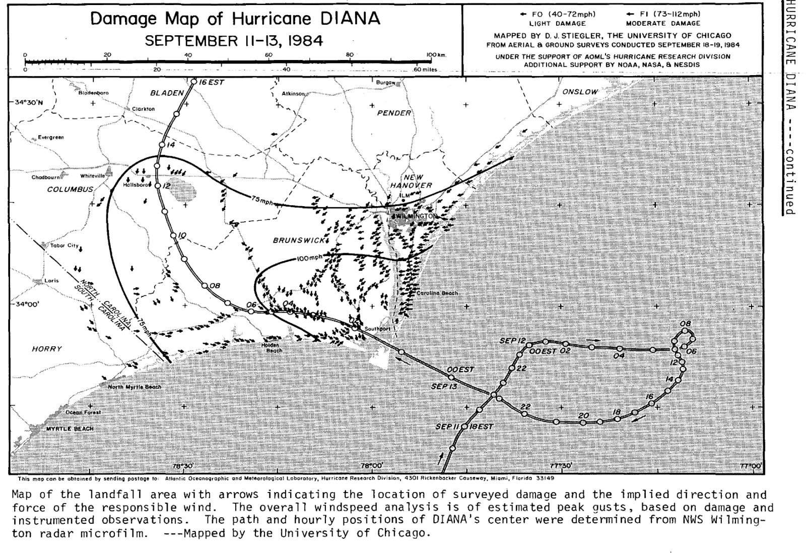
Hurricane Diana made a direct strike on North Carolina's Cape Fear area on September 13, 1984. While at one point an extremely dangerous category four hurricane just 20 miles off the coast, Diana looped erratically offshore and weakened to category two intensity before landfall. Winds up to 115 mph were measured on land and caused substantial damage across portions of Brunswick and New Hanover counties. Over a foot of rain fell in Wilmington and Southport causing freshwater flooding. Diana was the most powerful storm of the 1984 Atlantic Hurricane Season and was the first hurricane to strike this part of the U.S. coastline in over 24 years.
The area of low pressure that would become Hurricane Diana developed along a stalled front across the Bahamas on September 7, 1984. A report of 40 mph winds from a ship in the northern Bahamas at 8 am EDT on September 8 showed the low was becoming stronger. Post-analysis from the National Hurricane Center reveals this is likely when the system became a tropical storm although public advisories from the National Hurricane Center didn’t begin until later that afternoon.
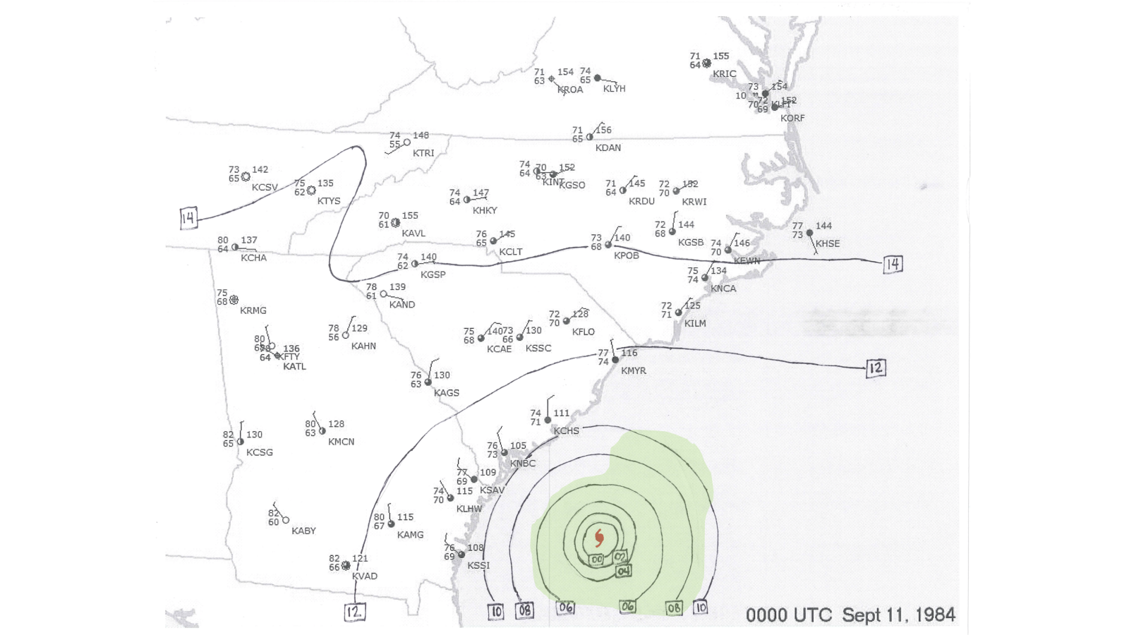
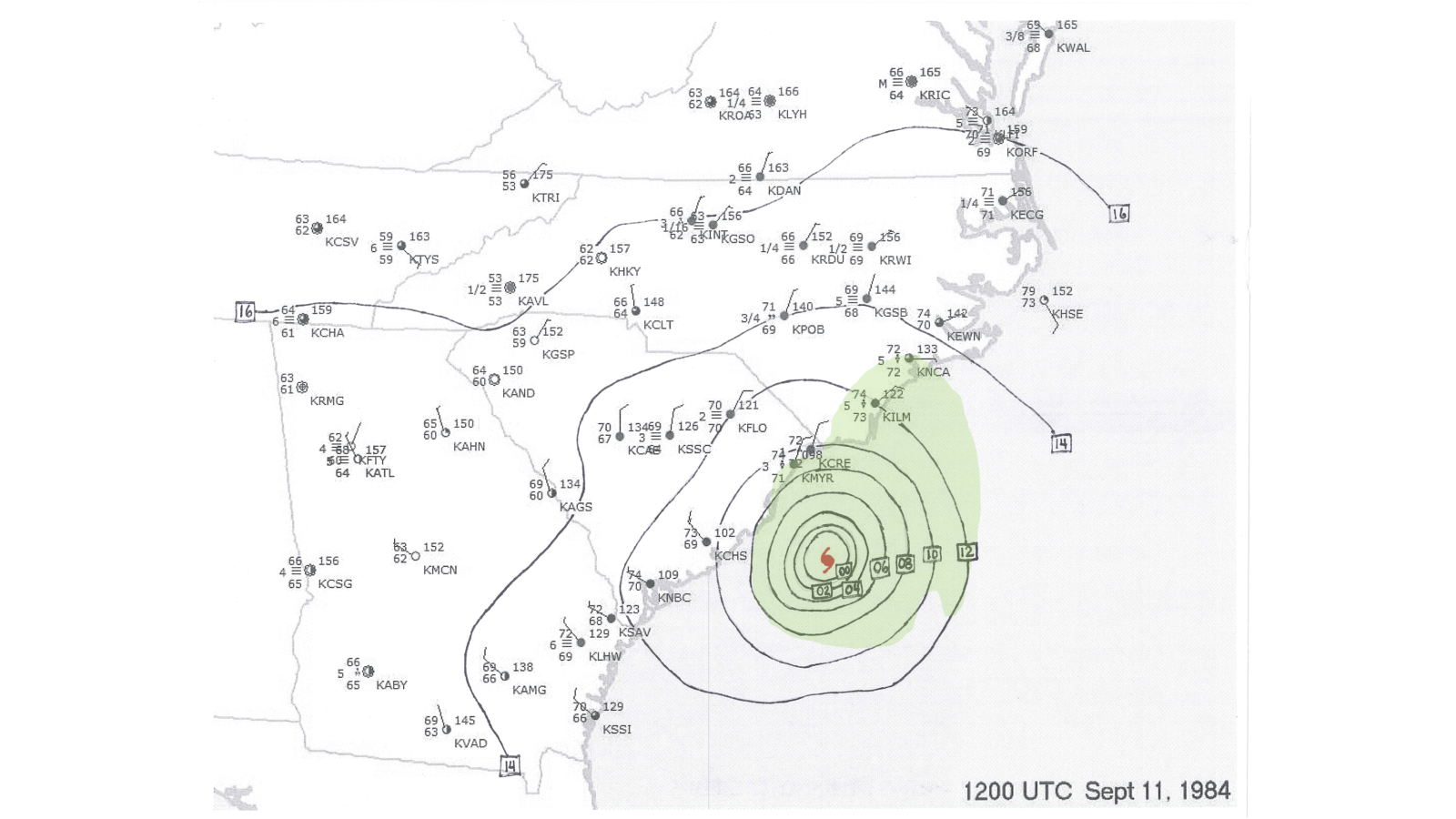
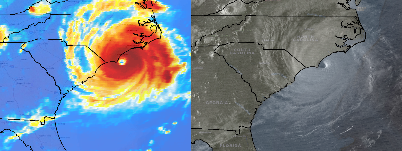
After moving generally northward parallel to the Florida East Coast on September 9, the storm turned northeastward on September 10 and became a hurricane while east of Jacksonville, FL. Imagery from the GOES-6 weather satellite showed an eye began to form late that afternoon and became well defined that night. Rapid intensification occurred on September 11 as the storm moved near the Gulf Stream. In just 24 hours Diana grew from a 90 mph category one hurricane to a 130 mph category four monster as the eye approached within 20 miles of Cape Fear, NC.
|
Infrared and visible satellite still images from the GOES-6 weather satellite shows Category Four Hurricane Diana located just east of Cape Fear, NC at 6:30 pm EDT on Sept 11, 1984 |
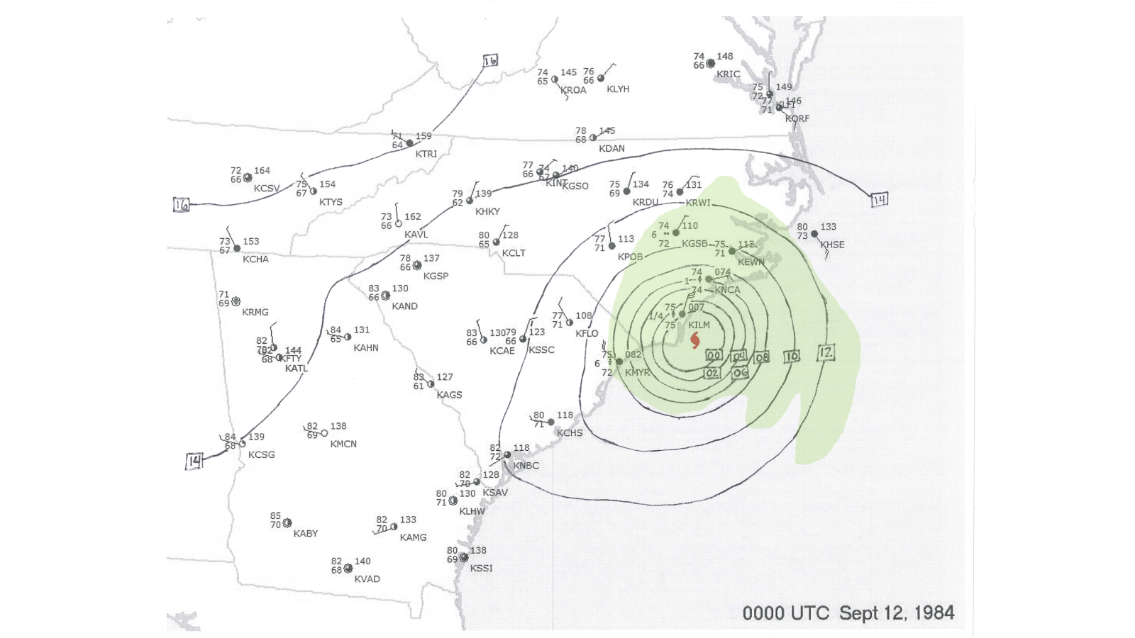
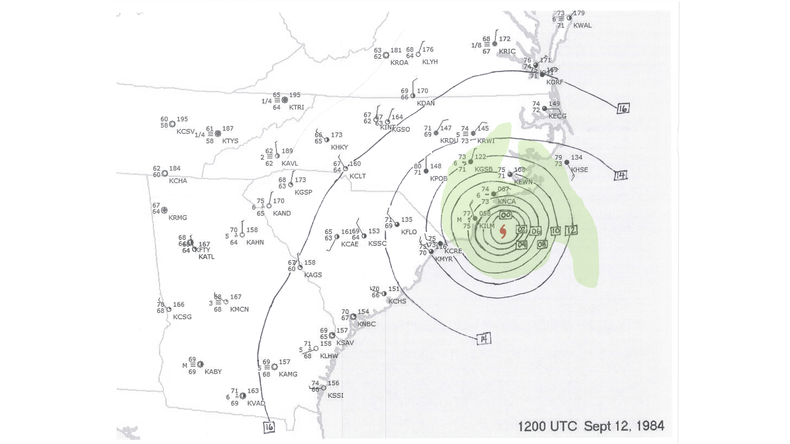
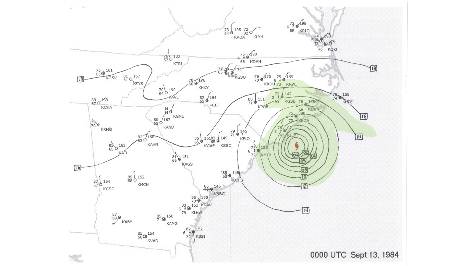
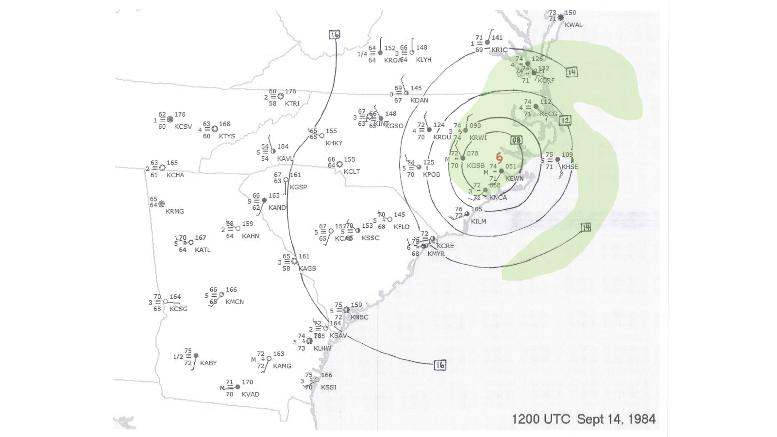
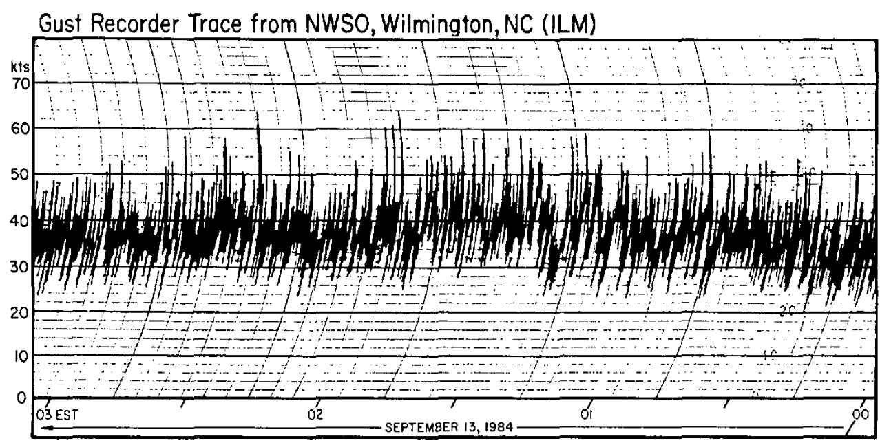
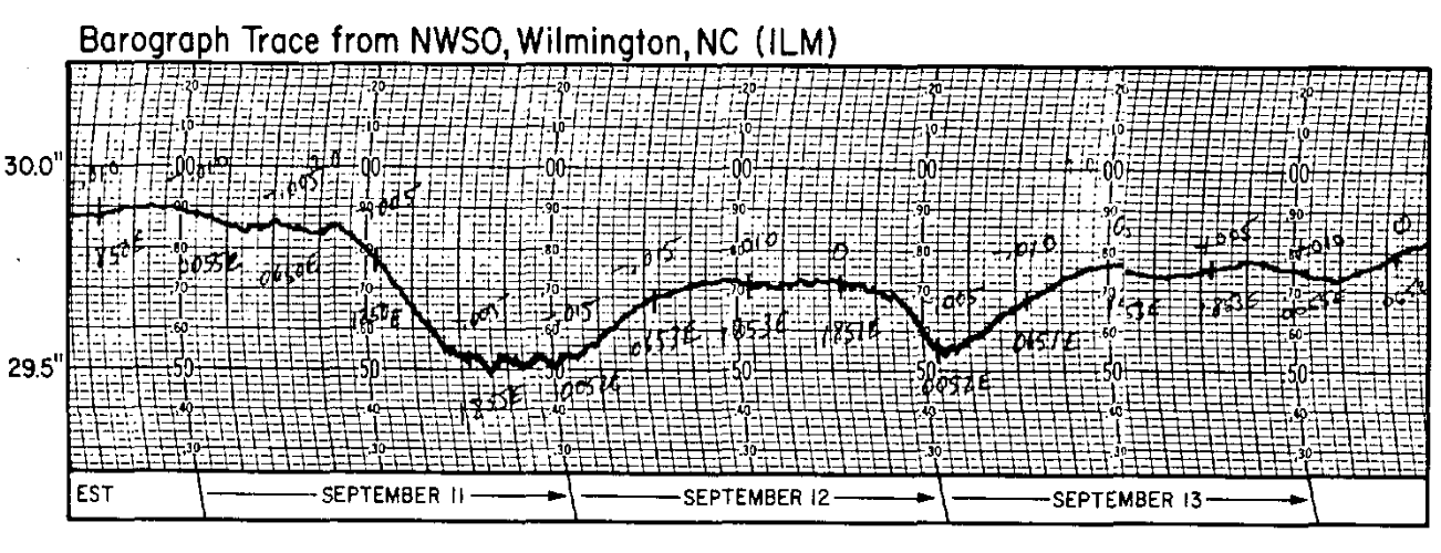
Diana’s eye remained offshore during September 12 as the storm made a slow clockwise turn about 50 miles east of Cape Fear. Cool, stable air produced by steady rain falling across eastern North Carolina was pulled into the western semicircle of the storm causing weakening. After turning westward, Diana finally made landfall near Bald Head Island early in the morning on September 13 with maximum sustained winds near 90 mph and a central pressure near 979 millibars. Fortunately, the storm moved onshore near low tide which limited the severity of storm surge and coastal inundation.
|
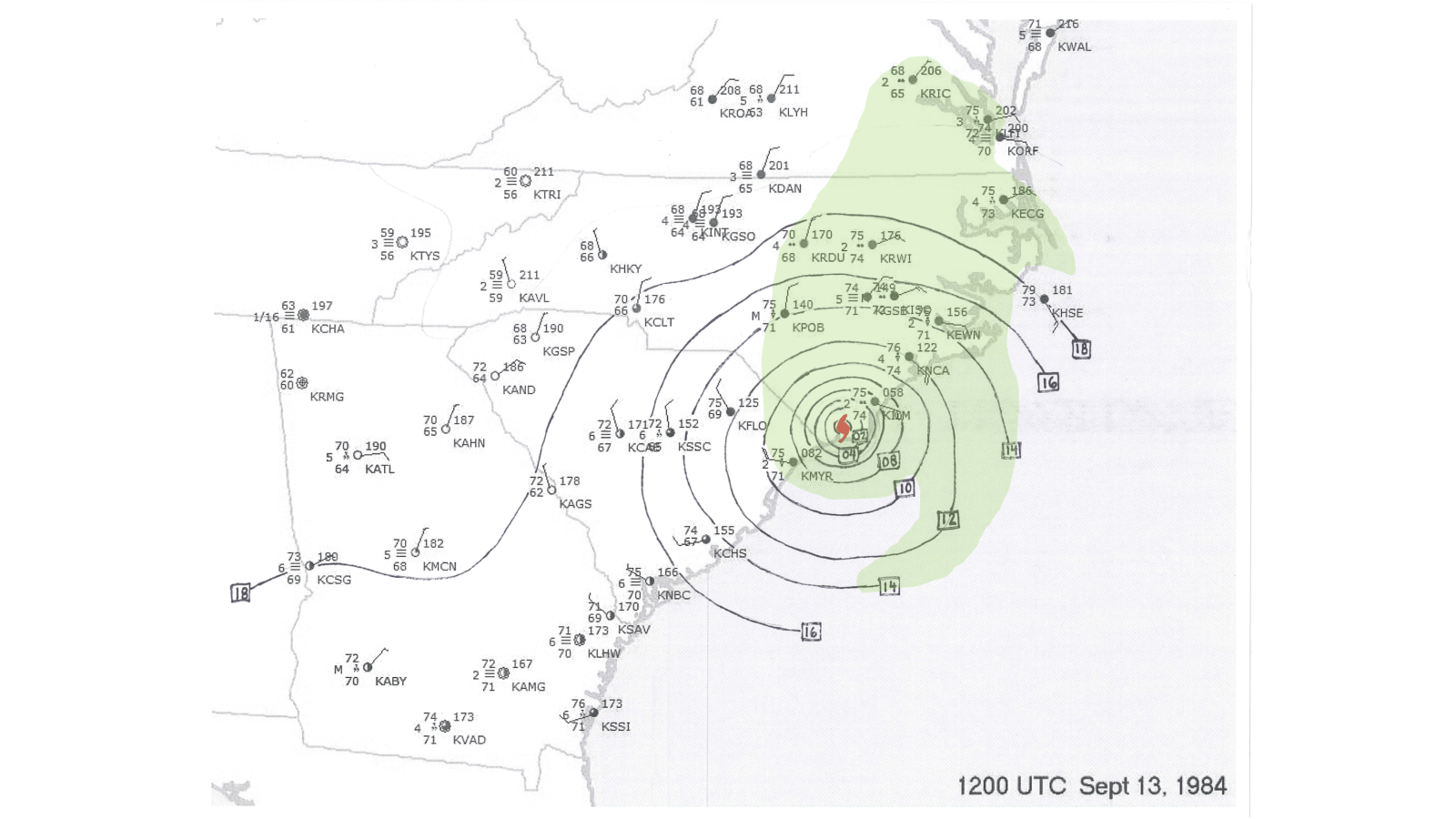
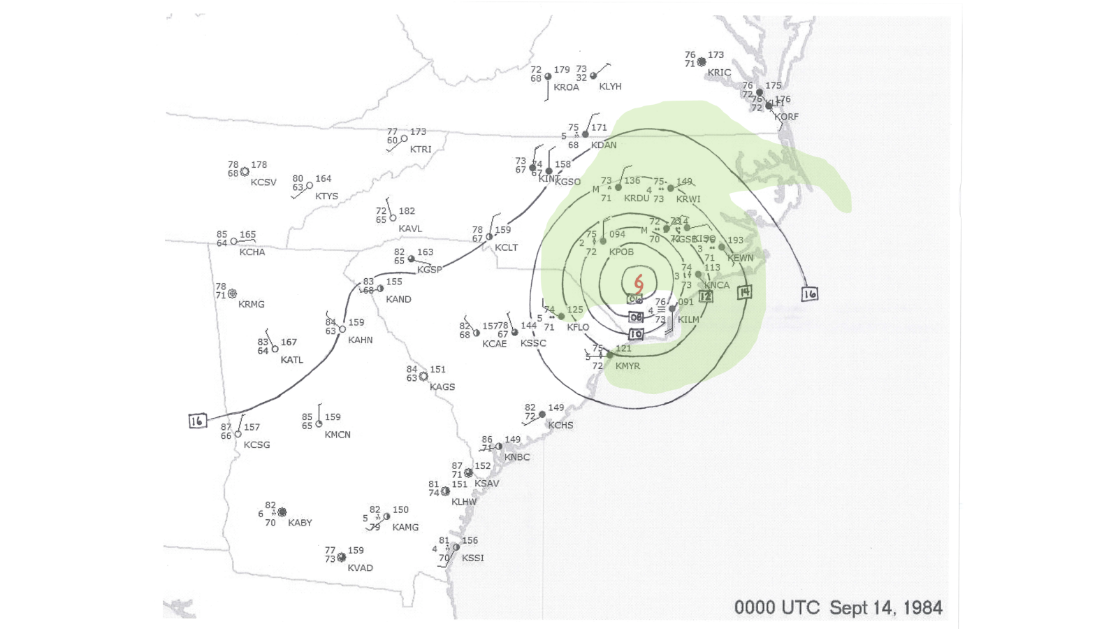
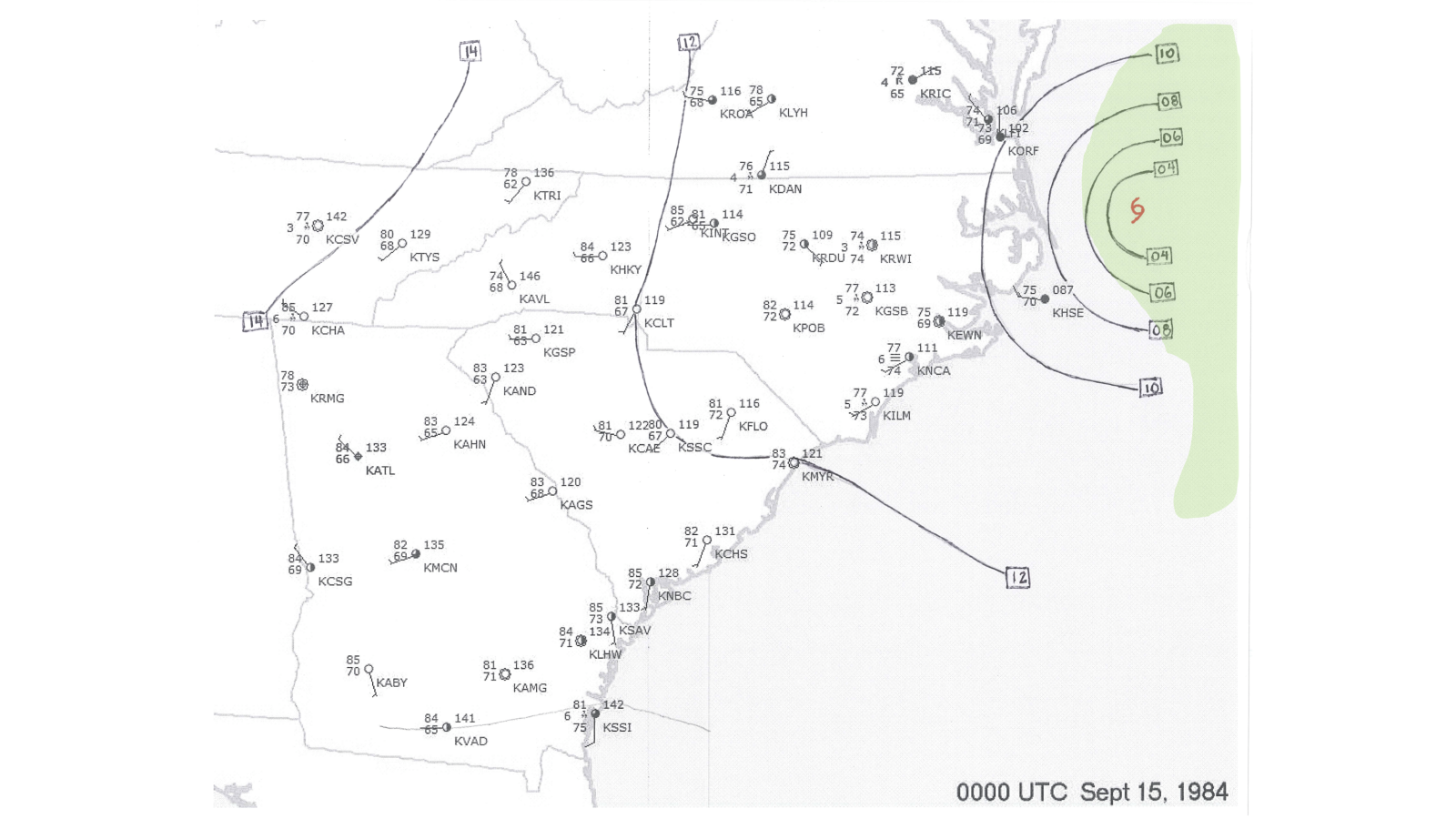
Hurricane Diana’s center moved northward across Brunswick, Columbus, and Bladen counties during the day of September 13, steadily weakening to a tropical storm but continuing to produce gusty winds and drop heavy rainfall. The storm then turned northeastward on September 14, accelerating northeastward across far-eastern North Carolina and out to sea.
| Location | Peak Wind | Location | Peak Wind | |
| Daytona Beach, FL | 35 mph | Carolina Beach, NC | 86 mph* | |
| St. Augustine Inlet, FL | 69 mph | Carolina Beach, NC (Loran Station) | 91 mph* | |
| Jacksonville Beach, FL | 46 mph | Brunswick Nuclear Station, NC | 97 mph | |
| Tybee Island, GA (Coast Guard) | 35 mph | Wilmington, NC (Airport) | 74 mph | |
| Crescent Beach, SC | 45 mph | Fort Macon, NC | 58 mph | |
| Florence, SC (Airport) | 30 mph | Beaufort, NC (15 miles north of town) | 75 mph* | |
| Fort Fisher, NC (Air Force Station) | 115 mph* | Diamond Shoals Light Tower, NC | 66 mph | |
| Oak Island, NC | 81 mph | Cherry Point, NC (Marine Air Station) | 44 mph | |
| Holden Beach, NC | 70 mph* | Cape Hatteras, NC | 45 mph | |
| Shallotte, NC | 70 mph* | Albemarle Sound Bridge, NC | 40 mph | |
| Oak Island, NC (Coast Guard Station) | 115 mph* | Duck, NC | 53 mph | |
| Kure Beach, NC | 81 mph* | Elizabeth City, NC (Airport) | 35 mph |
* from National Hurricane Center report, but no local records exist at NWS Wilmington
Impacts on North Carolina
Diana was responsible for three fatalities in the area. The Wilmington Star-News reported a 70-year old man died while preparing his home for the storm at Wrightsville Beach and a 32-year old man died in a car accident during the storm on Highway 17 in Brunswick County. Another fatality occurred in a car accident near Wallace, NC.
Brunswick, New Hanover, Columbus, Bladen, and Pender counties were declared disaster areas by President Reagan. Agricultural damage was significant enough that local farmers became eligible for federal aid. Widespread power outages occurred across the Cape Fear area. Commercial power was lost at the NWS Wilmington office and meteorologists relied on an emergency backup generator to maintain power for the radar, computers, radios, and other communications equipment.
Between Hurricane Donna in 1960 and Hurricane Diana in 1984, southeastern North Carolina went almost 24 years without a direct hurricane impact. During that period the highest measured wind gusts associated with tropical cyclones at the Wilmington airport were only 45 mph (Ginny in October 1963) and 44 mph (Ginger in October 1971). These gusts aren’t any higher than you might see with a strong summer thunderstorm and led to some unfamiliarity with regard to the threats posed by hurricanes.
|
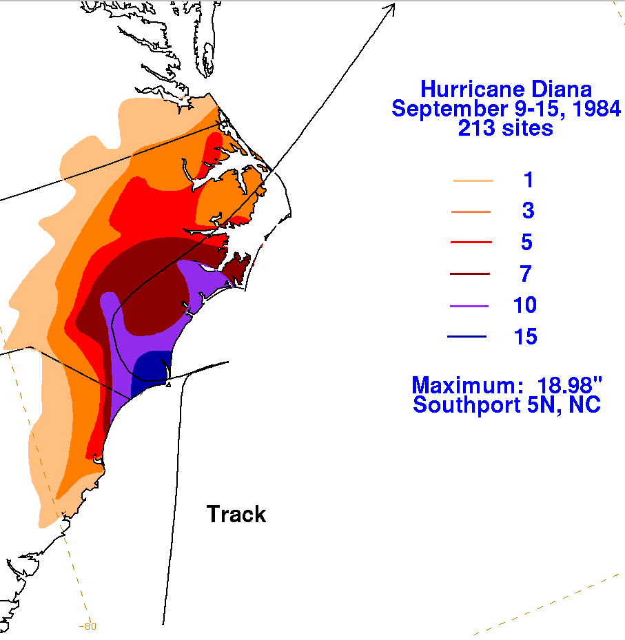
Rainfall associated with Hurricane Diana exceeded 18 inches in Southport. Wilmington recorded nearly 14 inches, the highest storm total measured up to that point in history. From https://www.wpc.ncep.noaa.gov/tropical/rain/diana1984.html |
|
TV news reports in the days leading up to Diana’s eventual landfall showed the Cape Fear region remained very tense, bracing for an impact that looked as if it would never come. Rumors circulated shortly after landfall, erroneously indicating that Southport had been completely destroyed and that the Brunswick Nuclear station had sustained damage. Neither of these rumors were correct.
New Hanover County, NC
|
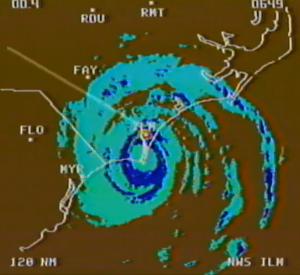
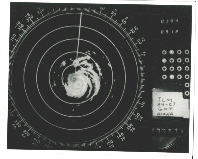
TV radar image from 2:49 a.m. EDT September 13, 1984 showing the eye of Hurricane Diana centered over Bald Head Island |
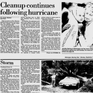
An American Red Cross spokesman said emergency shelters in Wilmington, Carolina Beach, and Southport served about 5,000 people during the storm. The greater Wilmington area suffered its greatest number of downed trees and power lines since Hurricanes Hazel and Helene in the 1950s. Cleanup of vegetative debris continued for months. At the National Weather Service office at the Wilmington airport, Diana’s storm total rainfall was measured at 13.72 inches and at the time was the heaviest single-storm rainfall event in the city’s written weather history dating back to 1871. Diana's rainfall has since been exceeded by Hurricane Floyd in September 1999, a non-tropical low in September 2010, and by Hurricane Florence in September 2018.
In Carolina Beach, streets were dotted with debris from roofs and downed power lines. The Anchor Motel and King’s Motel both lost their roofs and a business on the town’s boardwalk lost its second floor. The town’s water tower collapsed around 10:30 pm on September 12 but this older structure had already been planned to be replaced by a new water tower. Carolina Beach Lake overflowed and spilled onto Lake Park Blvd., flooding the highway up to three feet deep. Tidal flooding led to around one foot of water covering Canal Drive. Several residential buildings under construction were destroyed by winds. A boat owner who stayed with his vessel at Snow’s Cut Marina said in an interview with WRAL news that waves reached 5 to 6 feet on the Intracoastal Waterway. A nighttime curfew was enforced by local law enforcement to discourage looting.
Kure Beach had similar impacts from winds including downed power lines, broken windows, and major roof damage to at least at least two motels. Kure Beach Pier was heavily damaged, and sand covered some portions of US Highway 421. According to a report from NWS Wilmington Meteorologist-in-Charge Al Hinn, tides were up to 5.5 feet above normal a few hours prior to landfall in southern New Hanover County.
Wrightsville Beach was fully evacuated prior to the storm and only a few emergency response personnel rode out the storm on the island. Storm damage was mainly limited to power lines and roof shingles. Beach erosion was significant on the north end of the island but no significant flooding was reported.
WWAY news reported that “few yards were without fallen trees” in the Myrtle Grove area where power remained out over 24 hours after the storm. NCEI's Storm Data publication says tides on the Cape Fear River at downtown Wilmington were measured at 1.8 feet above normal during the afternoon of Sept 13.
UNCW Marine Geology Professor William Cleary was quoted in a September 17, 1984 Wilmington Star-News article saying Wrightsville Beach and Carolina Beach lost 15 to 20 feet of sand with up to 30 feet of sand lost near inlets. Duke University coastal geology professor Orrin Pilkey remarked on the relative lack of storm surge damage at Carolina Beach and Wrightsville Beach. He was quoted “It appeared to me from the air that damage was purely from the winds. The really damaging part of a hurricane we were lucky not to get is the storm surge.”
|
|
Brunswick County, NC
The Wilmington Star-News reported that 95 percent of Brunswick County lost electrical power during Hurricane Diana. Wind damage was considerable across the entire county from the beaches to points well inland. Fallen trees and power lines blocked most major and secondary roads. Gas station canopies and billboards were destroyed, roofs were torn off houses and trailers, but damage was less than had been observed 30 years earlier during Hurricane Hazel’s passage.
Despite being at the point of landfall, Bald Head Island experienced relatively little damage from the hurricane. Storm surge reportedly did not cross the dune line and property damage was largely confined to roofing shingles, broken windows, and some water inundation from rainfall. A WWAY TV interview with island General Manager James Harrington revealed that only a handful of people stayed on the island during the storm, taking shelter in the Bald Head Lighthouse.
|
|
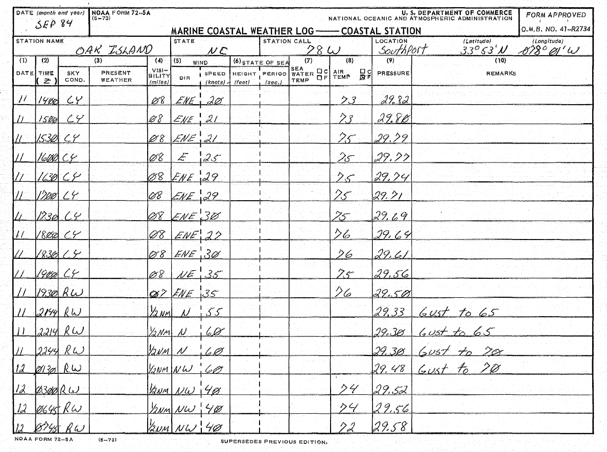
Weather observations from Oak Island, NC on Sep 11-12, 1984 as Hurricane Diana made its first close pass by the NC coastline. Peak wind gusts during that time were 70 knots, or 81 mph. |
Southport saw a number of large oaks uprooted or broken. Although no structures were completely destroyed, significant wind damage occurred to many homes and businesses. Southport’s Police Chief Bill Coring said in an interview with WRAL Channel 5, “We’ve been hit, we’ve been hit hard, but we are not wiped out and we’ll be back strong next week.” The Brunswick County Airport (today known as the Cape Fear Regional Jetport) suffered substantial damage to its office and terminal buildings. At least three airplanes were damaged when a hangar partially collapsed around them. The NCEI Storm Data publication says tides were measured at 1.6 feet above normal at Southport at 9:00 am EST on Sept 13.
Meteorological instruments at the Brunswick Nuclear plant recorded sustained winds of 75 mph with peak gusts of 97 mph, making this the first time in U.S. history a nuclear power plant had been struck by a hurricane. There was no damage to the power facility itself but a shed and mobile office trailer on the power plant's property were destroyed.
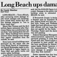
The mayor of Long Beach, today part of Oak Island, was quoted in a September 22, 1984 Wilmington Star-News article saying “many buildings have serious interior water damage” and that some municipal buildings were destroyed. Long Beach’s town hall, public works, and public safety buildings were also damaged. The town manager said four homes and one business were destroyed, 181 homes experienced major damage, and another 433 had minor damage. TV news reports showed stretches of the beach where sand dunes had been completely scoured away up to wooden bulkheads where the first row of beach houses were still perched. Neighboring Yaupon Beach also suffered wind damage to roofs of beach homes.
Reports from Holden Beach showed about one-third of the town’s buildings had at least minor roof damage. Approximately 30 homes suffered structural damage. The dunes held back the waves and the only flooding was from heavy rainfall, not storm surge. Holden Beach Pier was undamaged, however the drawbridge that connected the island with the mainland suffered wind damage. Tides were reported to have reached 2 feet above normal.
Ocean Isle Beach also saw relatively minor impacts. Dunes remained intact and wind damage was reported to a small number of homes.
Big Lake and North Lake in the town of Boiling Spring Lakes both flooded; the former covered NC Highway 87 to a depth of three feet according to a September 14, 1984 article in the Wilmington Star-News. NCEI's Storm Data publication mentioned there was widespread freshwater flooding in Brunswick County that "washed out many roadways."
Pender County, NC
The end of the Surf City Pier was sheared away from large breaking waves. One house on Topsail Island was pushed off its stilts and crashed onto the beach where it was destroyed by surf. Beach erosion was described as "especially bad" on the south end of Topsail Island in NCEI's Storm Data publication.
NCEI's Storm Data publication mentioned there was approximately $5 million ($15 million in 2025 dollars) property damage across the county with approximately $60,000 ($190,000 in 2025 dollars) damage to power lines.
A September 29, 1984 article in the Wilmington Star News reported that the Shelter Creek community in northern Pender County suffered exceptional flooding during Hurricane Diana. Large sections of NC Highway 53 were flooded and 27 families and farms were impacted by floodwaters up to chest deep. Local residents blamed runoff from nearby commercial timberland that covered the expanse between Highway 53 and the Angola Bay gameland.
Columbus County, NC
The Star-News interviewed a resident of Tabor City who said power was interrupted around 10:00 am on September 13 due to fallen trees. A Red Cross damage assessment team reported damage mainly to roofing shingles, trees, and power lines. The Riverview area near the Waccamaw River experienced some flooding.
NCEI's Storm Data publication mentioned that many trees were blown down across eastern Columbus County with approximately $520,000 ($1.6 million in 2025 dollars) in property damage reported.
Bladen & Sampson Counties, NC
Downed trees and power outages were reported mainly across southern Bladen County. The Wilmington Star-News reported wind gusts in Elizabethtown reached 55 mph during the afternoon of September 13. A small dam near the town of Roseboro failed due to heavy rainfall.
Onslow & Carteret Counties, NC
NCEI's Storm Data publication says damage occurred to the end of the fishing pier at West Onslow Beach. Forty feet of a fishing pier at Emerald Isle was destroyed.
Horry County, SC
According to NCEI's Storm Data publication, considerable beach erosion occurred along the Grand Strand beaches with damage reported to 90 homes, 8 mobile homes, 40 multi-unit dwellings, and a few businesses.
|
Infrared satellite loop from Sept 8-15, 1984 courtesy of NWS Lake Charles, LA |
Visible satellite loop from Sept 8-15, 1984 courtesy of NWS Lake Charles, LA |
Agricultural Damage
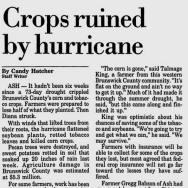
A significant portion of Hurricane Diana’s impact away from the immediate coast was due to wind damage to corn, soybeans, and tobacco. A Wilmington Star-News article from September 27, 1984 quoted Jim Gordon, North Carolina Commission of Agriculture, that only 30 to 40 percent of the corn crop across Columbus County was able to be harvested. Estimated agricultural losses across just Brunswick, Columbus, and Bladen counties was estimated to be near $20 million ($61 million in 2025 dollars). Another Star-News article gave a total for agricultural damage across six counties of southeastern North Carolina at nearly $26.5 million (nearly $81 million in 2025 dollars).
In the Ash community in western Brunswick County, summer drought already had negatively impacted corn and tobacco crops. These crops, plus sweet potatoes and pecan trees were further damaged or destroyed outright by the storm. A September 18, 1984 Wilmington Star-News article quoted a farmer who said his corn was a complete loss. Another farmer related that even though Hurricane Hazel (1954) was a much stronger storm, the fact it hit in October instead of September means many crops had been harvested and therefore Hazel’s agricultural impact was less than Diana’s.
Forecast Difficulties
Diana’s track and intensity were not well forecast. National Hurricane Center Specialist Hal Gerrish was quoted, “Two problems bug us to death: one is a storm that begins to intensify rapidly prior to landfall. The other is when the steering isn’t very clear.” Diana unfortunately displayed both of these traits during its approach to North Carolina.
Diana formed on Sept 8 near the northern Bahamas in a region of light steering flow near a subtropical ridge along the Southeast and Gulf coasts. The storm was lifted northward from the Bahamas toward North Carolina on Sept 10 and 11 as an upper level trough moved eastward across the Great Lakes, opening up a hole in the subtropical ridge along the East Coast.
As Diana approached Cape Fear at 00z Sept 12 the trough was moving eastward across New England which allowed the subtropical ridge to restrengthen north of the hurricane, stopping Diana's northward movement and causing the storm to execute a slow loop just east of the North Carolina coast on Sept 12. Moving westward, Diana finally moved inland near Cape Fear early on Sept 13, then turned north and eventually northeastward and moved off the coast on Sept 14 as a new upper level trough moving into the Great Lakes again eroded the subtropical ridge.
Computer weather models of the mid 1980s were primitive compared to what we have today. Although upper level weather data from weather balloons was extensive, satellite-derived wind data was much more sparse and of lower quality than today. Subtle changes in the strength of the subtropical ridge caused by the passing upper level troughs to the north had huge impacts on Diana's movement.
 |
Local Newspaper Reports
|
WWAY TV 3 Wilmington, NC: "Diana: A Week to Remember" |
WRAL TV 5 Raleigh, NC: Hurricane Diana Coverage |
|
WPDE TV Myrtle Beach, SC: Hurricane Diana Coverage |
WWAY TV 3 Wilmington, NC: Diana Coverage Sept 14, 1984 |
Ms. Edna M. Terwillinger of Wilmington wrote the following poem about Hurricane Diana and shared it with the National Weather Service.
|
“Saga of Hurricane Diana” For days she lingered just offshore and plotted her way to strike, Then her sights on us, on land, her rage unladylike Her blinded fury railed at us and broke our cars like toys, With toppled trees and wiring down her rains poured down with noise In houses batter’d, determin’d, all life was put on hold, In trailers mired in lakes, once land, were people wet and cold Unlisted heroes, wand’ring nights, to strangers offered aid, In time of need they proved they cared, and many friends were made And we were flooded, every street, as gutters overflow, Our windows broke from giant gusts while winds were whipped and rode When TV stations left the air, from Diana’s shrieking thrust, We took her wrath but still had life and thank the God we trust Now every year we sit and wait, we know we cannot win, New storms are born to taunt our days, the next may be her twin. |
Other Links of Interest
National Hurricane Center Report on Hurricane Diana
NWS Newport/Morehead City Hurricane Diana Event Review https://www.weather.gov/mhx/Sep131984EventReview
NHC Monthly Weather Review 1984 Hurricane Season Summary https://www.nhc.noaa.gov/data/mwreview/1984.pdf
Research and Page Author: Tim Armstrong
Last Updated: July 26, 2025


 Coastal Flood