
Scattered thunderstorms with severe gusts, hail and a tornado risk are possible near a cold front from the Ohio Valley to the Mid-Atlantic tonight. Tropical Storm Bertha is expected to bring tropical storm conditions to portions of the Gulf Coast from the panhandle of Florida into Louisiana through Wednesday. Read More >
|
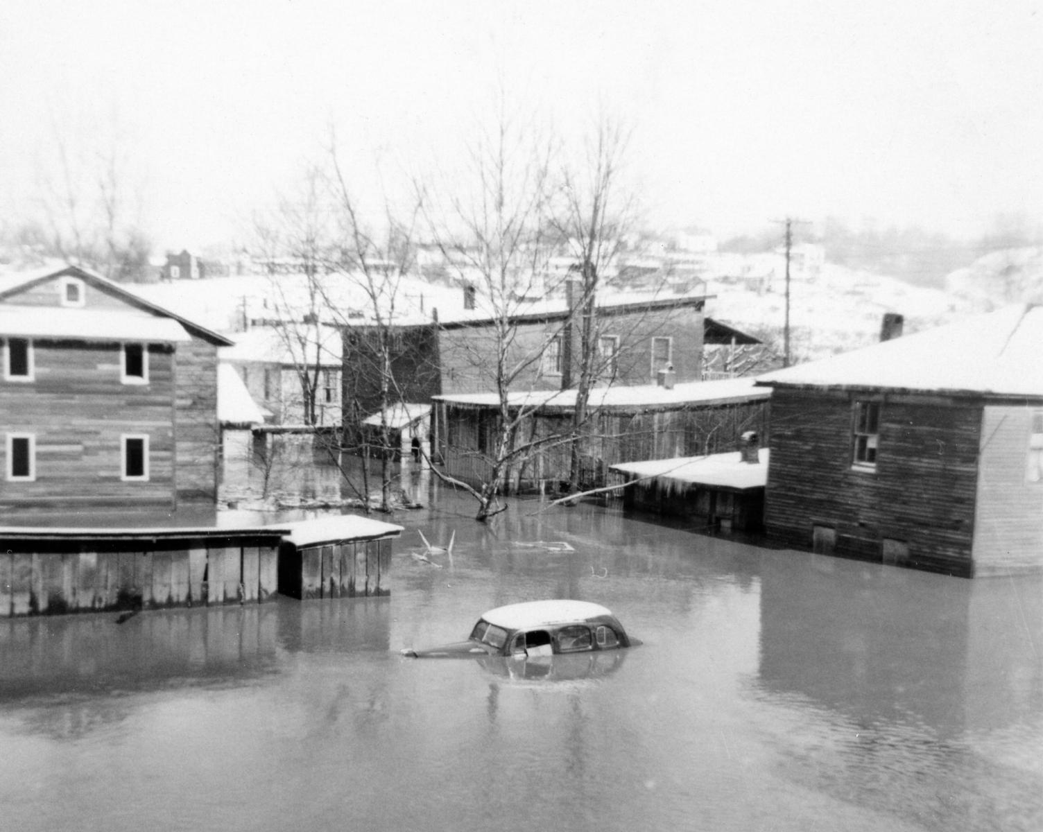
Devastating floods occurred across southeastern Kentucky, southwestern West Virginia, western Virginia, and northeastern Tennessee in late January and early February of 1957. In eastern Kentucky, the headwaters of the Big Sandy, Kentucky and Cumberland Rivers were especially hard hit. In fact, the 1957 flood remains the flood of record at several points on the Levisa Fork of the Big Sandy, the North, Middle and South Forks of the Kentucky River, and on the upper reaches of the Cumberland River. Impacts from the floods were major. Water rises occurred so fast that many residents had to evacuate without their belongings. Communications were disrupted and food shortages developed as the result of damage to stores. Water supplies were contaminated in some locations and there was no gas for cooking. Reports indicated that 30 state and federal highways were blocked by flood waters or mudslides and most secondary roads were impassable due to the heavy rains. In Kentucky alone nine people died from the flooding and the Red Cross reported that 597 homes were destroyed with over 10,000 structures sustaining some type of damage. |
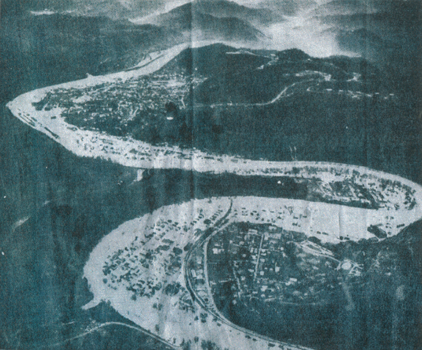 The North Fork of the Kentucky River sweeps through Hazard in one of the worst floods in eastern Kentucky's history. (AP Wirephoto) |
Meteorological Setup & Rainfall
The first three weeks of January 1957 were drier than normal across eastern Kentucky. However, a general one to two inches of rain fell on the 22nd and 23rd, saturating the ground and bringing streams up to normal levels. A frontal boundary then moved into the state on the 28th, stalled into the 29th and then moved south on the 30th. While the front remained to the south of the state January 31st through February 1st, a weak area of low pressure tracked along the front producing additional light rain across southeast Kentucky.
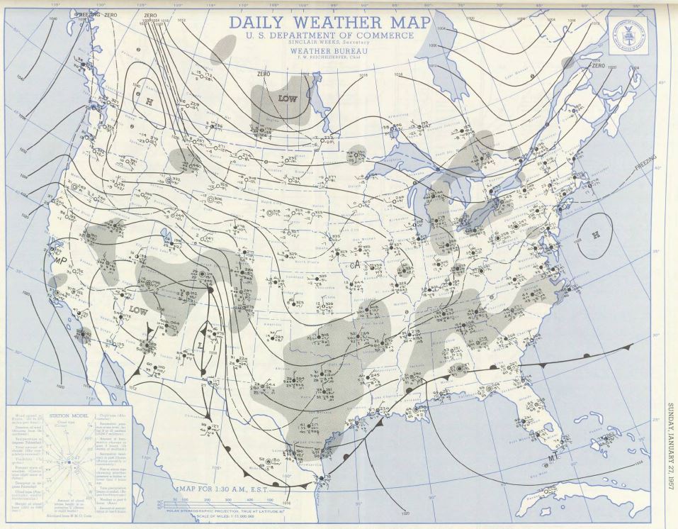
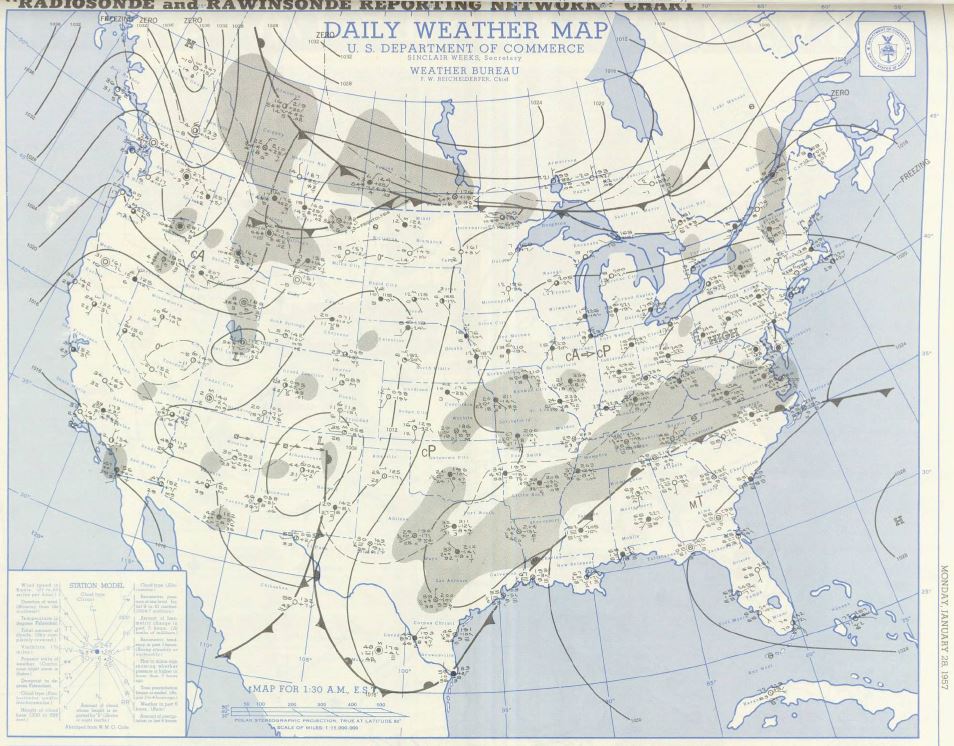
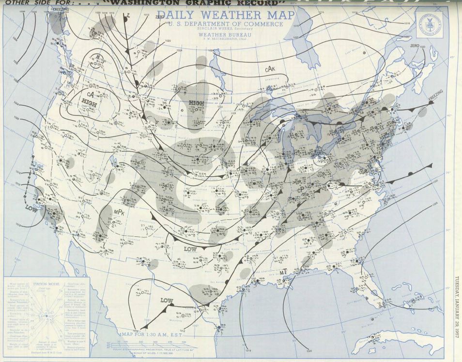
Clicking on the graphics below will open up the Daily Weather Map publication in pdf format for that date.
 |
 |
 |
 |
| 1:30 am EST January 27, 1957 Surface Analysis |
1:30 am EST January 28, 1957 Surface Analysis |
1:30 am EST January 29, 1957 Surface Analysis |
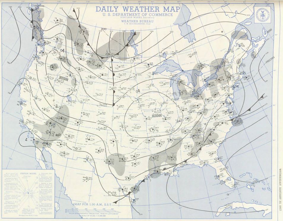
1:30 am EST January 30, 1957 Surface Analysis |
 |
 |
 |
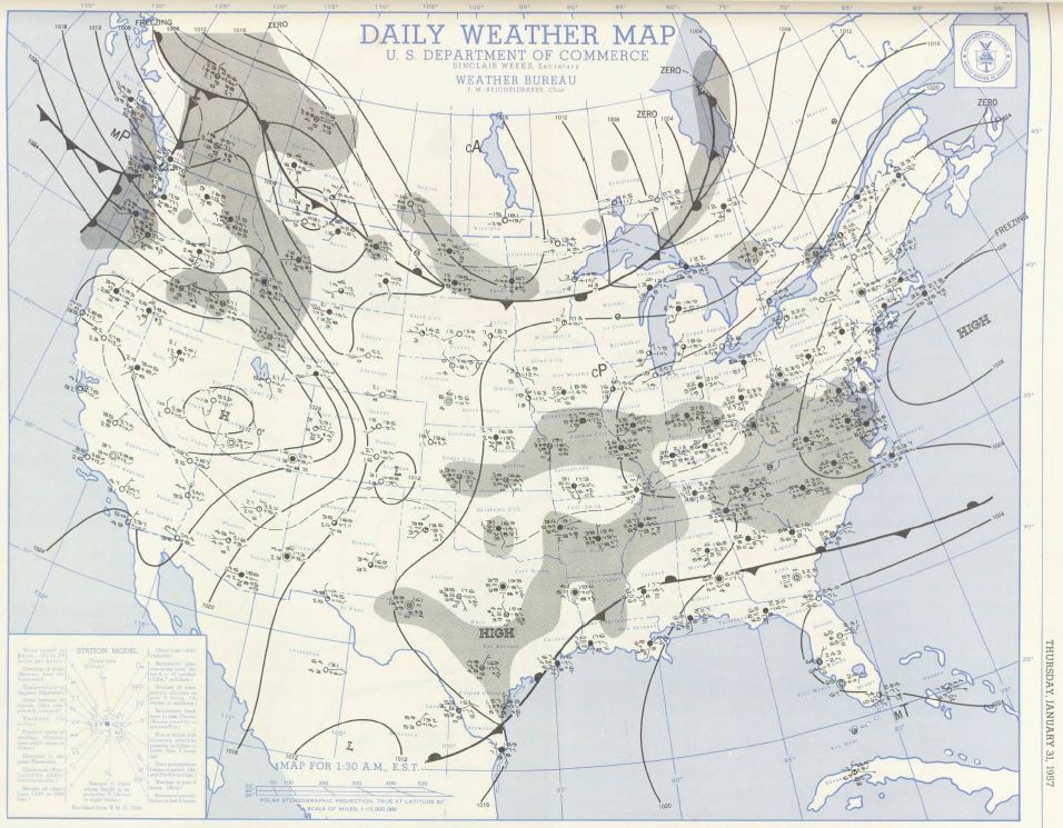
| 1:30 am EST January 31, 1957 Surface Analysis |
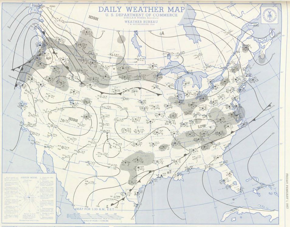
1:30 am EST February 1, 1957 Surface Analysis |
1:30 am EST February 2, 1957 Surface Analysis |
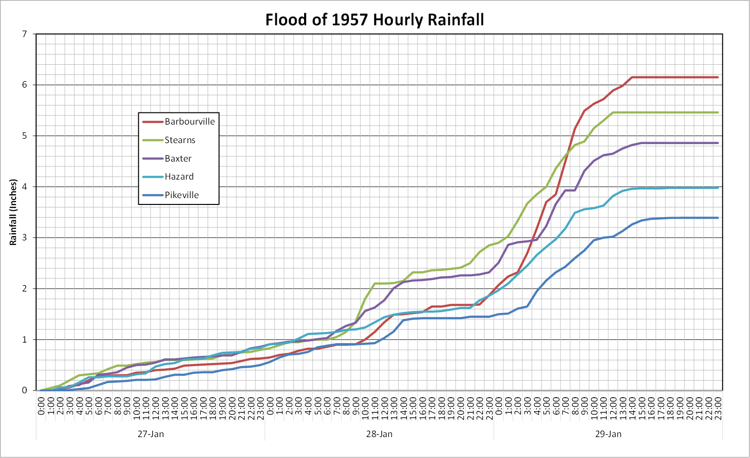
The following graph illustrates the timing of the rainfall prior to and then during the flood by depicting rainfall accumulation at Barbourville, KY (Knox County), Jeremiah, KY (Letcher County), London, KY (Laurel County), Baxter, KY (Harlan County) and Hazard, KY (Perry County) between January 20, 1957 and February 2, 1957. The heaviest rain occurred over the flood area on January 28th and 29th, when a general two to six inches of rain fell over southeast Kentucky.
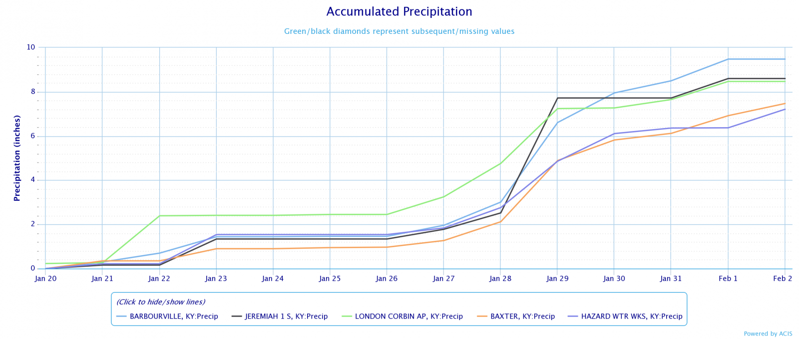
A further examination of hourly rainfall amounts during the period of heaviest rains, January 27th through the 29th, shows around 60 hours of nearly continuous rain fell over southeast Kentucky with two distinct waves of heavy rain. The first wave of heavy rainfall occurred during the late morning and midday hours of January 28th with two to six hours of two-tenths to one-half inch per hour rainfall rates. The second heavier wave of rain hit later that evening and lasted through much of the morning of January 29th. Hourly rainfall rates during this wave of rain were generally between two-tenths and six tenths of an inch. At Barbourville, 1.29" of rain fell in two hours between 6:00 am and 8:00 am ET on January 29th and 3.17" of rain fell in seven hours between 2:00 am and 9:00 am ET.
The multi-day rains added up to impressive amounts over the region with a large swath of the Tennessee, Cumberland, Kentucky and Big Sandy watersheds receiving from four to ten inches of rain. The following graphic depicts storm total rainfall from January 26th through February 1st over the southern Appalachian region.
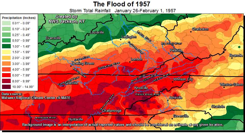
Rainfall measurements used to create the above map were obtained from the Midwest Regional Climate Center's cli-MATE application. Some quality control was performed on the data to smooth out irregularities in the data.
Kentucky River Impacts
The headwaters of the North, South and Middle Forks of the Kentucky River were in or near the area of highest precipitation. This produced unprecedented peak discharges on the three forks with record levels at many gauging stations. Many of these records still stand today.
| North Fork at Whitesburg, KY | North Fork at Hazard, KY | North Fork at Jackson, KY* | Middle Fork at Hyden, KY | Middle Fork at Tallega, KY | |
|---|---|---|---|---|---|
| 1 | 14.7 ft - 1/29/1957 | 37.5 ft - 1/29/1957 | 43.1 ft - 2/4/1939 | 33.3 ft - 1/29/1957 | 43.3 ft - 1/30/1957 |
| 2 | 14.5 ft - 7/1/1942 | 36.3 ft - 1/1/1912 | 42.9 ft - 5/30/1927 | 26.1 ft - 3/12/1963 | 40.5 ft - 2/1/1939 |
| 3 | 14.4 ft - 5/1/1927 | 35.0 ft - 3/12/1963 | 42.0 ft - 5/8/1984 | 25.0 ft - 6/15/1989 | 40.1 ft - 2/2/1951 |
| South Fork at Oneida, KY | South Fork at Booneville, KY | Kentucky at Heidelberg, KY | Kentucky at Ravenna, KY | |
|---|---|---|---|---|
| 1 | 40.4 ft - 6/28/1947 | 43.4 ft - 1/30/1957 | 35.6 ft - 2/4/1939 | 39.4 ft - 2/4/1939 |
| 2 | 40.2 ft - 1/29/1957 | 41.7 ft - 6/29/1947 | 35.0 ft - 1/30/1957 | 38.9 ft - 3/27/1913 |
| 3 | 36.9 ft - 3/12/1963 | 41.1 ft - 5/8/1984 | 34.4 ft - 3/24/1929 | 38.4ft - 1/31/1957 |
Most communities located along the North Fork of the Kentucky and its tributaries were damaged in some form. Damage was particularly bad at Whitesburg, Fleming-Neon and Blackey in Letcher County and in Hazard and surrounding areas in Perry County. The North Fork reached a peak stage of 37.5 feet at Hazard, KY. All highways leading into the town were blocked by the floodwaters, and all utilities were out of operation. The main streets of town were inundated with as much as 17 feet of water. Six people lost their lives in Hazard and surrounding areas. More than 300 residences and 180 commercial buildings were damaged in Hazard. At least 70 buildings of all types were destroyed and total damages in the city amounted to about $4.5 million.
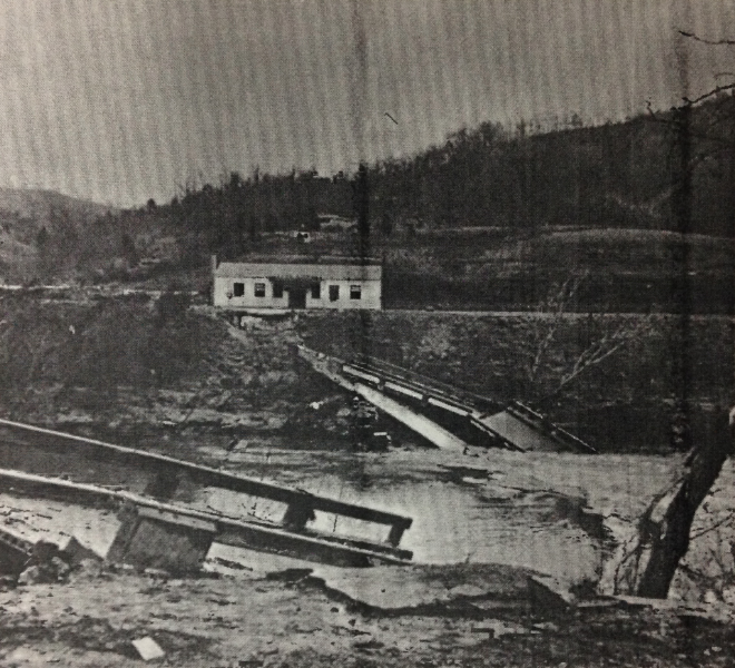
Bridge at the Hazard Airport was washed out by floodwaters of the North Fork of the Kentucky River.
(Photograph by Louisville Courier-Journal and Times)
Further downstream, although the maximum discharge at Jackson, KY was greater than any recorded prior to 1957, the peak stage was lower due to a cutoff completed in 1956 half a mile below the gauge. The Corps of Engineers estimated that the cutoff reduced the peak stage of the flood at Jackson by 4 feet, which would have been the record flood stage at that gauge.
 |
 |
 |
| Scenes of flood waters from the North Fork of the Kentucky river in Jackson, KY. (Photographs courtesy of Stephen Bowling and the Breathitt County Public Library) |
||
On the Middle Fork, most of the urban damage occurred at Buckhorn and Hyden. One person died at Wooton. In Hyden, about half of the commercial properties and 30 percent of the residential properties in town were affected, including a lumber company which lost a large amount of lumber and had 20 company houses inundated. The Middle Fork of the Kentucky at Buckhorn peaked 5.0 feet higher than the previous highest level set in the 1939 flood and almost all structures in town were inundated, some to a depth of 10 feet.
In the South Fork basin, severe damage occurred at Oneida and Manchester. Twenty-five residences and thirty-four commercial properties were inundated in Manchester. In Onieda, flow from Goose Creek cut across town and approximately 80 percent of the town was inundated by as much as 9 feet. The peak stage at Booneville exceeded the previous highest stage set in 1947 by 1.7 feet. Damage was much less than in Manchester, however, with thirty residences and one public building flooded.
Flood waters in the main business section of Beattyville, KY, located at the Forks of the Kentucky, reached 6 feet deep and 70 commercial and 20 residential structures were flooded. Further down on the main stem of the river, the flood stage at Irvine-Ravenna fell about a foot below that of the level reached in 1939. Still, about 25 residences in low-lying areas were flooded.
Big Sandy River Impacts
The Flood of 1957 exceeded the previous record levels set in 1862 and 1918 in the upper reaches of the Levisa Fork of the Big Sandy River. The crests of both the Levisa Fork and its large tributary the Russell Fork arrived at the mouth of the Russell Fork at about the same time. This caused a very sharp rise and extreme gauge height downstream as illustrated by the discharge hydrograph for the Levisa Fork at Pikeville, KY below. The river rose from about 18 feet on January 29th to a crest of 52.72 feet early on January 30th at the Pikeville gauge.
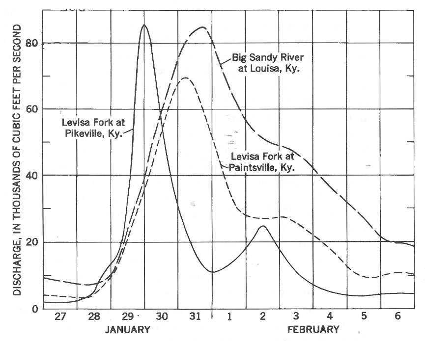
Discharge at selected gauging stations in the Big Sandy River basin during the 1957 Flood.
(source Floods of January-February 1957 in Southeastern Kentucky and Adjacent Areas, Geological Survey Water-Supply Paper 1652-A)
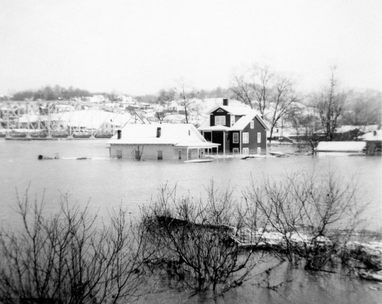
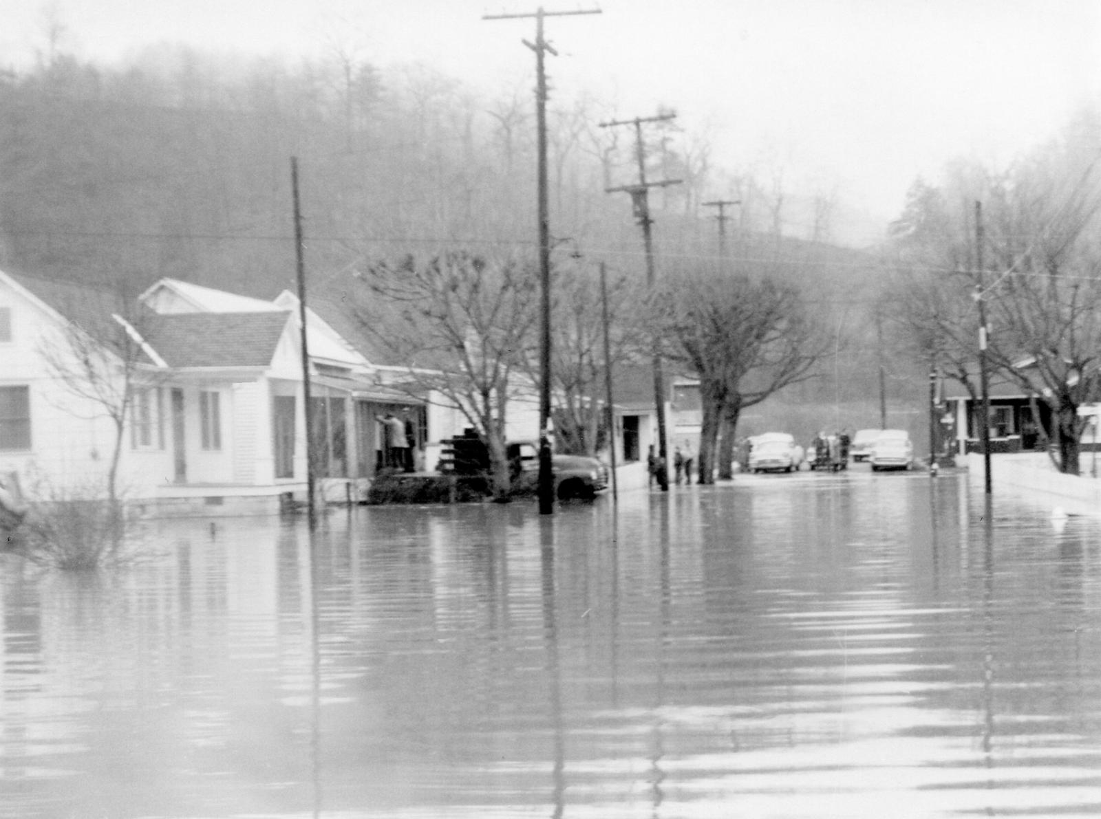
The city of Pikeville was almost entirely under water at the height of the flood, the first time that had happened since 1862. Water stood three feet deep or more in Main Street businesses and houses and as much as nine feet deep in some stores on other streets. More than 250 houses were destroyed with approximately 2,400 damaged in Pikeville and the immediate area and it was estimated that 400 automobiles were submerged.
Prestonsburg, Paintsville and other smaller communities on the Levisa Fork and its tributaries suffered similar damage. Three-fourths of Prestonsburg was under water and approximately 1,000 persons were forced from their homes. About 700 residences in Paintsville were flooded but advanced warning enabled 200 families to evacuate. Martin, KY, located on Beaver Creek, was severely damaged by backwater flooding from the Levisa Fork when water reached the roofs of most businesses. Elkhorn City and Fishtrap also suffered damage.
Overall, two persons lost their lives due to the flooding in the Big Sandy River basin. Damage exceeded $15 million dollars in Pike County alone.
| Russell Fork at Haysi, VA | Russell Fork at Elkhorn City, KY | Levisa Fork at Big Rock, VA | Levisa Fork at Pikeville, KY | |
|---|---|---|---|---|
| 1 | 28.2 ft - 4/4/1977 | 24.8 ft - 4/4/1977 | 27.4 ft - 4/4/1977 | 52.7 ft - 1/30/1957 |
| 2 | 23.2 ft - 1/29/1957 | 24.2 ft - 1/29/1957 | 23.0 ft - 1/29/1957 | 52.0 ft - 2/1/1862 |
| 3 | 22.8 ft - 3/7/1984 | 21.7 ft - 3/12/1963 | 20.7 ft - 5/7/1984 | 51.5 ft - 4/5/1977 |
Cumberland River Impacts
In the Cumberland River Basin, the 1957 floods exceeded previously known maximum stages on the Poor Fork at Cumberland and on the Laurel River at Corbin. The greatest impact of the flood was upon the towns along the main stem of the Cumberland River. There were 55 commercial establishments moderately to severely damaged in Cumberland and 200 homes were flooded with 17 rendered unfit for habitation. One person drowned in Nolansburg, ten miles downstream of Cumberland.
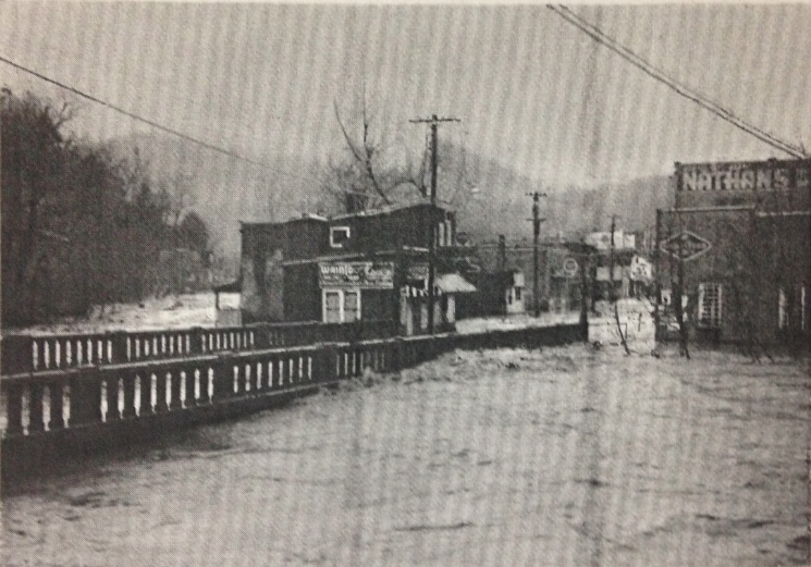
Main street and the business district in Cumberland on January 29, 1957 at about 4 pm. Bridge over Poor Fork in left foreground.
(Photograph by Vic Howard, Cumberland, KY)
Further downstream, peak discharges and stages were slightly lower than during the 1946 flood at Harlan and Pineville and damage was relatively minor. At Barbourville, the peak stage was about half a foot below the known maximum at the time set in the 1946 flood. Approximately 80 percent of the city was inundated to depths as much as 10 feet, and about 200 families were evacuated. In excess of $1 million in damage occurred to residential, commercial and municipal properties.
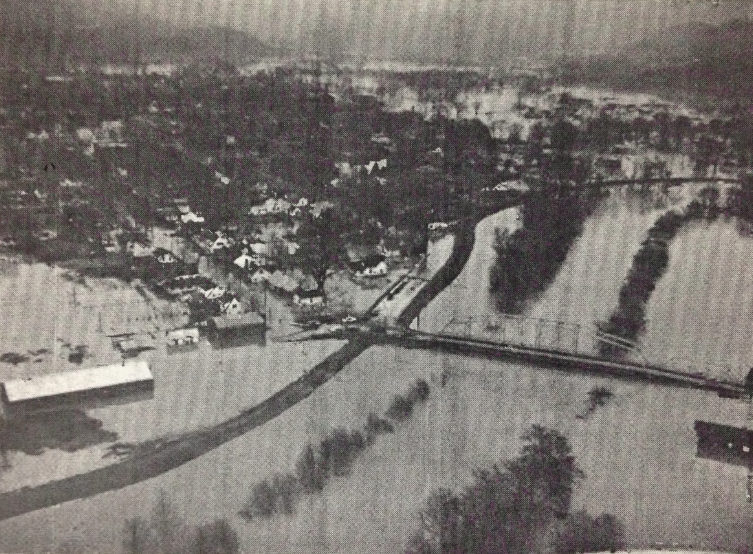
Aerial view of flooding in south Barbourville at 2 pm January 30, 1957. The levee in this view looking north was not completed, but it prevented water from flowing through the city. (Photograph by Louisville Courier-Journal and Times)
At Williamsburg, damage was much less. Still, water rose to depths of three feet on some streets but only a few families were forced to move.
Flood damage in Corbin from the Laurel River was extensive. Approximately 400 residences, 90 businesses, two industries and several schools and churches were inundated to depths of as much as 10 feet in parts of the city. Reports from older residents along Lynn Camp Creek, which flows through the city, said that it was five to six feet higher than in any other flood during the prior 50 years.
The hydrologic significance of the floods on the Cumberland River was demonstrated by the maximum discharge attained at Cumberland Falls. The discharge observed in 1957 was only 4 percent less than the previous known maximum of 59,600 cfs observed in 1918.
| Cumberland | Barbourville | Williamsburg | |
|---|---|---|---|
| 1 | 16.5 ft - 1/29/1957 | 45.9 ft - 4/6/1977 | 35.0 ft - 4/7/1977 |
| 2 | 15.9 ft - 4/4/1977 | 42.8 ft - 1/1/1946 | 35.0 ft - 3/31/1886 |
| 3 | 15.5 ft - 3/23/1929 | 42.7 ft - 11/29/1973 | 34.5 ft - 3/15/1975 |
| 4 | 15.2 ft - 1/1/1927 | 42.3 ft - 1/1/1970 | 34.2 ft - 1/10/1946 |
| 5 | 15.0 ft - 5/30/1927 | 42.2 ft - 1/30/1957 | 33.8 ft - 1/31/1957 |
References
Much of the information and pictures included in this page was taken from the Floods of January-February 1957 in Southeastern Kentucky and Adjacent Areas Geological Survey Water-Supply Paper 1652-A.
Historical river crest information was obtained from the National Weather Service Advanced Hydrologic Prediction Service and data obtained from the Midwest Regional Climate Center's cli-MATE application were used to map the rainfall for the event.
Finally, thanks to Stephen Bowling and the Breathitt County Public Library for supplying flood pictures of Jackson, KY.
 |
Media use of NWS Web News Stories is encouraged! Please acknowledge the NWS as the source of any news information accessed from this site. |
|

